Historic Moravian District (Central / North Side)
Best for
Colonial history, UNESCO heritage walking, fine dining, boutique shopping
 AdventriaLocalOpen App
Bethlehem Local Decision Guide
Trying to decide what to do in Bethlehem? Adventria helps you cut through the options and choose a good-enough plan without endless scrolling. Whether you are crossing the Lehigh River for evening dining, visiting UNESCO World Heritage sites, or planning around major festivals at SteelStacks, this guide provides clear decision frameworks for navigating Bethlehem.
The local decision problem
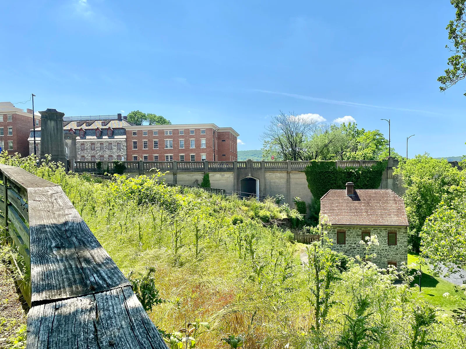
Navigating river crossings, parking zones, and festival logistics while choosing activities across Historic Moravian Bethlehem and the SouthSide Arts District.
That is where Adventria comes in. Adventria helps narrow the options in Bethlehem around practical factors like location, distance, budget, vibe, who you are with, and the kind of experience you actually want, so research can turn into a decision.
Let Adventria narrow the optionsPick the right part of town
Different parts of Bethlehem work for different kinds of plans. Start with the experience you want, then narrow the map.
Best for
Colonial history, UNESCO heritage walking, fine dining, boutique shopping
Best for
Live music, craft breweries, creative venues, industrial history, casual global dining
Best for
Quiet residential walks, craftsman home architecture, neighborhood parks
Best for
Suburban retail errands, mid-century residential living, municipal park recreation
Best for
Historic industrial heritage, garden walks, colonial restoration sites
Best for
Historic residential architecture tours, regulated preservation walks
Eat & drink
When the decision is less about what to do and more about where to eat or grab a drink, start here. These local cues narrow the food and drink decision without turning dinner or a night out into another hour of comparison.
Head to South Bethlehem along 3rd and 4th Streets for casual options like sub shops (The Goosey Gander Deli), craft brewpubs (Bonn Place Brewing Co., Seven Sirens), or college taprooms (Molly's Irish Grille, Lehigh Pizza). On the North Side, sample tapas or craft beers at casual counters, or utilize garage parking near Main Street for walk-in tavern seating.
For a conversational evening, reserve fine dining at 1741 on the Terrace or Apollo Grill before enjoying nightcaps on Main Street. For live performance, head to SouthSide for intimate folk at Godfrey Daniels, live bands at The Funhouse or Musikfest Café, or indie films at Frank Banko Alehouse Cinemas.
Still comparing options? Adventria can narrow the choice around budget, distance, vibe, and who you are with.
Decide with AdventriaPlan by situation
Start with the kind of plan you are actually trying to make. These city-specific ideas narrow the choice around who you are with, what you want to spend, the weather, and the kind of outing you want.
For a day trip from Bethlehem, compare Cape May and Beacon. More options are listed in the trip section below.
Stroll the illuminated Hoover-Mason Trestle at sunset, followed by rooftop New American dining with views of the steel blast furnaces at ZEST bar + grille. Alternatively, enjoy modern-colonial fusion at Tavern at the Sun Inn followed by a stroll along Main Street.
Visit the National Museum of Industrial History at SteelStacks to view interactive locomotive and machinery exhibits, catch a free seasonal outdoor concert at Levitt Pavilion, or explore Burnside Plantation along Monocacy Creek.
Spend rainy days indoors visiting the Smithsonian-affiliated National Museum of Industrial History, touring decorative arts at the Kemerer Museum, catching an independent film at Frank Banko Alehouse Cinemas, or visiting Wind Creek Casino Resort.
Take a free self-guided walking tour of the Historic Moravian UNESCO grounds, walk the elevated Hoover-Mason Trestle, browse the Banana Factory resident artist studios, or attend the Live Advent Calendar outdoor event held daily December 1–23.
For an outdoor plan from Bethlehem, compare trails, state parks, national parks within trip range, and scenic drives. Options in the current city guide include Delaware Canal State Park and Delaware River Access State Park.
Grab a specialty coffee at Lit Coffee Roastery, browse the historic shelves at Moravian Book Shop (established 1745), jog along the paved South Bethlehem Greenway, or explore free exhibition galleries at Lehigh University Art Galleries (LUAG).
Outdoors nearby
Use these nearby outdoor options when the plan calls for a trail, protected landscape, park, or drive instead of another indoor stop. Proximity here is geographic, not a promise about driving time.
Get out of town
When staying in town is not the answer, these nearby destinations give you a smaller starting set for a day trip, overnight escape, or weekend away.
Destination relationships are screened geographically. Straight-line proximity is not presented as road mileage or estimated travel time.
Local landmarks & attractions
These notable destinations offer a starting point when you want something specific to see, visit, or build into a day around Bethlehem. Distances are approximate from the city area.
amusement park in Pennsylvania
transportation museum in Allentown, Pennsylvania
zoo in USA
motorsport track in the United States
complex of the oldest surviving buildings in Bethlehem, Pennsylvania
museum in Allentown, Pennsylvania
Small amusement park in Easton, Pennsylvania
statue at Lafayette College in Easton, Pennsylvania, US
Notable places are selected from structured public destination data and ranked for relevance, prominence, proximity, and variety.
Local decision signals
A useful local recommendation depends on how the city actually works. These conditions affect where to go, what to do, and whether a plan makes sense right now.
The Lehigh River splits Bethlehem into North and South sides, connected primarily by three vehicular bridges: PA Route 378 (Hill to Hill Bridge), Fahy Bridge (New Street), and Minsi Trail Bridge.
Inscribed in July 2024, the Moravian Church Settlements — Bethlehem site covers 14.7 acres in the Historic Moravian District, featuring nine original structures and four ruins.
On-street parking is split into RapidPark zones ($2.50/hr, 2-hr max limit for quick turnover) and FlexPark zones ($1.50/hr, 3-hr max limit) managed via ParkMobile or PayByPhone.
Musikfest brings roughly one million visitors over 10 days in August, creating major road closures across both downtowns and requiring satellite park-and-ride shuttles.
The 10-acre SteelStacks campus converts former Bethlehem Steel blast furnaces into an arts precinct featuring the Hoover-Mason Trestle elevated walkway and National Museum of Industrial History.
The 2+ mile paved South Bethlehem Greenway runs parallel to 3rd Street, while the D&L Trail towpath connects Sand Island Park along the river.
Neighborhood context
Neighborhoods are not interchangeable. Each area offers a different balance of atmosphere, transportation, food, nightlife, activities, and planning friction.
Best for: Colonial history, UNESCO heritage walking, fine dining, boutique shopping
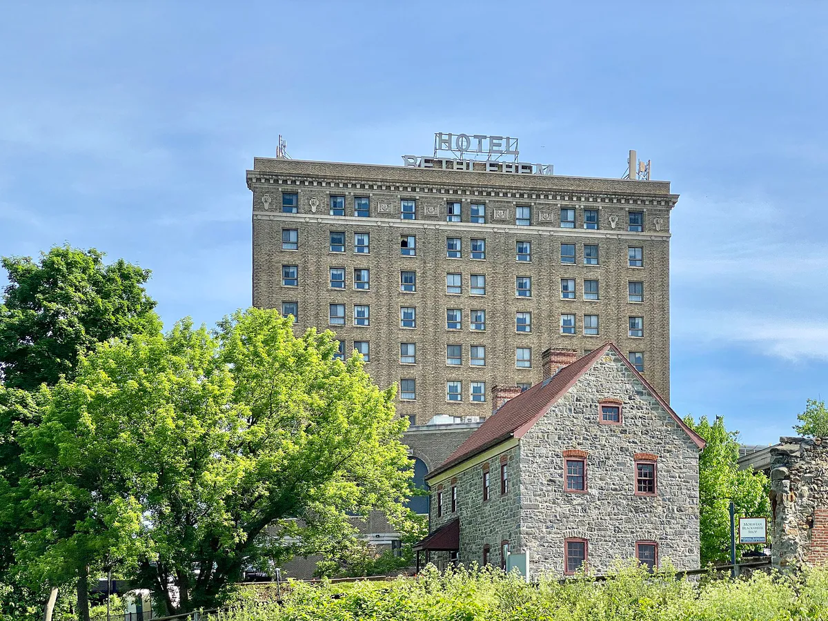
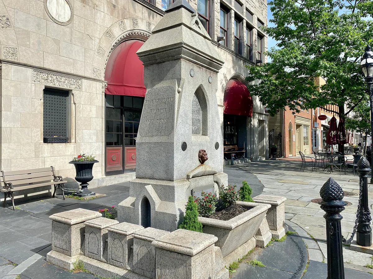
Centered along Main, Broad, Church, and Market Streets north of the Lehigh River. Governed by HARB, it houses the 1741 Gemeinhaus, 1806 Central Moravian Church, and historic hotel dining.
Best for: Live music, craft breweries, creative venues, industrial history, casual global dining
Stretches along 3rd and 4th Streets south of the river to the SteelStacks campus. Home to Lehigh University, ArtsQuest Center, and craft taprooms.
Best for: Quiet residential walks, craftsman home architecture, neighborhood parks
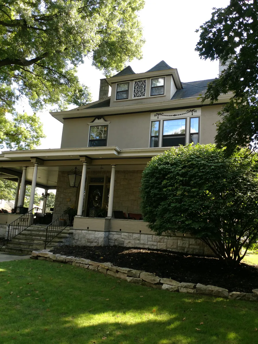
Located west of Monocacy Creek extending toward Allentown. Characterized by early 20th-century brick rowhomes and detached single-family houses.
Best for: Suburban retail errands, mid-century residential living, municipal park recreation
Extends east of Center Street and Pembroke Road toward Freemansburg. Offers off-street shopping plaza parking and parks like Johnston Park.
Best for: Historic industrial heritage, garden walks, colonial restoration sites
Nestled along Monocacy Creek below Main Street. Contains the 1761 Tannery and 1762 Waterworks within the UNESCO World Heritage footprint.
Best for: Historic residential architecture tours, regulated preservation walks
A historic residential sub-district located within West Bethlehem, regulated by the Historic Conservation Commission (HCC).
Bethlehem local guide
The Lehigh River splits Bethlehem into distinct North and South halves, making river crossings one of the city's primary travel friction points. The multi-level Hill to Hill Bridge (PA Route 378) serves as the main vehicular artery connecting Route 22, North Bethlehem, South Bethlehem, and I-78. Heavy congestion is standard on Route 378 during peak morning and evening commute windows, amplified by ongoing PennDOT rehabilitation projects.
To avoid traffic delays during peak hours or festival weekends, drivers should utilize alternative crossings. The Fahy Bridge (New Street Bridge) offers a direct connection between downtown North Bethlehem and the SouthSide Arts District, complete with wide sidewalks for walking or cycling. Further east, the Minsi Trail Bridge connects East Bethlehem directly to Route 412 and I-78, though it carries substantial commercial truck traffic heading toward industrial parks and Wind Creek Casino.
Explore your options
Choose your destination based on neighborhood character, parking availability, and outing goals.
Ideal for fine dining, colonial history, and boutique shopping within a compact, walkable grid.
Ideal for live entertainment, industrial heritage, craft taprooms, and global casual eats.
Ideal for neighborhood park access, historic home architecture, and quieter residential streets.
Practical local guidance
Keep these verified rules in mind when planning trips and parking in Bethlehem.
A simpler way to decide
Follow these practical steps to navigate severe festival traffic and parking restrictions during major annual events.
Check event calendars for Musikfest (early August) across both North and South sides, or Christkindlmarkt (mid-November through December) at SteelStacks on the South Side.
Avoid searching for on-street parking or central garages in downtown districts during major festivals, as restrictions and closures are widespread.
For 10-day events like Musikfest, drive directly to designated remote shuttle lots (such as Valley Center Parkway or Emery Street) and board festival shuttles.
If traveling between North and South festival sites, walk across the Fahy Bridge (New Street) rather than sitting in vehicular bridge traffic.
Check operating hours for independent attractions, as standard schedules may shift or require advance booking during major city events.
Common local questions
These are common situations people face when trying to decide where to eat, what to do, where to get drinks, or how to spend their time in Bethlehem.
Bethlehem planning questions
Practical answers for people deciding where to eat, what to do, where to go, or how to make plans in Bethlehem.
Inscribed in July 2024, the Moravian Church Settlements — Bethlehem World Heritage site encompasses a 14.7-acre footprint in the Historic Moravian District. It includes nine historic structures (such as the 1741 Gemeinhaus and 1806 Central Moravian Church), four ruins, God's Acre cemetery, and the Colonial Industrial Quarter.
The Bethlehem Parking Authority divides on-street parking into RapidPark zones ($2.50/hr, 2-hour max) on core commercial blocks and FlexPark zones ($1.50/hr, 3-hour max) on perimeter streets. Payments are accepted via mobile apps like ParkMobile and PayByPhone.
For longer visits, park in structured garages. On the North Side, use the Walnut Street Garage (33 W Walnut St) or North Street Garage (85 W North St). On the South Side, use the New Street Garage (324 S New St) or Riverport Garage (11 W 2nd St).
The Fahy Bridge (New Street Bridge) is the best pedestrian route across the Lehigh River, featuring wide paved sidewalks connecting Main/Broad Streets on the North Side directly to 3rd/New Streets in the SouthSide Arts District.
The primary bottleneck is the Hill to Hill Bridge (PA Route 378), which experiences severe rush-hour traffic between 7:30–9:00 AM and 4:30–6:00 PM, as well as during major festival weekends.
No. Bicycles, skateboards, and scooters are prohibited on the elevated Hoover-Mason Trestle walkway at SteelStacks; it is reserved exclusively for pedestrians.
LANTA operates local bus routes centered at the Bethlehem Transportation Center (BTC) at Broad and Guetter Streets. Rapid corridor lines (EBS Green and Blue) connect Bethlehem to Allentown, Easton, and the Lehigh Valley Mall.
Held over 10 days in early August, Musikfest draws around one million visitors, causing severe road closures and filling downtown parking. Visitors are strongly advised to use remote satellite park-and-ride shuttle lots.
Fine dining, historic taverns, and upscale casual restaurants cluster around Main and Broad Streets in the Historic Moravian District. Global cuisine, craft brewpubs, rooftop dining, and casual student eateries cluster along 3rd and 4th Streets in the SouthSide Arts District.
No. Many historic sites and museums, including the National Museum of Industrial History (open Wed–Sun), operate on limited weekly schedules or close on Mondays and Tuesdays. Visitors should verify operating days before planning visits.
Source transparency
Official and locally relevant sources used to verify the practical information presented in this Bethlehem decision guide.
Bethlehem decision engine
Tell Adventria what kind of experience you want, set your practical limits, and turn the options in Bethlehem into one workable plan.
Choose a Bethlehem Plan