Downtown / Riverfront
Best for
First-time visitors, family museum outings, civic events, and river access.
 AdventriaLocalOpen App
Chattanooga City Guide
Trying to decide what to do in Chattanooga? Adventria helps you cut through the options and choose a good-enough plan without endless scrolling. Chattanooga's dramatic landscape—nested between steep Appalachian ridges and a winding river—shapes how people move, dine, and spend their days. Whether you are looking for a car-free downtown path, late-night craft brews, or shelter from a sudden thunderstorm, this guide cuts through generic tourist lists to give you actionable, neighborhood-tested decisions.
The local decision problem
Navigating Chattanooga's river and mountain barriers to choose the right neighborhood, parking strategy, and activity based on real-time weather and traffic.
That is where Adventria comes in. Adventria helps narrow the options in Chattanooga around practical factors like location, distance, budget, vibe, who you are with, and the kind of experience you actually want, so research can turn into a decision.
Let Adventria narrow the optionsPick the right part of town
Different parts of Chattanooga work for different kinds of plans. Start with the experience you want, then narrow the map.
Best for
First-time visitors, family museum outings, civic events, and river access.
Best for
Boutique shopping, casual independent dining, green space walks, and local coffee.
Best for
Craft breweries, chef-driven dining, late-night venues, and open-container nightlife.
Best for
Romantic dates, espresso and pastry breaks, art galleries, and river cliff vistas.
Best for
Historic architecture fans, local neighborhood stops, and lower mountain excursions.
Best for
Civil rights history, live music watering holes, and student-friendly casual spots.
This is a quick starting point. The full guide covers 8 local neighborhoods and districts in Chattanooga.
Eat & drink
When the decision is less about what to do and more about where to eat or grab a drink, start here. These local cues narrow the food and drink decision without turning dinner or a night out into another hour of comparison.
For chef-driven artisan dining and craft meats, head to the Main Street corridor in Southside (Niedlov's, Main Street Meats, Alleia). For casual brunch, gelato, or coffee, walk Frazier Avenue in North Shore (Milk & Honey, Clumpies). If you want scenic outdoor dining overlooking the river, reserve a table in the Bluff View Art District or near Ross's Landing.
Head to Southside's Station Street entertainment district. Enjoy the open-container permissions while hopping between live music at The Boneyard, craft brews at Wanderlinger, or retro dancing at Reagan's. For a quieter evening, catch a headliner at the Tivoli Theatre or order rooftop cocktails at Whiskey Thief overlooking the river.
Still comparing options? Adventria can narrow the choice around budget, distance, vibe, and who you are with.
Decide with AdventriaPlan by situation
Start with the kind of plan you are actually trying to make. These city-specific ideas narrow the choice around who you are with, what you want to spend, the weather, and the kind of outing you want.
Rain does not affect underground environments—book a tour at Ruby Falls, 260 feet inside Lookout Mountain. Alternatively, spend hours inside the dual-building Tennessee Aquarium, scale indoor walls at High Point Climbing, or play unlimited arcade games at the Chattanooga Pinball Museum.
Ride the CARTA Free Electric Shuttle between Downtown and Southside. Walk across the Walnut Street Bridge, explore the River Gallery Sculpture Garden for free, and picnic in Coolidge Park where carousel rides cost only $1.
For an outdoor plan from Chattanooga, compare trails, state parks, national parks within trip range, and scenic drives. Options in the current city guide include Booker T. Washington State Park and Booker T Washington.
Begin in the Bluff View Art District with hand-drip espresso and artisan chocolates at Rembrandt's Coffee House. Walk through the River Gallery Sculpture Garden perched over the limestone bluffs, then cross the illuminated Walnut Street Bridge at dusk before sitting down for rustic Italian dining at Alleia in Southside.
Pair the Tennessee Aquarium's freshwater and ocean buildings with hands-on exhibits at the nearby Creative Discovery Museum. Afterward, take the CARTA shuttle across to Coolidge Park for the $1 antique carousel rides and interactive splash pad.
Rent a bike through Bike Chattanooga and ride the Riverwalk trail. Head to High Point Climbing & Fitness downtown for bouldering and auto-belays. Grab a single seat at a Southside craft brewery bar or spend hours exploring retro pinball cabinets at the Chattanooga Pinball Museum.
Book a group bowling lane or lawn game area at Southside Social, or hang out in the open-air court along Station Street. For outdoorsy groups, organize a guided white-water rafting trip on the nearby Ocoee River or rent paddleboards at Ross's Landing.
Outdoors nearby
Use these nearby outdoor options when the plan calls for a trail, protected landscape, park, or drive instead of another indoor stop. Proximity here is geographic, not a promise about driving time.
Get out of town
When staying in town is not the answer, these nearby destinations give you a smaller starting set for a day trip, overnight escape, or weekend away.
Destination relationships are screened geographically. Straight-line proximity is not presented as road mileage or estimated travel time.
Local landmarks & attractions
These notable destinations offer a starting point when you want something specific to see, visit, or build into a day around Chattanooga. Distances are approximate from the city area.
public aquarium in the United States
art museum in Chattanooga, Tennessee
multi-purpose hall and theatre in Chattanooga, Tennessee, United States
stadium in Tennessee
amusement park in Georgia, U.S.
botanical garden in Tennessee, US
Railroad museum in Chattanooga, Tennessee
human settlement in Chattanooga, Tennessee, United States of America
Notable places are selected from structured public destination data and ranked for relevance, prominence, proximity, and variety.
Local decision signals
A useful local recommendation depends on how the city actually works. These conditions affect where to go, what to do, and whether a plan makes sense right now.
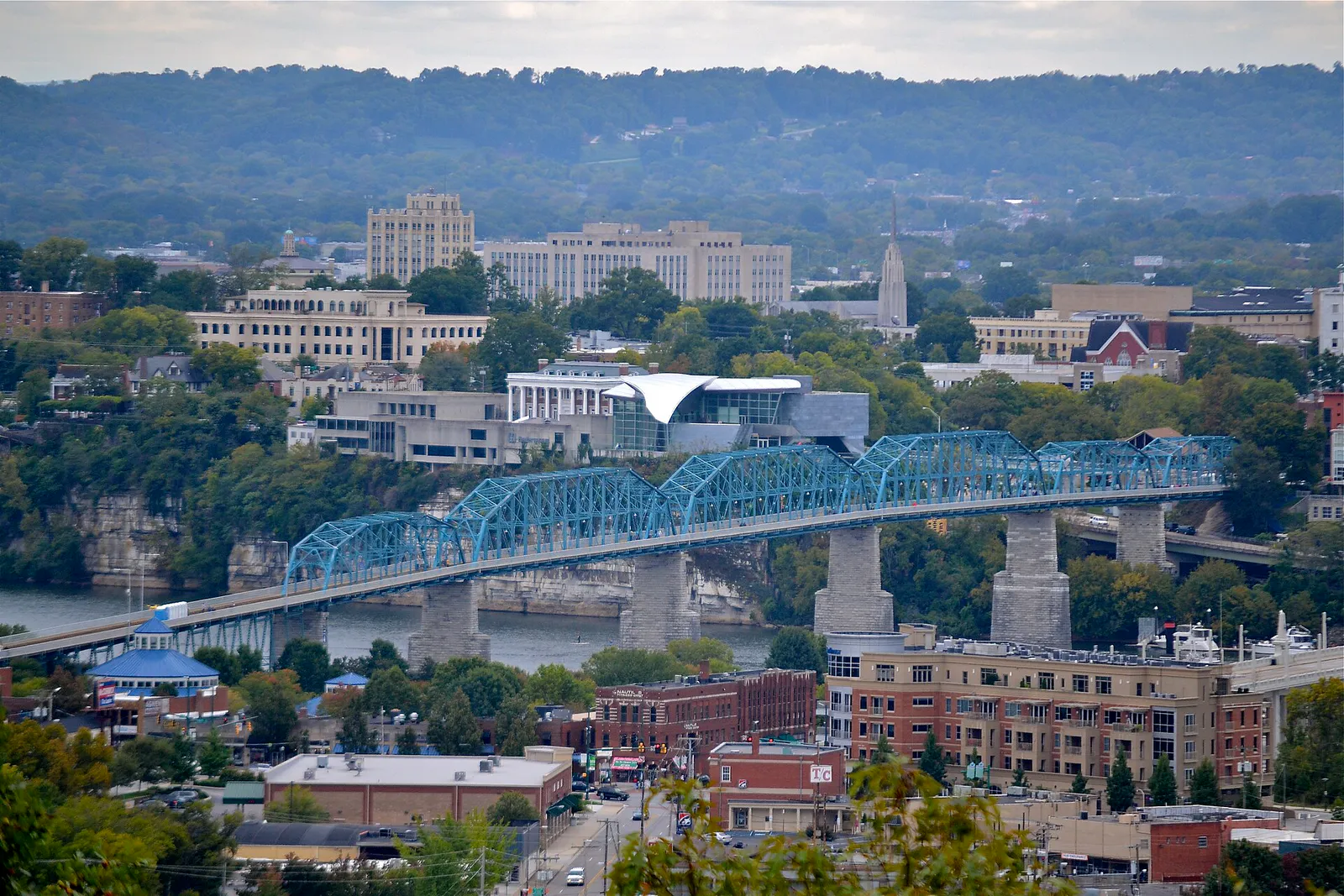
The Tennessee River divides Downtown from North Shore. Vehicles use Market Street Bridge or Olgiati Bridge, while pedestrians rely on Walnut Street Bridge to avoid bridge chokepoints.
Route 33 connects Southside Choo Choo to Riverfront every 5-10 minutes. Route 2 runs across the river to Frazier Avenue in North Shore.
Station Street in Southside is one of Tennessee's few designated open-container zones, allowing patrons to walk between participating venues with drinks.
Lookout Mountain and Signal Mountain run 5°F to 8°F cooler than the valley floor and frequently experience morning valley fog that obscures bluff overlooks.
CARTA Shuttle Park garages offer the first hour free. EPB offers complimentary 2-hour passes daily at the Downtown Library garage, and ParkMobile offers a $25 weekend pass.
Daily freight congestion impacts the I-24/I-75 split and the steep Lookout Mountain Curve ('The Ridge Cut'). Local drivers bypass east-west highway stalls via Broad Street.
Matches at Finley Stadium (Southside) or AT&T Field (Downtown) absorb surrounding street parking and double wait times at nearby restaurants.
Neighborhood context
Neighborhoods are not interchangeable. Each area offers a different balance of atmosphere, transportation, food, nightlife, activities, and planning friction.
Best for: First-time visitors, family museum outings, civic events, and river access.
Anchored by Broad Street and Riverfront Parkway, Downtown is the urban core containing the Tennessee Aquarium, Ross's Landing, and Miller Plaza. It offers high density, seamless pedestrian connections, and access to the CARTA shuttle hub.
Best for: Boutique shopping, casual independent dining, green space walks, and local coffee.
Located directly across the river along Frazier Avenue and Cherokee Boulevard. Known for Coolidge Park's historic carousel, Renaissance Park's restored wetlands, eco-conscious shops, and neighborhood eateries.
Best for: Craft breweries, chef-driven dining, late-night venues, and open-container nightlife.
A former industrial rail yard transformed into Chattanooga's culinary and entertainment capital. Centered on Main Street and Station Street near the historic Choo Choo complex.
Best for: Romantic dates, espresso and pastry breaks, art galleries, and river cliff vistas.
A compact, European-style micro-neighborhood perched on high limestone bluffs overlooking the river. Features brick cobblestone walkways, Rembrandt's Coffee, Tony's Pasta, and the River Gallery Sculpture Garden.
Best for: Historic architecture fans, local neighborhood stops, and lower mountain excursions.
Located at the base of Lookout Mountain south of downtown. Filled with restored Victorian homes, Craftsman bungalows, independent cafes, and the lower terminus of the Incline Railway.
Best for: Civil rights history, live music watering holes, and student-friendly casual spots.
Extending east along Martin Luther King Boulevard, this historic African American cultural corridor is anchored by the Bessie Smith Cultural Center and borders the University of Tennessee at Chattanooga campus.
Best for: Panoramas, natural cave formations, Civil War military history, and bluff trails.
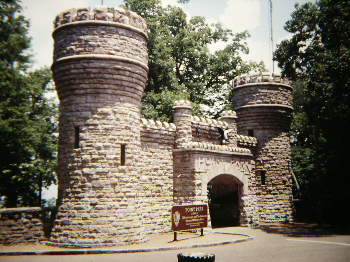
A prominent mountain ridge rising south of the city basin. Houses iconic attractions like Ruby Falls, Rock City, and Point Park, though access relies on winding mountain roads.
Best for: Value lodging, broad retail hubs, suburban parks, and quick highway access.
Red Bank forms an independent enclave 10 minutes north of downtown along Dayton Boulevard, while East Brainerd and Hamilton Place host the region's commercial shopping centers along I-75.
Chattanooga local guide
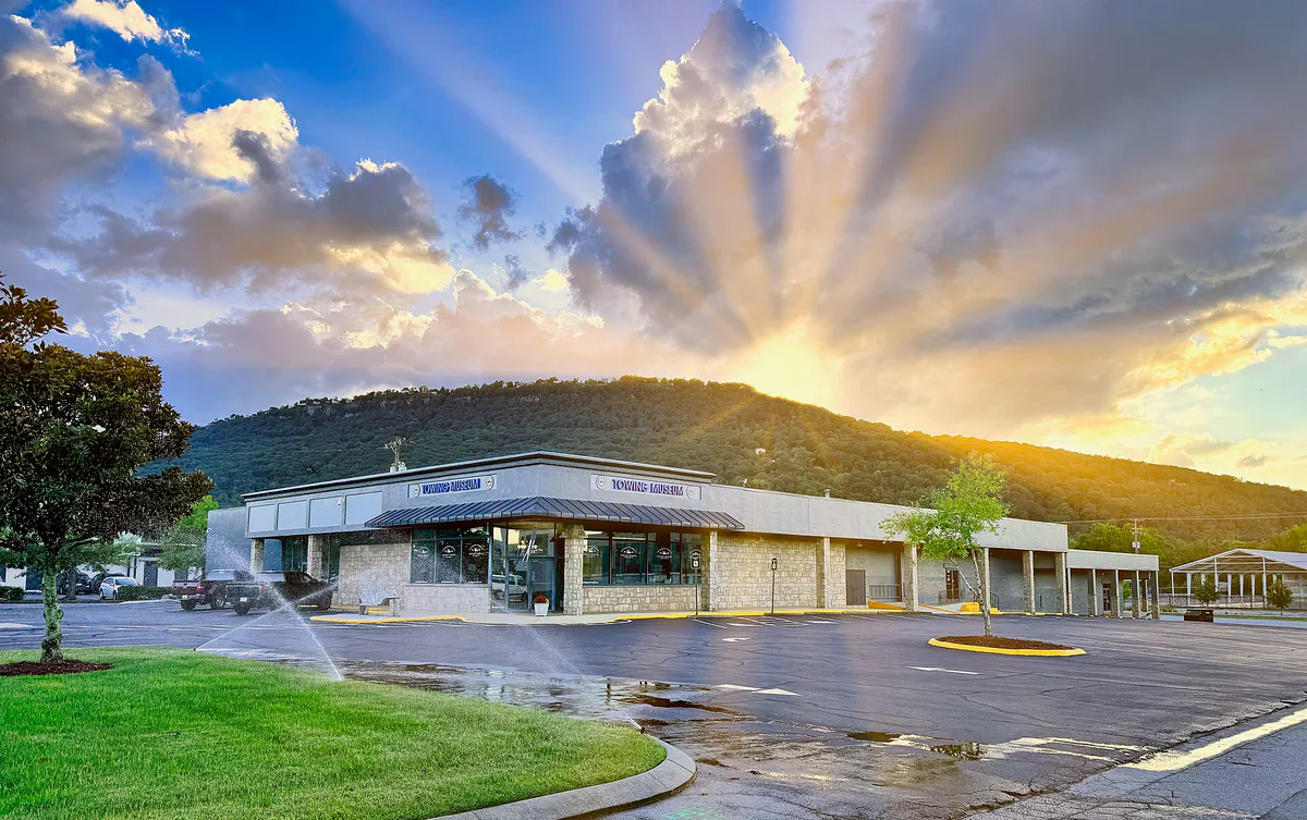
Chattanooga sits in a tight basin carved by the Tennessee River and hemmed in by steep mountain barriers: Lookout Mountain to the south, Walden's Ridge (Signal Mountain) to the northwest, and Missionary Ridge to the east. Because of this geography, city travel is heavily influenced by specific natural chokepoints.
The primary urban divide is the Tennessee River, which separates Downtown from North Shore. While four bridges cross the river, vehicle traffic condenses heavily on the Market Street Bridge and the US-27 Olgiati Bridge during morning and evening rush hours or major riverfront festivals. The pedestrian-only Walnut Street Bridge offers a car-free link between the two shorelines.
Highway travel through the region faces its own bottlenecks. The junction of I-24 and I-75 east of downtown carries heavy regional freight traffic, while the steep curve of I-24 around the base of Lookout Mountain (known locally as 'The Ridge Cut') is prone to sudden freight slowdowns. Understanding these physical constraints helps you pick the right neighborhood base and transport mode.
Explore your options
Adjust your choices based on weather patterns, elevation changes, and major community schedules.
Summers in the river valley bring high heat indices and late-afternoon thunderstorms.
Fall brings clear skies, low humidity, and peak leaf-peeping from late October to early November.
Winters are mild but wet and overcast, with occasional mountain ice.
Major events like Ironman Chattanooga or matches at Finley Stadium alter city access.
A simpler way to decide
Follow this step-by-step connection plan to explore the city core without driving or reparking.
Leave your vehicle at Shuttle Park South near the historic Chattanooga Choo Choo on Market Street.
Catch the zero-emission electric shuttle heading north toward Riverfront every 5 to 10 minutes along Broad or Market Street.
Disembark at the Tennessee Aquarium terminus. Explore Ross's Landing and take a short 10-minute walk east to the Bluff View Art District.
Walk across the historic 1894 pedestrian bridge to cross the Tennessee River into North Shore without vehicle friction.
Browse Frazier Avenue and Coolidge Park, then take CARTA Route 2 back across Veterans Bridge or grab a Bike Chattanooga bike share cycle.
Take Route 33 back south to Main Street for dinner, craft beer, and live music on Station Street.
Common local questions
These are common situations people face when trying to decide where to eat, what to do, where to get drinks, or how to spend their time in Chattanooga.
Chattanooga planning questions
Practical answers for people deciding where to eat, what to do, where to go, or how to make plans in Chattanooga.
The easiest way is walking across the pedestrian Walnut Street Bridge, which directly links the Downtown Bluff View area with North Shore's Coolidge Park and Frazier Avenue. Alternatively, CARTA operates the free Route 2 North Shore Shuttle, connecting the Aquarium area to North Market Street.
CARTA Shuttle Park North (215 Broad St) offers the first hour free. If staying longer, look for street parking metered via the ParkMobile app, or check for EPB's 40 complimentary 2-hour validated parking passes offered daily at the garage next to the Downtown Library.
Station Street is a dedicated entertainment block in Southside next to the Choo Choo complex. It is one of Tennessee's legally designated open-container zones, allowing patrons to buy alcoholic beverages in approved cups from participating venues and carry them outdoors within the street boundaries.
Yes, within the urban core (Southside, Downtown, Riverfront, Bluff View, and North Shore). The CARTA Free Electric Shuttle system, the pedestrian Walnut Street Bridge, the 13-mile Tennessee Riverwalk, and Bike Chattanooga stations make a car-free day simple. A car is only necessary if visiting mountain top sites like Lookout Mountain.
Head to underground or weather-enclosed options: Ruby Falls cave tours remain completely dry, the dual-building Tennessee Aquarium provides hours of indoor marine exhibits, High Point Climbing offers indoor climbing walls, and the Chattanooga Pinball Museum provides unlimited indoor gaming.
Elevations on Lookout Mountain and Signal Mountain run roughly 5°F to 8°F cooler than the downtown river valley. During late fall and winter, this can mean icy road conditions on steep mountain passes even when downtown roads remain clear.
Southside is Chattanooga's primary nightlife and craft dining hub, centered along Main Street and Station Street. It features artisan bakeries, butcher shops, craft breweries, speakeasies, and late-night music venues.
Fall foliage generally peaks between late October and early November. Prime spots for viewing include Point Park on Lookout Mountain, Signal Point on Signal Mountain, and the bluffs along the Tennessee River Gorge.
Yes. You can explore the interactive water features at The Passage memorial at Ross's Landing, walk through the wetlands of Renaissance Park, picnic in Coolidge Park, or cross the pedestrian Walnut Street Bridge.
Avoid driving through the I-24 Ridge Cut during peak morning and evening commute hours (7:30–9:00 AM and 4:30–6:00 PM). To cross the Tennessee River when Market Street Bridge is backed up, detour via Veterans Memorial Bridge or use US-27 Olgiati Bridge.
Source transparency
Official and locally relevant sources used to verify the practical information presented in this Chattanooga decision guide.
Chattanooga decision engine
Tell Adventria what kind of experience you want, set your practical limits, and turn the options in Chattanooga into one workable plan.
Choose a Chattanooga Plan