Downtown
Best for
Walkable culture, state government landmarks, theater, and minor league baseball
 AdventriaLocalOpen App
Local Decision Guide
Trying to decide what to do in Hartford? Adventria helps you cut through the options and choose a good-enough plan without endless scrolling. Hartford offers a compact, culturally rich environment balancing world-class art collections, historic literary landmarks, and vibrant food halls. Making the most of the city requires understanding how physical barriers like Interstate 84 split districts, how winter weather dictates parking rules, and where to find walkable dining corridors.
The local decision problem
Navigating Hartford's distinct neighborhood pockets, seasonal shifts, transit options, and parking regulations for seamless daily plans, dining, and cultural outings.
That is where Adventria comes in. Adventria helps narrow the options in Hartford around practical factors like location, distance, budget, vibe, who you are with, and the kind of experience you actually want, so research can turn into a decision.
Let Adventria narrow the optionsPick the right part of town
Different parts of Hartford work for different kinds of plans. Start with the experience you want, then narrow the map.
Best for
Walkable culture, state government landmarks, theater, and minor league baseball
Best for
Historic architecture, rose gardens, and relaxed neighborhood dining
Best for
Culinary diversity, food halls, independent cinema, and contemporary art
Best for
Caribbean and Latino culinary traditions, vibrant street life
Best for
19th-century American literature history and corporate headquarters
Best for
Industrial heritage, riverfront access, and public park space
This is a quick starting point. The full guide covers 8 local neighborhoods and districts in Hartford.
Eat & drink
When the decision is less about what to do and more about where to eat or grab a drink, start here. These local cues narrow the food and drink decision without turning dinner or a night out into another hour of comparison.
Head to Parkville Market at 1400 Park Street in the Parkville district. Located in a repurposed lumber building, it features 22 independent food stalls serving Caribbean, Asian, Mexican, and American options alongside 3 full bars. The vast open hall seating and outdoor areas eliminate the need for group dining reservations or split checks.
Begin on pedestrian Pratt Street with craft cocktails at Hartford Flavor Cocktail Parlour or sorellahartford wood-fired pizza. After dinner, walk two blocks to catch a touring Broadway show at The Bushnell Center for the Performing Arts or a live production at Hartford Stage.
Still comparing options? Adventria can narrow the choice around budget, distance, vibe, and who you are with.
Decide with AdventriaPlan by situation
Start with the kind of plan you are actually trying to make. These city-specific ideas narrow the choice around who you are with, what you want to spend, the weather, and the kind of outing you want.
For fine arts, visit the Wadsworth Atheneum Museum of Art downtown to view nearly 50,000 works spanning European Baroque to Impressionism. If traveling with children, choose the Connecticut Science Center at Front Street, which offers 10 floors of interactive exhibits and a 3D digital theater under one roof.
For an outdoor plan from Hartford, compare trails, state parks, national parks within trip range, and scenic drives. Options in the current city guide include Auerfarm State Park Scenic Reserve and Windsor Meadows State Park.
For an overnight getaway from Hartford, compare Princeton and Cooperstown. More options are listed in the trip section below.
Take the family to Bushnell Park for $1 rides on the historic 1914 wooden carousel featuring a 1921 Wurlitzer organ. Afterwards, head north to Dunkin' Park to catch a Hartford Yard Goats minor league baseball game, complete with dedicated kids' play zones and local food vendors.
On-street metered parking managed by the Hartford Parking Authority is free all day Saturday and Sunday, as well as after 6:00 PM on weekdays. On busy event nights, municipal garages like Front Street Garages or Church Street Garage offer flat-rate options.
Start in Asylum Hill with a guided tour of The Mark Twain House & Museum and the adjacent Harriet Beecher Stowe Center. Afterwards, travel to Real Art Ways on Arbor Street in Parkville to view contemporary gallery exhibits and catch an independent film screening.
Outdoors nearby
Use these nearby outdoor options when the plan calls for a trail, protected landscape, park, or drive instead of another indoor stop. Proximity here is geographic, not a promise about driving time.
Get out of town
When staying in town is not the answer, these nearby destinations give you a smaller starting set for a day trip, overnight escape, or weekend away.
Destination relationships are screened geographically. Straight-line proximity is not presented as road mileage or estimated travel time.
Local landmarks & attractions
These notable destinations offer a starting point when you want something specific to see, visit, or build into a day around Hartford. Distances are approximate from the city area.
art museum in Hartford, Connecticut
state capitol building of the U.S. state of Connecticut
amusement park
non-profit organization in the USA
sports venue in Hartford, Connecticut, USA
botanical garden in Westfield, United States
outdoor/indoor theatre in Hartford, Connecticut
amusement park
Notable places are selected from structured public destination data and ranked for relevance, prominence, proximity, and variety.
Local decision signals
A useful local recommendation depends on how the city actually works. These conditions affect where to go, what to do, and whether a plan makes sense right now.
Flashing blue lights at 16 major city intersections illuminate 4 to 6 hours before a declared Snow Emergency Parking Ban takes effect, warning drivers to move off-street.
Metered street parking managed by the Hartford Parking Authority is free on weekdays after 6:00 PM, all day Saturday and Sunday, and on official city holidays.
An elevated 3/4-mile highway section physically bisects the city center, separating Asylum Hill and northern neighborhoods from Downtown.
CTfastrak operates on its own dedicated 9.1-mile busway strip, allowing buses to bypass highway traffic between Hartford Union Station and New Britain.
Elevated plaza decks across Interstate 91 bridge the city center directly to Mortensen Riverfront Plaza on the Connecticut River.
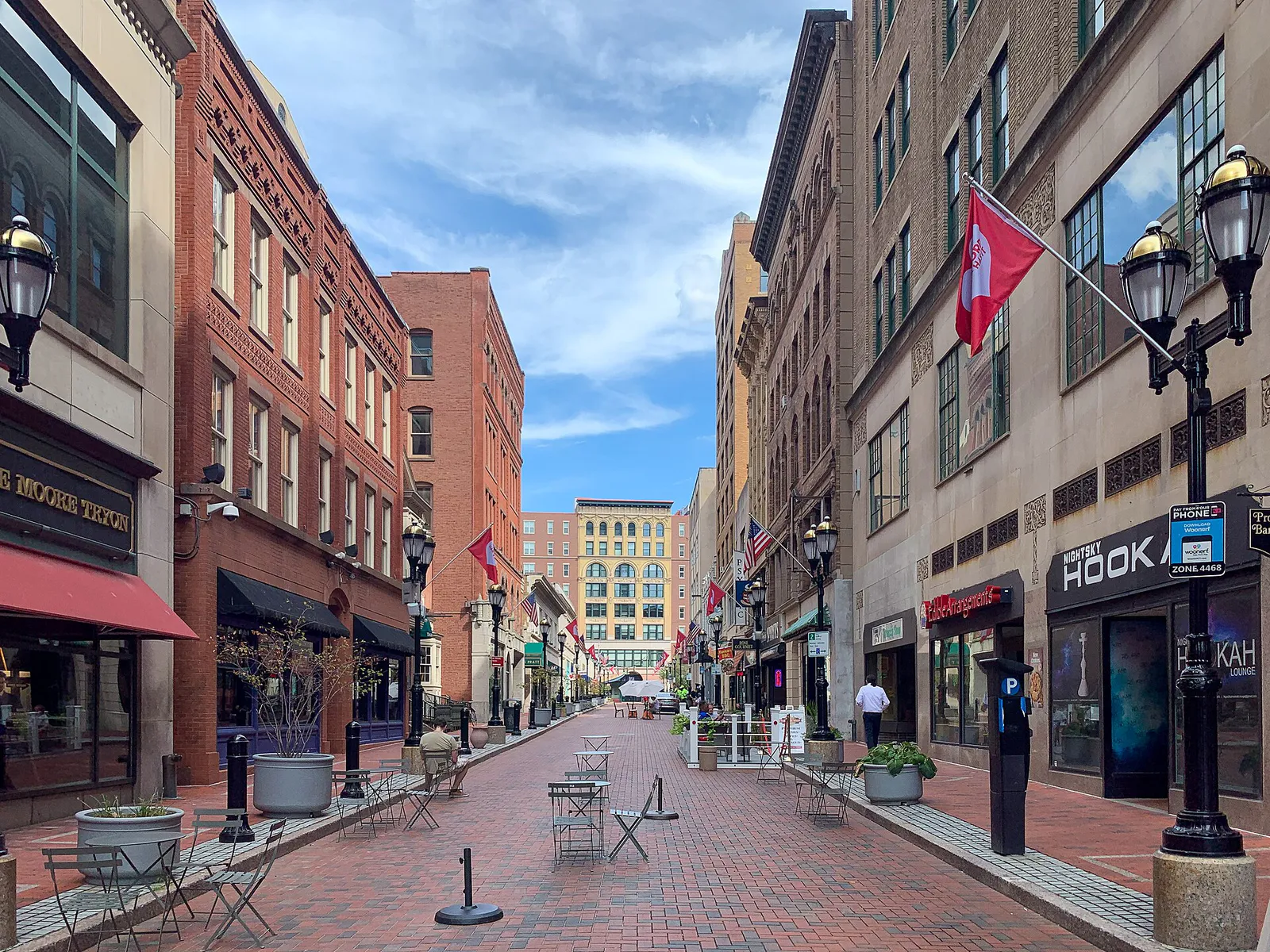
A historic brick-paved downtown block closed to vehicle traffic, anchored by outdoor dining patios, craft beverage spots, and local shops.
A shared historic complex in Asylum Hill housing both The Mark Twain House & Museum and the Harriet Beecher Stowe Center.
Neighborhood context
Neighborhoods are not interchangeable. Each area offers a different balance of atmosphere, transportation, food, nightlife, activities, and planning friction.
Best for: Walkable culture, state government landmarks, theater, and minor league baseball
The civic and corporate core bounded by Bushnell Park and the Connecticut River. Houses the Wadsworth Atheneum, Pratt Street, Front Street, XL Center, and Dunkin' Park.
Best for: Historic architecture, rose gardens, and relaxed neighborhood dining
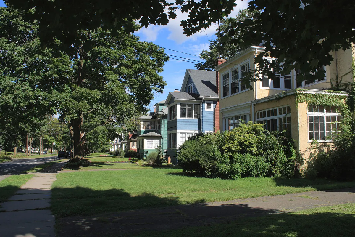
A green residential district bordering West Hartford, featuring early 1900s homes, the Farmington Avenue commercial corridor, and Elizabeth Park.
Best for: Culinary diversity, food halls, independent cinema, and contemporary art
A former industrial zone west of Downtown transformed into a creative and food hub, anchored by Parkville Market and Real Art Ways.
Best for: Caribbean and Latino culinary traditions, vibrant street life
Located southwest of Downtown along Park Street ('Calle San Juan'), known for multi-family brick architecture and authentic Puerto Rican cuisine.
Best for: 19th-century American literature history and corporate headquarters
Positioned west across I-84 from Downtown, containing Victorian homes, major insurance offices, and the historic Nook Farm literary complex.
Best for: Industrial heritage, riverfront access, and public park space
Southeast of Downtown along the river, featuring the iconic blue-domed Colt Armory landmark, Colt Park, and Charter Oak Landing.
Best for: Traditional Italian bakeries, specialty delis, and classic dining
A classic residential community stretched along Franklin Avenue and Wethersfield Avenue, celebrated for long-standing bakeries and trattorias.
Best for: Collegiate campus grounds and historic avenues
Situated south of Frog Hollow around Trinity College, featuring historic cemetery grounds and local neighborhood retail along Broad Street.
Hartford local guide
Hartford is structured as a compact urban hub situated along the west bank of the Connecticut River. While its geographic footprint allows quick travel across town, physical infrastructure creates distinct barriers between districts. Interstate 84 runs along an elevated 3/4-mile viaduct directly through the city center, dividing Downtown from Asylum Hill and northern residential sections. Similarly, Interstate 91 separates Downtown and Sheldon/Charter Oak from direct riverbank access, though elevated pedestrian plazas bridge this divide at Mortensen Riverfront Plaza.
Travel friction in Hartford peaks during weekday commute hours. The major interchange known as the 'Mixmaster'—where I-84 and I-91 converge near the Connecticut River—experiences heavy congestion during morning (7:00 AM–9:00 AM) and evening (4:00 PM–6:30 PM) drive times. River bridge crossings such as the Founders Bridge (Route 44) and Bulkeley Bridge (I-84) regularly slow traffic bound for East Hartford. Drivers cross town far more efficiently during peak hours by utilizing surface arterials including Farmington Avenue, Capitol Avenue, and Asylum Avenue.
Understanding neighborhood identities makes daily planning straightforward. Downtown holds major corporate hubs, state government buildings, and primary entertainment venues. Creative dining and arts thrive immediately to the west in Parkville, while literary sites sit in Asylum Hill. Authentic global dining corridors extend along Park Street in Frog Hollow and Franklin Avenue in the South End, offering hyper-local experiences just minutes from the city center.
Explore your options
Match your interests with the specific neighborhood pockets that hold Hartford's key cultural, dining, and outdoor highlights.
The walkable central business district featuring major performing arts venues, historic architecture, and concentrated dining.
A former industrial district turned modern culinary and arts zone situated west of the highway divide.
A leafy, historic neighborhood home to 19th-century literary giants and grand Victorian architecture.
A quiet residential neighborhood along Farmington Avenue offering historic parklands and neighborhood taverns.
Practical local guidance
Select from public bus rapid transit, regional rail lines, or municipal parking systems based on your travel itinerary.
Common local questions
These are common situations people face when trying to decide where to eat, what to do, where to get drinks, or how to spend their time in Hartford.
Hartford planning questions
Practical answers for people deciding where to eat, what to do, where to go, or how to make plans in Hartford.
Metered street parking in Hartford is free on weekdays after 6:00 PM, all day on Saturdays and Sundays, and on official City Holidays including New Year's Day, Memorial Day, July 4th, Labor Day, Thanksgiving, and Christmas.
CTfastrak is Connecticut's bus rapid transit system. It runs along a dedicated 9.1-mile busway separated from regular street traffic between Hartford Union Station and New Britain. Passengers purchase tickets at platform vending machines before boarding.
During a declared snow ban, all on-street parking is illegal citywide. Flashing blue lights at 16 city intersections signal the ban 4 to 6 hours ahead of time. Vehicles left on the street are subject to a $100 fine and towing. Drivers must use private driveways or authorized Blue Light municipal lots.
Downtown houses Bushnell Park and its historic 1914 Carousel, the Wadsworth Atheneum Museum of Art, the Pratt Street pedestrian block, Front Street dining, the XL Center arena, and Dunkin' Park ballpark.
The CTrail Hartford Line provides passenger rail northbound to Springfield, MA, and southbound to New Haven, CT, where riders transfer to Metro-North or Amtrak trains bound for New York City. Highway travel to either NYC or Boston takes approximately 2 hours depending on traffic.
Nook Farm is a historic 19th-century literary neighborhood in Asylum Hill. It houses both The Mark Twain House & Museum—where Samuel Clemens lived and wrote his classic novels—and the adjacent Harriet Beecher Stowe Center.
Parkville Market located at 1400 Park Street in the Parkville neighborhood is Connecticut's first and largest food hall, featuring 22 food stalls, 3 bars, and communal indoor/outdoor seating.
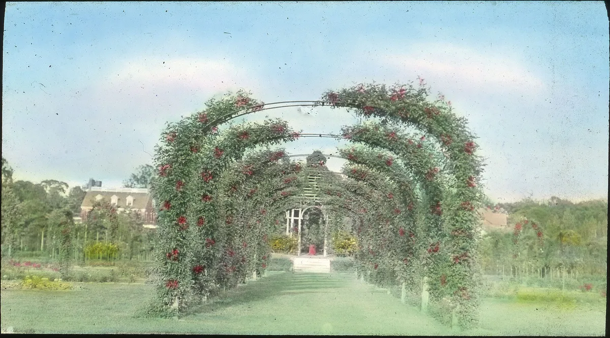
Yes, Elizabeth Park is a public park listed on the National Register of Historic Places. Visitors can access the grounds, rose gardens, and walking paths free of charge daily.
Vehicles cross the river via the Founders Bridge (Route 44) or the Bulkeley Bridge (I-84). Pedestrians and cyclists can use the dedicated walkway on the Founders Bridge connecting Mortensen Riverfront Plaza to East Hartford riverfront parks.
The Hartford Yard Goats, the Double-A minor league baseball affiliate of the Colorado Rockies, play their home games at Dunkin' Park in northern Downtown.
Source transparency
Official and locally relevant sources used to verify the practical information presented in this Hartford decision guide.
Hartford decision engine
Tell Adventria what kind of experience you want, set your practical limits, and turn the options in Hartford into one workable plan.
Choose a Hartford Plan