Downtown Juneau
Best for
History, government, fine dining, craft beverages, and cultural sites
 AdventriaLocalOpen App
Local Decision Guide
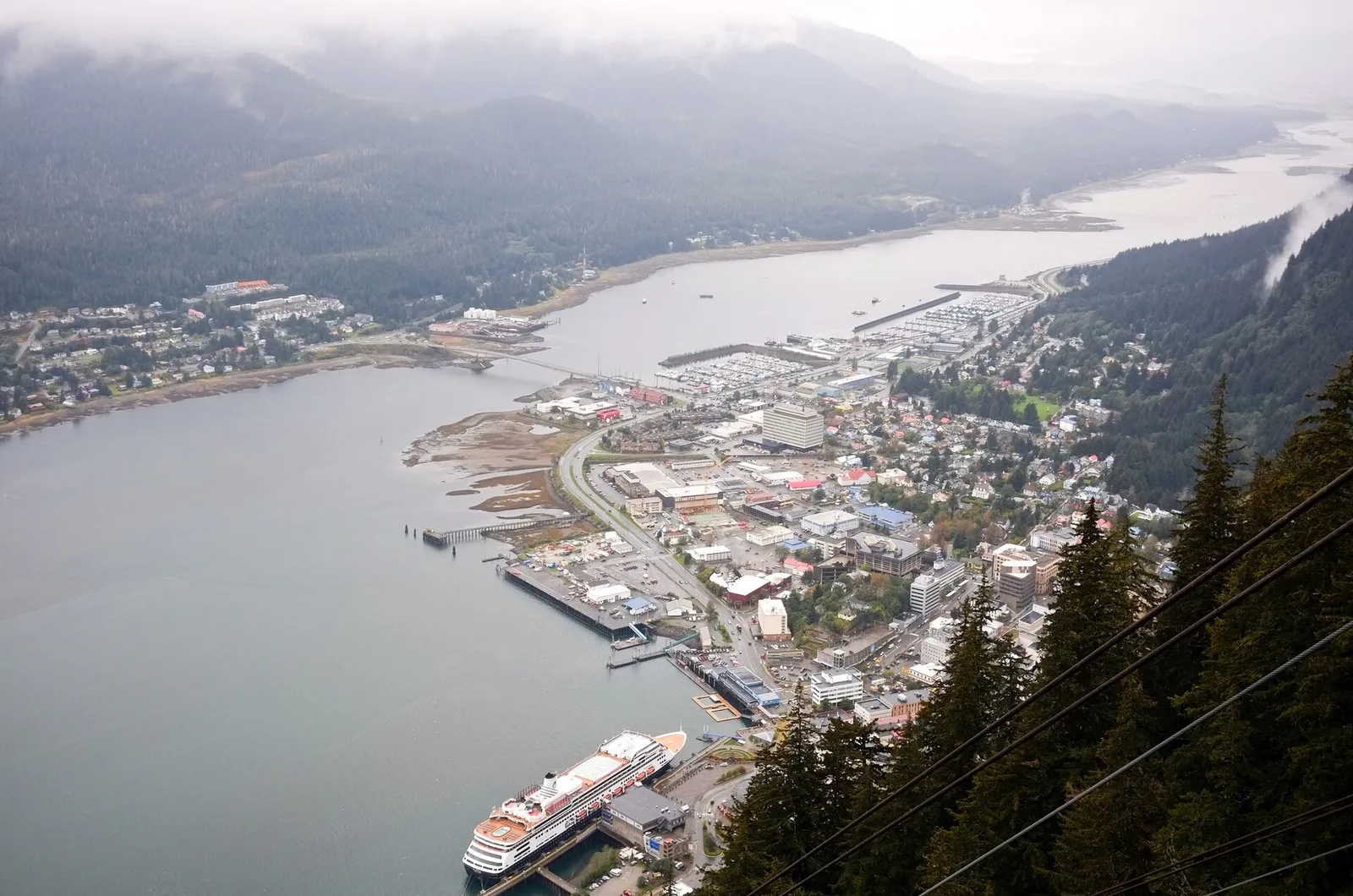
Trying to decide what to do in Juneau? Adventria helps you cut through the options and choose a good-enough plan without endless scrolling. Juneau's lack of outside road access, steep topography, and dramatic cruise crowds demand practical planning. Whether heading out to Mendenhall Glacier, crossing the channel to Douglas Island, or exploring downtown, here is how to navigate local transit, microclimates, and regional distinctiveness.
The local decision problem
Navigating geographic isolation, severe rain, cruise ship congestion, and distinct district friction when planning activities in Juneau.
That is where Adventria comes in. Adventria helps narrow the options in Juneau around practical factors like location, distance, budget, vibe, who you are with, and the kind of experience you actually want, so research can turn into a decision.
Let Adventria narrow the optionsPick the right part of town
Different parts of Juneau work for different kinds of plans. Start with the experience you want, then narrow the map.
Best for
History, government, fine dining, craft beverages, and cultural sites
Best for
Glacier access, major retail shopping, and suburban residential convenience
Best for
Skiing, quiet historic walking trails, beachcombing, and local pub dining
Best for
Whale watching excursions, charter fishing, ferry travel, and harbor views
Best for
Industrial services, trade supplies, and visiting flagship craft brewing
Best for
Low-density coastal living and scenic channel drives
This is a quick starting point. The full guide covers 7 local neighborhoods and districts in Juneau.
Eat & drink
When the decision is less about what to do and more about where to eat or grab a drink, start here. These local cues narrow the food and drink decision without turning dinner or a night out into another hour of comparison.
For casual, no-reservation dining downtown, order hot Russian dumplings at Pel'Meni, rockfish tacos at Deckhand Dave's food truck yard, or King crab legs at Tracy's King Crab Shack on the waterfront. In Douglas, drop into The Island Pub for wood-fired pizza and channel views, or try Zerelda's Bistro in the Mendenhall Valley for rotating lunch specials.
Start with a late afternoon stroll along the causeway and labyrinth at the National Shrine of St. Thérèse Out the Road. Head downtown for gin flights at Amalga Distillery, followed by dinner at In Bocca Al Lupo for handmade pasta and wood-fired Neapolitan pizza, or modern Alaskan seafood at Salt.
Still comparing options? Adventria can narrow the choice around budget, distance, vibe, and who you are with.
Decide with AdventriaPlan by situation
Start with the kind of plan you are actually trying to make. These city-specific ideas narrow the choice around who you are with, what you want to spend, the weather, and the kind of outing you want.
For an outdoor plan from Juneau, compare trails, state parks, national parks within trip range, and scenic drives. Options in the current city guide include Point Bridget State Park and Chilkat State Park.
Take children to Savikko Park on Douglas Island to explore 'Sandy Beach' and walk the flat Treadwell Mine Historic Trail through forested ruins. On rainy afternoons, visit the Juneau-Douglas City Museum at 4th and Main Streets or play indoors after walking the easy Moraine Ecology or Nugget Falls trails.
When heavy rain sets in, explore the Alaska State Museum (APK Building) downtown to see state history and Alaska Native artifacts, or visit the Sealaska Heritage Institute at Heritage Plaza. Alternatively, ride the elevator to the top floor of the Marine Parking Garage to visit the Juneau Public Library for floor-to-ceiling panoramic views of Gastineau Channel out of the weather.
If taking public transit (Capital Transit Routes 3 or 4), note that the bus drops off at Mendenhall Loop Road, requiring a 1.5-mile walk each way to the visitor center. Once there, you can walk the flat 0.8-mile Nugget Falls Trail directly to the base of the waterfall or walk the Photo Point Trail without paying private tour prices.
Solo visitors can embark on the historic Perseverance Trail starting right at the top of Basin Road downtown, passing Gold Creek and waterfalls. Afterward, sample wild sours and IPAs at Devil's Club Brewing Company on North Franklin Street or order a late-night box of dumplings at Pel'Meni.
For a day trip from Juneau, compare Sitka. More options are listed in the trip section below.
Outdoors nearby
Use these nearby outdoor options when the plan calls for a trail, protected landscape, park, or drive instead of another indoor stop. Proximity here is geographic, not a promise about driving time.
Get out of town
When staying in town is not the answer, these nearby destinations give you a smaller starting set for a day trip, overnight escape, or weekend away.
Destination relationships are screened geographically. Straight-line proximity is not presented as road mileage or estimated travel time.
Local landmarks & attractions
These notable destinations offer a starting point when you want something specific to see, visit, or build into a day around Juneau. Distances are approximate from the city area.
State Capitol Building in Juneau, Alaska, USA
museum in Juneau, Alaska
museum in Juneau, Alaska
theatre in Juneau, Alaska, United States
historic district in Alaska, USA
Notable places are selected from structured public destination data and ranked for relevance, prominence, proximity, and variety.
Local decision signals
A useful local recommendation depends on how the city actually works. These conditions affect where to go, what to do, and whether a plan makes sense right now.
Juneau is the only U.S. state capital unreachable by road; all arrivals occur by air at Juneau International Airport (JNU) or by water via Alaska Marine Highway ferries and cruise ships.
Precipitation varies drastically over short distances within the Tongass rainforest, with Downtown Juneau receiving over 90 inches annually while Juneau Airport averages roughly 55 inches.
Peak summer days see up to 5 or 6 ships berthing simultaneously, bringing 10,000 to 18,000+ passengers into a concentrated 10-block area along South Franklin Street.
Capital Transit public buses do not run directly to the Mendenhall Glacier Visitor Center; disembarking at Mendenhall Loop Road requires a 1.5-mile walk each way on foot.
Street parking provides two free hours daily, while off-street municipal lots use the ParkSmarter app and are monitored by License Plate Recognition cameras.
Attractions contract operating schedules outside peak summer; for example, the Mendenhall Glacier Visitor Center reduces operations to weekends only in winter.
Mid-summer to fall salmon runs bring black bears to Steep Creek boardwalks and local rivers, requiring hikers to carry bear spray and maintain safe distances.
Neighborhood context
Neighborhoods are not interchangeable. Each area offers a different balance of atmosphere, transportation, food, nightlife, activities, and planning friction.
Best for: History, government, fine dining, craft beverages, and cultural sites
Anchored around South Franklin Street, Front Street, and 4th and Main. Features historic gold-rush architecture, cruise docks, state museums, and steep hillside streets leading to trailheads.
Best for: Glacier access, major retail shopping, and suburban residential convenience
Located 9 to 12 miles northwest of downtown. Holds major retailers like Costco and Fred Meyer, residential subdivisions, and primary access to the Mendenhall Glacier Recreation Area.
Best for: Skiing, quiet historic walking trails, beachcombing, and local pub dining
Connected via the Juneau-Douglas Bridge. Home to West Juneau, historic Douglas townsite, Savikko Park dark sand beach, Treadwell Mine ruins, and Eaglecrest Ski Area.
Best for: Whale watching excursions, charter fishing, ferry travel, and harbor views
Located 12 to 15 miles northwest of downtown. Features Statter Harbor, University of Alaska Southeast, the marine highway ferry terminal, and waterfront dining.
Best for: Industrial services, trade supplies, and visiting flagship craft brewing
Commercial corridor along Glacier Highway halfway between Downtown and the Valley. Hosts municipal facilities, auto services, and the main Alaskan Brewing Company brewery.
Best for: Low-density coastal living and scenic channel drives
A quiet residential strip extending several miles south of Downtown Juneau along the base of Mount Roberts along the Gastineau Channel.
Best for: Wilderness solitude, quiet coastal parks, and scenic northern drives
Refers to the rural stretch of Glacier Highway extending past Auke Bay from Tee Harbor to Echo Cove. Contains state recreation areas and the National Shrine of St. Thérèse.
Juneau local guide
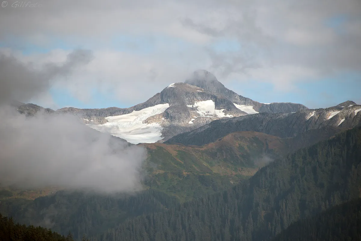
Juneau's geography is fundamentally shaped by the 1,500-square-mile Juneau Icefield to the east and the saltwater channels of the Inside Passage to the west. Unconnected to any outside road network, the City and Borough of Juneau spans a massive land area, yet daily life is concentrated along a narrow coastal strip along Egan Drive and Glacier Highway. Distances between hubs are significant: Downtown Juneau lies 9 to 12 miles from the Mendenhall Valley, 12 to 15 miles from Auke Bay, and over 20 miles from rural trailheads 'Out the Road.'
Understanding local travel friction is essential for setting expectations. While Downtown Juneau is compact and walkable, steep hillside streets challenge pedestrians moving toward upper neighborhoods or Basin Road. Furthermore, public transit through Capital Transit connects core districts but contains distinct gaps—such as requiring a 1.5-mile walk from the nearest bus stop to reach the Mendenhall Glacier Visitor Center. Planning around rental cars, local tour shuttles, or designated bus stops prevents unexpected delays.
Explore your options
Match your daily plans to the right neighborhood based on atmosphere, travel friction, and primary attractions.
The historic, political, and tourism epicenter of the city, framed by steep mountains and Gastineau Channel.
The suburban commercial engine and natural focal point of Juneau.
Coastal hubs offering outdoor recreation, maritime operations, and local dining escapes.
Practical local guidance
Operating inside the Tongass National Forest temperate rainforest requires strict adherence to practical layering and weather preparation.
A simpler way to decide
Ensure a smooth visit to Juneau's most famous natural landmark by following these sequential steps.
Decide whether to book a direct commercial shuttle, drive a rental car, or take Capital Transit. Note that public buses require a 1.5-mile walk each way from Mendenhall Loop Road.
Verify operating days and fee requirements for accessing the visitor center exhibits, Photo Point, and Steep Creek boardwalk during your season of travel.
During mid-summer and fall salmon runs, carry bear spray, stay at least 50 yards away from black bears, and pack out all food scraps in sealed containers.
Choose between the flat 0.8-mile Nugget Falls Trail, the paved Photo Point Trail, or longer day hikes like East Glacier Loop depending on your timing and fitness.
Ensure every member of your party wears waterproof footwear and a hooded rain shell, as weather at the lake shoreline is often cooler and wetter than downtown.
Common local questions
These are common situations people face when trying to decide where to eat, what to do, where to get drinks, or how to spend their time in Juneau.
Juneau planning questions
Practical answers for people deciding where to eat, what to do, where to go, or how to make plans in Juneau.
No. Juneau is the only U.S. state capital with no road connections to the outside highway system. All visitors, vehicles, and goods arrive by air at Juneau International Airport or by water via the Alaska Marine Highway System ferries, barges, or cruise ships.
Mendenhall Glacier is located in the Mendenhall Valley, approximately 12 miles northwest of Downtown Juneau. The drive takes about 15 to 20 minutes via Egan Drive.
No. Capital Transit public buses drop off at Mendenhall Loop Road and Glacier Spur Road. Reaching the Mendenhall Glacier Visitor Center requires an additional 1.5-mile (2.4 km) walk on foot each way.
Head indoors to the Alaska State Museum (APK Building) downtown, explore Southeast Alaska Native art at Sealaska Heritage Institute, or visit the Juneau Public Library on the top floor of the Marine Parking Garage for panoramic channel views.
Visit the pioneer Alaskan Brewing Company tasting room in Lemon Creek, Devil's Club Brewing Company or Barnaby Brewing downtown, Forbidden Peak Brewery in Auke Bay, or Amalga Distillery downtown for gin and spirits.
On-street parking offers two free hours daily. Off-street municipal lots and garages require payment through automated pay stations or the ParkSmarter mobile payment app.
Top low-friction walks include the flat 0.8-mile Nugget Falls Trail at Mendenhall Lake, the Treadwell Mine Historic Trail at Savikko Park on Douglas Island, and the Juneau Seawalk along the downtown waterfront.
Peak days bring up to 5 or 6 ships and 10,000 to 18,000+ passengers into a concentrated 10-block area downtown. Expect high pedestrian traffic along South Franklin Street, longer taxi waits, and busy tour buses.
'Out the Road' refers locally to the rural stretch of Glacier Highway extending north past Auke Bay toward Echo Cove, home to scenic beaches, coastal trailheads, and the National Shrine of St. Thérèse.
Yes, black bears are active throughout Juneau, especially near salmon streams like Steep Creek from mid-summer through fall. Always carry bear spray, maintain a 50-yard distance, and do not carry unsealed food on trails.
Source transparency
Official and locally relevant sources used to verify the practical information presented in this Juneau decision guide.
Juneau decision engine
Tell Adventria what kind of experience you want, set your practical limits, and turn the options in Juneau into one workable plan.
Choose a Juneau Plan