Downtown / Monument Square Historic District
Best for
Civic landmarks, historic architecture, local dining, greenway walks
 AdventriaLocalOpen App
North Central Massachusetts Local Planning
Trying to decide what to do in Leominster? Adventria helps you cut through the options and choose a good-enough plan without endless scrolling. Whether you are catching the train at North Leominster, hiking the Monoosnoc Hills, planning an afternoon at Sholan Farms, or looking for indoor entertainment, this guide helps you navigate Leominster's distinct districts, seasonal patterns, and travel friction.
The local decision problem
How to navigate dining, outdoor trails, transit, and family entertainment options in Leominster based on local geography and traffic patterns.
That is where Adventria comes in. Adventria helps narrow the options in Leominster around practical factors like location, distance, budget, vibe, who you are with, and the kind of experience you actually want, so research can turn into a decision.
Let Adventria narrow the optionsPick the right part of town
Different parts of Leominster work for different kinds of plans. Start with the experience you want, then narrow the map.
Best for
Civic landmarks, historic architecture, local dining, greenway walks
Best for
Commuter rail access, commercial corridors, mixed residential
Best for
Outdoor hiking, suburban living, school events
Best for
Local eateries, multi-family triple-deckers, historic architecture
Best for
Quiet residential living near downtown amenities
Best for
Indoor entertainment, shopping malls, casual chain dining
This is a quick starting point. The full guide covers 7 local neighborhoods and districts in Leominster.
Eat & drink
When the decision is less about what to do and more about where to eat or grab a drink, start here. These local cues narrow the food and drink decision without turning dinner or a night out into another hour of comparison.
For historic tavern dining in the downtown core, head to Monument Square to find Rye & Thyme inside the Wood Block building. If you prefer traditional sit-down Italian, Il Camino on Central Street offers long-standing local service. For casual neighborhood dining or quick Latin American dishes, explore the eateries around French Hill and the Water Street corridor.
Leominster's evening scene is informal and relaxed. Start with draft beer and pub meals around Monument Square, check for seasonal summer live music during Downtown Sounds on Central Street, or head to Retro Knights Arcade on Harvard Street for late-night vintage console and arcade gaming.
Still comparing options? Adventria can narrow the choice around budget, distance, vibe, and who you are with.
Decide with AdventriaPlan by situation
Start with the kind of plan you are actually trying to make. These city-specific ideas narrow the choice around who you are with, what you want to spend, the weather, and the kind of outing you want.
When rain falls, spend the day indoors playing retro console games at Retro Knights Arcade on Harvard Street, visit Launch Family Entertainment for indoor VR and bowling, or explore regional records at the Leominster Public Library.
For an outdoor plan from Leominster, compare trails, state parks, national parks within trip range, and scenic drives. Options in the current city guide include Johnny Appleseed State Park and Wachusett Mountain State Reservation.
Begin an afternoon date with a walk through the formal gardens and open meadows of Doyle Community Park on Abbott Avenue. Afterward, head downtown for dinner at Il Camino on Central Street or enjoy casual pub plates at Rye & Thyme.
Take kids to Barrett Park for open playgrounds and streamside walking trails. On rainy or high-heat days, head to Launch Family Entertainment on Commercial Road for trampolines and bowling, or spend an afternoon at Retro Knights Arcade with flat-rate admission for unlimited games.
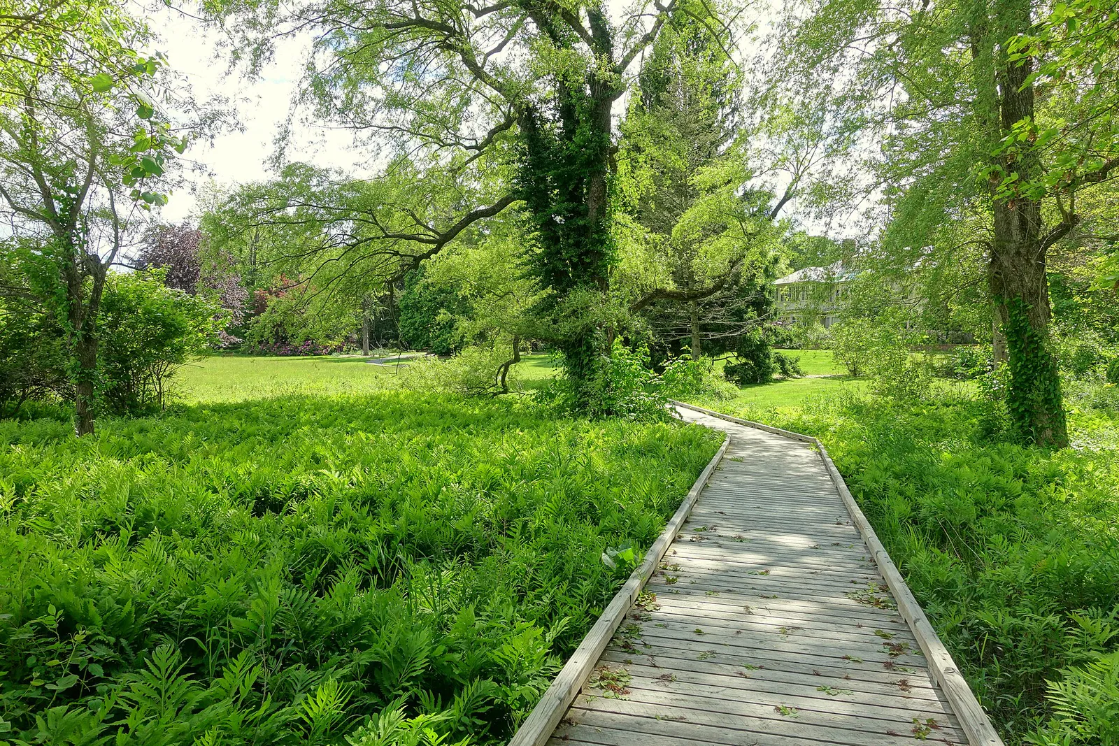
Enjoy no-cost recreation by cycling the paved Twin Cities Rail Trail, strolling the Monoosnoc Brook Greenway from downtown, exploring Pierce Meadow at Doyle Community Park, or browsing local history exhibits at the public library.
For a solo day outdoors, hike the 8.7-mile point-to-point Monoosnoc Ridge Trail from West Street through to Sholan Farms. If you prefer quiet indoor learning, visit the Local History Room at the Leominster Public Library or check the Tuesday/Saturday morning hours at the Leominster Historical Society.
Groups can rent lanes or arcade space at Launch Family Entertainment, organize a group ride along the Twin Cities Rail Trail, or gather for civic events inside City Hall's Tata Auditorium.
Outdoors nearby
Use these nearby outdoor options when the plan calls for a trail, protected landscape, park, or drive instead of another indoor stop. Proximity here is geographic, not a promise about driving time.
Get out of town
When staying in town is not the answer, these nearby destinations give you a smaller starting set for a day trip, overnight escape, or weekend away.
Destination relationships are screened geographically. Straight-line proximity is not presented as road mileage or estimated travel time.
Local landmarks & attractions
These notable destinations offer a starting point when you want something specific to see, visit, or build into a day around Leominster. Distances are approximate from the city area.
art museum in Worcester, Massachusetts
Botanic garden in Boylston, Massachusetts
arena and convention in Worcester, Massachusetts
art museum in Fitchburg, Massachusetts
multi-use auditorium located in downtown Lowell, Massachusetts
state park in Fitzwilliam, New Hampshire
dam in Clinton, Massachusetts, USA
public monument in Worcester
Notable places are selected from structured public destination data and ranked for relevance, prominence, proximity, and variety.
Local decision signals
A useful local recommendation depends on how the city actually works. These conditions affect where to go, what to do, and whether a plan makes sense right now.
Heavy morning and evening traffic gathers around Exits 98, 99, and 100 where Route 12, I-190, and highway retail corridors merge.
Severe summer thunderstorms produce sudden runoff along Monoosnoc Brook, occasionally inundating low-lying underpasses at Route 2 and Merriam Avenue.
Reaching the North Monoosnoc Hill trailhead on Granite Street requires traversing an unpaved, rutted dirt road that challenges low-clearance vehicles.
Fruit harvesting at Sholan Farms brings elevated weekend traffic along Pleasant Street from late August through October.
Parking at Crow Hill Pond in Leominster State Forest requires payment between Memorial Day and Labor Day, while off-season parking is free.
The Leominster Historical Society opens on limited morning hours on Tuesdays and Saturdays, requiring advance planning for visits.
The North Leominster Commuter Rail garage lacks physical ticket kiosks, so parking must be paid via mobile app or conductor.
Neighborhood context
Neighborhoods are not interchangeable. Each area offers a different balance of atmosphere, transportation, food, nightlife, activities, and planning friction.
Best for: Civic landmarks, historic architecture, local dining, greenway walks
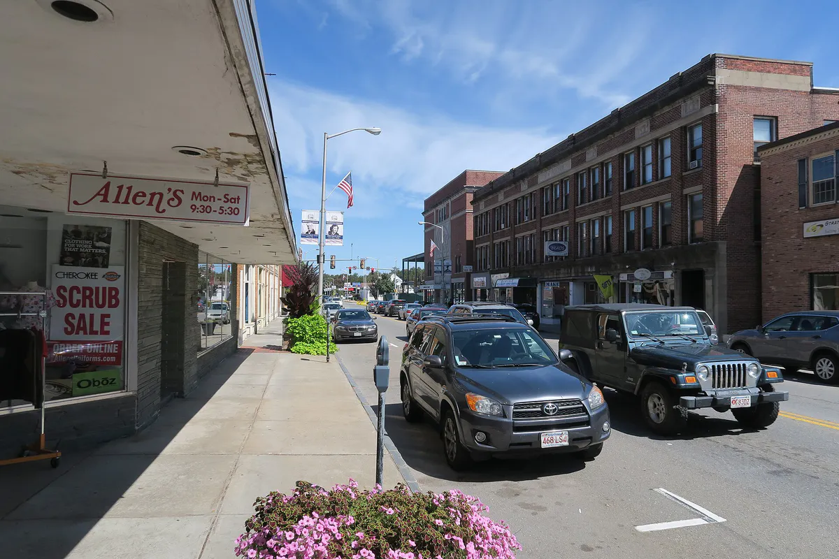
Anchored by Monument Square on Main and Water Streets, this walkable core houses City Hall, First Church, historic commercial blocks like the Wood Block building, local taverns, and access to the Monoosnoc Brook Greenway.
Best for: Commuter rail access, commercial corridors, mixed residential
Bordering Fitchburg and Lunenburg, North Leominster centers around the Nashua Street MBTA station garage and features dense neighborhood streets, industrial parks, and Route 12 strip retail.
Best for: Outdoor hiking, suburban living, school events
Extending west toward Leominster State Forest, this wooded area contains Leominster High School and acts as the entry point to the Monoosnoc Hills trail network via Granite and West Street trailheads.
Best for: Local eateries, multi-family triple-deckers, historic architecture
A dense neighborhood north of downtown historically settled by Franco-American factory workers, characterized by classic New England triple-deckers and casual neighborhood dining options.
Best for: Quiet residential living near downtown amenities
A residential enclave tucked between North Main Street and the Monoosnoc Brook basin, providing proximity to both North Leominster transportation and downtown shopping.
Best for: Indoor entertainment, shopping malls, casual chain dining
Located near the Route 2 and Interstate 190 exchange, this high-traffic district features The Mall at Whitney Field and indoor recreation destinations.
Best for: Big-box shopping, wide selection of national retailers
A retail plaza off Route 2 and Route 117 hosting major national retail anchors and spacious surface parking lots.
Explore your options
Leominster features a rich mix of preserved agricultural lands, state forests, and urban parks.
A 169-acre city-owned, non-profit community-operated apple orchard. Offers U-Pick seasonal harvesting, raspberries, blueberries, hiking trails, and hilltop views of North Central Massachusetts.
Spanning over 4,300 acres, this state park offers outdoor activities including swimming at Crow Hill Pond, rock climbing at Crow Hill Ledges, and access to the 95-mile Midstate Trail.
A 157-acre urban park reservation managed by The Trustees of Reservations, built on the historic estate of industrialist Harry W. Pierce.
A paved, 12-foot-wide multi-use rail trail running 4.5 miles along the former Fitchburg & Worcester Railroad line.
Practical local guidance
Keep these seasonal considerations and operational factors in mind when planning activities in Leominster:
A simpler way to decide
Follow these practical steps for a smooth transit experience at the North Leominster Commuter Rail station:
Navigate to 44 Nashua Street in North Leominster. The station features a multi-level parking garage managed by MART containing 436 total spaces.
Note that there are no physical ticket-vending machines inside the garage. Pay the daily parking fee using the mobile app system or directly with the conductor on board.
Confirm train arrival times on the Fitchburg Line (Zone 8). Trains run eastbound toward Boston's North Station and westbound toward Fitchburg and Wachusett.
Buy your commuter train ticket via the MBTA mTicket app on your smartphone before boarding, or purchase directly onboard from train staff.
Arrive on the platform 5 to 10 minutes prior to scheduled departure. Accessibility ramps and designated accessible parking spaces (7 spaces) are available near the entrance.
Common local questions
These are common situations people face when trying to decide where to eat, what to do, where to get drinks, or how to spend their time in Leominster.
Leominster planning questions
Practical answers for people deciding where to eat, what to do, where to go, or how to make plans in Leominster.
Parking at the 44 Nashua Street garage is managed by MART. Because there are no ticket machines on-site, parking payments are handled electronically via mobile app systems or directly through train staff.
The 8.7-mile point-to-point trail can be accessed via trailheads on West Street, Granite Street, or near Sholan Farms on Pleasant Street. Note that the dirt access road to the Granite Street trailhead lot is rough and unpaved.
Daily parking fees at the Crow Hill Pond parking area apply between Memorial Day weekend and Labor Day. Off-season parking is free.
In 1957, artist Don Featherstone designed the original plastic pink lawn flamingo while working for Union Products, a local manufacturing company in Leominster, earning the city nationwide fame in plastics history.
No. While Barrett Park offers walking trails, picnic tables, a playground, and a fishing pier, swimming in Barrett Pond is prohibited due to water turbidity.
The 4.5-mile paved trail starts near Carter Park on Mechanic Street in downtown Leominster and runs north over Route 2 into First Street in Fitchburg.
The Montachusett Regional Transit Authority (MART) operates local routes including Route 1, Route 2, Route 2 Express, and Route 3, connecting Monument Square to Fitchburg, Leominster Hospital, and The Mall at Whitney Field.
A roadside granite marker and miniature log cabin diorama are located on Johnny Appleseed Lane near Route 13. Additionally, the official Johnny Appleseed Visitor Center is located nearby on Route 2 Westbound.
During major winter snow events, MART bus routes transition to designated 'Snow Routes' with modified detours. Check transit announcements during winter storms.
High-clearance vehicles are only recommended for the unpaved, eroded dirt road leading to the Granite Street trailhead lot. Trailheads off West Street and Doyle Community Park feature paved or standard surface parking.
Source transparency
Official and locally relevant sources used to verify the practical information presented in this Leominster decision guide.
Leominster decision engine
Tell Adventria what kind of experience you want, set your practical limits, and turn the options in Leominster into one workable plan.
Choose a Leominster Plan