Lowertown (District 17)
Best for
Craft breweries, weekend brunch, art galleries, and farmers market visits.
 AdventriaLocalOpen App
St. Paul Local Decision Guide
Trying to decide what to do in St. Paul? Adventria helps you cut through the options and choose a good-enough plan without endless scrolling. Making smooth choices in St. Paul requires understanding its unique river topography, 17 official planning districts, skyway operating hours, and event-driven traffic patterns. Whether you are looking for a pre-game dinner on West 7th, a family morning at Como Regional Park, or a quiet solo afternoon in St. Anthony Park, this guide helps you weigh practical tradeoffs before heading out.
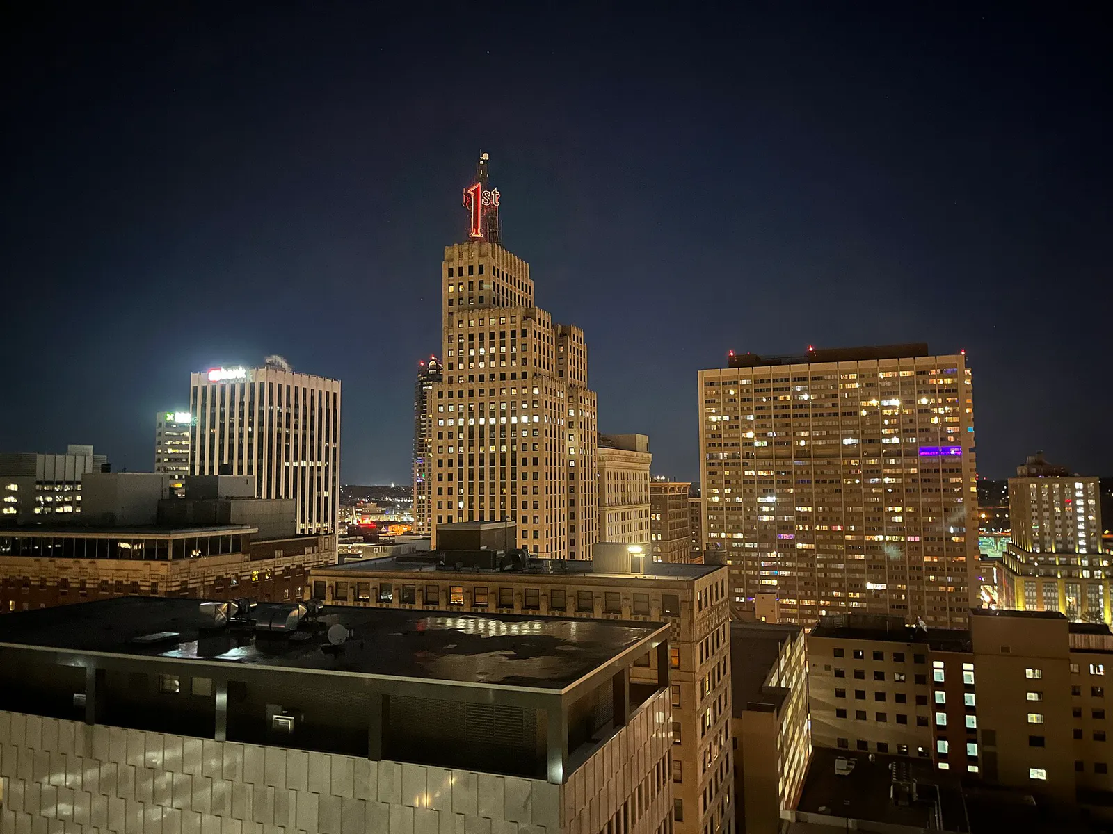
The local decision problem
How to choose where to eat, explore, and spend time in St. Paul by understanding neighborhood identities, river boundaries, skyway rules, and seasonal timing.
That is where Adventria comes in. Adventria helps narrow the options in St. Paul around practical factors like location, distance, budget, vibe, who you are with, and the kind of experience you actually want, so research can turn into a decision.
Let Adventria narrow the optionsPick the right part of town
Different parts of St. Paul work for different kinds of plans. Start with the experience you want, then narrow the map.
Best for
Craft breweries, weekend brunch, art galleries, and farmers market visits.
Best for
Theater outings, civic landmarks, luxury hotel dining, and museum trips.
Best for
Pre-game meals, classic supper club lounge vibes, Italian dining, and sports bars.
Best for
Romantic date nights, Victorian architecture walks, cozy coffee shops, and boutique dining.
Best for
Historic mansion tours, neighborhood boutique shopping, and casual campus dining.
Best for
Authentic Southeast Asian cuisine, Hmong food markets, and transit-adjacent dining.
This is a quick starting point. The full guide covers 8 local neighborhoods and districts in St. Paul.
Eat & drink
Trying to decide where to eat in St. Paul? Start with the local dining context below and narrow the decision around the kind of meal or experience you actually want.
Head to the West 7th corridor early to secure seating before arena crowds arrive. Cossetta Alimentari offers multi-floor cafeteria-style Italian dining with rapid throughput and no reservations needed. For a classic steakhouse lounge experience, Mancini's Char House offers open-hearth grilling, while Parlour St. Paul and Tom Reid's Hockey City Pub provide burger and tavern options within brief walking distance of the venue entrance.
Still comparing options? Adventria can narrow the choice around budget, distance, vibe, and who you are with.
Decide with AdventriaPlan by situation
Start with the kind of plan you are actually trying to make. These city-specific ideas narrow the choice around who you are with, what you want to spend, the weather, and the kind of outing you want.
Begin with a late-afternoon walking tour along Summit Avenue to view historic 19th-century mansions and the Cathedral of Saint Paul. Transition to Cathedral Hill along Selby Avenue for dinner on the shaded stone patio at W.A. Frost & Company or cozy Russian dining at Moscow on the Hill, followed by coffee at Nina's Coffee Cafe.
Start at Como Regional Park, where admission to the Como Park Zoo and Marjorie McNeely Conservatory is completely free year-round (voluntary suggested donation requested). Afterwards, explore the Mississippi River Visitor Center located inside the lobby of the Science Museum of Minnesota, which offers free national park interactive exhibits on river ecology.
Spend the morning inside the heated Marjorie McNeely Conservatory at Como Park to experience tropical plant rooms and the Sunken Garden. In the afternoon, explore the Science Museum of Minnesota on Kellogg Boulevard or visit Can Can Wonderland in Midway for indoor mini-golf and vintage arcade games inside a converted industrial complex.
For an outdoor plan from St. Paul, compare trails, state parks, national parks within trip range, and scenic drives. Options in the current city guide include State Capitol Ground and Gateway State Trail.
For a short escape from St. Paul, compare Mankato and Maple Grove. More options are listed in the trip section below.
Outdoors nearby
Use these nearby outdoor options when the plan calls for a trail, protected landscape, park, or drive instead of another indoor stop. Proximity here is geographic, not a promise about driving time.
Get out of town
When staying in town is not the answer, these nearby destinations give you a smaller starting set for a day trip, overnight escape, or weekend away.
Destination relationships are screened geographically. Straight-line proximity is not presented as road mileage or estimated travel time.
Local landmarks & attractions
These notable destinations offer a starting point when you want something specific to see, visit, or build into a day around St. Paul. Distances are approximate from the city area.
contemporary art center in Minneapolis, Minnesota, United States
multi-purpose arena in St. Paul, MN, USA
zoo and conservatory in Saint Paul, Minnesota, United States
art museum in Minneapolis, Minnesota
amusement park inside Mall of America
center for theater performance, production, education, and professional training in Minneapolis, Minnesota
zoo in Apple Valley, Minnesota, United States
baseball stadium in Minneapolis, Minnesota, USA
Notable places are selected from structured public destination data and ranked for relevance, prominence, proximity, and variety.
Local decision signals
A useful local recommendation depends on how the city actually works. These conditions affect where to go, what to do, and whether a plan makes sense right now.
The Mississippi River bends dramatically around St. Paul's southern and western edges. Steep sandstone bluffs isolate riverfront parks like Crosby Farm and Hidden Falls from upper neighborhoods like Highland Park and Summit Hill, requiring access via specific winding park roads like Edgcumbe Road or Wheelock Parkway.
District 3 (West Side) sits on the south bank of the river directly across from Downtown St. Paul due to the river's S-curve. Access is limited to specific river bridges, including the Smith Avenue High Bridge, Wabasha Street, Robert Street, and the Lafayette Bridge (US-52).
Downtown's 47-block, 5-mile climate-controlled skyway system handles most quick-service lunch dining and office walking during weekday business hours. In the evening and on weekends, skyway foot traffic thins, and dining shifts to street-level hubs in Lowertown, Rice Park, and West 7th.
I-35E through central St. Paul features a enforced 45 mph speed limit and a heavy-truck ban designed to protect adjacent historic neighborhoods along West 7th and Summit Hill.
A declared Snow Emergency triggers strict Night Plow (9:00 PM to 8:00 AM) and Day Plow (8:00 AM to 8:00 PM) parking rules across all 17 districts. Vehicles parked on active plow routes are ticketed and towed to impound facilities.
West 7th Street experiences heavy congestion 60 to 90 minutes before NHL Wild games or major concerts at Xcel Energy Center. Similarly, Snelling Avenue experiences severe traffic spikes during Minnesota United FC matches at Allianz Field and during the 12 days of the Minnesota State Fair.
St. Paul operates on an earlier schedule than neighboring Minneapolis. Many independent neighborhood restaurant kitchens close by 9:00 PM or 10:00 PM on weeknights, except in active event corridors like West 7th.
Neighborhood context
Neighborhoods are not interchangeable. Each area offers a different balance of atmosphere, transportation, food, nightlife, activities, and planning friction.
Best for: Craft breweries, weekend brunch, art galleries, and farmers market visits.
Situated around Mears Park at the eastern end of Downtown, Lowertown features converted historic brick warehouses, loft apartments, chef-driven bistros, and Union Depot.
Best for: Theater outings, civic landmarks, luxury hotel dining, and museum trips.
The cultural anchor of Downtown St. Paul, containing Landmark Center, the Ordway Center for the Performing Arts, St. Paul Public Library, and Saint Paul Hotel surrounding historic Rice Park.
Best for: Pre-game meals, classic supper club lounge vibes, Italian dining, and sports bars.
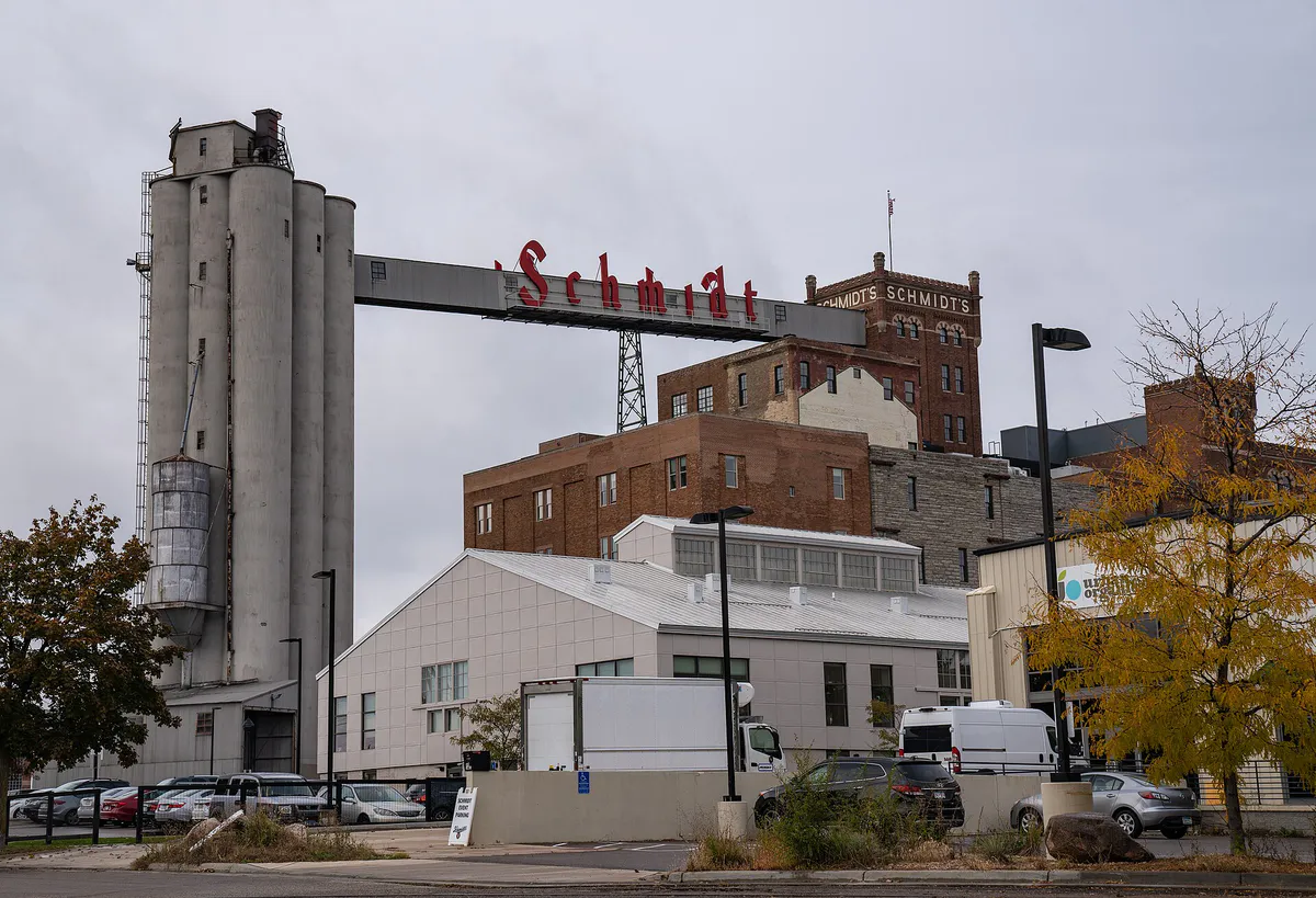
A working-class historic strip stretching southwest from Downtown toward Fort Snelling, anchored by Xcel Energy Center, the historic Schmidt Brewery lofts, and multi-generational eateries.
Best for: Romantic date nights, Victorian architecture walks, cozy coffee shops, and boutique dining.
Centered along Selby Avenue and anchored by the towering Cathedral of Saint Paul, this historic neighborhood features leafy brownstones, shaded stone patios, and independent local shops.
Best for: Historic mansion tours, neighborhood boutique shopping, and casual campus dining.
Flanked by Grand Avenue and Summit Avenue, these historic residential districts host the James J. Hill House, Macalester College, St. Thomas University, and miles of Victorian homes.
Best for: Authentic Southeast Asian cuisine, Hmong food markets, and transit-adjacent dining.
Located along University Avenue directly west of the State Capitol, Frogtown is the vibrant cultural hub for St. Paul's Hmong, Vietnamese, and East African communities.
Best for: Mexican bakeries, traditional taquerias, Latin markets, and river bluff views.
Located on the south bank of the Mississippi River, the West Side is defined by the Cesar Chavez Street commercial corridor, rich Mexican-American heritage, and scenic bluff overlooks.
Best for: Quiet coffee outings, independent bookstores, and peaceful academic village vibes.
Tucked away in the city's northwest corner near the U of M St. Paul Campus, this quiet district offers a self-contained village center at Como and Carter avenues.
St. Paul local guide
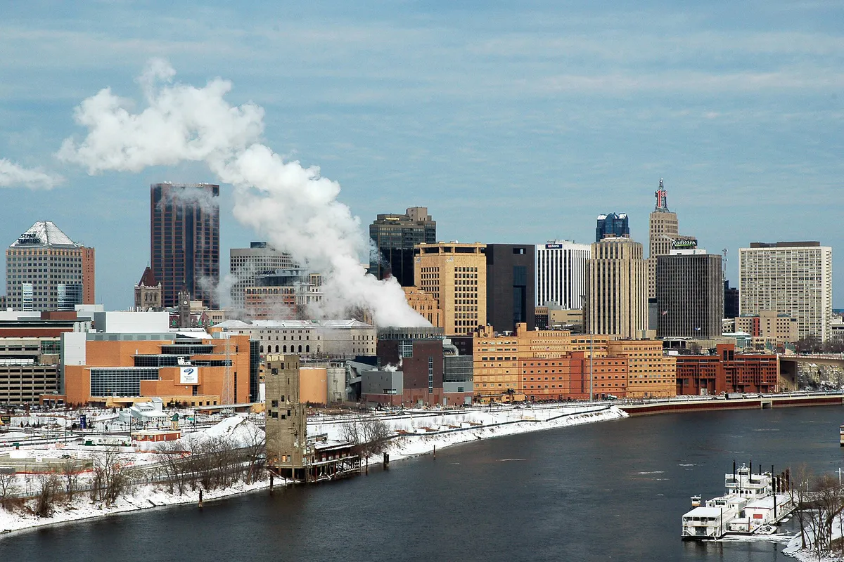
Saint Paul is officially organized into 17 Planning Districts, governed by citizen-led District Councils established in 1975. Understanding this structure helps visitors and residents navigate land use, commercial corridors, and community distinctiveness. Rather than a uniform grid, St. Paul is shaped by dramatic geological features—most notably the steep sandstone bluffs and radical S-curve of the Mississippi River.
Unlike Minneapolis, where the river runs predominantly north-south, the Mississippi curves along St. Paul's southern and western perimeter. This curve creates the geographic quirk of the West Side (District 3), which actually lies south of Downtown across the river. Traversing between Downtown and the West Side requires crossing specific elevated river bridges, such as the Smith Avenue High Bridge or Wabasha Street Bridge. Meanwhile, bluffs isolate lower riverfront parks like Crosby Farm and Hidden Falls from upper residential districts like Highland Park and Summit Hill, restricting vehicle access to designated parkways like Edgcumbe Road and Wheelock Parkway.
Transportation across the city is further defined by historic transit channels and highway corridors. Interstate 94 runs east-west through the city, historically bisecting the Rondo community and separating northern districts like Frogtown and Midway from southern districts like Summit-University and Macalester-Groveland. Interstate 35E cuts north-south but features a unique 45 mph speed limit and heavy-truck restriction through the West 7th section to preserve the acoustic and structural integrity of adjacent historic neighborhoods. Recognizing these geographical barriers makes planning transit routes and neighborhood travel far more predictable.
Explore your options
Match your group's operational constraints with the St. Paul district best suited for your outing.
Focus on high-capacity venues with predictable parking and flexible timeframes.
Combine historic architecture walks with intimate neighborhood dining.
Utilize transit-connected corridors and open civic spaces for casual, low-friction visits.
Select sprawling market halls and multi-level venues that accommodate unscheduled walk-ins.
Practical local guidance
Key operational guidelines to prevent parking fines, towing, and transit delays when traveling around St. Paul.
A simpler way to decide
Follow these steps to avoid gridlock and secure dining when attending an arena concert, theater show, or game.
Cross-reference start times at Xcel Energy Center, the Ordway, and Palace Theatre to anticipate cumulative downtown traffic compression.
If coming from the airport or West 7th corridor, take Metro Transit Route 54. If driving, target structured ramps near Kellogg Boulevard early rather than searching for street meters.
For fast counter-service, head to Cossetta on West 7th. For seated lounge dining, arrive at Mancini's or Parlour at least two hours prior to the event start time.
Use skyways during cold winter pre-game hours to reach arena corridors, but plan to exit to street level if heading to Lowertown bars after 10:00 PM.
Allow traffic to clear by lingering for a late drink on West 7th or take the Green Line LRT toward Union Depot or Minneapolis directly from the Central or 10th Street stations.
Common local questions
These are common situations people face when trying to decide where to eat, what to do, where to get drinks, or how to spend their time in St. Paul.
St. Paul planning questions
Practical answers for people deciding where to eat, what to do, where to go, or how to make plans in St. Paul.
Yes, admission to both the Como Park Zoo and the Marjorie McNeely Conservatory is free year-round. The facility accepts voluntary suggested donations ($8 for adults, $5 for children), but payment is not required for entry.
The St. Paul skyway system operates under a standardized city ordinance from 6:00 AM to midnight, Monday through Sunday. However, while the walkways remain open, skyway-level retail shops and quick-service eateries close after business hours, shifting food and nightlife activity to street-level storefronts.
The METRO Green Line light rail provides direct travel between Downtown St. Paul (Union Depot) and Downtown Minneapolis along University Avenue, operating daily with regular frequencies.
During a declared Snow Emergency, drivers must avoid parking on Night Plow routes from 9:00 PM to 8:00 AM and Day Plow routes from 8:00 AM to 8:00 PM. Free off-street parking is offered during the first 24 hours of an emergency at the Block 19 Ramp at 145 E 7th St.
Due to a sharp S-curve bend in the Mississippi River, District 3 (the West Side) sits geographically south of Downtown St. Paul on the river's south bank. It gets its name because historically it was on the west bank of the river relative to regional river travel.
In most St. Paul neighborhoods (such as Cathedral Hill, Mac-Grove, and St. Anthony Park), independent restaurant kitchens close around 9:00 PM or 10:00 PM on weeknights. Bars and eateries on West 7th near Xcel Energy Center remain open later on event nights.
Metro Transit Route 54 offers direct bus service from MSP Airport Terminal 1 along West 7th Street straight into Downtown St. Paul, connecting directly to Union Depot.
During the 12 days leading up to Labor Day, the Minnesota State Fair draws nearly 2 million visitors to the fairgrounds on the St. Paul border. Snelling Avenue, Como Avenue, and adjacent transit routes experience significant congestion and travel delays.
Visit Hmong Village at 1001 Johnson Parkway on the East Side or Hmongtown Central Market on Frogtown's University Avenue. Both complexes feature extensive food courts, authentic Hmong bakeries, counter-service papaya salad and noodle stalls, and fresh produce vendors.
I-35E through central St. Paul carries a enforced 45 mph speed limit and a heavy-truck prohibition to reduce noise and preserve adjacent historic residential districts along West 7th and Summit Hill.
Source transparency
Official and locally relevant sources used to verify the practical information presented in this St. Paul decision guide.
St. Paul decision engine
Tell Adventria what kind of experience you want, set your practical limits, and turn the options in St. Paul into one workable plan.
Choose a St. Paul Plan