Downtown Historic District
Best for
Independent dining, live theatre, outdoor music, walkability, and local shopping.
 AdventriaLocalOpen App
Waukesha Local Decision Guide
Trying to decide what to do in Waukesha? Adventria helps you cut through the options and choose a good-enough plan without endless scrolling. Navigate Waukesha with clear strategies for downtown dining, Fox River waterfront recreation, regional trail hubs, seasonal community events, and local travel friction points.
The local decision problem
How to plan outings, dining, outdoor recreation, and travel routes in Waukesha across changing seasons, parking regulations, train interruptions, and distinct districts.
That is where Adventria comes in. Adventria helps narrow the options in Waukesha around practical factors like location, distance, budget, vibe, who you are with, and the kind of experience you actually want, so research can turn into a decision.
Let Adventria narrow the optionsPick the right part of town
Different parts of Waukesha work for different kinds of plans. Start with the experience you want, then narrow the map.
Best for
Independent dining, live theatre, outdoor music, walkability, and local shopping.
Best for
Architectural walking, peaceful residential strolls, and historic campus sightseeing.
Best for
Riverfront walking, pedal boating, botanical garden strolls, and outdoor events.
Best for
Historical exploration and quiet park walks.
Best for
Big-box shopping, auto services, and convenient suburban dining.
Best for
County administrative business, trade shows, and fairground events.
This is a quick starting point. The full guide covers 8 local neighborhoods and districts in Waukesha.
Eat & drink
When the decision is less about what to do and more about where to eat or grab a drink, start here. These local cues narrow the food and drink decision without turning dinner or a night out into another hour of comparison.
Head downtown early to park before event closures take effect. Choose gastropub options like People's Park on Main Street for rooftop views, classic Italian at Mia's Italian Restaurant, or walk to Williams Street for Mexican cuisine served in converted train cars at La Estación. Expect heavy foot traffic and set aside extra travel time.
Take visitors on a self-guided downtown tour of the 10-foot painted Gibson Les Paul guitar sculptures, pick up baked goods at Rochester Deli, walk the Carroll University historic district, and enjoy an evening craft beer at Raised Grain Brewing Co.'s outdoor Terrace.
Still comparing options? Adventria can narrow the choice around budget, distance, vibe, and who you are with.
Decide with AdventriaPlan by situation
Start with the kind of plan you are actually trying to make. These city-specific ideas narrow the choice around who you are with, what you want to spend, the weather, and the kind of outing you want.
For an outdoor plan from Waukesha, compare trails, state parks, national parks within trip range, and scenic drives. Options in the current city guide include Glacial Drumlin State Trail and Allen Valley Siata.
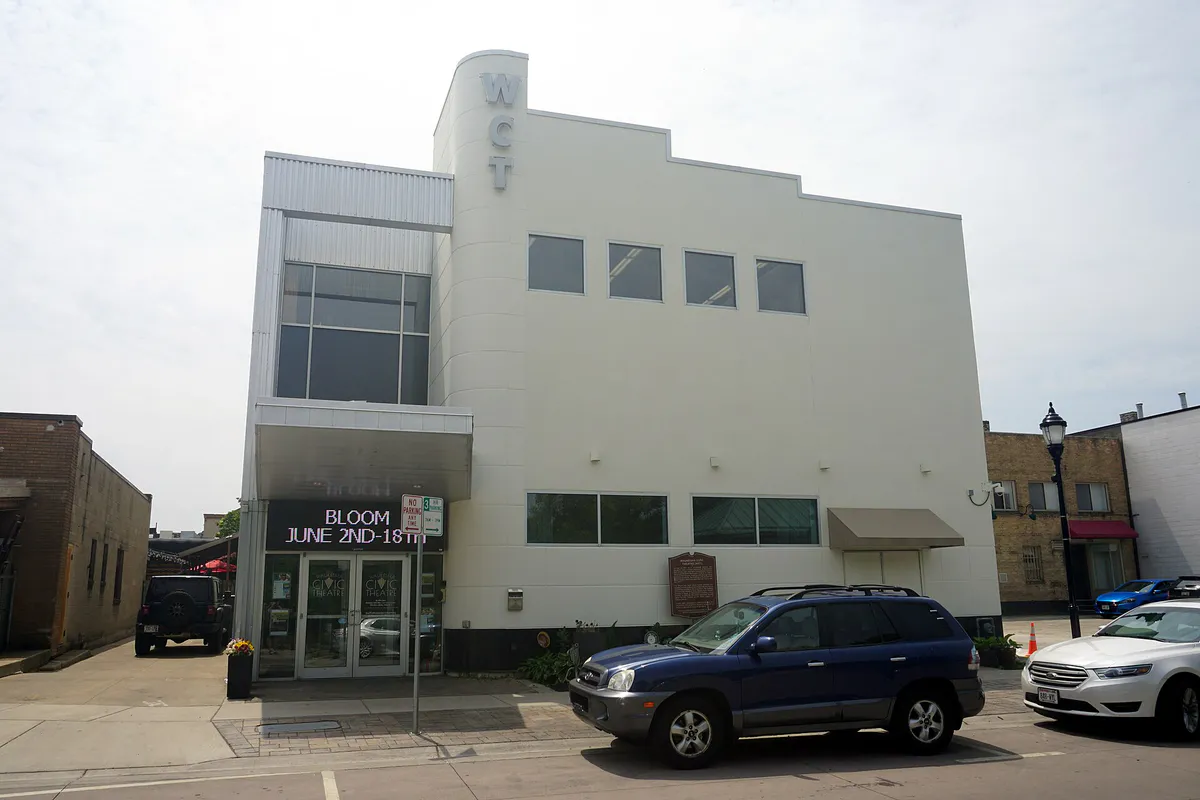
Reserve a table for chef-driven shared plates at Tofte's Table, follow with drinks at People's Park rooftop deck or House of Guinness, and catch a stage play or musical at Waukesha Civic Theatre on Main Street.
Start with a free walk or bike ride along the paved Riverwalk at Frame Park, exploring the formal botanical gardens and playground. Later, visit Retzer Nature Center to walk the accessible Discovery Trail through prairies and woodlands with no entry fee required for grounds.
Explore local history at the Waukesha County Historical Society & Museum inside the 1893 courthouse to view 'The Wizard of Waukesha' Les Paul exhibit. Follow up with specialty coffee and bakery items at The Steaming Cup in the historic Nickell Building, catch a planetarium show at Horwitz-DeRemer Planetarium, or attend a live show at Waukesha Civic Theatre.
Grab a hot drink at The Steaming Cup, browse local art at Almont Gallery, walk the 1.9-mile Frame Park river loop, or take a peaceful stroll through the tree-lined streets of the McCall Street Historic District.
Gather a group at Raised Grain Brewing Co. on Dolphin Drive to sit outside on 'The Terrace' container beer garden with live music and darts. For outdoor private events, reserve a picnic shelter at Minooka Park or the Rotary Building at Frame Park.
For a day trip from Waukesha, compare Holland and Wisconsin Dells. More options are listed in the trip section below.
Outdoors nearby
Use these nearby outdoor options when the plan calls for a trail, protected landscape, park, or drive instead of another indoor stop. Proximity here is geographic, not a promise about driving time.
Get out of town
When staying in town is not the answer, these nearby destinations give you a smaller starting set for a day trip, overnight escape, or weekend away.
Destination relationships are screened geographically. Straight-line proximity is not presented as road mileage or estimated travel time.
Local landmarks & attractions
These notable destinations offer a starting point when you want something specific to see, visit, or build into a day around Waukesha. Distances are approximate from the city area.
art museum in Milwaukee, Wisconsin
zoo in the United States
indoor arena in downtown Milwaukee, Wisconsin
music venue and former movie theater in Milwaukee, Wisconsin, United States
hotel in Milwaukee, United States
botanical garden
public museum in Wisconsin, United States
architectural structure
Notable places are selected from structured public destination data and ranked for relevance, prominence, proximity, and variety.
Local decision signals
A useful local recommendation depends on how the city actually works. These conditions affect where to go, what to do, and whether a plan makes sense right now.
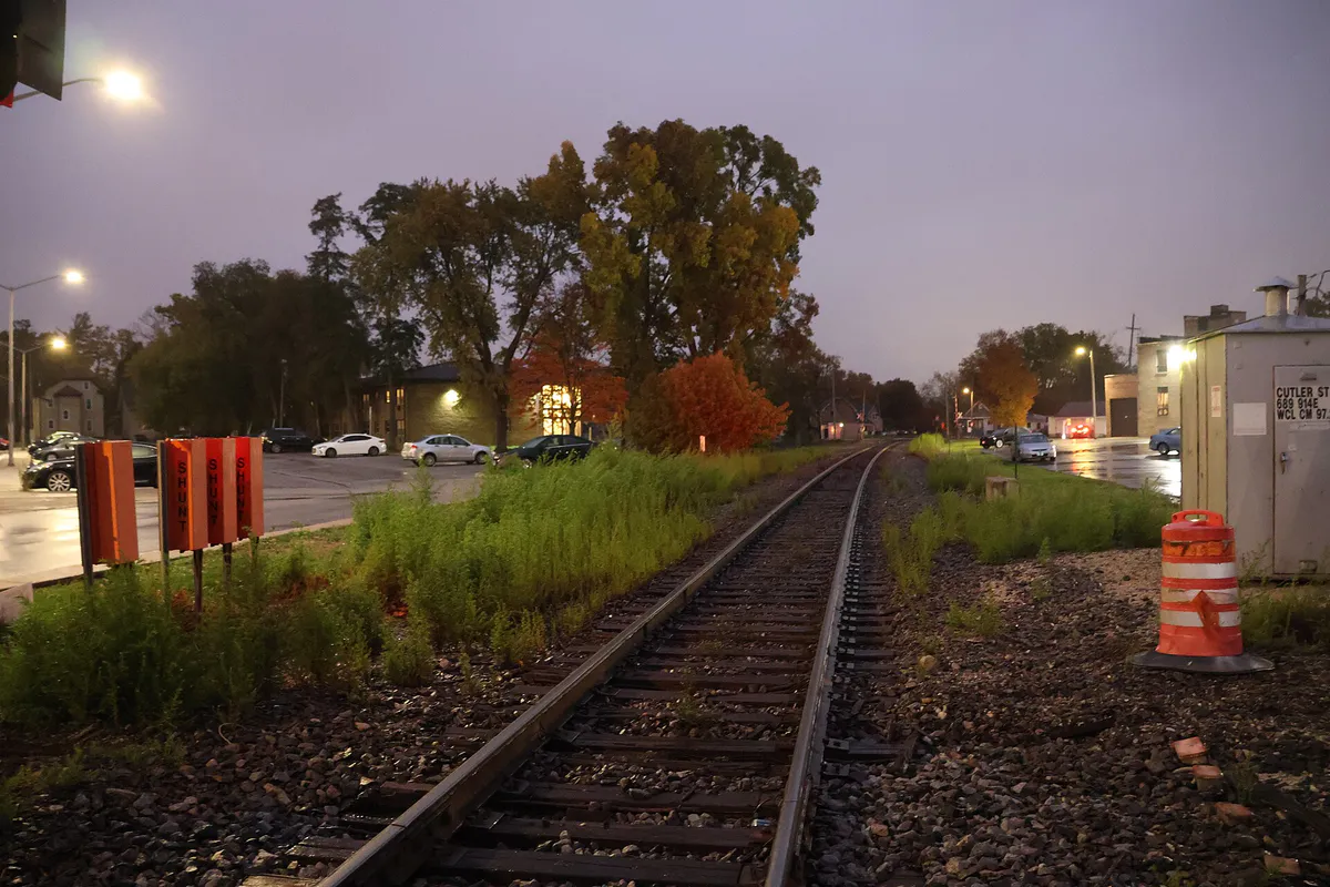
Active Canadian National and Wisconsin & Southern lines cross downtown at Williams Street, Grand Avenue, and Broadway, occasionally stopping traffic for 10 to 15 minutes.
Street closures for summer Friday Night Live begin at 5:00 PM on Main and Clinton Streets; cars remaining on designated blocks are towed at owner expense.
City-managed parks are free to access, whereas Waukesha County parks require a daily vehicle permit or annual sticker, and state bike trails require a trail pass for cyclists 16 and older.
The Fox River splits the city into sectors, making Moreland Boulevard, St. Paul Avenue, Barstow Street, Grand Avenue, and Broadway the vital river crossing points.
Waukesha Metro operates out of the Downtown Transit Center at 212 E. St. Paul Ave, connecting to Brookfield Square and the Milwaukee Regional Medical Center via Route 1.
Honoring guitar inventor Les Paul, downtown features ten-foot painted Gibson guitar sculptures, outdoor murals, and the Les Paul Performance Center in Cutler Park.
Waukesha's 19th-century resort era originated around Bethesda Park and Dunbar Park following Richard Dunbar's 1868 discovery of local mineral springs.
Neighborhood context
Neighborhoods are not interchangeable. Each area offers a different balance of atmosphere, transportation, food, nightlife, activities, and planning friction.
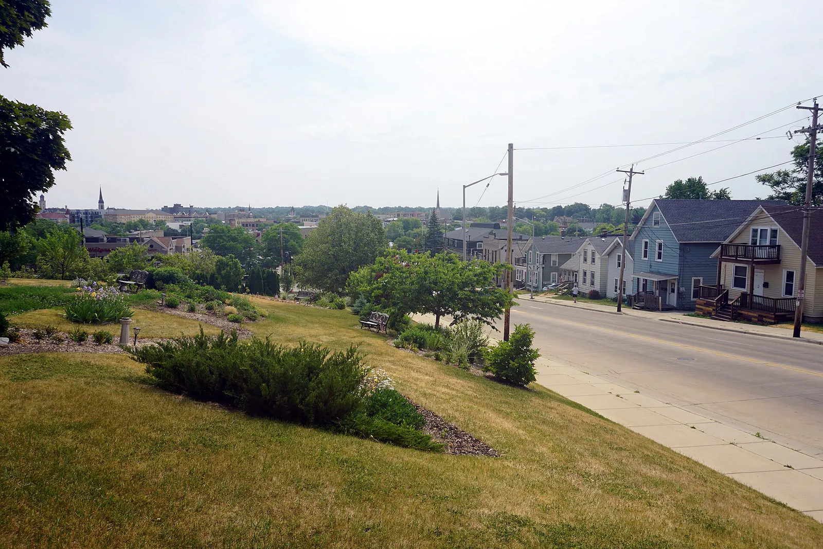
Best for: Independent dining, live theatre, outdoor music, walkability, and local shopping.
Centered along Main, Clinton, Grand, and Broadway, featuring 19th-century commercial buildings, the Waukesha Civic Theatre, Riverfront Plaza, and public art installations.
Best for: Architectural walking, peaceful residential strolls, and historic campus sightseeing.
Surrounds Wisconsin's first four-year college (est. 1846) with preserved Queen Anne, Greek Revival, and Victorian homes along McCall Street and College Avenue.
Best for: Riverfront walking, pedal boating, botanical garden strolls, and outdoor events.
A recreation-focused greenway along the Fox River anchored by 34.5-acre Frame Park, formal gardens, Rotary Building, Barstow Plaza, and the paved Riverwalk.
Best for: Historical exploration and quiet park walks.
Located southwest of downtown around Bethesda Park and Dunbar Park, marking the birthplace of Waukesha's mineral spring resort era.
Best for: Big-box shopping, auto services, and convenient suburban dining.
A high-traffic commercial strip extending along West Sunset Drive (Highway 59) featuring retail centers like The Shoppes at Fox River.
Best for: County administrative business, trade shows, and fairground events.
Anchored by the Waukesha County Courthouse complex and the Waukesha County Expo Center at 1000 Northview Road.
Best for: Commuter parking, regional highway transit, medical hubs, and chain lodging.
Positioned near Interstate 94 and Highway 18 (Bluemound Road), hosting high-density commercial strips and the Goerkes Corners Park & Ride hub.
Best for: Low-density suburban and rural open spaces.
A separate municipality bordering the city's south and west sides, characterized by larger lot residential land and independent local governance.
Waukesha local guide
Waukesha sits in central Waukesha County along the Fox River, approximately 15 to 18 miles west of downtown Milwaukee. The Fox River weaves through the city center, physically bisecting Waukesha into north, south, and central sectors. Cross-river travel relies heavily on major arterial bridge crossings at Moreland Boulevard, St. Paul Avenue, Barstow Street, Grand Avenue, and Broadway. Navigating these pinch points effectively requires understanding how local event traffic and active rail lines interact with daily road circulation.
Downtown Waukesha retains a compact, highly walkable grid filled with 19th-century commercial structures, independent shops, and arts venues. Extending south from downtown are the historic residential enclaves of McCall Street and College Avenue, surrounding Carroll University—Wisconsin's oldest four-year college, founded in 1846. Suburban retail corridors dominate the city's perimeter, with West Sunset Drive handling retail traffic at The Shoppes at Fox River, while Eastside / Goerkes Corners handles commuter hotel and highway business near Interstate 94 and Highway 18.
Public transit centers around Waukesha Metro Transit, anchored at the Downtown Transit Center (212 E. St. Paul Ave). Fixed bus routes provide key connections across the city, including Route 1, which links downtown Waukesha to Brookfield Square and the Milwaukee Regional Medical Center / Froedtert Hospital campus, and Route 15, serving southeastern residential zones. Regional commuters rely on Wisconsin Coach Lines operating out of the Goerkes Corners Park & Ride.
Explore your options
Use this seasonal summary to align outdoor plans, community events, and trail conditions with changing weather in Waukesha.
Mild temperatures ranging from 50°F to 65°F mark the return of outdoor markets and seasonal trail use.
Peak festival and warm-weather season with average highs between 75°F and 85°F.
Temperatures cool from 70°F down to 40°F with vibrant foliage along the Fox River waterfront.
Sub-freezing conditions (20°F–32°F) transition local recreation to snow sports and ice activities.
Practical local guidance
Avoid unexpected citations or entry delays by verifying park jurisdiction, fee requirements, and towing policies before heading out.
A simpler way to decide
Summer Friday nights draw high volume downtown for live music across multiple stages. Follow these steps to navigate travel and street closures smoothly.
Review downtown road closure maps for Main Street and Clinton Street to plan your approach routes via St. Paul Avenue or Moreland Boulevard.
If arriving early, park outside the closure footprint; if arriving after 5:00 PM, head directly to the South Street parking structure or Transit Center garage.
Put your name in early at popular spots like People's Park or Tofte's Table, or grab quick bakery and coffee bites at The Steaming Cup.
Stroll Main Street, Clinton Street, and Broadway to catch live acoustic performances, explore local shops, and view painted Gibson guitar sculptures.
After outdoor performances end around 9:00 PM, move indoors to local establishments like House of Guinness, Salty Toad, or Nice Ash Cigar Bar.
Common local questions
These are common situations people face when trying to decide where to eat, what to do, where to get drinks, or how to spend their time in Waukesha.
Waukesha planning questions
Practical answers for people deciding where to eat, what to do, where to go, or how to make plans in Waukesha.
The City of Waukesha is an incorporated urban municipality with roughly 72,000 residents providing full municipal services, historic districts, and commercial cores. The Village of Waukesha (formerly the Town of Waukesha) is a separate municipal entity bordering the city's south and west sides, featuring lower-density suburban and rural land with its own local board and tax base.
Downtown features a mix of metered/timed street parking, surface lots, and multi-level parking structures on South Street and above the Transit Center on St. Paul Avenue. Rules vary by block and time of day, so verify posted signs upon parking.
A Wisconsin State Trail Pass ($5 daily / $25 annual) is required for cyclists and skaters 16 and older on the Glacial Drumlin State Trail. However, the New Berlin Trail and the Fox River Trail pedestrian paths do not require a state pass.
Waukesha Metro Route 1 runs directly from the Downtown Transit Center to Brookfield Square and the Milwaukee Regional Medical Center / Froedtert Hospital. For intercity transit to downtown Milwaukee, regional commuter buses operate out of the Goerkes Corners Park & Ride.
Waukesha JanBoree is a signature 10-day winter community festival held in mid-to-late January. Highlights include opening fireworks, a 350-foot lighted toboggan run at Lowell Park, ice sculpting demonstrations, Frame Park glow walks, sledding, cross-country skiing, and planetarium shows.
Yes, High Roller Fun Rentals operates seasonally at Frame Park along the Fox River, offering pedal boats, canoes, kayaks, and specialty quadricycles for rent.
Ten-foot-tall painted Gibson Les Paul guitar sculptures are displayed throughout the Downtown Historic District as part of a self-guided public art trail honoring the Waukesha-born inventor and musician.
Waukesha County parks, such as Minooka Park and Fox River Park, require a daily $7 vehicle permit or an annual county park sticker. City-operated parks like Frame Park, Cutler Park, and Lowell Park offer free public vehicle entry.
On summer Fridays, event street closures on Main Street and Clinton Street begin at 5:00 PM. Any vehicles remaining parked on designated event blocks after 5:00 PM are towed at the owner's expense.
Source transparency
Official and locally relevant sources used to verify the practical information presented in this Waukesha decision guide.
Waukesha decision engine
Tell Adventria what kind of experience you want, set your practical limits, and turn the options in Waukesha into one workable plan.
Choose a Waukesha Plan