South of Broad
Best for
Quiet historic strolls, architectural photography, and harbor views
 AdventriaLocalOpen App
Local Micro-Locational Guide
Trying to decide what to do in Charleston? Adventria helps you cut through the options and choose a good-enough plan without endless scrolling. Charleston's historic peninsula and surrounding coastal islands offer world-class dining, historic architecture, and vibrant waterfronts—provided you know how to navigate bridge bottlenecks, tidal flooding, and reservation constraints.
The local decision problem
Navigating bridge choke points, tidal flooding, and strict reservation horizons to build realistic plans across Charleston's downtown peninsula and surrounding islands.
That is where Adventria comes in. Adventria helps narrow the options in Charleston around practical factors like location, distance, budget, vibe, who you are with, and the kind of experience you actually want, so research can turn into a decision.
Let Adventria narrow the optionsPick the right part of town
Different parts of Charleston work for different kinds of plans. Start with the experience you want, then narrow the map.
Best for
Quiet historic strolls, architectural photography, and harbor views
Best for
Art galleries, historic theaters, waterfront parks, and classic Southern dining
Best for
Intimate chef-driven dining, wine bars, and boutique bakeries
Best for
Rooftop lounges, high-energy nightlife, and boutique shopping
Best for
Waterfront deck drinks, casual dockside seafood, and water sports
Best for
Laid-back local dining, craft breweries, and low-stress evening plans
This is a quick starting point. The full guide covers 8 local neighborhoods and districts in Charleston.
Eat & drink
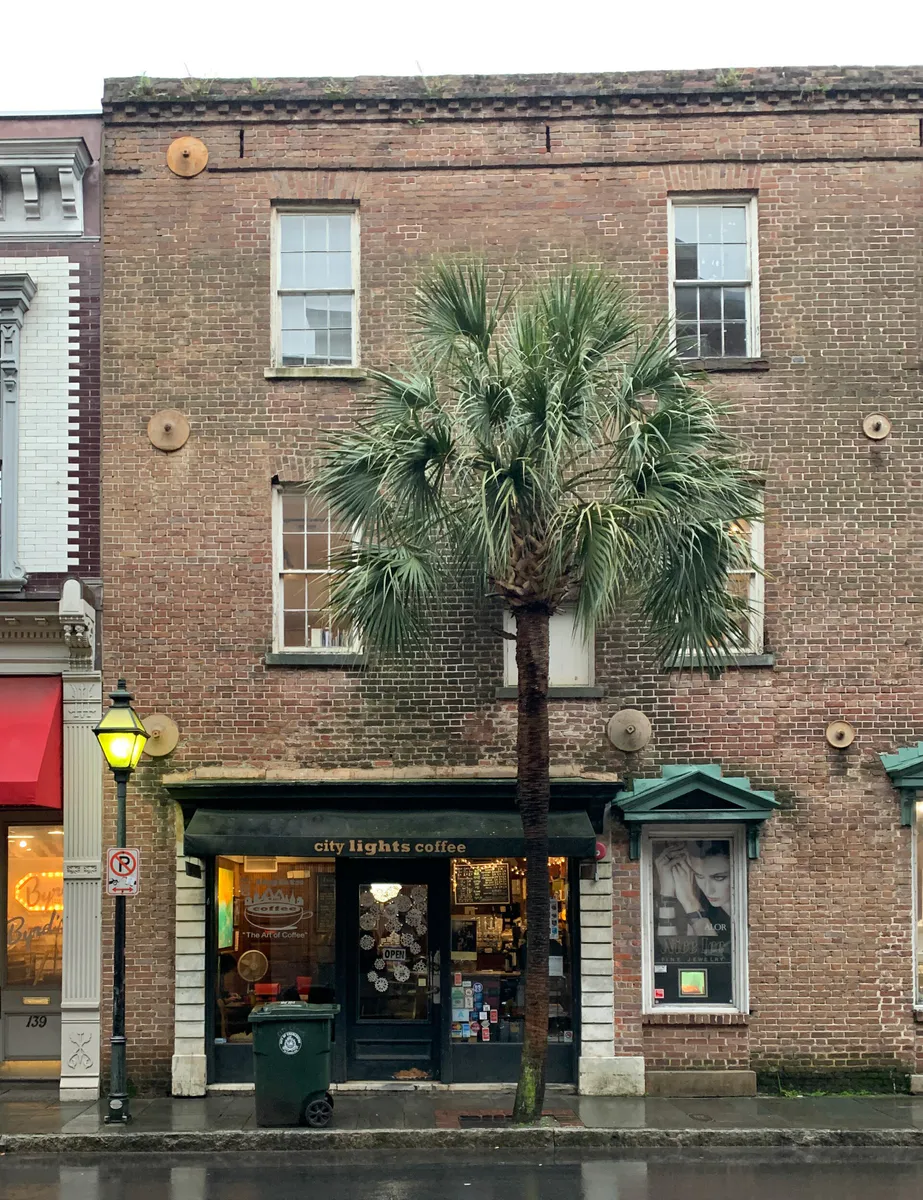
When the decision is less about what to do and more about where to eat or grab a drink, start here. These local cues narrow the food and drink decision without turning dinner or a night out into another hour of comparison.
Downtown, walk up early to popular raw bars on Upper King or Cannonborough that save counter seats for walk-ins. Alternatively, drive out to the Maybank Highway corridor on Johns Island or the East Montague Avenue strip in Park Circle, where open-air venues and casual hubs accommodate spontaneous arrivals.
Head to Shem Creek in Mount Pleasant, where dockside seafood decks and outdoor bars offer views of paddleboarders, boats, and dolphins. If you prefer craft beer and open green spaces, visit the brewery clusters in NOMO (North of Morrison) or the Firefly Distillery outdoor lawn along Noisette Creek in North Charleston.
Still comparing options? Adventria can narrow the choice around budget, distance, vibe, and who you are with.
Decide with AdventriaPlan by situation
Start with the kind of plan you are actually trying to make. These city-specific ideas narrow the choice around who you are with, what you want to spend, the weather, and the kind of outing you want.
Spend the morning at the South Carolina Aquarium on Concord Street to view the Sea Turtle Care Center, then take a short walk to Waterfront Park so kids can splash around the Pineapple Fountain and ride the covered pier swings. Combine this with a trip to The Charleston Museum's Kidstory or a RiverDogs minor league baseball game at Joseph P. Riley Jr. Park.
Focus on indoor cultural sites clustered around Meeting and Concord streets. Visit the South Carolina Aquarium to see the 385,000-gallon Great Ocean Tank, tour the historic collection at The Charleston Museum (including the interactive Kidstory section), or explore the galleries at the Gibbes Museum of Art and International African American Museum at Gadsden's Wharf.
Grab a coffee at a neighborhood roaster in Elliotborough, then browse the free first-floor public art gallery at the Gibbes Museum of Art on Meeting Street. Afternoon walk options include the Wonders' Way path on the Ravenel Bridge or a peaceful loop around Colonial Lake in Harleston Village.
For an outdoor plan from Charleston, compare trails, state parks, national parks within trip range, and scenic drives. Options in the current city guide include Givhans Ferry State Park and Kitfield Park.
For a short escape from Charleston, compare Beaufort and Hilton Head Island. More options are listed in the trip section below.
Head to the Cannonborough or Elliotborough neighborhoods along Spring and Cannon streets. This district is known for small, chef-owned bistros, cozy wine bars, and wood-fired kitchens. Because dining rooms here are compact, make reservations several weeks in advance for peak weekend dinner times.
Outdoors nearby
Use these nearby outdoor options when the plan calls for a trail, protected landscape, park, or drive instead of another indoor stop. Proximity here is geographic, not a promise about driving time.
Get out of town
When staying in town is not the answer, these nearby destinations give you a smaller starting set for a day trip, overnight escape, or weekend away.
Destination relationships are screened geographically. Straight-line proximity is not presented as road mileage or estimated travel time.
Local landmarks & attractions
These notable destinations offer a starting point when you want something specific to see, visit, or build into a day around Charleston. Distances are approximate from the city area.
1943 Essex-class aircraft carrier
aquarium in Charleston, South Carolina
theater in Charleston, South Carolina, United States
multi-purpose arena in North Charleston, South Carolina
human settlement in South Carolina, United States of America
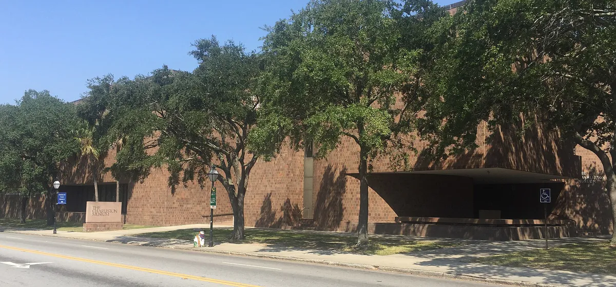
historic museum in Charleston, South Carolina, United States of America
historic district in Charleston, South Carolina
monument
Notable places are selected from structured public destination data and ranked for relevance, prominence, proximity, and variety.
Local decision signals
A useful local recommendation depends on how the city actually works. These conditions affect where to go, what to do, and whether a plan makes sense right now.
Traveling between the downtown peninsula and surrounding sub-markets requires crossing water barriers via high-volume structures like the Arthur Ravenel Jr. Bridge (US-17) or Ashley River drawbridges, where commuter rushes create substantial travel delays.
Coastal King Tides and afternoon downpours trigger localized sunny-day flooding across key low-lying peninsula corridors including Huger Street, Market Street, and Lockwood Drive.
On Upper King Street between Spring and John streets, street parking is strictly prohibited on Thursday, Friday, and Saturday nights from 6:00 PM to 3:00 AM to facilitate emergency vehicle access and crowd management.
CARTA operates three distinct zero-fare DASH shuttle routes (210, 211, 213) that connect major downtown parking garages with central shopping corridors, university campuses, and historic sites.
Top-tier culinary spots and high-demand cultural institutions like the International African American Museum often require bookings weeks in advance, whereas public waterfronts and neighborhood hubs accommodate spontaneous drop-ins.
During official high-tide and severe storm advisories, the City opens designated elevated parking garages, including the Charleston Tech Center Garage on Morrison Drive and 99 WestEdge, for free emergency vehicle protection.
Neighborhood context
Neighborhoods are not interchangeable. Each area offers a different balance of atmosphere, transportation, food, nightlife, activities, and planning friction.
Best for: Quiet historic strolls, architectural photography, and harbor views
Situated at the southernmost tip of the peninsula, this quiet residential district features 18th- and 19th-century mansions, Charleston single houses, cobblestone alleys, and public landmarks like White Point Garden and Rainbow Row. Commercial dining and retail are virtually non-existent here.
Best for: Art galleries, historic theaters, waterfront parks, and classic Southern dining
Occupying the original walled city footprint, the French Quarter contains a high density of art galleries, historic churches, landmark performance spaces like Dock Street Theatre, and Waterfront Park. It offers excellent walkability and classic white-cloth dining.
Best for: Intimate chef-driven dining, wine bars, and boutique bakeries
Located in the mid-peninsula along upper King, Spring, and Cannon streets, this neighborhood functions as Charleston's premier dining hub. It is packed with cozy bistros, small-plate tapas bars, natural wine spots, and neighborhood bakeries.
Best for: Rooftop lounges, high-energy nightlife, and boutique shopping
Extending north from Marion Square toward the Crosstown Expressway, Upper King is the main nightlife and high-density restaurant strip on the peninsula. It features cocktail lounges, late-night venues, and stylish boutiques, but experiences strict weekend parking bans.
Best for: Waterfront deck drinks, casual dockside seafood, and water sports
Located across the Cooper River in Mount Pleasant, Shem Creek is centered around dockside seafood spots, deck bars, and paddle sports. Kayakers and boats pull right up to dockside venues, making it a favorite spot for sunset drinks.
Best for: Laid-back local dining, craft breweries, and low-stress evening plans
A planned circular community in North Charleston centered on East Montague Avenue. It features craft bakeries, wood-fired pizzerias, Irish pubs, craft whiskey bars, and neighborhood breweries away from downtown tourist traffic.
Best for: Farm-to-table dining, ancient oak canopy views, and rustic venues
A sprawling rural-suburban barrier island west of James Island. Home to the historic Angel Oak Tree, agricultural fields, and an acclaimed culinary corridor along Maybank Highway featuring open-air fire-to-table dining and Italian eateries.
Best for: Walkable neighborhood drinks, casual pub eats, and chef-driven bistros
An established commercial cluster directly west across the Ashley River. Avondale offers a walkable, village-style strip with wine bars, casual burger spots, and neighborhood pubs, serving as a low-friction alternative to downtown.
Explore your options
Charleston's distinct neighborhoods offer varied urban settings, architectural backdrops, and dining styles tailored to specific plans.
The architectural and historical core of the Lower Peninsula, characterized by cobblestone streets, grand historic homes, and waterfront vistas.
The mid-to-upper peninsula culinary and nightlife engine, packed with chef-driven restaurants, cocktail bars, and boutiques.
A coastal waterfront hub east of the Cooper River known for dockside seafood decks, water sports, and historic charm.
A thriving local sub-market north of the peninsula offering a relaxed, community-focused food and beverage landscape.
Practical local guidance
When you want to explore Charleston without managing advance reservations or strict ticket schedules, consider these flexible options:
A simpler way to decide
Follow these practical steps to navigate local parking rules, transit options, and tide events without unexpected delays.
Before heading out, review regional tide predictions. Tides exceeding 7.0 to 8.0 feet above mean lower low water (MLLW) cause saltwater flooding on low-lying streets like Market, Huger, and Lockwood, even without rain.
Avoid low-lying surface lots during high-tide advisories. Instead, use mid-peninsula city garages like the Visitor Center Garage at 63 Mary Street or elevated garages like 99 WestEdge and the Charleston Tech Center Garage on Morrison Drive.
Once parked, board CARTA's zero-fare DASH shuttles. Route 211 runs down Meeting and King streets to Broad Street, Route 210 connects College of Charleston with the SC Aquarium, and Route 213 serves Calhoun Street and Lockwood Drive.
Book timed-entry passes for major venues like the International African American Museum or prime dinner tables in Cannonborough weeks in advance to secure your preferred times.
If you plan to stay on Upper King Street past 6:00 PM Thursday through Saturday, ensure your vehicle is parked in an off-street garage, as street parking between Spring and John streets is prohibited until 3:00 AM.
Common local questions
These are common situations people face when trying to decide where to eat, what to do, where to get drinks, or how to spend their time in Charleston.
Charleston planning questions
Practical answers for people deciding where to eat, what to do, where to go, or how to make plans in Charleston.
Plan travel around peak morning and evening commuter hours over major river bottlenecks like the Arthur Ravenel Jr. Bridge (US-17) and Ashley River drawbridges. If traveling from James Island, the James Island Connector (SC-30) often experiences less friction than secondary drawbridge routes.
Yes, CARTA DASH shuttle routes (210, 211, and 213) are zero-fare for all passengers. They connect major parking garages, university campuses, shopping districts, and cultural sites across the downtown peninsula.
On-street metered parking is enforced Monday through Saturday from 9:00 AM to 6:00 PM (free on Sundays and official city holidays). Standard rates are $3.00 per hour. On Thursday, Friday, and Saturday nights, street parking is strictly prohibited on Upper King Street between Spring and John streets from 6:00 PM to 3:00 AM.
The city-operated Visitor Center Garage at 63 Mary Street offers discounted evening parking flat rates after 3:00 PM and 5:00 PM, provided vehicles exit before standard rates resume at 3:00 AM.
Sunny-day flooding occurs during coastal King Tides (tides exceeding 7.0 to 8.0 feet) when high tide waters back up through storm drains onto low-lying streets without rain. Common flood corridors include Huger Street, Market Street, Lockwood Drive, and US-17 at Septima Clark Parkway.
During officially declared flood events, the City of Charleston opens designated elevated garages for free emergency protection, including the Charleston Tech Center Garage at 997 Morrison Drive and the 99 WestEdge Garage.
Yes, the International African American Museum at Gadsden's Wharf utilizes timed-entry ticketing. Booking passes online well in advance is highly recommended to secure your entry slot.
The French Quarter has the highest concentration of art galleries, historic churches, and performance spaces like Dock Street Theatre, all located within a compact, highly walkable district.
Park Circle in North Charleston (along East Montague Avenue) and Avondale in West Ashley offer walkable commercial strips with craft bakeries, local pubs, pizzerias, and breweries frequented by local residents.
Located within Angel Oak Park on Johns Island, viewing the 400-to-500-year-old live oak tree is free to the public, though donations supporting park preservation are welcomed.
Source transparency
Official and locally relevant sources used to verify the practical information presented in this Charleston decision guide.
Charleston decision engine
Tell Adventria what kind of experience you want, set your practical limits, and turn the options in Charleston into one workable plan.
Choose a Charleston Plan