Downtown / Marina Arts District
Best for
Walkable arts, waterfront strolls, craft beer, and evening nightlife.
 AdventriaLocalOpen App
Local Practical Planning Guide
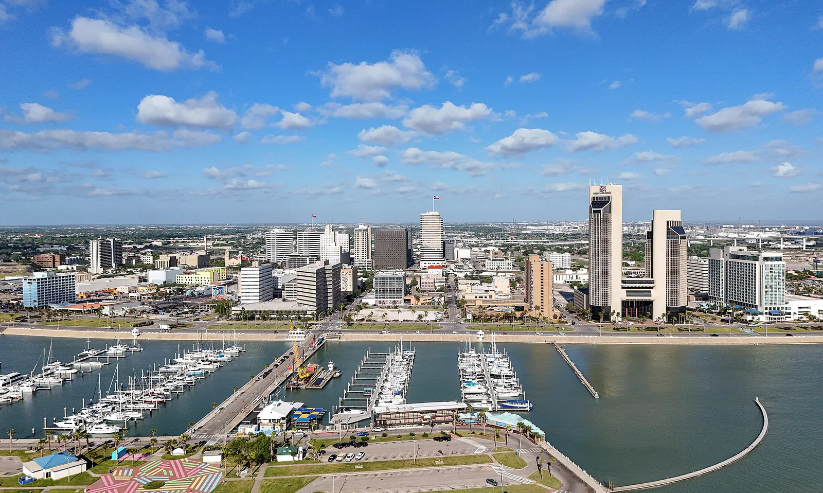
Trying to decide what to do in Corpus Christi? Adventria helps you cut through the options and choose a good-enough plan without endless scrolling. Corpus Christi spans across extensive bays, barrier islands, and high-speed highway corridors. Choosing what to do requires balancing coastal wind conditions, midday heat indices, bridge crossings, and beach driving rules so you spend less time in transit and more time enjoying South Texas.
The local decision problem
Navigating geography, wind conditions, beach permits, and traffic bottlenecks to plan daily activities in Corpus Christi.
That is where Adventria comes in. Adventria helps narrow the options in Corpus Christi around practical factors like location, distance, budget, vibe, who you are with, and the kind of experience you actually want, so research can turn into a decision.
Let Adventria narrow the optionsPick the right part of town
Different parts of Corpus Christi work for different kinds of plans. Start with the experience you want, then narrow the map.
Best for
Walkable arts, waterfront strolls, craft beer, and evening nightlife.
Best for
Family attraction days and calm bayfront beach access.
Best for
Scenic coastal drives, trail biking, and public bayfront parks.
Best for
Local boutique dining, bakeries, and historic neighborhood stops.
Best for
Suburban shopping, regional retail centers, and family sports bars.
Best for
Waterfront access, military bases, and gateway island transit.
This is a quick starting point. The full guide covers 8 local neighborhoods and districts in Corpus Christi.
Eat & drink
When the decision is less about what to do and more about where to eat or grab a drink, start here. These local cues narrow the food and drink decision without turning dinner or a night out into another hour of comparison.
Head to Water Street Market in Downtown for open seating at Executive Surf Club, offering burgers, local beers, and patio space. Alternatively, drive out to Snoopy's Pier or Doc's Seafood & Steaks under the JFK Causeway bridge for counter service fresh Gulf fish directly over the water.
Gather in Downtown along Chaparral Street. Grab a craft cocktail at BUS (Bar Under the Sun), catch a live rock set at House of Rock, or enjoy open-air patio acoustic sets and local oysters at Executive Surf Club.
Still comparing options? Adventria can narrow the choice around budget, distance, vibe, and who you are with.
Decide with AdventriaPlan by situation
Start with the kind of plan you are actually trying to make. These city-specific ideas narrow the choice around who you are with, what you want to spend, the weather, and the kind of outing you want.
Pack a lunch and head to Cole Park along Ocean Drive for its large wooden playground, skatepark, and free bayfront views. Afterward, head to McGee Beach for free paved parking and shallow, calm bay water ideal for young swimmers.
Start on North Beach with self-guided tours inside the aircraft carrier USS Lexington or the Texas State Aquarium. Shift inland to the Selena Museum on Leopard Street to view her awards and red Porsche, or browse retail and indoor entertainment at La Palmera Mall.
For an outdoor plan from Corpus Christi, compare trails, state parks, national parks within trip range, and scenic drives. Options in the current city guide include Mustang Island State Park and Goose Island State Park.
Reserve a table for fine dining with floor-to-ceiling bay views at Elizabeth's at the Art Museum or Republic of Texas on top of the Omni Hotel. Follow dinner with an evening walk along the lighted Downtown Seawall, especially on Wednesday evenings during the local weekly sailing regatta.
Visit the Hans & Pat Suter Wildlife Refuge to walk the elevated wooden boardwalk extending into Oso Bay marshlands, an active migratory corridor. Continue to the Oso Bay Wetlands Preserve for over two miles of quiet paved and dirt trails.
For a day trip from Corpus Christi, compare South Padre Island and Edinburg. More options are listed in the trip section below.
Outdoors nearby
Use these nearby outdoor options when the plan calls for a trail, protected landscape, park, or drive instead of another indoor stop. Proximity here is geographic, not a promise about driving time.
Get out of town
When staying in town is not the answer, these nearby destinations give you a smaller starting set for a day trip, overnight escape, or weekend away.
Destination relationships are screened geographically. Straight-line proximity is not presented as road mileage or estimated travel time.
Local landmarks & attractions
These notable destinations offer a starting point when you want something specific to see, visit, or build into a day around Corpus Christi. Distances are approximate from the city area.
1942 Essex-class aircraft carrier
non-profit organization in the USA
entertainment complex located in Corpus Christi, Texas, United States
botanical garden and nature center in Corpus Christi, Texas
art Museum in Corpus Christi, TX United States
historic district in Port Aransas (vicinity), Aransas County, Texas
baseball and softball park in Corpus Christi, Texas, United States
Notable places are selected from structured public destination data and ranked for relevance, prominence, proximity, and variety.
Local decision signals
A useful local recommendation depends on how the city actually works. These conditions affect where to go, what to do, and whether a plan makes sense right now.
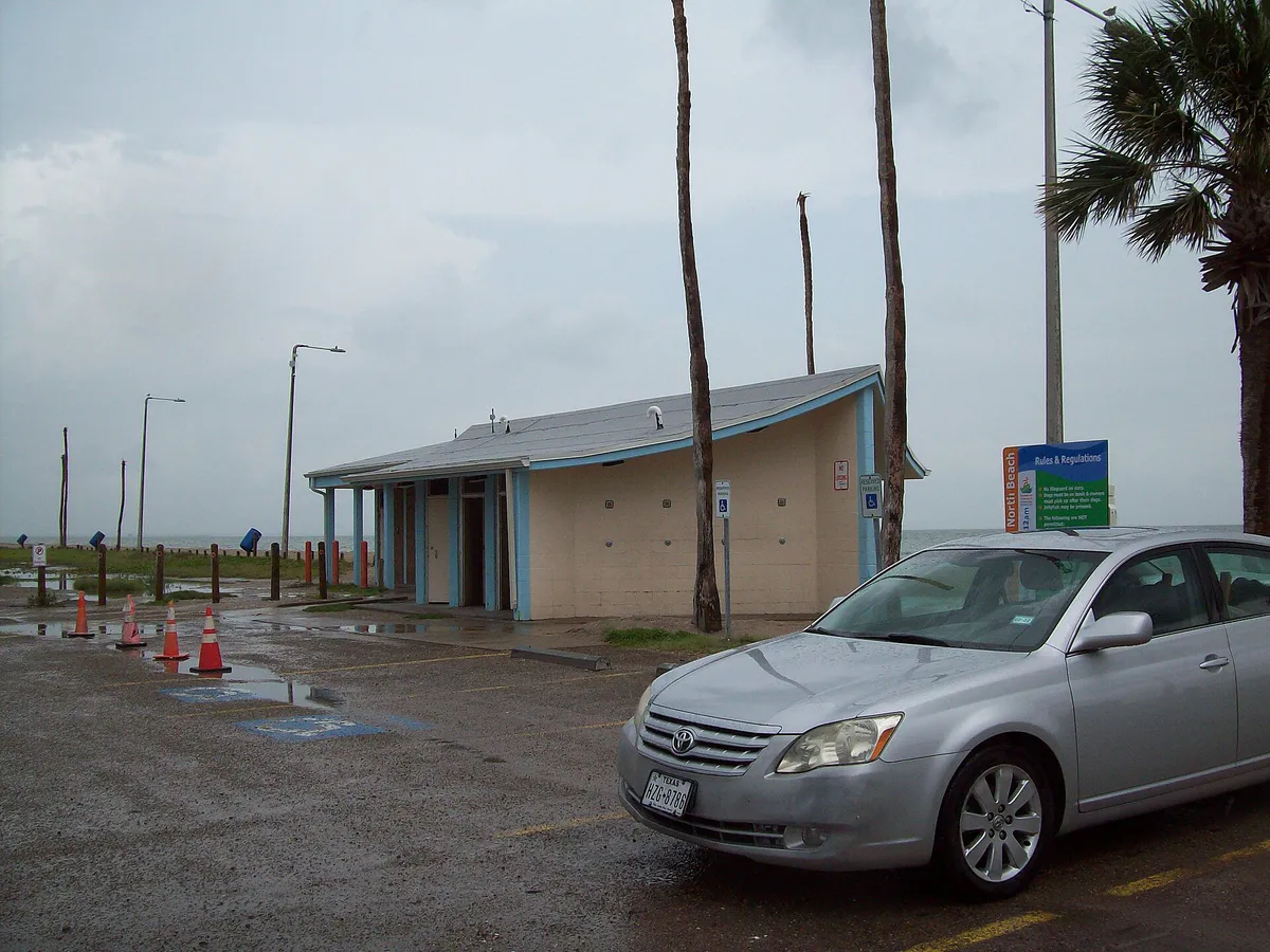
Driving or parking on designated city and county Gulf beach sand on North Padre and Mustang Islands requires an annual $12 permit, available at local H-E-B and Stripes stores. Paved lots like McGee Beach and Ellis Beach remain free.
With average winds of 12-16 mph and afternoon gusts frequently hitting 25-35 mph, open beach shade pop-ups often collapse. High wind days favor sheltered bay spots or windsurfing at Bird Island Basin.
The JFK Causeway (Park Road 22) is the sole direct vehicle link between mainland Flour Bluff and North Padre Island. Traffic peaks on summer Friday afternoons and Sunday evenings.
US 181 crosses the Corpus Christi Ship Channel, connecting Downtown to North Beach. Traffic moves via the cable-stayed Harbor Bridge alignment opened in mid-2025.
Midday heat indices regularly exceed 105°F from June through August. Unshaded outdoor physical activities should be limited between 11:00 AM and 5:00 PM.
Winter cold fronts can drop local temperatures by 30°F to 40°F in just a few hours, accompanied by severe northerly wind gusts.
Neighborhood context
Neighborhoods are not interchangeable. Each area offers a different balance of atmosphere, transportation, food, nightlife, activities, and planning friction.
Best for: Walkable arts, waterfront strolls, craft beer, and evening nightlife.
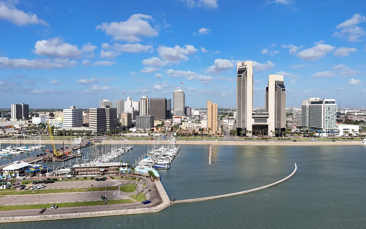
Centered around the Corpus Christi Marina and the 1.5-mile Seawall. Houses the SEA District, Heritage Park, live music hubs on Chaparral Street, and monthly ArtWalk events.
Best for: Family attraction days and calm bayfront beach access.
Located across the Ship Channel from Downtown. Home to major regional anchors including the Texas State Aquarium and the USS Lexington Museum.
Best for: Scenic coastal drives, trail biking, and public bayfront parks.
Runs southeast along Corpus Christi Bay from Downtown past Cole Park down to Texas A&M University–Corpus Christi. Features mid-century residential architecture and the Bay Trail.
Best for: Local boutique dining, bakeries, and historic neighborhood stops.
Inland district situated behind Ocean Drive. Contains Del Mar College, Lamar Park shopping center, and residential pockets with mature shade trees.
Best for: Suburban shopping, regional retail centers, and family sports bars.
The primary growth corridor anchored along South Padre Island Drive (SPID). Packed with major retail centers like La Palmera Mall, restaurants, and modern housing developments.
Best for: Waterfront access, military bases, and gateway island transit.
Peninsula community situated between Oso Bay and Laguna Madre. Home to Naval Air Station Corpus Christi and serving as the mainland access point to North Padre Island.
Best for: Gulf beach driving, ocean surfing, channel fishing, and resort dining.
Barrier island communities offering open Gulf coast beaches, canal-front properties, Packery Channel, and access to Padre Island National Seashore.
Best for: Quiet suburban stays, inland nature trails, and river access.
Suburban and semi-rural areas located 15 to 20 miles inland along I-37 and US 77. Known for Hazel Bazemore Park and freedom from ocean salt spray.
Corpus Christi local guide
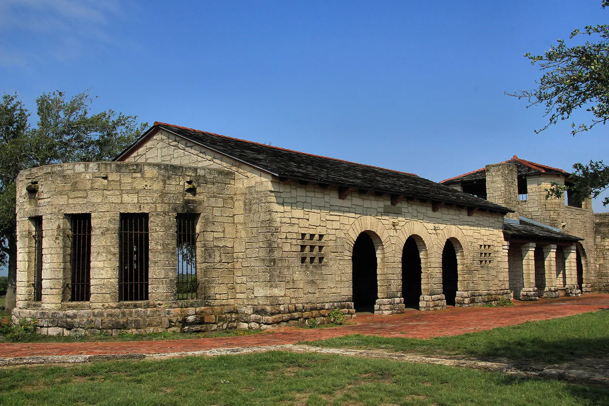
Corpus Christi's urban layout is defined by physical water bodies that divide daily activities into distinct geographic clusters. Understanding the spatial relationship between mainland districts and barrier islands prevents unexpected transit friction.
The primary commercial axis runs along South Padre Island Drive (SH 358 / SPID). Peak travel congestion occurs around the La Palmera Mall corridor during late afternoon rush hours and weekend middays. Furthermore, traveling to the barrier islands requires crossing the JFK Causeway from Flour Bluff, which narrows to a single major highway link.
When planning outings, group your activities geographically. Pair Downtown arts and museum visits with North Beach attractions, or combine South Side retail visits with trips to the Oso Bay nature preserves.
Explore your options
Corpus Christi offers drastically different shoreline environments depending on whether you choose bay or Gulf locations.
Calm, low-wave waters ideal for casual walking, gentle wading, and wind-assisted water sports without heavy surf.
Open ocean waters on barrier islands with ocean surf, wide sandy shores, and vehicle beach driving opportunities.
Protected marshlands and coastal wetlands dedicated primarily to nature observation, hiking trails, and birdwatching.
Practical local guidance
Enjoy the best of Corpus Christi without expensive entrance fees by taking advantage of public spaces and recurring community events.
A simpler way to decide
Driving on Gulf beaches requires proper preparation to handle local regulations and shifting sand conditions.
Review local wind forecasts and high tide schedules. Sustained winds over 20 mph make unshaded beach setups difficult, and high tides narrow the vehicle driving lane.
If you plan to drive onto the sand at Whitecap or Mustang Island beaches, stop at any local H-E-B grocery store or Stripes convenience store to buy a $12 annual windshield permit.
Use heavy sand anchors or weighted straps for beach umbrellas instead of lightweight pop-up canopy tents that can easily catch afternoon sea breezes.
Head to Ellis Beach if you prefer free paved parking. Enter via Park Road 22 if driving directly onto the sand.
Observe the strictly enforced 15 mph speed limit, park at least 25 feet away from the water line, and stay completely off the protected sand dunes.
Common local questions
These are common situations people face when trying to decide where to eat, what to do, where to get drinks, or how to spend their time in Corpus Christi.
Corpus Christi planning questions
Practical answers for people deciding where to eat, what to do, where to go, or how to make plans in Corpus Christi.
No. Permits are only required if you park a motorized vehicle directly on the sand on designated city or county Gulf beaches. Free paved parking is available at McGee Beach downtown and Michael J. Ellis Beach on North Padre Island.
Beach parking permits cost $12 annually and are valid for the calendar year. They can be purchased at H-E-B grocery stores, Stripes convenience stores, and city offices throughout Corpus Christi.
Drive across the Corpus Christi Ship Channel using the US 181 Harbor Bridge route, which provides quick access directly to North Beach attractions like the Texas State Aquarium and USS Lexington.
Yes, on main packed-sand driving corridors near Whitecap Beach and Ellis Beach. However, driving down-island past Mile Marker 5 at Padre Island National Seashore requires a 4WD vehicle due to soft, deep sand.
Focus on sheltered activities like exploring the Texas State Aquarium, visiting the Art Museum of South Texas, browsing shops at Lamar Park, or windsurfing at Bird Island Basin.
Spring (March to April) and autumn (October to November) offer warm temperatures, lower humidity, moderate crowd levels, and pleasant coastal breezes.
Public Kemp's ridley sea turtle hatchling releases take place at Malaquite Beach inside Padre Island National Seashore, typically on summer mornings between May and August.
No. Glass containers are strictly prohibited on all public beaches and waterways within Corpus Christi city limits and Nueces County.
Source transparency
Official and locally relevant sources used to verify the practical information presented in this Corpus Christi decision guide.
Corpus Christi decision engine
Tell Adventria what kind of experience you want, set your practical limits, and turn the options in Corpus Christi into one workable plan.
Choose a Corpus Christi Plan