Downtown / Arts District / Union Plaza
Best for
Museums, historic hotels, rooftop cocktails, and baseball games
 AdventriaLocalOpen App
LOCAL DECISION GUIDE
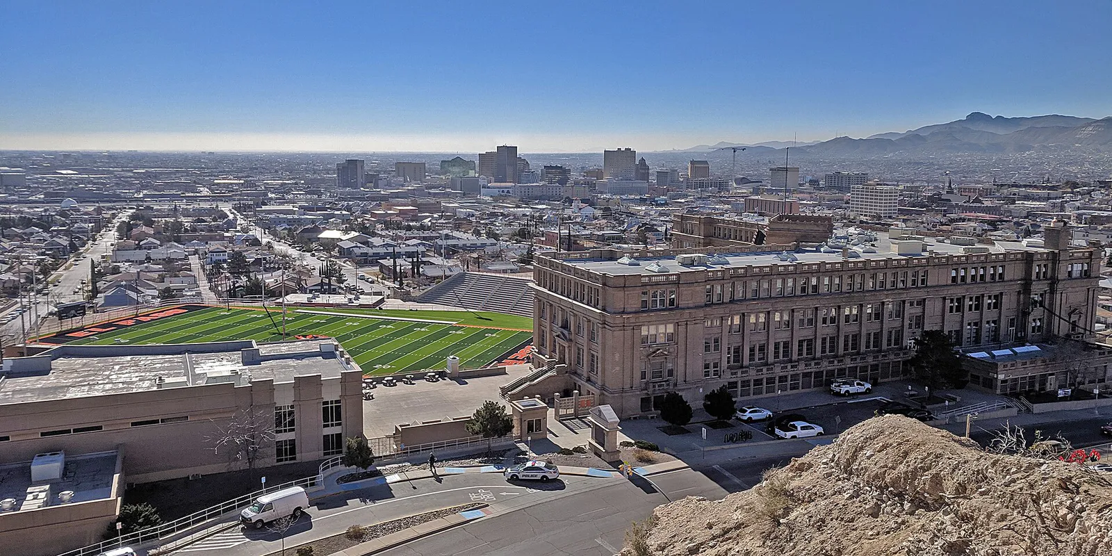
Trying to decide what to do in El Paso? Adventria helps you cut through the options and choose a good-enough plan without endless scrolling. Whether traversing the Franklin Mountains, catching vintage streetcar loops between Downtown and Kern Place, or tracking down authentic green chile enchiladas, navigating El Paso requires understanding its vast desert sprawl, high elevation, and distinct east-west divide.
The local decision problem
Navigating El Paso's distinct geographic split, extreme seasonal weather patterns, and rich borderland cultural landscape to plan ideal daily itineraries.
That is where Adventria comes in. Adventria helps narrow the options in El Paso around practical factors like location, distance, budget, vibe, who you are with, and the kind of experience you actually want, so research can turn into a decision.
Let Adventria narrow the optionsPick the right part of town
Different parts of El Paso work for different kinds of plans. Start with the experience you want, then narrow the map.
Best for
Museums, historic hotels, rooftop cocktails, and baseball games
Best for
Collegiate nightlife, stone bungalows, and local patio dining
Best for
Bohemian vibe, craft beer, indie music, and legendary Mexican diners
Best for
Historic murals, Victorian architecture, and Mexican bakeries
Best for
Scenic mountain drives, upscale shopping, and rural pecan orchards
Best for
Suburban shopping centers, family entertainment, and broad residential avenues
This is a quick starting point. The full guide covers 7 local neighborhoods and districts in El Paso.
Eat & drink
When the decision is less about what to do and more about where to eat or grab a drink, start here. These local cues narrow the food and drink decision without turning dinner or a night out into another hour of comparison.
For places to eat in El Paso, start with Kern Place & The Rim Area or Five Points & Manhattan Heights depending on the kind of stop you want. Start with Kern Place & The Rim Area for collegiate nightlife, stone bungalows, and local patio dining. Founded in 1914 next to UTEP, Kern Place surrounds Madeline Park and centers around the Cincinnati Street Entertainment District with lively sports bars and casual eateries. Five Points & Manhattan Heights is another area to consider. A historic node northeast of Downtown offering vintage shops, indie concert venues, craft beer, and iconic local diners like L&J Cafe and Kiki's.
Catch a AAA baseball game with the El Paso Chihuahuas or USL soccer match at Southwest University Park in Downtown. Afterward, enjoy cocktail lounges like La Perla atop the Plaza Hotel Pioneer Park or head up to the Cincinnati Street Entertainment District near UTEP for bustling outdoor bar patios.
Still comparing options? Adventria can narrow the choice around budget, distance, vibe, and who you are with.
Decide with AdventriaPlan by situation
Start with the kind of plan you are actually trying to make. These city-specific ideas narrow the choice around who you are with, what you want to spend, the weather, and the kind of outing you want.
Begin with pre-dinner cocktails on the rooftop of Plaza Hotel Pioneer Park, followed by fine dining at Cafe Central or refined Southwestern dishes nearby. Afterward, attend a touring Broadway show or symphony performance at the restored 1930s Spanish Colonial Revival Plaza Theatre.
Spend the morning at La Nube, the multi-story indoor STEAM children's museum in Downtown. Follow it up with a fun ride on the El Paso Streetcar loop. On warm afternoons, rent pedal boats at Ascarate Park or catch an evening ballgame at Southwest University Park.
Explore the vibrant street murals of El Segundo Barrio on foot, then hop the vintage El Paso Streetcar up to Kern Place for coffee and indie bookstore browsing near UTEP. Cap off your day with a solo hike on the Aztec Cave Trail in the Franklin Mountains.
Plan an excursion to Cattleman's Steakhouse at Indian Cliffs Ranch in Fabens for big steaks, desert sunset views, and western movie set walking grounds. Alternatively, book a suite or terrace block at Southwest University Park for a Chihuahuas baseball game.
For an outdoor plan from El Paso, compare trails, state parks, national parks within trip range, and scenic drives. Options in the current city guide include Franklin Mountains State Park and Hueco Tanks State Park & Historic Site.
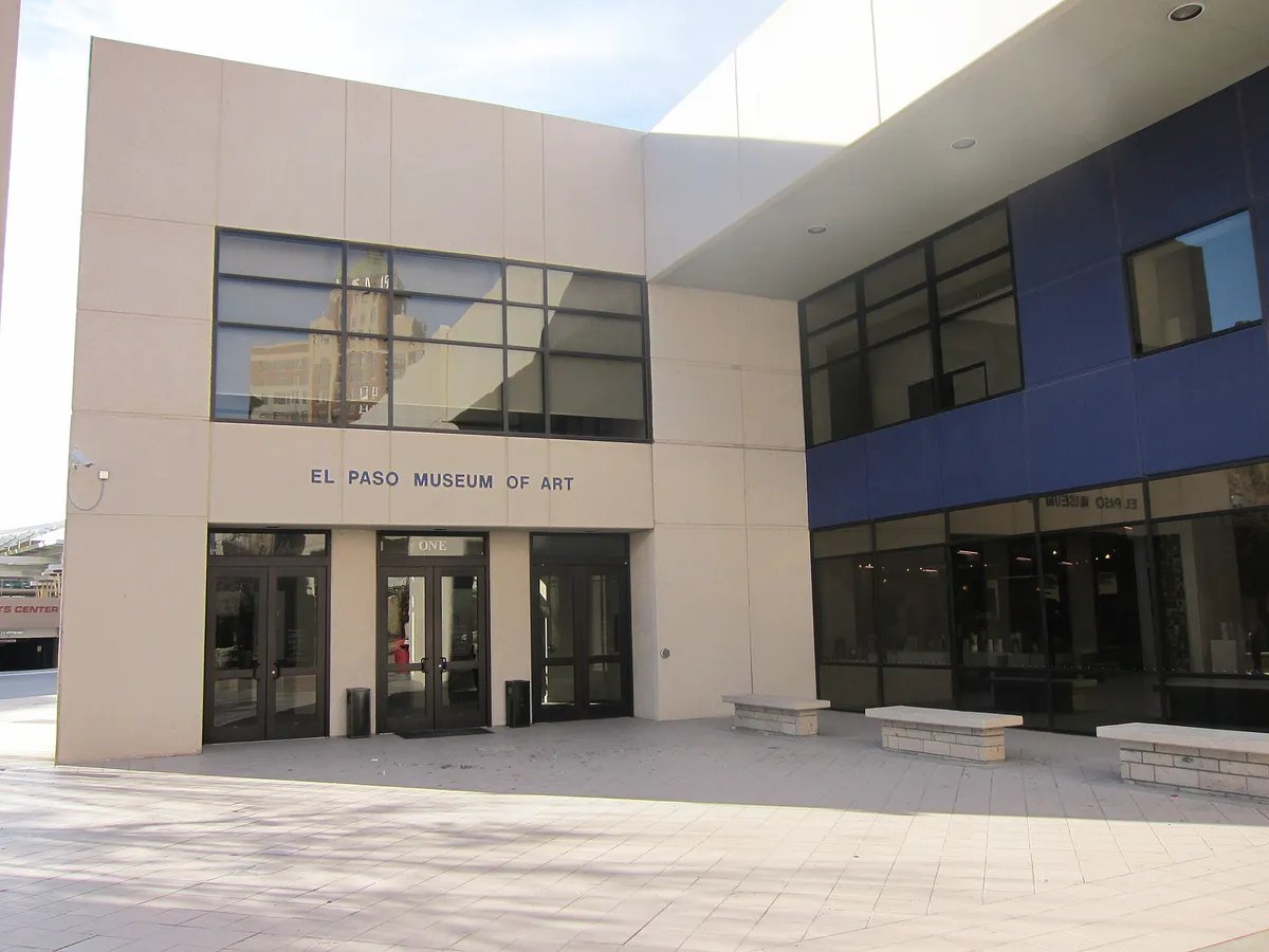
Escape extreme heat or high spring windstorms by spending hours inside the climate-controlled Downtown cultural hub: combine the free El Paso Museum of Art, the El Paso Museum of History (featuring the 3D DIGIE interactive wall), and Chamizal National Memorial's indoor gallery.
Enjoy zero-cost admission at the El Paso Museum of Art and El Paso Museum of History year-round. Take a self-guided mural walk through El Segundo Barrio, attend free summer Alfresco! Fridays concerts, and grab a budget-friendly meal at Chico's Tacos.
Outdoors nearby
Use these nearby outdoor options when the plan calls for a trail, protected landscape, park, or drive instead of another indoor stop. Proximity here is geographic, not a promise about driving time.
Get out of town
When staying in town is not the answer, these nearby destinations give you a smaller starting set for a day trip, overnight escape, or weekend away.
Destination relationships are screened geographically. Straight-line proximity is not presented as road mileage or estimated travel time.
Local landmarks & attractions
These notable destinations offer a starting point when you want something specific to see, visit, or build into a day around El Paso. Distances are approximate from the city area.
zoo located in El Paso, Texas
art museum in El Paso, Texas
historic district in El Paso, El Paso County, Texas
building in El Paso, El Paso County, Texas
amusement park in Sunland Park, New Mexico, United States
stadium
cultural history and natural history museum
U.S. national cemetery in El Paso, Texas
Notable places are selected from structured public destination data and ranked for relevance, prominence, proximity, and variety.
Local decision signals
A useful local recommendation depends on how the city actually works. These conditions affect where to go, what to do, and whether a plan makes sense right now.
The 7,192-ft Franklin Mountains physically split the city. Crossing between Westside and Eastside means driving around the southern tip on I-10 or taking Woodrow Bean Transmountain Road (Loop 375) through Smuggler's Gap.
At 3,740 to 4,000+ feet above sea level, intense sun, low humidity, and large daily temperature drops (up to 30°F) require extra hydration and layered clothing year-round.
Summer high temperatures regularly top 100°F. Local outdoor life shifts to dawn (6:00 AM–9:00 AM) or after sunset, reserving midday hours for air-conditioned indoor culture.
Self-guided access to North Mountain at Hueco Tanks is strictly limited to 70 people at a time. Permits must be reserved by phone up to 90 days in advance.
Loop 375 across the Franklins offers swift east-west transit but can close temporarily during high wind storms, intense monsoon rain, or rare winter freezing ice.
Though designated a National Monument in 2023, Castner Range remains completely closed to public entry for military unexploded ordnance remediation; view it strictly from surrounding roads or state park trails.
The restored El Paso Streetcar connects Downtown (San Jacinto Plaza) and Uptown (UTEP/Kern Place) across a 4.8-mile loop equipped with AC and bike racks.
Neighborhood context
Neighborhoods are not interchangeable. Each area offers a different balance of atmosphere, transportation, food, nightlife, activities, and planning friction.
Best for: Museums, historic hotels, rooftop cocktails, and baseball games
The civic and cultural core anchored by San Jacinto Plaza, major museums (EPMA, Museum of History, La Nube), Southwest University Park, and restored historic boutique hotels.
Best for: Collegiate nightlife, stone bungalows, and local patio dining
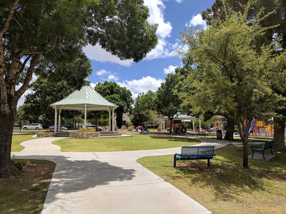
Founded in 1914 next to UTEP, Kern Place surrounds Madeline Park and centers around the Cincinnati Street Entertainment District with lively sports bars and casual eateries.
Best for: Bohemian vibe, craft beer, indie music, and legendary Mexican diners
A historic node northeast of Downtown offering vintage shops, indie concert venues, craft beer, and iconic local diners like L&J Cafe and Kiki's.
Best for: Historic murals, Victorian architecture, and Mexican bakeries
Culturally rich borderland neighborhoods near Downtown and the Rio Grande featuring historic street art, traditional panaderías, and grand Victorian homes overlooking Mexico.
Best for: Scenic mountain drives, upscale shopping, and rural pecan orchards
Stretching up the western slopes of the Franklins to New Mexico. Offers master-planned hillsides, fine shopping, and lush agricultural pockets with pecan groves along the Rio Grande.
Best for: Suburban shopping centers, family entertainment, and broad residential avenues
El Paso's fast-growing eastern sector near the airport and Fort Bliss, anchored by major retail centers like Cielo Vista Mall and The Fountains at Farah.
Best for: Centuries-old Spanish missions, Native American heritage, and quiet historic drives
Southeast along the Rio Grande, encompassing Ysleta, Socorro, and San Elizario. Home to Texas's oldest historic missions and rich adobe cultural sites.
El Paso local guide
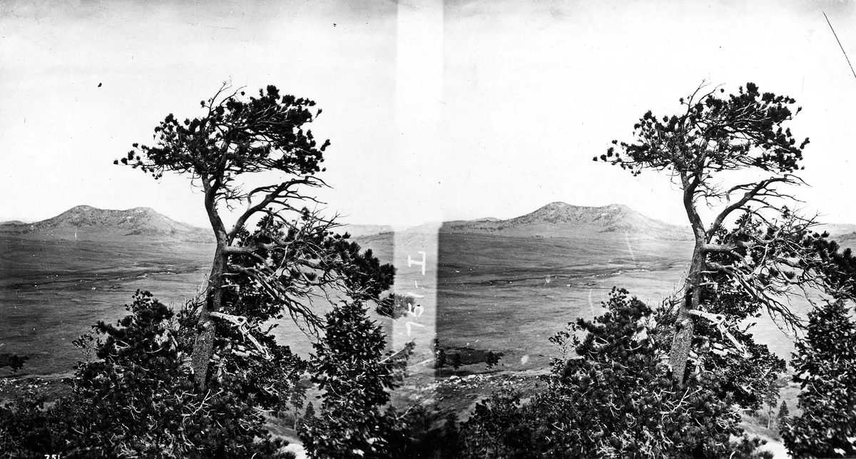
El Paso's unique urban layout is framed by the tilted fault-block peaks of the Franklin Mountains, which rise abruptly in the middle of the city to over 7,000 feet. This dramatic range acts as both a scenic backdrop and a physical barrier, dividing the city into distinct Westside and Eastside sectors. Moving between sides requires either traveling around the southern tip of the mountain spine via Interstate 10 through Downtown or taking Woodrow Bean Transmountain Road (Loop 375) over Smuggler's Gap at an elevation of 5,280 feet.
For visitors and locals alike, timing commutes around peak travel friction is essential. Heavy morning and afternoon rush hours, military shift changes around Fort Bliss gates, and unexpected freight train crossings along cross-city tracks can impact drive times. Utilizing high-frequency transit options like the Sun Metro Brio RTS along major commercial avenues or riding the vintage El Paso Streetcar loop between Downtown and UTEP offers efficient navigation through the urban core.
Explore your options
Explore El Paso's core districts, each offering distinct architectural characters, cultural traditions, and culinary highlights.
The historic civic center featuring major cultural institutions, performance halls, and stylish cocktail lounges.
A vibrant university neighborhood filled with stone bungalows, leafy streets, and energetic nightlife.
A bohemian pocket northeast of downtown, celebrated for indie music, craft beer, and borderland diners.
A historic corridor holding centuries of Spanish colonial and Indigenous borderland history.
Practical local guidance
Don't miss these essential state parks, scenic lookouts, and historic sites unique to the Sun City.
A simpler way to decide
Follow this step-by-step route to sample both sides of the mountain range safely and efficiently.
Arrive at Franklin Mountains State Park (Tom Mays Unit) off Transmountain Road around 7:00 AM to beat summer heat. Hike the Aztec Cave Trail for canyon views.
Drive East over Smuggler's Gap on Woodrow Bean Transmountain Road, stopping at designated mountain pullouts to take photos of the desert terrain.
Descend the eastern slopes to visit the El Paso Museum of Archaeology and walk its 15-acre native desert botanical trail.
Head south via US-54 into Five Points for a traditional borderland Mexican lunch at L&J Cafe or Kiki's Mexican Restaurant.
Park near San Jacinto Plaza, visit the El Paso Museum of Art, and take the El Paso Streetcar loop up to Kern Place and UTEP.
Drive up Scenic Drive before dusk to watch the city lights turn on across both sides of the international border.
Common local questions
These are common situations people face when trying to decide where to eat, what to do, where to get drinks, or how to spend their time in El Paso.
El Paso planning questions
Practical answers for people deciding where to eat, what to do, where to go, or how to make plans in El Paso.
Autumn (October–November) offers ideal weather, with clear skies, warm daytime temperatures (70°F–85°F), and comfortable crisp evenings. Winter is also pleasant for daytime hiking, though nighttime temperatures drop near freezing.
Yes, El Paso is predominantly car-dependent due to suburban sprawl and the mountain barrier. However, key central districts like Downtown, Sunset Heights, and Kern Place are walkable and connected by the El Paso Streetcar.
Access to North Mountain is capped at 70 visitors to protect rock art and ecology. You must call Texas State Parks advance reservations by phone (512-389-8911) up to 90 days ahead. Walk-ins are rarely available.
No, Castner Range is completely closed to the public while the U.S. Army conducts unexploded ordnance remediation. You can view the range safely from public roads or neighboring Franklin Mountains State Park trails.
El Paso borderland cuisine heavily emphasizes traditional red and green chile sauces, caldillo (chile beef stew), and flautas, leaning into authentic Chihuahua state border influences rather than heavy yellow cheese Tex-Mex traditions.
The El Paso Streetcar operates restored 1950s PCC trolley cars over a 4.8-mile dual loop connecting Downtown (San Jacinto Plaza) to Uptown (UTEP/Kern Place). Cars are equipped with modern air conditioning, Wi-Fi, and bike racks.
If Woodrow Bean Transmountain Road (Loop 375) closes due to high winds, ice, or monsoon flooding, reroute via I-10 around the southern tip of the Franklin Mountains near Downtown.
Yes, Scenic Drive is open daily for vehicle traffic and offers a pullout park overlooking El Paso and Ciudad Juárez. On Sunday mornings, it is frequently closed to vehicles for pedestrians and cyclists.
Yes, premier institutions like the El Paso Museum of Art and the El Paso Museum of History offer zero-cost admission year-round. Interactive spaces like La Nube require paid admission tickets.
Source transparency
Official and locally relevant sources used to verify the practical information presented in this El Paso decision guide.
El Paso decision engine
Tell Adventria what kind of experience you want, set your practical limits, and turn the options in El Paso into one workable plan.
Choose a El Paso Plan