Old Town (Downtown Core)
Best for
Walkability, dining, arts, and nightlife
 AdventriaLocalOpen App
Local Decision Guide
Trying to decide what to do in Scottsdale? Adventria helps you cut through the options and choose a good-enough plan without endless scrolling. Scottsdale stretches over 31 miles from South Scottsdale's innovation hubs to the high-desert granite boulders of Troon North. Whether you are avoiding major event traffic, planning around summer temperature limits, or choosing between Old Town nightlife and quiet desert preserves, this guide provides real-time clarity for residents and visitors alike.
The local decision problem
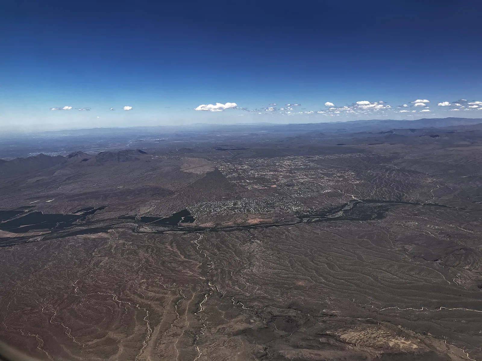
Navigating Scottsdale's 31-mile linear layout, extreme summer heat regulations, and distinct district dynamics to choose where to eat, stay, and explore.
That is where Adventria comes in. Adventria helps narrow the options in Scottsdale around practical factors like location, distance, budget, vibe, who you are with, and the kind of experience you actually want, so research can turn into a decision.
Let Adventria narrow the optionsPick the right part of town
Different parts of Scottsdale work for different kinds of plans. Start with the experience you want, then narrow the map.
Best for
Walkability, dining, arts, and nightlife
Best for
Affordable dining, mid-century vibe, and quick airport access
Best for
Resort living, greenbelt access, and family neighborhood parks
Best for
Open-air luxury retail, corporate hubs, and upscale apartment living
Best for
Secluded luxury estates, dramatic desert scenery, and preserve hiking
Best for
Equestrian properties and spacious low-density residential lots
Eat & drink
When the decision is less about what to do and more about where to eat or grab a drink, start here. These local cues narrow the food and drink decision without turning dinner or a night out into another hour of comparison.
If popular places like The Mission or FnB are fully booked, head toward the Brown & Stetson District or Craftsman Court for lively bar seating, or check Virtù Honest Craft for early walk-in courtyard seating. Alternatively, grab a table along the Scottsdale Waterfront where larger restaurant footprints offer quicker turnover.
Focus on the Old Town Entertainment District centered along Saddlebag Trail. Reserve a table at Bottled Blonde, Riot House, or Maple & Ash for high-energy group dining, then hit Maya Dayclub or Whiskey Row for late-night entertainment.
Still comparing options? Adventria can narrow the choice around budget, distance, vibe, and who you are with.
Decide with AdventriaPlan by situation
Start with the kind of plan you are actually trying to make. These city-specific ideas narrow the choice around who you are with, what you want to spend, the weather, and the kind of outing you want.
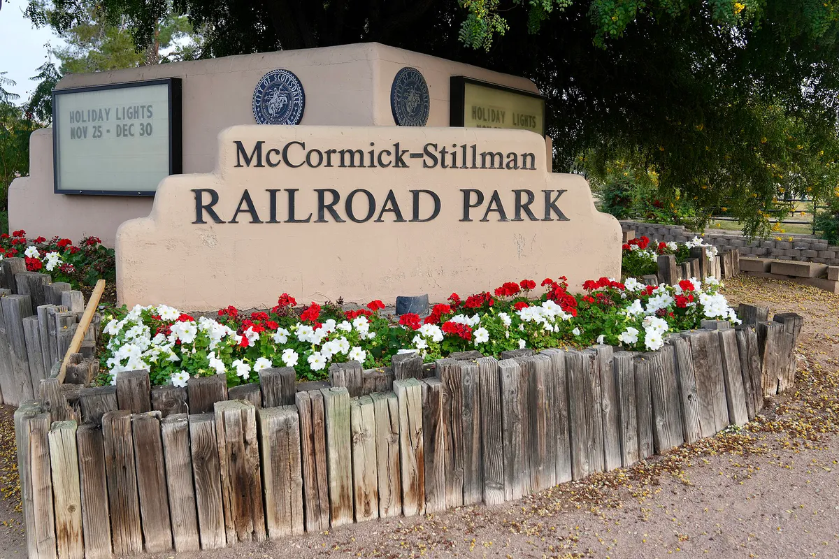
Head to the air-conditioned Arizona Boardwalk complex on the SRPMIC border to visit OdySea Aquarium and Butterfly Wonderland. For low-cost outdoor fun, go early to McCormick-Stillman Railroad Park for $3 train rides and shaded playgrounds before heat peaks.
Escape summer heat or monsoon rain inside Scottsdale Fashion Square—the region's largest luxury mall—or visit Wonderspaces, an interactive indoor art space. Explore SMoCA or tour Frank Lloyd Wright's UNESCO-listed Taliesin West via covered desert pathways.
Ride the Indian Bend Wash Greenbelt, an 11-mile paved multi-use trail running from Shea Blvd down to Tempe Town Lake. With 24 grade-separated underpasses, cyclists can ride straight through without encountering cross-street traffic.
Explore the McDowell Sonoran Preserve's Gateway or Bajada trails for zero entry or parking fees. Walk the self-guided public art trail through Old Town to see over 100 sculptures, or ride the free Scottsdale Downtown Trolley between Fashion Square and the 21-acre Civic Center lawn.
Begin with a morning hike at Gateway Loop in the McDowell Sonoran Preserve. Head to Old Town for lunch at Citizen Public House (sit at the bar), tour Western Spirit: Scottsdale's Museum of the West, and browse the shaded boutiques along Fifth Avenue.
For an outdoor plan from Scottsdale, compare trails, state parks, national parks within trip range, and scenic drives. Options in the current city guide include McFarland State Historic Park and Fort Verde State Historic Park.
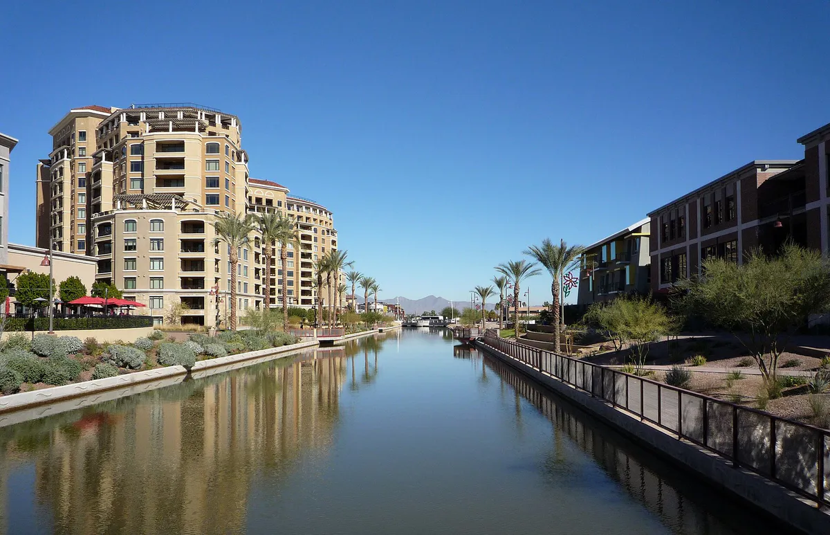
Start with an intimate Mediterranean dinner in the Arts District at Virtù Honest Craft or Chef Charleen Badman’s vegetable-forward menu at FnB. Follow with a stroll across the Soleri Bridge along the Arizona Canal or attend the free Thursday Night ArtWalk.
Outdoors nearby
Use these nearby outdoor options when the plan calls for a trail, protected landscape, park, or drive instead of another indoor stop. Proximity here is geographic, not a promise about driving time.
Get out of town
When staying in town is not the answer, these nearby destinations give you a smaller starting set for a day trip, overnight escape, or weekend away.
Destination relationships are screened geographically. Straight-line proximity is not presented as road mileage or estimated travel time.
Local landmarks & attractions
These notable destinations offer a starting point when you want something specific to see, visit, or build into a day around Scottsdale. Distances are approximate from the city area.
Non-profit zoo in the United States, opened 1962
art museum in Phoenix, Arizona
arena in Phoenix, Arizona, United States
non-profit organization in Arizona, USA
amusement park in Phoenix, Arizona, United States
theatre in Phoenix, Arizona, United States
museum in Phoenix, Arizona
casino in Scottsdale, Arizona, United States
Notable places are selected from structured public destination data and ranked for relevance, prominence, proximity, and variety.
Local decision signals
A useful local recommendation depends on how the city actually works. These conditions affect where to go, what to do, and whether a plan makes sense right now.
Scottsdale stretches 31 miles north to south along Loop 101. Driving from South Scottsdale or Old Town to Far North Scottsdale trailheads takes 30 to 45 minutes.
City ordinance strictly prohibits dogs on all city trails when ambient temperatures reach or exceed 90°F due to extreme risk of heat stroke and paw burns.
The Scottsdale Trolley operates fare-free circulators connecting Old Town, Fashion Square, Civic Center, and adjacent neighborhood corridors.
Unlike most major metro centers, Old Town Scottsdale offers multiple multi-level public parking garages (Drinkwater, Library, 2nd St, 3rd/5th Ave) with 100% free parking.
The 11-mile Indian Bend Wash Greenbelt doubles as a parks system and engineered drainage basin. During summer monsoons, multi-use underpasses deliberately submerge to channel runoff.
The 30,500-acre McDowell Sonoran Preserve charges zero entrance or parking fees across all 11 public trailheads year-round.
Every Thursday from 7:00 PM to 9:00 PM, galleries in the Old Town Arts District host open houses with free admission, artist receptions, and live music.
Neighborhood context
Neighborhoods are not interchangeable. Each area offers a different balance of atmosphere, transportation, food, nightlife, activities, and planning friction.
Best for: Walkability, dining, arts, and nightlife
A compact 1-square-mile walkable core encompassing nine distinct sub-districts including Historic Old Town, the Arts District, Fifth Avenue, and the high-energy Entertainment District.
Best for: Affordable dining, mid-century vibe, and quick airport access
Residential grid bordering Tempe and Phoenix, anchored by SkySong tech center, casual eateries, and easy access to Phoenix Sky Harbor Airport.
Best for: Resort living, greenbelt access, and family neighborhood parks
Lush, established master-planned communities centered around man-made lakes, golf courses, and the paved Indian Bend Wash Greenbelt.
Best for: Open-air luxury retail, corporate hubs, and upscale apartment living
A bustling commercial and lifestyle corridor anchored by Kierland Commons, Scottsdale Quarter, and corporate offices surrounding Scottsdale Airport.
Best for: Secluded luxury estates, dramatic desert scenery, and preserve hiking
High-elevation Sonoran Desert enclaves set against granite boulders and saguaro forests, situated immediately adjacent to top McDowell Sonoran Preserve trailheads.
Best for: Equestrian properties and spacious low-density residential lots
A quiet residential pocket between Central and North Scottsdale featuring large acreage, horse setups, and ranch-style homes.
Scottsdale local guide
Scottsdale's geographic identity is defined by its extreme north-south length. Stretching 31 miles along the eastern edge of the Phoenix metropolitan area, the city transitions rapidly from dense, historic urban cores in the south to sprawling luxury master plans and pristine high-desert foothill preserves in the north. Understanding this geography is critical for planning travel: moving between Old Town and trailheads in Troon North or Brown's Ranch can easily take 30 to 45 minutes depending on Loop 101 traffic.
Seasonal dynamics play an equally transformative role in local planning. High season spans from November through April, delivering ideal temperatures in the mid-70s, packed outdoor dining patios, and peak resort pricing driven by major international events like the WM Phoenix Open and Barrett-Jackson. Conversely, summer brings extreme heat with daily highs exceeding 100°F. While midday outdoor hiking becomes dangerous after 10:00 AM, summer offers dramatic advantages for savvy locals and visitors, including 50% to 60% discounts on luxury resort stays and uncrowded indoor cultural venues.
Explore your options
Scottsdale's distinct districts cater to vastly different trip profiles. Choose your base and daily activities according to your group's focus:
Ideal for travelers who prefer to leave the car behind. Nine sub-districts offer walkable art galleries, boutique shopping, Southwestern dining, and high-energy nightlife.
Perfect for active families, resort leisure seekers, and cyclists wanting quiet, shaded multi-use paths away from main traffic arteries.
Tailored for outdoor enthusiasts, golfers, and shoppers seeking modern outdoor lifestyle hubs set against mountain backdrops.
Practical local guidance
Avoid common tourist mistakes by keeping these verified local operational guidelines in mind:
A simpler way to decide
Follow this step-by-step decision framework to maximize your time and navigate local heat, traffic, and reservation barriers:
If traveling between May and September, lock in all outdoor hiking or golf before 10:00 AM. In winter and spring, plan midday outdoor activities when temperatures are ideal.
Calculate driving times using Loop 101 or major north-south arterials (Scottsdale Rd, Pima Rd, Hayden Rd). Group activities geographically into Old Town, Central, or North Scottsdale to avoid mid-day cross-city driving.
Identify if major events are occurring (Barrett-Jackson in late January, WM Phoenix Open in early February, or Spring Training in February/March). Avoid WestWorld and TPC corridors during major tournament hours.
For Old Town visits, park directly in a free public garage (e.g., Drinkwater or Library garage) and ride the free Downtown Trolley or walk the shaded colonnades.
Plan afternoon visits to air-conditioned institutions like Western Spirit Museum, SMoCA, or Wonderspaces, or lounge on mist-cooled resort patios as the day warms up.
Common local questions
These are common situations people face when trying to decide where to eat, what to do, where to get drinks, or how to spend their time in Scottsdale.
Scottsdale planning questions
Practical answers for people deciding where to eat, what to do, where to go, or how to make plans in Scottsdale.
Yes, Old Town Scottsdale features multiple city-managed multi-level parking garages and surface lots that offer 100% free parking with no hourly fees, including garages on Drinkwater Blvd, 2nd Street, Library, and 3rd/5th Avenue.
High season runs from November through April when daily temperatures average 65°F to 82°F. Summer (June to September) brings high heat over 100°F, but offers resort room rate discounts up to 60%.
No, Valley Metro Light Rail does not operate within Scottsdale city limits. However, Valley Metro buses run local routes (such as Route 72 along Scottsdale Rd), and the city provides a free Scottsdale Trolley circulator service around Old Town and nearby neighborhoods.
Dogs are allowed on designated trails in the McDowell Sonoran Preserve on leashes, but are strictly prohibited on all city hiking trails whenever temperatures reach or exceed 90°F to prevent heat stroke and paw burns.
No, entry and parking are 100% free year-round across all 11 trailheads, including Gateway, Tom's Thumb, Brown's Ranch, and Lost Dog Wash.
The 11-mile greenbelt serves as an engineered flood control channel. During monsoon downpours, its multi-use path underpasses deliberately flood to collect stormwater and prevent urban street flooding. Never enter flooded underpasses.
The Scottsdale ArtWalk is a free community event held every Thursday from 7:00 PM to 9:00 PM in the Old Town Arts District, where dozens of art galleries host free public open houses, artist receptions, and live music.
Taliesin West, located in the North Scottsdale foothills, was Frank Lloyd Wright's winter home and desert laboratory. It is a UNESCO World Heritage site and offers daily guided public tours that require advance reservations.
Phoenix Sky Harbor International Airport (PHX) is approximately 15 to 20 minutes by car from South Scottsdale and Old Town via Arizona State Route 143 and Loop 202.
Scottsdale Stadium in Old Town hosts the San Francisco Giants, while Salt River Fields at Talking Stick (on the SRPMIC border) hosts the Arizona Diamondbacks and Colorado Rockies.
Source transparency
Official and locally relevant sources used to verify the practical information presented in this Scottsdale decision guide.
Scottsdale decision engine
Tell Adventria what kind of experience you want, set your practical limits, and turn the options in Scottsdale into one workable plan.
Choose a Scottsdale Plan