Historic Downtown / Courthouse Plaza District
Best for
Walkable sight-seeing, historic architecture, dining, and community events.
 AdventriaLocalOpen App
Local Decision Engine
Trying to decide what to do in Prescott? Adventria helps you cut through the options and choose a good-enough plan without endless scrolling. Make smart choices for outdoor recreation, historic district dining, arts, and city transit across Prescott, Arizona.
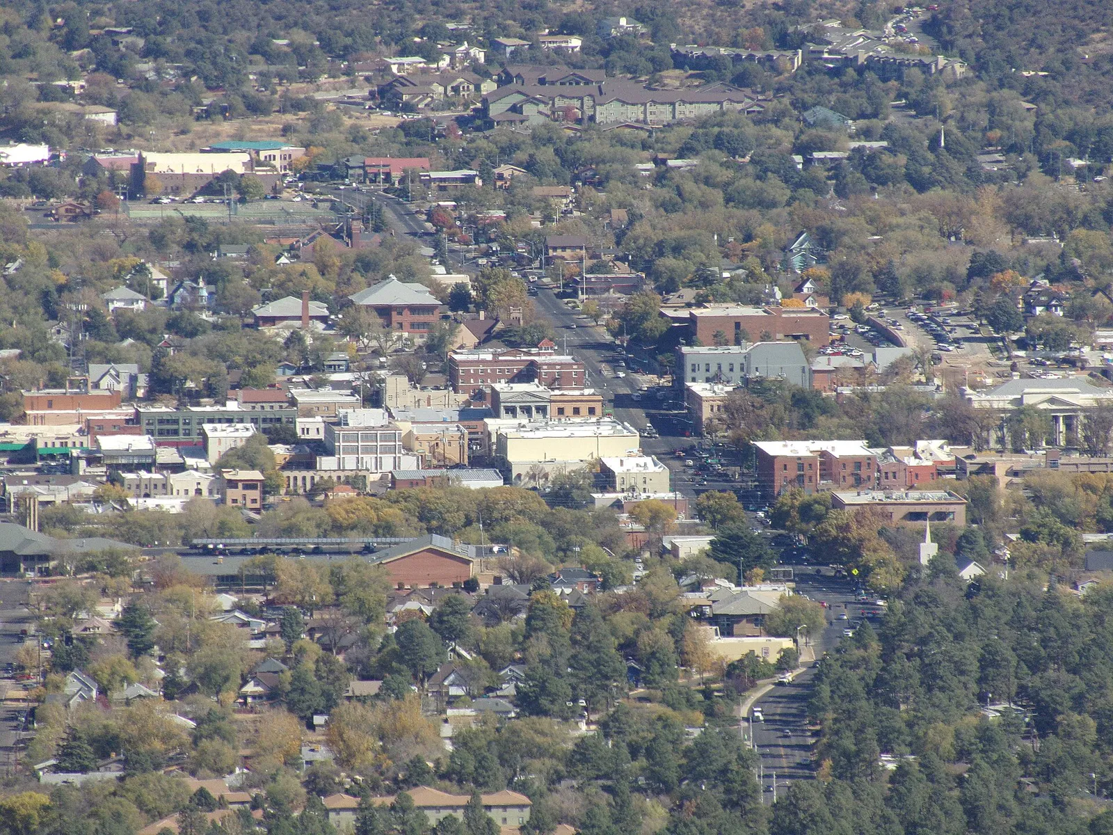
The local decision problem
Navigating district geography, seasonal monsoon weather windows, parking choices, and lake regulations across Prescott's historic downtown and outdoor trails.
That is where Adventria comes in. Adventria helps narrow the options in Prescott around practical factors like location, distance, budget, vibe, who you are with, and the kind of experience you actually want, so research can turn into a decision.
Let Adventria narrow the optionsPick the right part of town
Different parts of Prescott work for different kinds of plans. Start with the experience you want, then narrow the map.
Best for
Walkable sight-seeing, historic architecture, dining, and community events.
Best for
Historic saloons, live music, nightlife, and local dining.
Best for
Kayaking, rock trail hiking, scenery, and wildlife viewing.
Best for
Forest drives, historic mountain cottages, and gated luxury living.
Best for
Equestrian properties, large acreage homesteads, and rural views.
Best for
Direct forest access, mountain biking, and trail hiking.
This is a quick starting point. The full guide covers 8 local neighborhoods and districts in Prescott.
Eat & drink
When the decision is less about what to do and more about where to eat or grab a drink, start here. These local cues narrow the food and drink decision without turning dinner or a night out into another hour of comparison.
For places to eat in Prescott, start with Whiskey Row (Block 13 / S. Montezuma Street) or Historic Downtown / Courthouse Plaza District depending on the kind of stop you want. Start with Whiskey Row (Block 13 / S. Montezuma Street) for historic saloons, live music, nightlife, and local dining.. Montezuma Street from Courthouse Plaza, this historic block features rebuilt brick structures from after the 1900 Great Fire, hosting iconic saloons, taverns, and restaurants. Historic Downtown / Courthouse Plaza District works for walkable sight-seeing, historic architecture, dining, and community events..
Start with dinner at FARM Provisions for farm-to-table dining or El Gato Azul for Mediterranean tapas along Granite Creek. After dinner, grab drinks on the second-story balcony of Jersey Lilly Saloon overlooking the lighted Courthouse Plaza trees, then catch live theater or music at the historic 1905 Elks Theatre on Gurley Street.
Still comparing options? Adventria can narrow the choice around budget, distance, vibe, and who you are with.
Decide with AdventriaPlan by situation
Start with the kind of plan you are actually trying to make. These city-specific ideas narrow the choice around who you are with, what you want to spend, the weather, and the kind of outing you want.
For an outdoor plan from Prescott, compare trails, state parks, national parks within trip range, and scenic drives. Options in the current city guide include Verde River Greenway State Natural Area and Dead Horse Ranch State Park.
For an overnight getaway from Prescott, compare Page and Yuma. More options are listed in the trip section below.
Take kids to Lynx Lake in Prescott National Forest to walk the paved, flat 2-mile Lakeshore Loop Trail and rent electric or small motorboats at Lynx Lake Store & Cafe. Alternatively, visit Goldwater Lake for pine-shaded picnic ramadas and playground access, or spend a morning meeting native animals at Heritage Park Zoological Sanctuary overlooking Willow Lake.
Enjoy coffee and a book on the rooftop deck at Raven Café, followed by a solo bike ride or walk along the 6-mile crushed-gravel Prescott Peavine National Recreation Trail through the Granite Dells boulder formations ($2 trailhead parking fee). You can also complete a self-guided historic walking tour around Courthouse Plaza.
Reserve outdoor picnic ramadas at Goldwater Lake or Thumb Butte recreation sites through Prescott National Forest or City Parks. For indoor/outdoor group gatherings, look into private event space at the Elks Performing Arts Center's Crystal Hall or group dining at Colt Grill BBQ near the plaza.
Outdoors nearby
Use these nearby outdoor options when the plan calls for a trail, protected landscape, park, or drive instead of another indoor stop. Proximity here is geographic, not a promise about driving time.
Get out of town
When staying in town is not the answer, these nearby destinations give you a smaller starting set for a day trip, overnight escape, or weekend away.
Destination relationships are screened geographically. Straight-line proximity is not presented as road mileage or estimated travel time.
Local landmarks & attractions
These notable destinations offer a starting point when you want something specific to see, visit, or build into a day around Prescott. Distances are approximate from the city area.
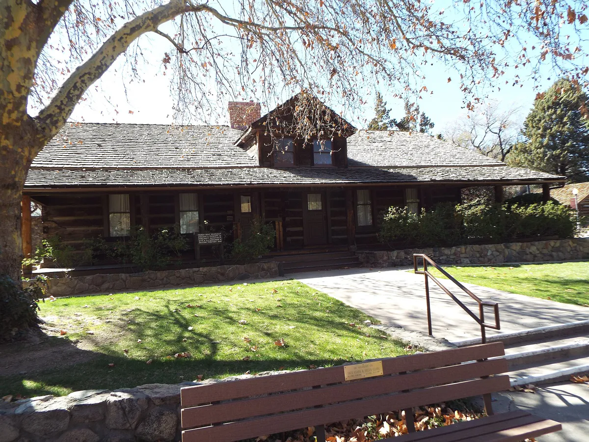
an open-air museum located in Prescott, Arizona
zoo
opera house and performing arts center in Prescott, Arizona
museum in Prescott, Arizona
multi-purpose arena
historic district in Arizona, United States
US National Cemetery in Yavapai County, Arizona
historic district in Arizona, United States
Notable places are selected from structured public destination data and ranked for relevance, prominence, proximity, and variety.
Local decision signals
A useful local recommendation depends on how the city actually works. These conditions affect where to go, what to do, and whether a plan makes sense right now.
Sitting at 5,367 feet elevation, Prescott rapidly shifts from dense ponderosa pine forests on the south and west to high-desert granite outcroppings and chaparral on the north and east.
Summer afternoon thunderstorms develop rapidly from July through mid-September. Outdoor trail and lake outings are safest between 7:00 AM and 11:30 AM before lightning and sudden downpours start.
The 5-story Garage on Granite at 135 S. Granite Street provides 503 free public parking spaces one block west of Courthouse Plaza, with cross-alley access directly to Whiskey Row.
Human swimming is strictly prohibited in all city-owned and nearby lakes (Watson, Willow, Lynx, and Goldwater Lakes), restricting water activities strictly to paddling, boating, and fishing.
YAV Connect offers bookable shared-ride microtransit service between Prescott and Prescott Valley for $2.00 standard one-way fares ($1.00 reduced fare) operating Monday through Friday.
The upper trail and north face of Thumb Butte Trail #33 are closed annually from February 1 through July 31 to safeguard nesting peregrine falcons.
State Route 69 serves as the primary artery connecting Prescott, Prescott Valley, and Dewey-Humboldt, creating notable commuter slowdowns between Highway 89 and Prescott Valley during peak travel hours.
Neighborhood context
Neighborhoods are not interchangeable. Each area offers a different balance of atmosphere, transportation, food, nightlife, activities, and planning friction.
Best for: Walkable sight-seeing, historic architecture, dining, and community events.
Centered around the 4-acre Yavapai County Courthouse Plaza, this district features a pedestrian-friendly street grid, Victorian homes, Craftsman bungalows, and shaded walkways.
Best for: Historic saloons, live music, nightlife, and local dining.
Located directly across S. Montezuma Street from Courthouse Plaza, this historic block features rebuilt brick structures from after the 1900 Great Fire, hosting iconic saloons, taverns, and restaurants.
Best for: Kayaking, rock trail hiking, scenery, and wildlife viewing.
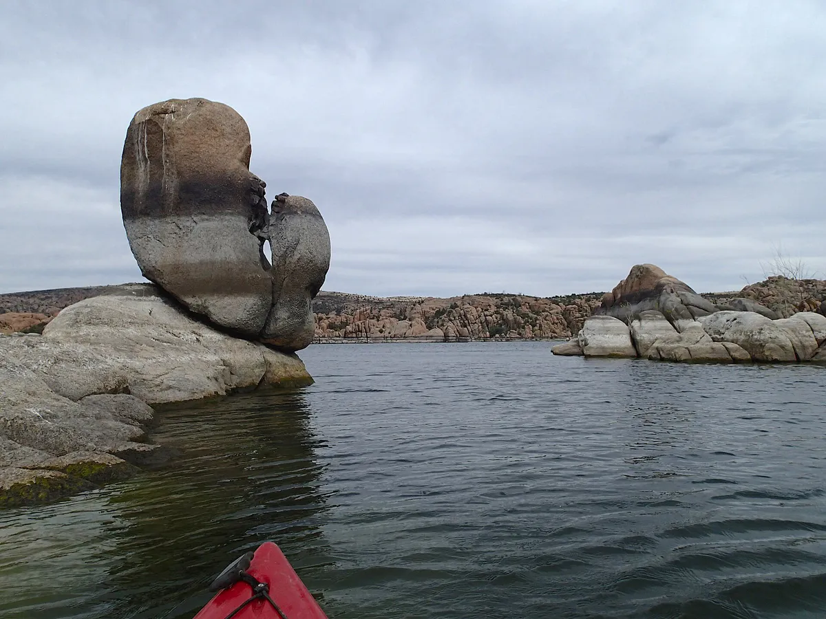
Situated 4 to 6 miles northeast of downtown, this region is defined by ancient exposed granite boulder formations surrounding Watson and Willow Lakes alongside new master-planned communities.
Best for: Forest drives, historic mountain cottages, and gated luxury living.
Tucked southwest of downtown in the Bradshaw Mountain foothills, offering pine-shaded residential pockets, historic mountain cabins, and the gated Hassayampa Golf Club.
Best for: Equestrian properties, large acreage homesteads, and rural views.
Extending northwest along Williamson Valley Road, this low-density district offers open rangeland, large custom acreage, and views of Granite Mountain.
Best for: Direct forest access, mountain biking, and trail hiking.
Positioned along Prescott's western edge at the foot of Thumb Butte, where hillside homes meet the boundary of Prescott National Forest amidst dense ponderosa pines.
Best for: Suburban master-planned living, golf, and central medical corridors.
A golf-centric suburban community located northeast of downtown along Willow Creek Road, featuring walking paths and proximity to major healthcare services.
Best for: Healthcare services, historical military architecture, and practical commercial errands.
A mixed commercial corridor north of downtown housing the Northern Arizona VA Health Care System at historic Fort Whipple along with service businesses.
Prescott local guide
Prescott sits at an elevation of 5,367 feet in central Arizona's Bradshaw Mountains, earning it the nickname 'The Mile-High City.' The regional landscape transitions rapidly across short distances, moving from dense ponderosa pine forests on the city's south and west sides to high-desert grasslands, granite outcrops, and chaparral on the north and east. Driving times between core districts are relatively short under standard conditions—downtown to the Granite Dells takes roughly 10 to 12 minutes via Highway 89, while traveling east to Prescott Valley takes 15 to 20 minutes along State Route 69.
Travel dynamics vary significantly by season and route. During the summer monsoon season from late June through mid-September, moist air triggers sudden afternoon thunderstorms across the Bradshaw Mountains. These storms deliver lightning, hail, and heavy downpours that cause sudden runoff in local washes like Granite Creek. Because of this, outdoor recreation across local lakes and mountain trails should always be planned during early morning hours. Winter brings mild daytime highs in the 50s with occasional snowstorms averaging roughly 22 inches annually. While snow on paved city streets typically melts within a day or two due to high-altitude solar radiation, shaded mountain roads can retain ice.
Navigating the city without a personal vehicle is practical around the historic downtown grid, which boasts high walkability near Courthouse Plaza. For intra-city and regional transit, YAV Connect offers bookable shared microtransit vans weekdays between Prescott and Prescott Valley for $2.00 standard fares. Regional fixed-route buses operated by Yavapai Regional Transit (YRT) connect Prescott with Chino Valley and Prescott Valley. Drivers should note that mountain access routes like Senator Highway and Copper Basin Road start as paved municipal streets but transition into narrow, unpaved Forest Service dirt roads that require high-clearance vehicles.
Explore your options
Match your day's objectives with specific district geographic conditions, venue rules, and outdoor access points.
The social and cultural center of Prescott, centered around Courthouse Plaza and South Montezuma Street.
Distinctive ancient exposed granite bedrock framing Watson and Willow Lakes northeast of downtown.
Pine-forested mountain recreation areas bordering Prescott National Forest to the south and west.
Commercial service zones, healthcare hubs, and airport infrastructure east and north of downtown.
Practical local guidance
Keep these operational rules and land-use restrictions in mind when planning your itinerary in Prescott.
A simpler way to decide
Follow this step-by-step itinerary sequence to manage weather windows, parking logistics, and dining schedules.
Start early in the Granite Dells or Prescott National Forest. Kayak Watson Lake or walk the Peavine Rail-Trail before high summer heat or afternoon monsoon lightning develops.
Drive to downtown Prescott and park at the 5-story Garage on Granite (135 S. Granite St) for free, covered parking one block west of Courthouse Plaza.
Walk through the cross-alley pedestrian passage to Whiskey Row or Gurley Street. Choose between light dining at The County Seat overlooking the plaza or gastropub meals at The Barley Hound.
Explore the 4-acre open-air Sharlot Hall Museum campus on W. Gurley Street to see the 1864 Territorial Governor's Mansion, or visit the Phippen Museum north on Highway 89 for Western fine art.
Experience historic frontier architecture and prime rib at The Palace Restaurant & Saloon on Whiskey Row, or enjoy Mediterranean tapas along Granite Creek at El Gato Azul.
Common local questions
These are common situations people face when trying to decide where to eat, what to do, where to get drinks, or how to spend their time in Prescott.
Prescott planning questions
Practical answers for people deciding where to eat, what to do, where to go, or how to make plans in Prescott.
No. Human swimming is strictly prohibited in Watson, Willow, Lynx, and Goldwater Lakes due to municipal safety and water conservation regulations. Water recreation is limited to kayaks, canoes, stand-up paddleboards, electric-motor boats, and fishing.
The Garage on Granite located at 135 S. Granite Street offers 503 free public parking spaces. It is located one block west of Courthouse Plaza and features glass elevators and direct pedestrian walkway access to S. Montezuma Street and Whiskey Row.
YAV Connect is an on-demand shared-ride service operated by CYMPO serving Prescott and Prescott Valley. Rides cost $2.00 standard one-way ($1.00 reduced fare) and can be requested via the YAV Connect mobile application or by calling 866-928-8726 weekdays between 6:00 AM and 8:00 PM.
United Airlines (operated by SkyWest) offers daily commercial passenger flights connecting Prescott Regional Airport directly to Denver International Airport (DEN) and Los Angeles International Airport (LAX). PRC provides free passenger parking for up to 10 consecutive days.
The upper loop trail and north face of Thumb Butte Trail #33 close annually from February 1 through July 31 to protect nesting peregrine falcons. The lower trail segments remain open during this period.
Prescott is approximately 90 miles north of Phoenix via Interstate 17 South and State Route 69 (typically a 1.5 to 2-hour drive). It is roughly 100 miles south of Flagstaff via I-17 North or SR 89 North (about 1.75 hours drive time).
The Palace Restaurant & Saloon, located at 120 S. Montezuma Street on Whiskey Row, opened in 1877 and is Arizona's oldest continuously operating frontier saloon. It retains its historic carved mahogany bar counter, which patrons rescued during the 1900 Great Fire.
When monsoon storms develop in July and August, move indoors to avoid lightning and flash flooding risks. Great afternoon indoor options include exploring the Sharlot Hall Museum, visiting the Phippen Museum of Western Art, or enjoying coffee on Gurley Street.
Within city limits, routes like Senator Highway and Copper Basin Road are paved standard streets. However, as they extend deeper south into the Bradshaw Mountains within Prescott National Forest, they transition into narrow, unpaved Forest Service dirt roads where high-clearance vehicles are recommended.
Source transparency
Official and locally relevant sources used to verify the practical information presented in this Prescott decision guide.
Prescott decision engine
Tell Adventria what kind of experience you want, set your practical limits, and turn the options in Prescott into one workable plan.
Choose a Prescott Plan