Main Street (Downtown Corridor)
Best for
Walking, shopping, and casual dining
 AdventriaLocalOpen App
Adventria Local Guide
Use this guide to cut through travel overwhelm. Pick your scenario, understand local constraints like heat and timed-entry rules, and make a workable plan for your time in Moab.
The local decision problem
Overwhelmed by vast public lands, timed-entry rules, and extreme desert weather, travelers struggle to efficiently choose what to do, where to eat, and how to sequence their time in Moab.
That is where Adventria comes in. Adventria helps narrow the options in Moab around practical factors like location, distance, budget, vibe, who you are with, and the kind of experience you actually want, so research can turn into a decision.
Let Adventria narrow the optionsPick the right part of town
Different parts of Moab work for different kinds of plans. Start with the experience you want, then narrow the map.
Best for
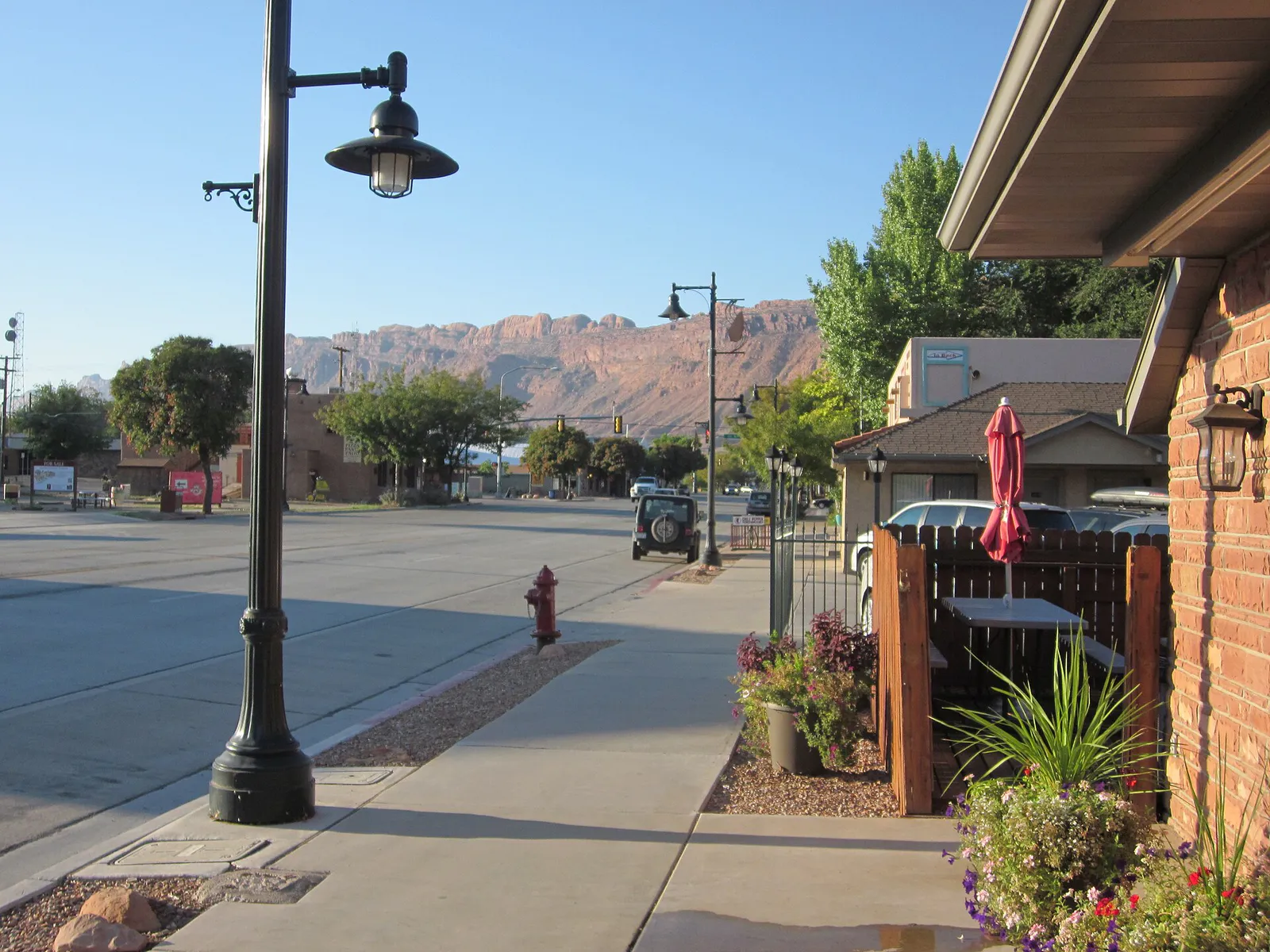
Walking, shopping, and casual dining
Best for
Scenic driving, luxury guest ranches, and wine tasting
Best for
Roadside petroglyphs, rock climbing, and dinosaur tracks
Best for
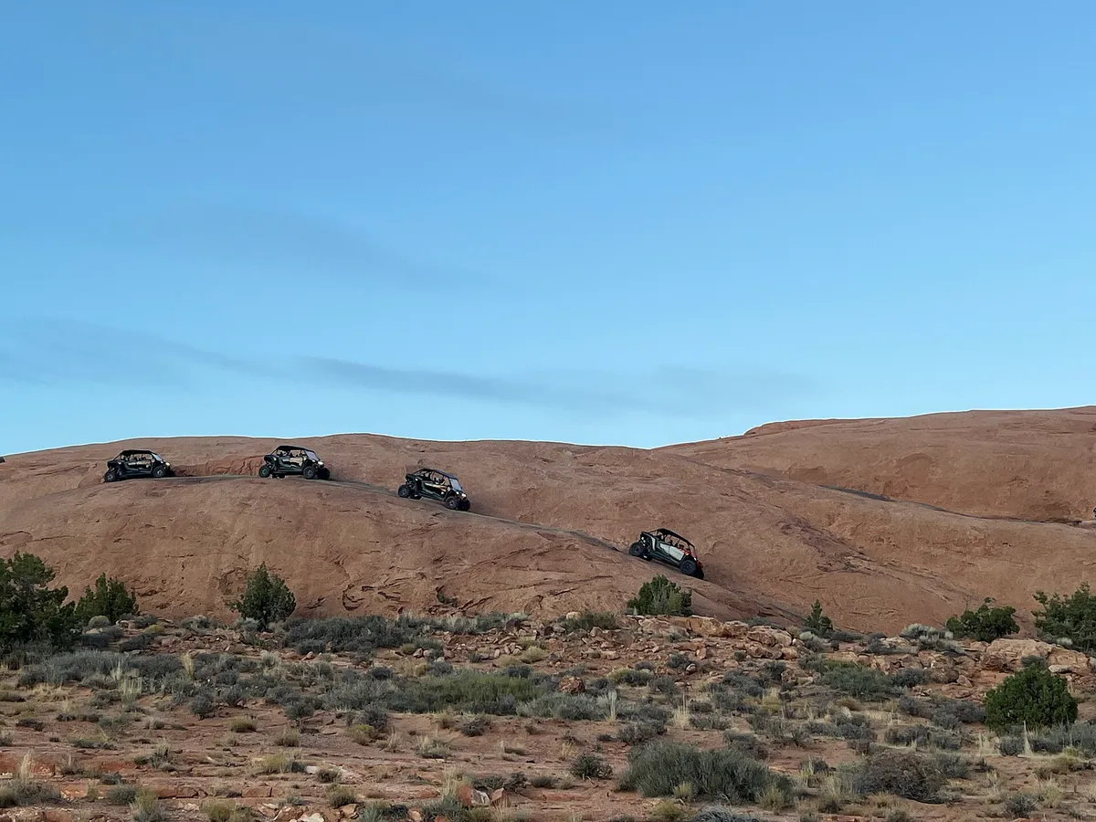
Mountain biking and 4x4 off-roading
Best for
High-elevation overlooks, camping, and cool-weather escapes
Eat & drink
Trying to decide where to eat in Moab? Start with the local dining context below and narrow the decision around the kind of meal or experience you actually want.
Grab southwestern-inspired dishes or local craft beers at microbreweries and casual spots along Main Street, or head to Highway 128 for wine tasting overlooking the river.
Still comparing options? Adventria can narrow the choice around budget, distance, vibe, and who you are with.
Decide with AdventriaPlan by situation
Start with the kind of plan you are actually trying to make. These city-specific ideas narrow the choice around who you are with, what you want to spend, the weather, and the kind of outing you want.
For an outdoor plan from Moab, compare trails, state parks, national parks within trip range, and scenic drives. Options in the current city guide include Dead Horse Point State Park and Utah State Department of State Parks 521.
For a short escape from Moab, compare Grand Junction. More options are listed in the trip section below.
Drive the Upper Colorado River Scenic Byway (SR-128) at sunset, visit Castle Creek Winery for a tasting, or enjoy a picnic overlooking Mesa Arch or Dead Horse Point.
Explore life-sized dinosaur replicas and the interactive tracks museum at Moab Giants, go smooth-water rafting on the Colorado River, or take a short walk to Double Arch.
Visit the Moab Museum downtown for geology and indigenous history, tour the free Moab Museum of Film and Western Heritage at Red Cliffs Ranch, or swim indoors at the Moab Recreation and Aquatic Center.
Hike to Corona and Bowtie Arches outside park boundaries, explore the Mill Canyon Dinosaur Trail, or hike Grandstaff Canyon to Morning Glory Natural Bridge.
Mountain bike the Slickrock Trail at Sand Flats, go trail running along Grandstaff Canyon, or catch a solo sunrise hike to Delicate Arch.
Outdoors nearby
Use these nearby outdoor options when the plan calls for a trail, protected landscape, park, or drive instead of another indoor stop. Proximity here is geographic, not a promise about driving time.
Get out of town
When staying in town is not the answer, these nearby destinations give you a smaller starting set for a day trip, overnight escape, or weekend away.
Destination relationships are screened geographically. Straight-line proximity is not presented as road mileage or estimated travel time.
Local decision signals
A useful local recommendation depends on how the city actually works. These conditions affect where to go, what to do, and whether a plan makes sense right now.
Arches National Park requires timed-entry permits daily between 7:00 AM and 4:00 PM from April 1 through October 31. Entering before 7:00 AM bypasses these restrictions.
Downtown Moab sits at 4,025 feet, while surrounding parks like Canyonlands and Dead Horse Point sit between 6,000 and 6,200 feet.
Moab is located 4 miles south of the main entrance to Arches National Park and 30 miles east of Canyonlands National Park.
Desert temperatures exceed 100°F (38°C) during summer mid-days, making early morning or late afternoon the safest times for outdoor recreation.
Much of the surrounding land is sensitive cryptobiotic crust; visitors must stay on established trails, pack out waste, and observe fire bans.
Neighborhood context
Neighborhoods are not interchangeable. Each area offers a different balance of atmosphere, transportation, food, nightlife, activities, and planning friction.
Best for: Walking, shopping, and casual dining
The walkable commercial heart of Moab along Highway 191, lined with local gear shops, casual restaurants, microbreweries, tour operators, and the central Moab Information Center at Main and Center Street.
Best for: Scenic driving, luxury guest ranches, and wine tasting
A scenic corridor northeast of town running along the river, home to river-access points, dramatic red-cliff canyons, luxury guest ranches, and wine tasting.
Best for: Roadside petroglyphs, rock climbing, and dinosaur tracks
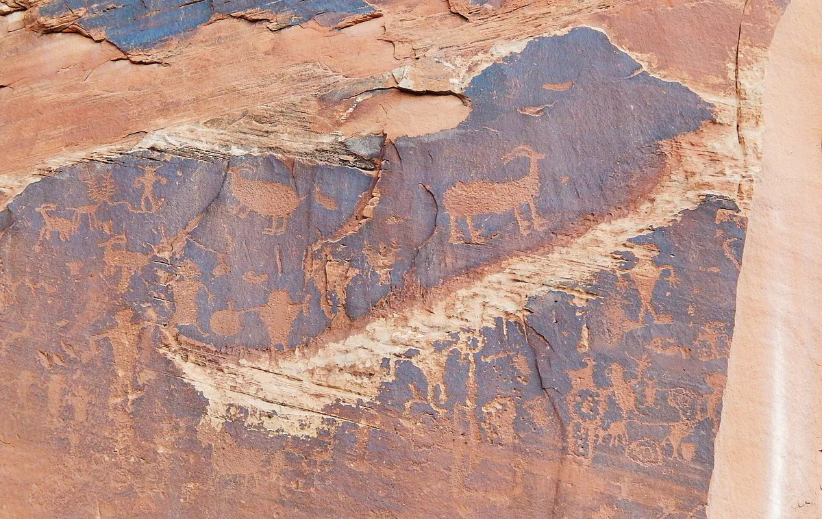
A scenic riverway corridor northwest of downtown known for easy-access roadside petroglyphs, rock climbing walls, dinosaur tracks, and trailheads.
Best for: Mountain biking and 4x4 off-roading
A high-desert slickrock playground located just east of downtown, serving as the world-famous anchor for mountain biking (Slickrock Trail) and 4x4 off-roading.
Best for: High-elevation overlooks, camping, and cool-weather escapes
A 60-mile paved mountain drive climbing out of the desert into alpine forests and Castle Valley, offering high-elevation overlooks, camping, and cool-weather escapes.
Explore your options
Quickly match your current travel constraints and goals to the right area of Moab.
Focus on the compact downtown corridor when you want walkability, gear shopping, and casual food options.
Plan ahead for national and state parks, keeping strict park reservation rules and driving distances in mind.
Venture onto scenic byways and public lands for river views, climbing, and off-road biking.
Practical local guidance
Keep these local realities in mind before heading out into the desert.
A simpler way to decide
Follow this sequence to avoid decision fatigue and logistical roadblocks.
If visiting Arches National Park between April 1 and October 31, secure your timed-entry reservation on Recreation.gov or plan to enter before 7:00 AM.
Schedule exposed desert hikes and slickrock biking for early morning or late afternoon to avoid mid-day heat exceeding 100°F.
Confirm you have a private vehicle, 4x4 rental, or shuttle booked for remote park trailheads, as downtown is best handled on foot.
Pick a specific direction—such as Highway 128 for river views and wine tasting, or Potash Road for petroglyphs and climbing walls.
Review local rules regarding cryptobiotic soil crust, pack-out trash policies, and active fire bans before hitting the trails.
Common local questions
These are common situations people face when trying to decide where to eat, what to do, where to get drinks, or how to spend their time in Moab.
Moab planning questions
Practical answers for people deciding where to eat, what to do, where to go, or how to make plans in Moab.
Yes, Arches National Park requires timed-entry permits daily between 7:00 AM and 4:00 PM from April 1 through October 31. Entering before 7:00 AM bypasses these restrictions.
Moab is located 4 miles south of the main entrance to Arches National Park and 30 miles east of Canyonlands National Park.
You can visit the Moab Museum downtown, tour the free Moab Museum of Film and Western Heritage at Red Cliffs Ranch along Highway 128, or swim indoors at the Moab Recreation and Aquatic Center.
While downtown Moab is compact and walkable on foot or bicycle, a private vehicle, 4x4 rental, or guided shuttle is essential for reaching national parks, remote trailheads, and river launch sites.
You can hike to Corona and Bowtie Arches outside park boundaries, explore the Mill Canyon Dinosaur Trail, hike Grandstaff Canyon to Morning Glory Natural Bridge, or view roadside petroglyphs along Potash Road.
Source transparency
Official and locally relevant sources used to verify the practical information presented in this Moab decision guide.
Moab decision engine
Tell Adventria what kind of experience you want, set your practical limits, and turn the options in Moab into one workable plan.
Choose a Moab Plan