Downtown / Main Street
Best for
Urban dining, theater national tours, sports events, and direct transit access.
 AdventriaLocalOpen App
Practical Valley & Mountain Navigation
Trying to decide what to do in Salt Lake City? Adventria helps you cut through the options and choose a good-enough plan without endless scrolling. Salt Lake City combines high-desert urban living with instant mountain access. Whether you are maneuvering around the city's massive grid blocks, escaping a winter inversion for sunny canyon peaks, or navigating Utah's distinct dining and beverage rules, this guide provides clear pathways for making real-time choices across the valley.
The local decision problem
How to navigate Salt Lake City's unique spatial layout, liquor regulations, weather inversions, and neighborhood hubs to plan real-time daily activities, dining, and mountain escapes.
That is where Adventria comes in. Adventria helps narrow the options in Salt Lake City around practical factors like location, distance, budget, vibe, who you are with, and the kind of experience you actually want, so research can turn into a decision.
Let Adventria narrow the optionsPick the right part of town
Different parts of Salt Lake City work for different kinds of plans. Start with the experience you want, then narrow the map.
Best for
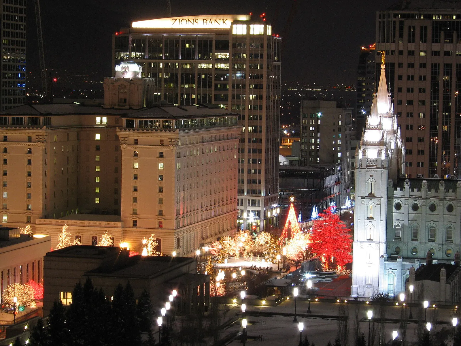
Urban dining, theater national tours, sports events, and direct transit access.
Best for
Walkable shopping, craft taprooms, urban parks, and local boutique retail.
Best for
Independent boutiques, artisanal coffee, chef-driven bistros, and strollable streets.
Best for
Craft brewery hopping, warehouse art spaces, live local indie music, and industrial murals.
Best for
Historic architecture walks, steep neighborhood hikes, quiet cafes, and sunset points.
Best for
Craftsman home character, extensive park space, tree-canopied bike lanes, and casual bites.
This is a quick starting point. The full guide covers 8 local neighborhoods and districts in Salt Lake City.
Eat & drink
When the decision is less about what to do and more about where to eat or grab a drink, start here. These local cues narrow the food and drink decision without turning dinner or a night out into another hour of comparison.
For places to eat in Salt Lake City, start with Downtown / Main Street or The Avenues & Marmalade depending on the kind of stop you want. Start with Downtown / Main Street for urban dining, theater national tours, sports events, and direct transit access.. The Avenues & Marmalade works for historic architecture walks, steep neighborhood hikes, quiet cafes, and sunset points..
For upscale chef-driven concept dining and pre-theater meals, head to Main Street in Downtown. If you prefer neighborhood bistros, artisan bakeries, and casual modern European spots, target 9th & 9th or 15th & 15th. For taproom kitchens and communal food halls, head to the Granary District. If you are searching for authentic regional Mexican fare, Central American pupusas, or Pacific Islander comfort food, head west of I-15 into the Rose Park and Fairpark neighborhoods.
Still comparing options? Adventria can narrow the choice around budget, distance, vibe, and who you are with.
Decide with AdventriaPlan by situation
Start with the kind of plan you are actually trying to make. These city-specific ideas narrow the choice around who you are with, what you want to spend, the weather, and the kind of outing you want.
Plan an afternoon date at Red Butte Garden enjoying the foothill paths, followed by an early evening stroll through 9th & 9th and dinner at a neighborhood bistro. For a classic night out downtown, reserve tickets for a performance at Capitol Theatre or Abravanel Hall, preceded by craft cocktails at an underground Main Street lounge.
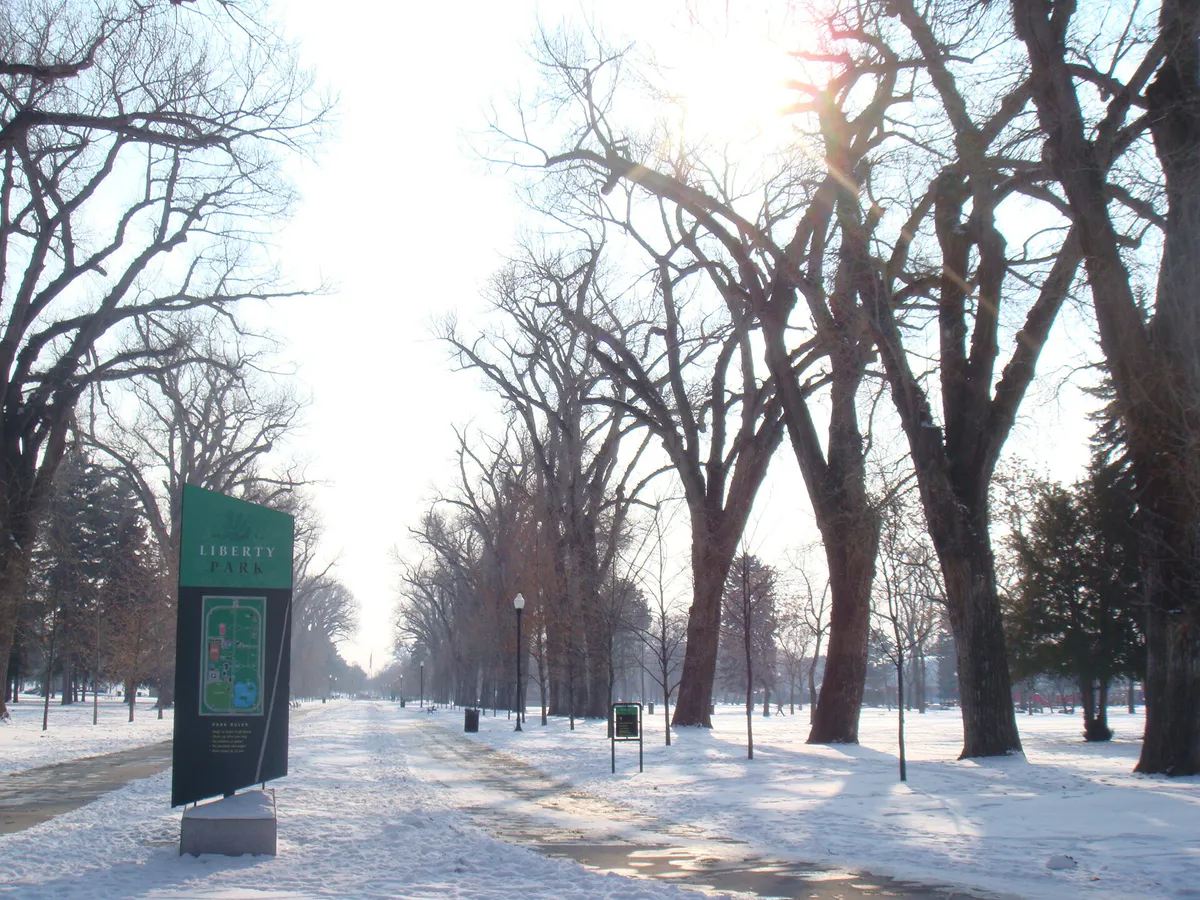
Take children to Liberty Park to ride the seasonal carousel, visit the Tracy Aviary, and play on the expansive playgrounds. On hot or rainy days, head to The Gateway complex downtown to combine the hands-on Clark Planetarium (which features free interactive exhibit floors) with the Discovery Gateway Children’s Museum.
If winter smog traps pollution on the valley floor, drive or take transit above 5,000 feet into the Wasatch Canyons or to Park City where the air is sunny and clear. If weather keeps you indoors in the city, visit the Natural History Museum of Utah, catch an IMAX documentary at Clark Planetarium, or climb indoors at The Front Climbing Club.
Ride TRAX for free within the Downtown Free Fare Zone, explore the 10,000 square feet of free interactive science exhibits at Clark Planetarium, hike up Memory Grove Park or Ensign Peak, and spend an afternoon walking around Liberty Park or Sugar House Park with incredible Wasatch mountain views.
Take the TRAX Red Line to the University campus to spend hours inside the Utah Museum of Fine Arts or the Natural History Museum of Utah. Grab a book and head to an independent coffee shop in Sugar House or 9th & 9th, or jump on the Bonneville Shoreline Trail for a solo foothill hike with constant mountain landmarks to keep your bearings.
The Granary District is ideal for groups due to its high concentration of spacious craft taprooms, outdoor patio seating, and food options like Woodbine Food Hall. For evening sports or big venue entertainment, grab tickets to a Utah Jazz or Utah Hockey Club game at the Delta Center, which sits directly on light rail lines.
For an outdoor plan from Salt Lake City, compare trails, state parks, national parks within trip range, and scenic drives. Options in the current city guide include Utah State Fair Park and Jordan River Golf Course State Park.
Outdoors nearby
Use these nearby outdoor options when the plan calls for a trail, protected landscape, park, or drive instead of another indoor stop. Proximity here is geographic, not a promise about driving time.
Get out of town
When staying in town is not the answer, these nearby destinations give you a smaller starting set for a day trip, overnight escape, or weekend away.
Destination relationships are screened geographically. Straight-line proximity is not presented as road mileage or estimated travel time.
Local landmarks & attractions
These notable destinations offer a starting point when you want something specific to see, visit, or build into a day around Salt Lake City. Distances are approximate from the city area.
indoor arena in Salt Lake City, Utah, United States
state capitol building of Utah, United States
zoo in Salt Lake City, Utah, United States
religious museum in Utah, United States
planetarium located at the Gateway Mall in Salt Lake City, Utah, United States
amusement park in Farmington, Utah, United States
football stadium at the University of Utah in Salt Lake City, Utah, US
museum in Salt Lake City, Utah, United States
Notable places are selected from structured public destination data and ranked for relevance, prominence, proximity, and variety.
Local decision signals
A useful local recommendation depends on how the city actually works. These conditions affect where to go, what to do, and whether a plan makes sense right now.
Salt Lake City's blocks are 660 feet per side (10 acres), making a three-block walk equal to nearly a mile. Addresses function as mathematical coordinates centered on Temple Square.
Cold air traps particulate matter on the valley floor between December and February. Locals monitor air indices and head above 5,000 feet for clear mountain sunshine.
Grocery stores sell beer and seltzers up to 5.0% ABV. Heavy beer, wine, and spirits are sold exclusively through state-run stores that close on Sundays and state holidays.
TRAX light rail trains and UTA buses operate entirely free of charge within the Downtown core bounded by North Temple, 500 South, 200 East, and 500 West.
UDOT strictly enforces winter tire and chain requirements on State Routes 190 and 210 during storm events; non-compliant vehicles are turned away at canyon entry checkpoints.
Utah enforces a 0.05% blood alcohol concentration limit—the strictest standard in the United States. Draft beer served in bars and restaurants is capped at 5.0% ABV.
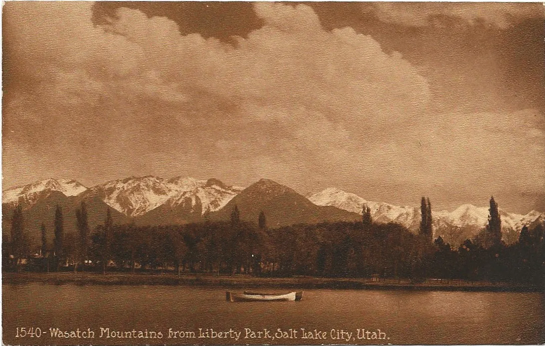
The steep Wasatch Range sits directly along the eastern boundary of the valley, providing immediate visual orientation: looking uphill always points east.
Neighborhood context
Neighborhoods are not interchangeable. Each area offers a different balance of atmosphere, transportation, food, nightlife, activities, and planning friction.
Best for: Urban dining, theater national tours, sports events, and direct transit access.
The civic and economic core centered around Temple Square, City Creek Center, and the Main Street commercial strip. High density, walkable within sub-zones, and connected by the Free Fare Zone.
Best for: Walkable shopping, craft taprooms, urban parks, and local boutique retail.
Anchored around 2100 South and Highland Drive, Sugar House combines a high-density commercial core with historic residential streets, local dining, and expansive green space at Sugar House Park.
Best for: Independent boutiques, artisanal coffee, chef-driven bistros, and strollable streets.
A charming, highly walkable micro-district focused on the intersection of 900 South and 900 East. Known for independent bookstores, local bakeries, and pedestrian-friendly brick storefronts.
Best for: Craft brewery hopping, warehouse art spaces, live local indie music, and industrial murals.
A rapidly evolving industrial zone southwest of downtown featuring historic brick warehouses converted into taprooms, maker spaces, food halls, and creative studios.
Best for: Historic architecture walks, steep neighborhood hikes, quiet cafes, and sunset points.
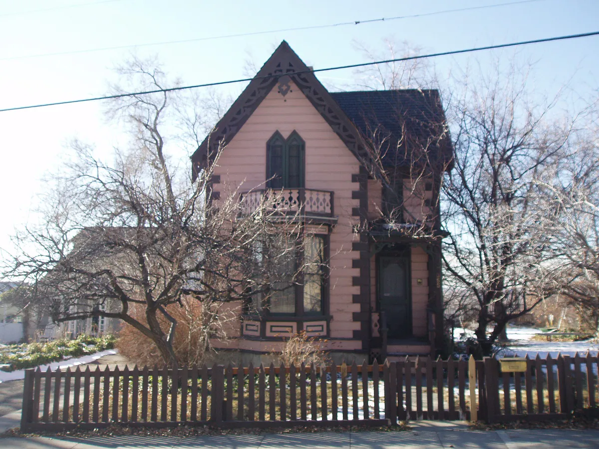
Northeast and northwest of downtown along the foothills. The Avenues offers historic homes on a strict numbered grid, while Marmalade features winding streets named after fruit trees and Capitol Hill views.
Best for: Craftsman home character, extensive park space, tree-canopied bike lanes, and casual bites.
Residential neighborhoods wrapping around 80-acre Liberty Park. High concentrations of 1920s bungalows, neighborhood coffee shops, and direct access to protected cross-city bike corridors.
Best for: World-class natural history, botanical garden strolls, foothill trails, and mountain panoramas.
Spanning the hillside campus of the University of Utah. Features high-elevation research hubs, regional museums, and direct trailheads along the Wasatch crest.
Best for: Diverse international cuisine, riverfront trails, historic fairgrounds, and neighborhood markets.
Stretching west of I-15 along the Jordan River Parkway. Offers rich cultural community hubs, long-standing ethnic eateries, and straightforward highway connectivity.
Explore your options
Seasonal weather in the Salt Lake Valley is heavily defined by high-desert geography and surrounding topography. Adjust your plans based on time of year and elevation.
High-pressure systems can trap cold air and fine particulate matter (PM2.5) on the valley floor, creating thick smog while high mountain elevations remain warm and crystal clear.
Temperatures vary widely between the valley and upper canyons. Low-elevation foothill trails dry out first while mountain passes remain snow-bound.
Valley afternoon temperatures routinely top 90°F to 100°F with low humidity, while ground-level ozone builds during late afternoon hours.
Crisp air and optimal atmospheric visibility make fall one of the finest seasons for scenic drives, hiking, and neighborhood walking.
Practical local guidance
Avoid common local friction points by keeping these legal, geographical, and transit realities in mind.
A simpler way to decide
Winter resort traffic in Little Cottonwood Canyon (SR-210) and Big Cottonwood Canyon (SR-190) can turn a 20-minute drive into a three-hour crawl. Follow this timeline to ensure smooth transit.
Review Utah Department of Transportation canyon road conditions and avalanche control updates by 6:00 AM.
Ensure your vehicle meets UDOT Traction Law standards (4WD/AWD with M+S or snow tires, or 2WD with 3PMSF winter tires/chains) before driving up the canyons.
To beat peak resort commuter traffic ('The Red Snake'), enter the canyon mouth prior to 7:00 AM on powder days and weekends.
Utilize UTA Ski Bus routes operating from valley park-and-ride lots to bypass canyon driving stress and parking reservations.
Avoid peak downhill canyon gridlock between 3:30 PM and 5:30 PM by leaving early or staying for apres-ski on the mountain.
If canyon roads close for avalanche mitigation, pivot to lower foothill outings or urban indoor cultural spots.
Common local questions
These are common situations people face when trying to decide where to eat, what to do, where to get drinks, or how to spend their time in Salt Lake City.
Salt Lake City planning questions
Practical answers for people deciding where to eat, what to do, where to go, or how to make plans in Salt Lake City.
Yes. TRAX light rail trains and UTA buses operate free of charge within the Downtown Free Fare Zone, bounded by North Temple, 500 South, 200 East, and 500 West.
Addresses function as grid coordinates originating from Temple Square (0 East, 0 South). An address at 900 South 900 East means the location sits exactly 9 blocks south and 9 blocks east of Temple Square.
A temperature inversion occurs during winter when a cap of warm air traps cold air and fine pollution on the valley floor. To avoid it, head to higher elevations above 5,000 feet in the Wasatch Mountains where the air is clear and sunny.
No. Grocery stores and convenience stores only carry beer and seltzers up to 5.0% ABV. Wine, spirits, and beers over 5.0% ABV must be purchased at state-run DABS liquor stores.
No. At establishments licensed as bars or taverns, you can order drinks without food. However, at establishments licensed as restaurants, state law requires you to order food along with your alcoholic beverages.
The UTA TRAX Green Line provides direct, affordable light rail service from Downtown Salt Lake City straight into Salt Lake City International Airport (SLC).
Plan to pass the canyon mouth checkpoint before 7:00 AM on weekends and powder days to avoid severe traffic delays.
Yes. Downtown blocks are 660 feet by 660 feet (10 acres each), meaning a walk of three blocks covers almost a full mile.
Most restaurant kitchens close between 9:00 PM and 10:00 PM. Late-night dining options are concentrated along Main Street, in the Granary District, and at select diners near downtown.
Source transparency
Official and locally relevant sources used to verify the practical information presented in this Salt Lake City decision guide.
Salt Lake City decision engine
Tell Adventria what kind of experience you want, set your practical limits, and turn the options in Salt Lake City into one workable plan.
Choose a Salt Lake City Plan