Historic Downtown District
Best for
Craft dining, boutique shopping, live theatre, and central community gatherings.
 AdventriaLocalOpen App
Local Planning & Activity Decision Guide
Trying to decide what to do in Twin Falls? Adventria helps you cut through the options and choose a good-enough plan without endless scrolling. From high-desert canyon trails and dramatic Snake River vistas to Historic Downtown craft breweries and adaptive-reuse food halls, Twin Falls presents unique local planning choices. Whether you are timing waterfall flows at Shoshone Falls, navigating microtransit across town, or avoiding peak commuter traffic across the I.B. Perrine Bridge, this guide provides actionable, local-first answers for every scenario.
The local decision problem
Navigating seasonal water flows, high-desert canyon microclimates, and localized travel friction across Twin Falls to plan outdoor recreation, dining, and cultural outings efficiently.
That is where Adventria comes in. Adventria helps narrow the options in Twin Falls around practical factors like location, distance, budget, vibe, who you are with, and the kind of experience you actually want, so research can turn into a decision.
Let Adventria narrow the optionsPick the right part of town
Different parts of Twin Falls work for different kinds of plans. Start with the experience you want, then narrow the map.
Best for
Craft dining, boutique shopping, live theatre, and central community gatherings.
Best for
Food hall dining, casual group gatherings, and indoor-outdoor seating.
Best for
Family playground outings, library visits, community park events, and shady walks.
Best for
Visitor services, major retail shopping, chain convenience, and canyon-edge dining.
Best for
Rainy-day cultural activities, planetarium shows, free museums, and paved walking paths.
Best for
Disc golf, RV camping, dog walking, and historical museum visits.
This is a quick starting point. The full guide covers 7 local neighborhoods and districts in Twin Falls.
Eat & drink
When the decision is less about what to do and more about where to eat or grab a drink, start here. These local cues narrow the food and drink decision without turning dinner or a night out into another hour of comparison.
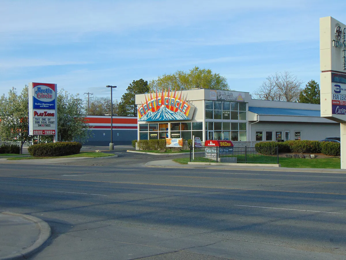
For places to eat in Twin Falls, start with Historic Warehouse District or Blue Lakes Boulevard / Canyon Rim Commercial Corridor depending on the kind of stop you want. Start with Historic Warehouse District for food hall dining, casual group gatherings, and indoor-outdoor seating.. Situated directly south of the commercial core along 2nd Avenue South, this repurposed industrial zone features 2nd South Market—Idaho's first food hall—housed in a 1926 industrial building with multiple food vendors and a spacious outdoor yard. Blue Lakes Boulevard / Canyon Rim Commercial Corridor works for visitor services, major retail shopping, chain convenience, and canyon-edge dining.. Lining Blue Lakes Boulevard North, Pole Line Road, and Cheney Drive, this commercial strip houses the Magic Valley Mall, major big-box retailers, hotels, the Twin Falls Visitor Center, and cliffside restaurants overlooking the Perrine Bridge.
Plan a late afternoon visit to Perrine Coulee Falls along Canyon Springs Road to catch the cascading spray, followed by a cliffside dinner at Elevation 486 or Redhawk Gastropub for local draft beer and Snake River Canyon views. Wrap up the evening with a live performance, comedy show, or classic film at the historic Orpheum Theatre downtown.
Still comparing options? Adventria can narrow the choice around budget, distance, vibe, and who you are with.
Decide with AdventriaPlan by situation
Start with the kind of plan you are actually trying to make. These city-specific ideas narrow the choice around who you are with, what you want to spend, the weather, and the kind of outing you want.
For an outdoor plan from Twin Falls, compare trails, state parks, national parks within trip range, and scenic drives. Options in the current city guide include Thousand Springs State Park and Lake Walcott State Park.
For a weekend getaway from Twin Falls, compare Jackson and Moscow. More options are listed in the trip section below.
Spend rainy or cold days at the Herrett Center for Arts and Science on the College of Southern Idaho campus. Families can explore free museum galleries showcasing intact mammoth skeletons and live reptile displays, then attend an immersive astronomy or educational show inside the 144-seat domed Faulkner Planetarium.
Free local activities include walking or cycling the 7.6-mile Canyon Rim Trail, visiting the Herrett Center museum galleries, attending monthly second-Saturday Star Parties at the Centennial Observatory, and strolling through Historic City Park. For low-cost transit, Ride TFT provides citywide microtransit rides for $3 each, while entry to Shoshone Falls Park costs $5 per vehicle load.
Gather large groups at 2nd South Market, where seven distinct vendors, an indoor layout, and the outdoor Yard allow everyone to choose their own meals while sitting together. For outdoor reunions or group picnics, reserve park pavilions at Rock Creek Park or Shoshone Falls Park through local parks departments.
Solo outdoor enthusiasts can ride the 10-mile dirt network and pump track at Auger Falls Heritage Park on the canyon floor, run along the paved Rock Creek Canyon Parkway, or play an 18-hole round at the Rock Creek Park championship disc golf course. For water workouts, solo kayakers can launch from Centennial Waterfront Park toward Pillar Falls.
Outdoors nearby
Use these nearby outdoor options when the plan calls for a trail, protected landscape, park, or drive instead of another indoor stop. Proximity here is geographic, not a promise about driving time.
Get out of town
When staying in town is not the answer, these nearby destinations give you a smaller starting set for a day trip, overnight escape, or weekend away.
Destination relationships are screened geographically. Straight-line proximity is not presented as road mileage or estimated travel time.
Local landmarks & attractions
These notable destinations offer a starting point when you want something specific to see, visit, or build into a day around Twin Falls. Distances are approximate from the city area.
museum in Idaho, USA
national historic site commemorating the WW II internment of Japanese Americans in Idaho and Bainbridge Island, Washington
former theater and movie theater in Gooding, Idaho, United States
historic district in Idaho, USA
Notable places are selected from structured public destination data and ranked for relevance, prominence, proximity, and variety.
Local decision signals
A useful local recommendation depends on how the city actually works. These conditions affect where to go, what to do, and whether a plan makes sense right now.
U.S. Route 93 across the I.B. Perrine Bridge is the city's sole direct northern canyon crossing, experiencing predictable morning (7:00–9:00 AM) and evening (4:30–6:30 PM) rush hour congestion along Blue Lakes Boulevard North.
Public transportation operates via Ride TFT, an app-based on-demand microtransit service charging $3 per ride within city limits Monday through Saturday, replacing traditional fixed-route buses.
Shoshone Falls flow peaks during spring melt (March to May) before agricultural irrigation diversions reduce its flow in late summer, whereas aquifer-fed Perrine Coulee Falls maintains steady year-round cascading water.
High basalt walls shelter Centennial Waterfront Park and canyon floor trails from plateau winds, though these deep canyon sites experience direct shade earlier in the afternoon.
The Historic Downtown core and adjacent Warehouse District offer free street parking and free public rear off-street parking lots, contrasting with fee-based entry ($5 per vehicle) at Shoshone Falls and Dierkes Lake.
Locations along the Snake River Canyon Rim Trail experience persistent high-desert wind exposure, making early morning or late afternoon the preferred time windows for walking and cycling during hot summer months.
Neighborhood context
Neighborhoods are not interchangeable. Each area offers a different balance of atmosphere, transportation, food, nightlife, activities, and planning friction.
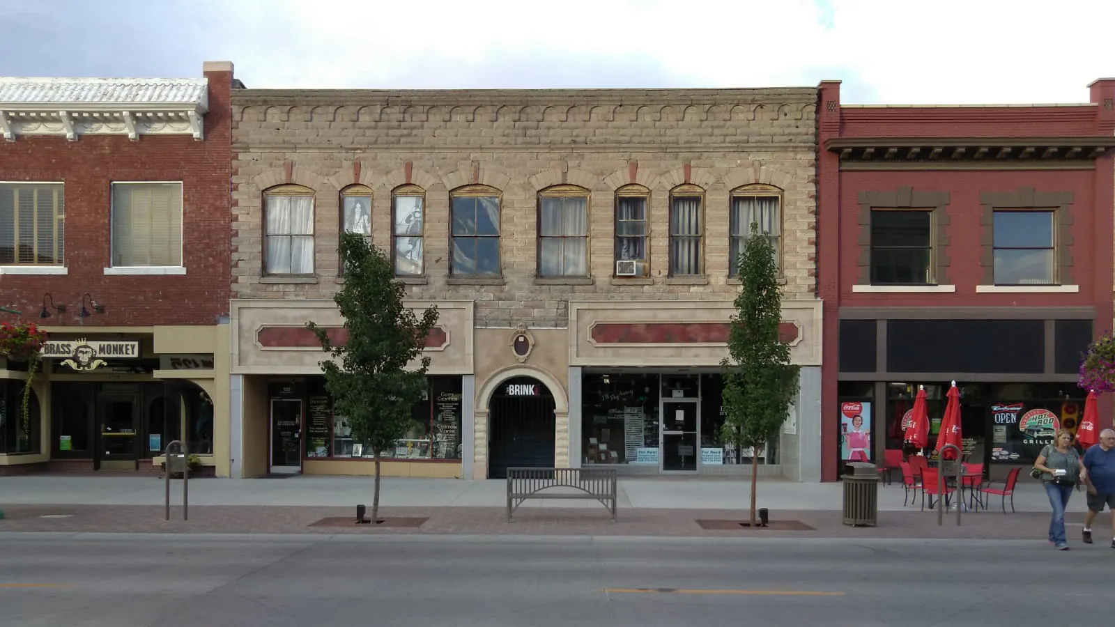
Best for: Craft dining, boutique shopping, live theatre, and central community gatherings.
Bounded roughly by 2nd Avenue North, 2nd Street East, 2nd Street South, and 3rd Street West, this historic 11-block district features 1920s architecture, the Orpheum Theatre, local craft breweries, and the Downtown Commons outdoor stage and splash pad.
Best for: Food hall dining, casual group gatherings, and indoor-outdoor seating.
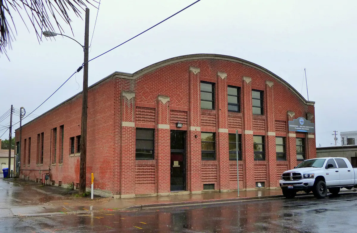
Situated directly south of the commercial core along 2nd Avenue South, this repurposed industrial zone features 2nd South Market—Idaho's first food hall—housed in a 1926 industrial building with multiple food vendors and a spacious outdoor yard.
Best for: Family playground outings, library visits, community park events, and shady walks.
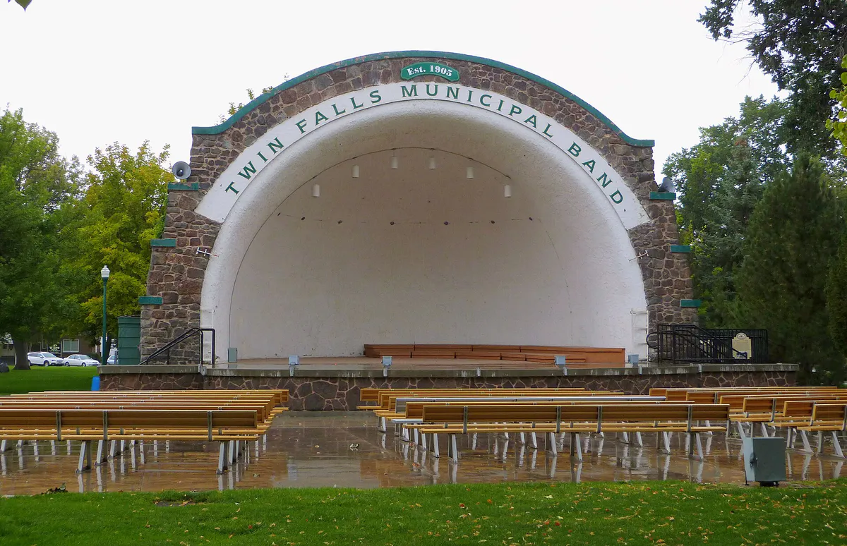
Anchored by the 5.5-acre Twin Falls City Park designed in 1904, this civic district includes the municipal bandshell, county courthouse, public library, rose garden, and an ADA-accessible playground connected directly to library steps.
Best for: Visitor services, major retail shopping, chain convenience, and canyon-edge dining.
Lining Blue Lakes Boulevard North, Pole Line Road, and Cheney Drive, this commercial strip houses the Magic Valley Mall, major big-box retailers, hotels, the Twin Falls Visitor Center, and cliffside restaurants overlooking the Perrine Bridge.
Best for: Rainy-day cultural activities, planetarium shows, free museums, and paved walking paths.
Encompassing the College of Southern Idaho campus along Falls Avenue East and North College Road, this neighborhood contains the Herrett Center for Arts and Science, Faulkner Planetarium, Centennial Observatory, and dedicated fitness paths.
Best for: Disc golf, RV camping, dog walking, and historical museum visits.
Following Highway 30 and Filer Avenue into the western canyon descent, this recreational corridor features the 12-acre Rock Creek Park, a 46.5-acre parkway with an 18-hole championship disc golf course, paved paths, and the Twin Falls County Historical Society Museum.
Best for: Watercraft launches, mountain biking, jump park skills training, and waterfall access.
Dropping below the rim via Canyon Springs Road, this riverfront zone encompasses Centennial Waterfront Park for kayak launching, Perrine Coulee Falls access, and the 680-acre Auger Falls Heritage Park dirt trail system.
Twin Falls local guide
Twin Falls sits on a high-desert plateau in Idaho's Magic Valley at an elevation of roughly 3,700 feet. The defining physical characteristics of the area are two deep canyon incisions: the Snake River Canyon along the northern boundary, dropping 486 feet below the surrounding plain, and Rock Creek Canyon cutting through the western and southern reaches of the city.
Local weather patterns feature low relative humidity, around 210 sunny days annually, and modest precipitation averaging 10 inches of rainfall and 18 to 26 inches of snow per year. However, localized microclimates exist between the canyon rim and canyon floor. Rim locations remain exposed to persistent high-desert wind, while canyon floor parks like Centennial Waterfront Park offer wind protection from high basalt cliffs but lose direct sunlight earlier in the afternoon.
Water recreation and waterfall viewing depend heavily on seasonal dynamics. Shoshone Falls reaches maximum flow during spring runoff from March through May, dropping 212 feet over a 900-foot rim. By June, upstream diversions for regional agricultural irrigation reduce Snake River levels, diminishing Shoshone Falls by late summer. Conversely, Perrine Coulee Falls cascades 197 feet over canyon cliffs fed by the Snake River Plain aquifer, maintaining steady flow through every season.
Explore your options
Explore the distinct character, primary uses, and transportation dynamics across the principal neighborhoods of Twin Falls.
The walkable commercial heart featuring 1920s architecture, craft breweries, independent dining, performing arts at the Orpheum Theatre, and Idaho's first food hall.
The city's primary retail, lodging, and scenic overlook strip running along Blue Lakes Boulevard North and Pole Line Road.
An educational and cultural hub along Falls Avenue East offering low-cost indoor discovery and peaceful outdoor fitness paths.
Rugged riverfront terrain accessed via steep canyon roads, ideal for paddling, mountain biking, and natural waterfall views.
Practical local guidance
Keep these practical operational guidelines in mind when planning outings, parking, and water recreation across Twin Falls.
A simpler way to decide
Follow these sequential steps to ensure a safe, well-equipped paddling trip from Centennial Waterfront Park toward Pillar Falls and Shoshone Falls.
Review current Snake River flow levels and check for any local aquatic invasive species inspects or access notices before setting out.
Rent kayaks, paddleboards, or canoes through the permitted outfitter at Centennial Waterfront Park, ensuring life jackets and paddles are properly fitted.
Descend the hairpin turns of Canyon Springs Grade Road carefully, keeping an eye out for pedestrians near Perrine Coulee Falls, and park near the waterfront launch ramp.
Paddle roughly 2 miles upstream beneath the 486-foot Perrine Bridge, watching overhead for BASE jumpers before arriving at the rhyolite rock formations of Pillar Falls.
If continuing toward Shoshone Falls, land watercraft and carry them across the designated quarter-mile Pillar Falls rock portage. Avoid entering the water around Pillar Falls channels.
Common local questions
These are common situations people face when trying to decide where to eat, what to do, where to get drinks, or how to spend their time in Twin Falls.
Twin Falls planning questions
Practical answers for people deciding where to eat, what to do, where to go, or how to make plans in Twin Falls.
You can use Ride TFT (Twin Falls Transit), an on-demand microtransit service. Passengers book door-to-door rides within city limits using the RIDE Twin Falls Transit app or by calling 208-974-7433. Rides operate Monday through Friday from 6:00 AM to 9:00 PM and Saturday from 7:00 AM to 9:00 PM for $3 per ride.
Admission to Shoshone Falls Park and adjacent Dierkes Lake costs $5 per vehicle daily from March 1st through fall. Annual season passes are available through the city for $25. Parking at other city parks and canyon rim trailheads is free.
BASE jumpers leap legally year-round from the I.B. Perrine Bridge. The primary viewing area is from the lawn and observation platform at the Twin Falls Visitor Center, located at 2015 Neilsen Point Place on the south rim of the canyon.
Peak water flow at Shoshone Falls occurs during spring runoff, typically between March and May, when upstream Snake River snowmelt is highest. By mid-to-late summer, irrigation diversions reduce the waterfall's volume significantly.
Swimming is allowed in designated areas at Dierkes Lake, which features a spring-fed 5-acre lake, grassy lawn, and seasonal lifeguard coverage during summer months. Swimming is not permitted at Shoshone Falls or Pillar Falls due to dangerous currents.
Yes, general admission to the Herrett Center for Arts and Science museum galleries and the Jean B. King Gallery is free. Tickets are required for show admission at the Faulkner Planetarium ($7.50 for adults, $6.50 for seniors, $5.50 for children ages 2–17).
2nd South Market is a 13,000-square-foot indoor food hall located in a restored 1926 industrial building at 210 2nd Avenue South. Food vendors include Smokey Bone BBQ, Lucy's NY Style Pizza, Fuji Xpress, Sushi & Poke Hut, Petite Creperie & Café, Cutthroat Coffee / Full Steam Espresso, and TapHouse Bar, alongside an outdoor yard for seating.
Auger Falls Heritage Park, located on the canyon floor, offers over 10 miles of dirt trails for mountain biking and trail running, along with the Auger Falls Skills Park featuring a pump track and dirt jump lines for beginner through advanced riders.
The Canyon Rim Trail is a paved multi-use path extending roughly 7.6 to 8.2 miles along the south rim of the Snake River Canyon. Major public access points include Washington Street North, the Twin Falls Visitor Center, Pole Line Road, and Shoshone Falls Park.
The U.S. Route 93 Perrine Bridge is the main north-south river crossing, connecting Twin Falls to Interstate 84. Expect slow traffic and congestion along Blue Lakes Boulevard North during peak commuting hours from 7:00 to 9:00 AM and 4:30 to 6:30 PM.
Source transparency
Official and locally relevant sources used to verify the practical information presented in this Twin Falls decision guide.
Twin Falls decision engine
Tell Adventria what kind of experience you want, set your practical limits, and turn the options in Twin Falls into one workable plan.
Choose a Twin Falls Plan