Downtown Davenport
Best for
Arts, riverfront sports, historic architecture, and local breweries
 AdventriaLocalOpen App
Local Decision Guide
Trying to decide what to do in Davenport? Adventria helps you cut through the options and choose a good-enough plan without endless scrolling. A practical planning framework for choosing where to go, how to move across river bluffs and bridges, and how to adapt activities around changing Mississippi River conditions.
The local decision problem
Navigating Davenport's unique east-to-west river geography, bluff topography, flood detours, and distinct neighborhood offerings effectively.
That is where Adventria comes in. Adventria helps narrow the options in Davenport around practical factors like location, distance, budget, vibe, who you are with, and the kind of experience you actually want, so research can turn into a decision.
Let Adventria narrow the optionsPick the right part of town
Different parts of Davenport work for different kinds of plans. Start with the experience you want, then narrow the map.
Best for
Arts, riverfront sports, historic architecture, and local breweries
Best for
Architectural walking tours and historic blufftop river views
Best for
Independent boutiques, cozy taverns, historic charm, and river access
Best for
Coffee shops, independent bookstores, casual student dining, and civic parks
Best for
Scenic driving, historic homes, and winding blufftop neighborhood walks
Best for
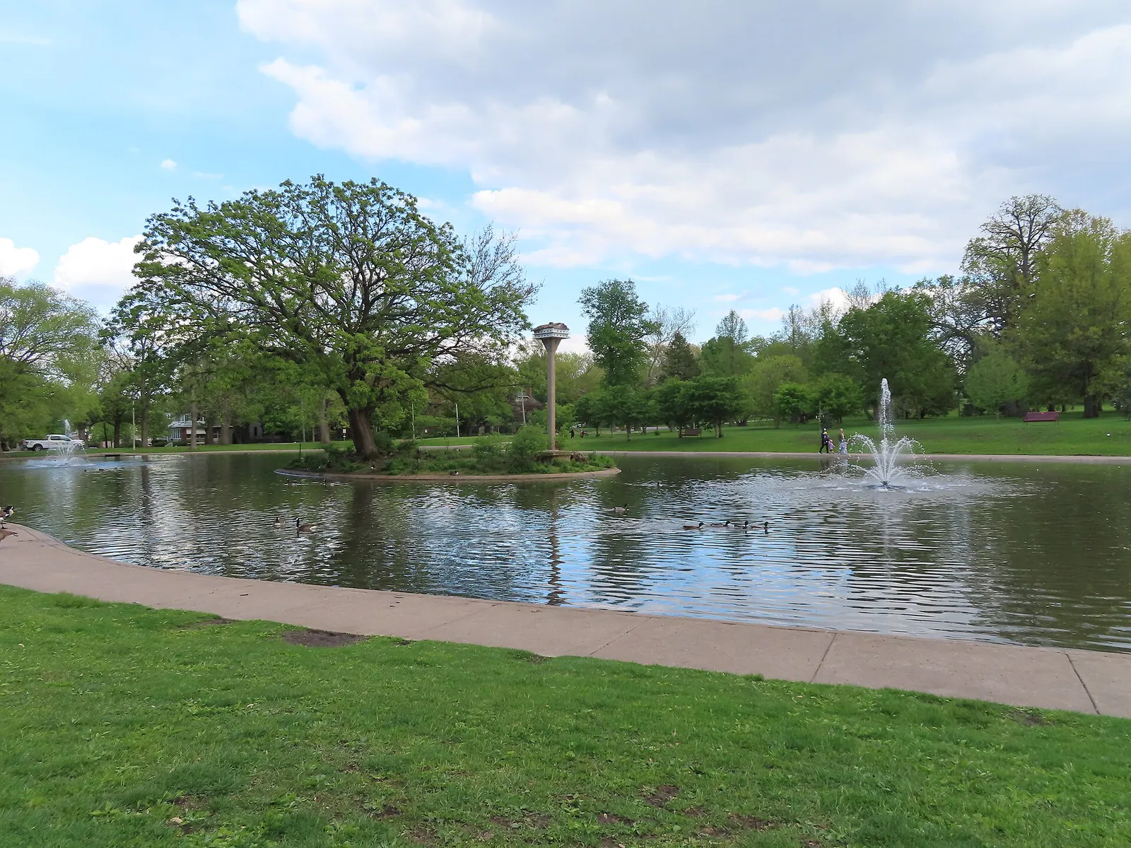
Botanical gardens, walking trails, historic fountains, and quiet green space
This is a quick starting point. The full guide covers 7 local neighborhoods and districts in Davenport.
Eat & drink
When the decision is less about what to do and more about where to eat or grab a drink, start here. These local cues narrow the food and drink decision without turning dinner or a night out into another hour of comparison.
Head to classic local establishments like Harris Pizza or Fat Boy's Pizza. Expect a soft, malt-sweetened crust, a zesty cayenne-spiced sauce, and heavy crumbled fennel sausage underneath a thick layer of mozzarella, served in long horizontal strips rather than traditional triangles.
Choose the part of Davenport that fits the night: Downtown Davenport for arts, riverfront sports, historic architecture, and local breweries; Village of East Davenport for independent boutiques, cozy taverns, historic charm, and river access.
Still comparing options? Adventria can narrow the choice around budget, distance, vibe, and who you are with.
Decide with AdventriaPlan by situation
Start with the kind of plan you are actually trying to make. These city-specific ideas narrow the choice around who you are with, what you want to spend, the weather, and the kind of outing you want.
For a day trip from Davenport, compare Rockford and Cedar Falls. More options are listed in the trip section below.
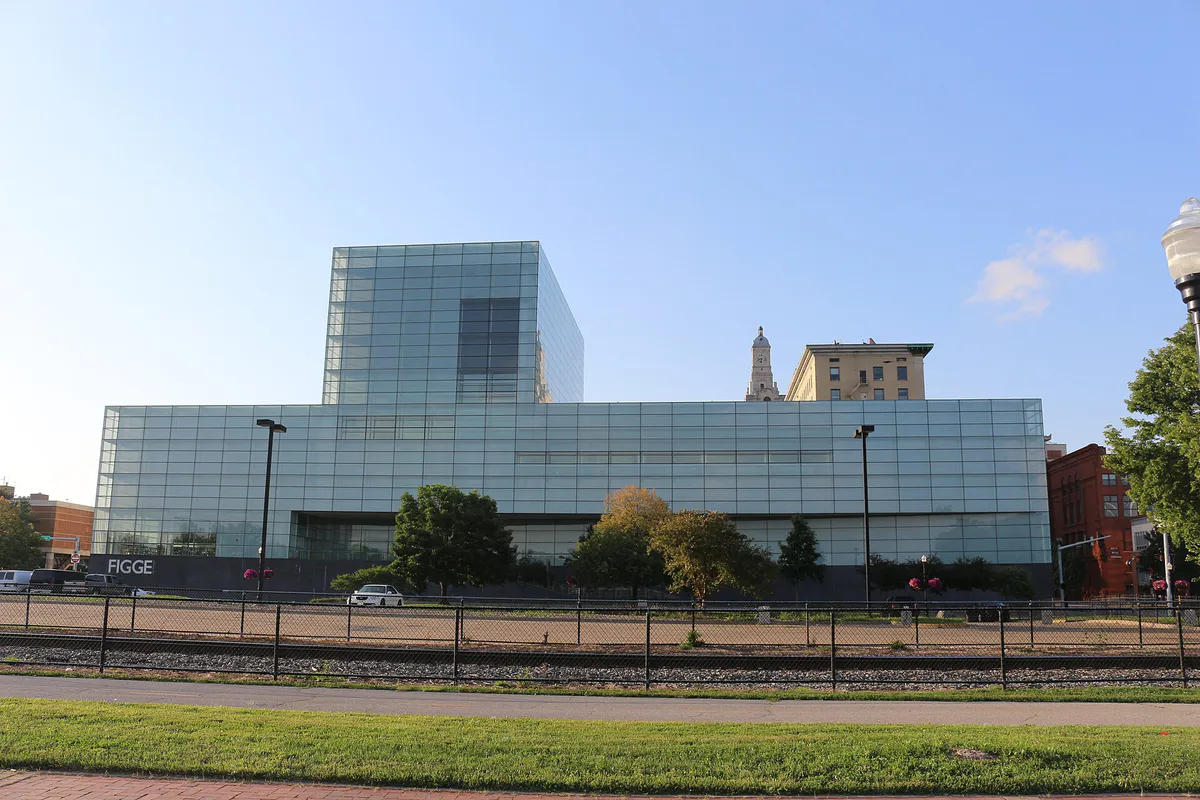
Start with an late afternoon exhibit at the Figge Art Museum, head to dinner in Downtown or the Village of East Davenport, catch a show at the historic Adler Theatre or live music at the Redstone Room, and conclude with an evening stroll through Vander Veer Botanical Park to view the color-changing Stone Fountain.
Take the family to Modern Woodmen Park to watch the Quad Cities River Bandits and ride the 110-foot outfield Ferris wheel. Follow it up with hands-on learning at the Putnam Museum & Science Center or an all-day river-hopping pass on the Channel Cat Water Taxi.
Explore the multi-story galleries at the Figge Art Museum on the downtown waterfront, visit the Putnam Museum and Science Center on the west side bluffs for interactive science and a GIANT Screen Theater, or retreat to the warm indoor tropical Conservatory at Vander Veer Botanical Park.
Stroll the free grounds and rose gardens of Vander Veer Botanical Park ($1 Conservatory entry), bike the paved 13-mile Mississippi River Trail or the east-west Duck Creek Trail, or take a self-guided architectural walking tour through the Gold Coast / Hamburg Historic District.
Explore jazz history at the Bix Beiderbecke Museum, pick up a book and coffee in the Hilltop Campus Village at The Brewed Book, or enjoy uninterrupted trail riding along the Duck Creek Recreational Trail or Mississippi River Trail.
For an outdoor plan from Davenport, compare trails, state parks, national parks within trip range, and scenic drives. Options in the current city guide include Wildcat Den State Park and Bishop Hill Park.
Outdoors nearby
Use these nearby outdoor options when the plan calls for a trail, protected landscape, park, or drive instead of another indoor stop. Proximity here is geographic, not a promise about driving time.
Get out of town
When staying in town is not the answer, these nearby destinations give you a smaller starting set for a day trip, overnight escape, or weekend away.
Destination relationships are screened geographically. Straight-line proximity is not presented as road mileage or estimated travel time.
Local landmarks & attractions
These notable destinations offer a starting point when you want something specific to see, visit, or build into a day around Davenport. Distances are approximate from the city area.
botanical garden in the above historic district
museum in Davenport, Iowa
theater and apartment building complex in Davenport, Iowa
lock and dam on the Mississippi River between Rock Island, Illinois and Davenport, Iowa, USA
arena in Moline, Illinois
history and science museum in Iowa, United States
historic cemetery in Davenport, Iowa
zoo in Illinois, United States
Notable places are selected from structured public destination data and ranked for relevance, prominence, proximity, and variety.
Local decision signals
A useful local recommendation depends on how the city actually works. These conditions affect where to go, what to do, and whether a plan makes sense right now.
The Mississippi River flows east to west along Davenport's southern boundary. Looking across the river means looking south toward Rock Island and Moline, Illinois.
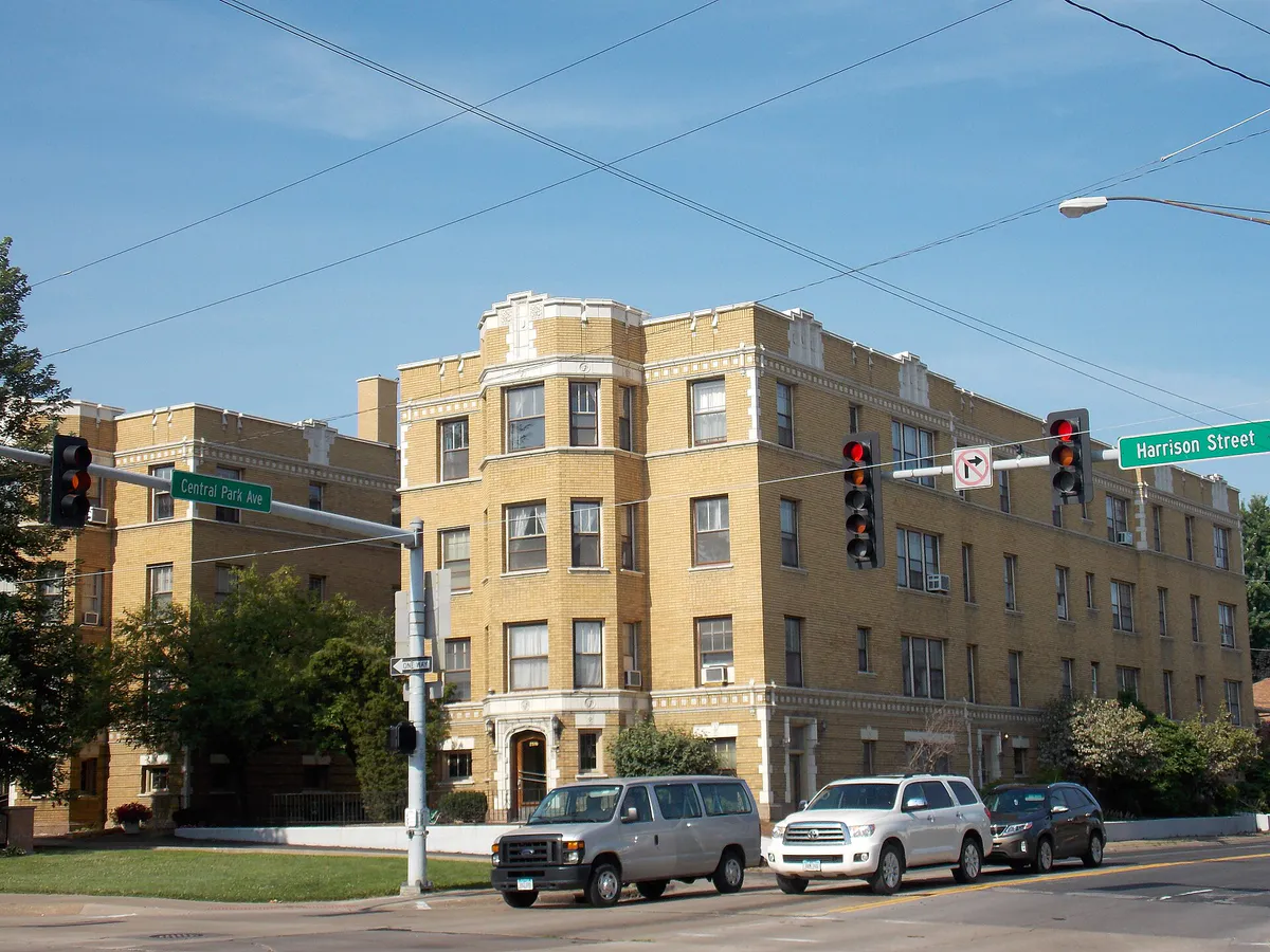
Davenport's topography rises sharply from flat river terraces up steep, wooded bluffs to upper plateaus via major north-bound inclines like Brady, Harrison, Gaines, and Ripley streets.
Because Davenport maintains an open, public riverfront without a concrete floodwall, Mississippi River levels above flood stage prompt River Drive (US 67) closures and detour traffic onto 3rd, 4th, 5th, or Locust streets.
The Government Bridge rotates open to accommodate barge traffic, causing sudden 10-to-15-minute delays between Downtown Davenport and Rock Island Arsenal. The four-lane Centennial Bridge serves as the primary alternative.
On-street downtown parking is free for up to 2 hours. Three public city ramps offer affordable hourly rates ($0.75/hr) and shift to free parking during official city-declared Downtown Snow Emergencies.
North-south vehicle routes through Central Davenport rely on paired one-way streets, with Brady Street carrying northbound traffic (US 61) and Harrison Street carrying southbound traffic (US 61).
Local pizza features a soft, malted dough, cayenne-spiced red sauce, heavy crumbled fennel sausage buried under mozzarella, and is distinctly cut into long horizontal strips using kitchen shears.
Neighborhood context
Neighborhoods are not interchangeable. Each area offers a different balance of atmosphere, transportation, food, nightlife, activities, and planning friction.
Best for: Arts, riverfront sports, historic architecture, and local breweries
The city's cultural and commercial core along the Mississippi River, featuring high-rise commercial structures, adaptive-reuse warehouses, art museums, historic performance venues, and minor league baseball.
Best for: Architectural walking tours and historic blufftop river views
A 24-block historic residential district on the steep bluffs directly above Fifth Street, filled with Victorian, Italianate, Gothic Revival, and Queen Anne mansions built by 19th-century merchant families.
Best for: Independent boutiques, cozy taverns, historic charm, and river access
Established as an independent community in 1851 at 2100 East River Drive, offering mid-19th-century brick commercial streets, specialty dining, Lindsay Park access, and a seasonal water taxi landing.
Best for: Coffee shops, independent bookstores, casual student dining, and civic parks
An energetic corridor along Brady and Harrison streets anchored by Palmer College of Chiropractic and St. Ambrose University, featuring student-focused amenities and MLK Park.
Best for: Scenic driving, historic homes, and winding blufftop neighborhood walks
A historic residential neighborhood on the east end bluffs featuring over 300 historic structures built along winding streets and natural ravines overlooking the river.
Best for: Botanical gardens, walking trails, historic fountains, and quiet green space
A central historic neighborhood anchored by the 33-acre Vander Veer Botanical Park between Brady and Harrison streets, modeled after New York's Central Park.
Best for: Suburban shopping, gaming, corporate lodging, and easy highway access
A modern commercial drag adjacent to Interstate 80, characterized by big-box retail, corporate hotel chains, casual dining hubs, and the Rhythm City Casino Resort.
Davenport local guide
Navigating Davenport efficiently requires recognizing two primary geographic features: the unusual east-to-west path of the Mississippi River along the city's southern edge, and the dramatic elevation shift from the river's flat terrace up to the blufftop plateaus. Because the river curves east-to-west here, looking across the water means looking south into Illinois. Traveling north from Downtown or River Drive means driving uphill along steep inclines such as Brady Street (US 61 N) and Harrison Street (US 61 S), which form a high-volume pair of one-way corridors through Central Davenport.
Davenport takes a deliberate approach to its riverfront by maintaining a 9-mile open greenway without a permanent concrete floodwall. While this provides public parks and trail access along the water, seasonal spring thaws and upper-river rainfall can push the Mississippi above its 15-foot flood stage. When river levels rise significantly, River Drive (US 67) closes to vehicular traffic, requiring drivers to detour onto 3rd, 4th, or 5th streets or upper arterials like Locust Street and 53rd Street.
Cross-river trips to Illinois also require planning around bridge operations. The double-decker Government Swing Bridge connects 2nd Street to the Rock Island Arsenal and Rock Island, IL. However, because river barge traffic takes precedence, the bridge periodically rotates open, causing 10-to-15-minute delays. Drivers needing strict schedules should utilize the four-lane Centennial Bridge (US 67) for direct, uninterrupted travel into downtown Rock Island.
Explore your options
Match your travel plans, dining choices, and activities to the practical layout of Davenport's distinct districts.
The urban core along the Mississippi River, best suited for visitors wanting cultural institutions, minor league sports, craft breweries, and riverfront trails within walking distance.
A historic 1851 brick village situated on River Drive east of Downtown, offering small-town charm, independent boutique shopping, local pubs, and direct river access.
Centrally located along the Brady and Harrison street corridors, catering to university communities and residents seeking historic parks and neighborhood cafes.
The city's modern suburban drag located adjacent to Interstate 80, optimized for fast vehicle navigation, commercial shopping, and regional entertainment.
Practical local guidance
Essential planning facts for major civic institutions, outdoor parks, and seasonal transportation options in Davenport.
A simpler way to decide
Follow these practical steps to navigate river conditions, bridge traffic, parking rules, and seasonal changes seamlessly.
Before heading toward River Drive or waterfront parks during spring thaws, verify whether the Mississippi River is approaching or exceeding its 15-foot flood stage, which prompts standard city detours onto 3rd, 4th, or Locust streets.
If traveling between Davenport and Illinois, check whether the Government Swing Bridge is open for river barge passage. Take the four-lane Centennial Bridge (US 67) if you require uninterrupted driving time.
For quick errands or short dining visits under 2 hours, utilize free on-street downtown spaces. For longer outings, head directly to the Redstone, Harrison, or RiverCenter parking ramps.
During official city-declared Downtown Snow Emergencies, move all parked vehicles off downtown streets and into one of the three municipal parking ramps, which offer free parking for the duration of the emergency.
When visiting between late spring and early autumn, buy an unlimited all-day pass for the Channel Cat Water Taxi to move easily between East Davenport and Illinois landings without driving.
Common local questions
These are common situations people face when trying to decide where to eat, what to do, where to get drinks, or how to spend their time in Davenport.
Davenport planning questions
Practical answers for people deciding where to eat, what to do, where to go, or how to make plans in Davenport.
Due to a distinct bend in the river's path, the Mississippi River flows from east to west along Davenport's southern border. Looking directly across the water from Davenport means looking south toward Illinois.
The Government Swing Bridge regularly opens for 10 to 15 minutes to let river barges pass. To avoid waiting, take the four-lane Centennial Bridge (US 67) located slightly west in downtown Davenport.
On-street parking spaces in Downtown Davenport are free for up to 2 hours. For extended stays, the city operates three public ramps—Redstone, Harrison, and RiverCenter—which charge $0.75 per hour.
During city-declared Downtown Snow Emergencies, street parking is prohibited so plows can clear curb lines. Vehicles can park for free inside the three city ramps (Redstone, Harrison, RiverCenter) until the emergency expires.
Quad Cities-style pizza features a soft crust made with malt syrup, a spicy cayenne-pepper tomato sauce, crumbled fennel sausage buried under a heavy blanket of mozzarella, and is cut into long horizontal strips.
Operated by MetroLINK from Memorial Day weekend through September (and fall weekends), the Channel Cat is an open-air passenger ferry. An all-day ticket ($8 adults, $4 children) allows unlimited rides across four landings in Davenport, Bettendorf, and Moline.
Davenport maintains an open, levee-free waterfront. When the river reaches flood stage (15 feet), River Drive (US 67) closes, and traffic detours onto 3rd, 4th, 5th, or Locust streets.
Yes, walking the grounds, Grand Allée, and gardens at Vander Veer Botanical Park is free. Entering the indoor tropical Conservatory costs $1, with children 15 and under admitted free with an adult.
The Freight House Farmers Market takes place at the historic Freight House Marketplace (421 W. River Drive) on the downtown riverfront, operating outdoors on weekends and indoors midweek and through winter.
Source transparency
Official and locally relevant sources used to verify the practical information presented in this Davenport decision guide.
Davenport decision engine
Tell Adventria what kind of experience you want, set your practical limits, and turn the options in Davenport into one workable plan.
Choose a Davenport Plan