Downtown / Central Business District
Best for
Museum visits, major sports games, concerts, and waterfront access
 AdventriaLocalOpen App
Local Outing & Transit Planning
Trying to decide what to do in Peoria? Adventria helps you cut through the options and choose a good-enough plan without endless scrolling. From the historic brick streets of the Warehouse District to the elevated vistas of Peoria Heights, planning an itinerary in Peoria requires balancing bluff-to-river elevation changes, river bridge access, and distinct district dining profiles.
The local decision problem
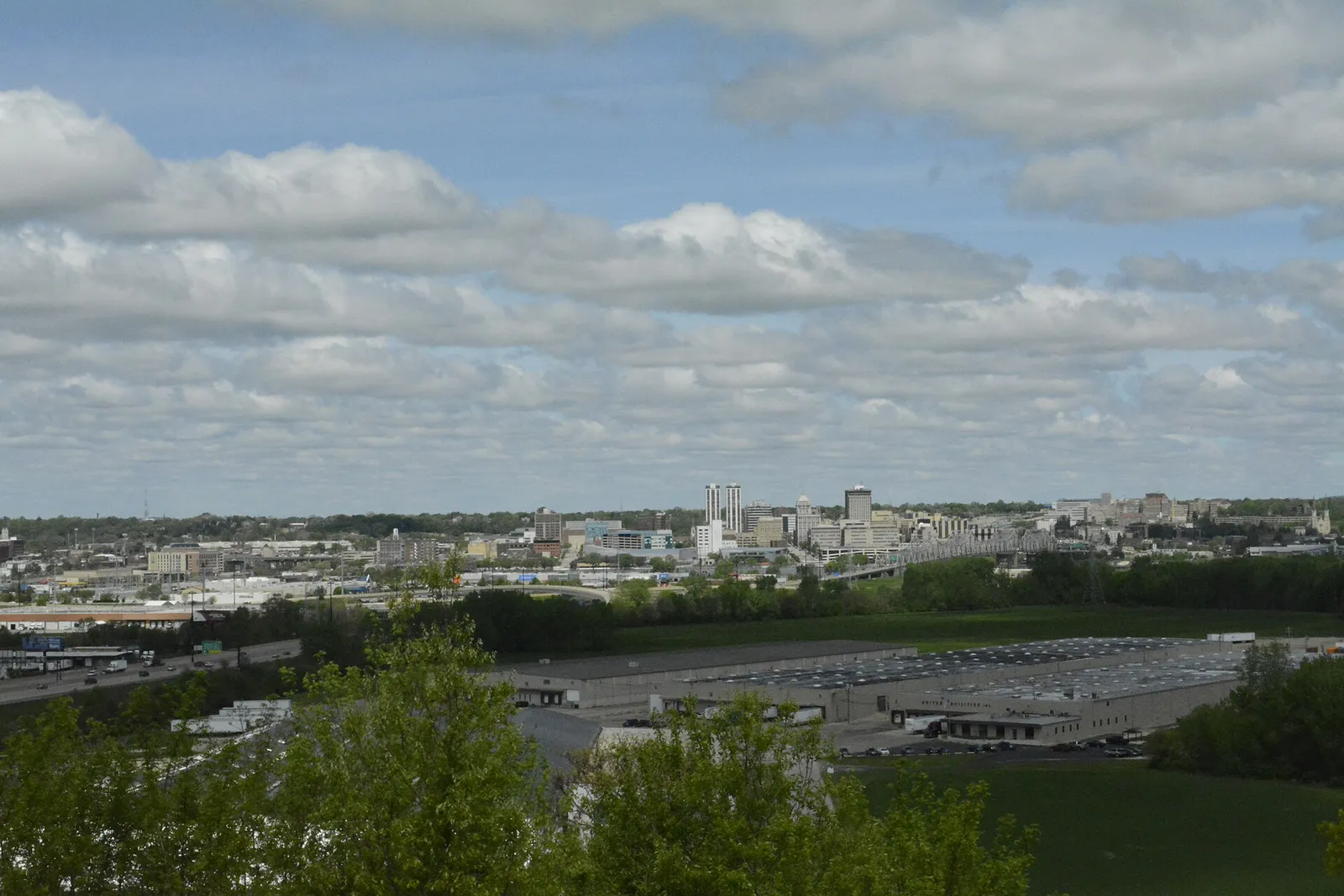
Navigating Peoria's distinct riverfront, blufftop, and suburban corridors while managing river crossings and steep bluff topography.
That is where Adventria comes in. Adventria helps narrow the options in Peoria around practical factors like location, distance, budget, vibe, who you are with, and the kind of experience you actually want, so research can turn into a decision.
Let Adventria narrow the optionsPick the right part of town
Different parts of Peoria work for different kinds of plans. Start with the experience you want, then narrow the map.
Best for
Museum visits, major sports games, concerts, and waterfront access
Best for
Craft breweries, historic loft architecture, artisanal shops, and casual dining
Best for
Historic architecture walks, college campus activity, and budget dining
Best for
Scenic riverfront overlooks, fine dining, boutique shopping, and courtyard concerts
Best for
Healthcare facilities and historic residential access
Best for
Suburban shopping centers, modern housing developments, and chain retail
This is a quick starting point. The full guide covers 7 local neighborhoods and districts in Peoria.
Eat & drink
When the decision is less about what to do and more about where to eat or grab a drink, start here. These local cues narrow the food and drink decision without turning dinner or a night out into another hour of comparison.
For places to eat in Peoria, start with Peoria Heights or West Bluff & University Corridor depending on the kind of stop you want. Start with Peoria Heights for scenic riverfront overlooks, fine dining, boutique shopping, and courtyard concerts. An independent municipality perched on the high west bluffs, known for Prospect Road dining, Tower Park's 200-foot glass observation tower, and the start of Grandview Drive. West Bluff & University Corridor works for historic architecture walks, college campus activity, and budget dining.
Head to the Warehouse District for craft beer at Bearded Owl Brewing or Rhodell Craft Brewery, classic pinball at 8-Bit Arcade Bar, and live music at Kelleher's Irish Pub. In Peoria Heights, visit Pour Bros. Craft Taproom to pour your own beer or relax in the outdoor courtyard during summer concert nights.
Still comparing options? Adventria can narrow the choice around budget, distance, vibe, and who you are with.
Decide with AdventriaPlan by situation
Start with the kind of plan you are actually trying to make. These city-specific ideas narrow the choice around who you are with, what you want to spend, the weather, and the kind of outing you want.
For a weekend getaway from Peoria, compare Holland and Louisville. More options are listed in the trip section below.
Reserve a table along Prospect Road in Peoria Heights at spots like Hearth or Joe's Original Italian, followed by drinks in the courtyard at Pour Bros. Taproom. Complete the evening with a sunset drive along Grandview Drive overlooking the Illinois River valley or catch a show at Corn Stock Theatre in Bradley Park.
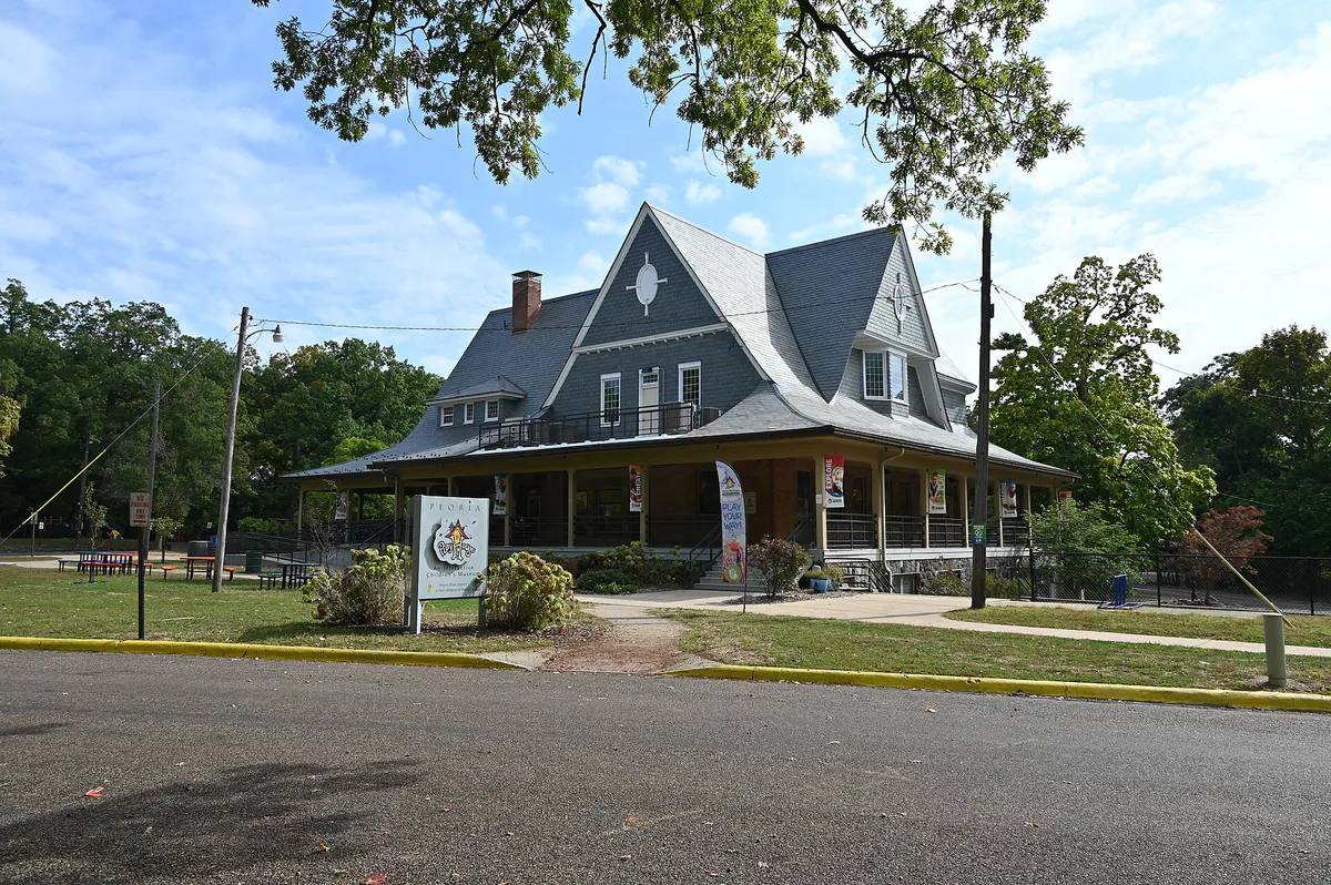
Gather at Glen Oak Park, where you can combine visits to the Peoria Zoo, Luthy Botanical Garden, and the hands-on Peoria PlayHouse Children's Museum. Wildlife Prairie Park west of town offers expansive animal exhibits featuring bison, elk, and wolves, plus a ride on the Prairie Zephyr train.
Head to the Peoria Riverfront Museum to explore indoor galleries, planetarium shows, and the Giant Screen Theater, utilizing its attached covered parking garage off Water Street. The nearby Caterpillar Visitors Center offers 50,000 square feet of climate-controlled interactive manufacturing exhibits.
Visit Luthy Botanical Garden or Forest Park Nature Center, both of which offer free admission (donations encouraged). You can also attend free Saturday evening courtyard concerts at Pour Bros. from mid-May through September or hike/bike the Rock Island Greenway.
Walk or bike a section of the 13-mile paved Rock Island Greenway, which runs from downtown through Peoria Heights up to Alta. Alternatively, spend an undisturbed afternoon touring interactive heavy-equipment simulators at the Caterpillar Visitors Center or walking trail paths at Forest Park Nature Center.
Take a group to Pour Bros. Taproom in Peoria Heights to utilize the self-pour tap wall, or visit 8-Bit Arcade Bar in the Warehouse District for group gaming. For outdoorsy groups, Wildlife Prairie Park provides disc golf, hiking trails, and cabin rentals.
Outdoors nearby
Use these nearby outdoor options when the plan calls for a trail, protected landscape, park, or drive instead of another indoor stop. Proximity here is geographic, not a promise about driving time.
Get out of town
When staying in town is not the answer, these nearby destinations give you a smaller starting set for a day trip, overnight escape, or weekend away.
Destination relationships are screened geographically. Straight-line proximity is not presented as road mileage or estimated travel time.
Local landmarks & attractions
These notable destinations offer a starting point when you want something specific to see, visit, or build into a day around Peoria. Distances are approximate from the city area.
public zoo in Glen Oak Park, Peoria, Illinois
museum in downtown Peoria, Illinois, USA
casino in East Peoria, Illinois, United States
theater and former movie theater in Peoria, Illinois, United States
botanical garden and conservatory in Peoria, Illinois
historic district in Peoria, Illinois
annual haunted event in Chillicothe, Illinois
soccer venue and former baseball stadium in Peoria, Illinois
Notable places are selected from structured public destination data and ranked for relevance, prominence, proximity, and variety.
Local decision signals
A useful local recommendation depends on how the city actually works. These conditions affect where to go, what to do, and whether a plan makes sense right now.
A sharp 150- to 200-foot bluff separates the lowland riverfront and downtown strip from elevated blufftop districts, requiring driving via incline corridors like Main Street, Knoxville Avenue (IL 40), Cedar Street, or War Memorial Drive (US 150).
Five major highway bridges span the Illinois River into Tazewell County and East Peoria, including the I-74 Murray Baker Bridge, Bob Michel Bridge (IL 40), Cedar Street Bridge, McClugage Bridge (US 150), and I-474 Shade-Lohmann Bridge.
The Greater Peoria Mass Transit District runs 17 fixed routes out of the CityLink Transit Center on SW Adams Street with a standard $1.00 fare; transfers are not offered, requiring a separate fare per bus boarding.
Local performance and sports venues adapt seasonally, including Corn Stock Theatre operating in its outdoor Bradley Park tent during summer and Peoria Chiefs baseball at Dozer Park running April through September.
Peoria Heights hosts Pour Bros. Craft Taproom featuring a self-pour tap wall and a free outdoor courtyard concert series running Saturday nights from mid-May through September.
Local dining anchors include the Avanti's Gondola sandwich served on sweet Italian white bread, Agatucci's ultra-thin tavern-style pizza topped with Tiger Sauce, and oversized deep-fried pork tenderloin sandwiches.
Neighborhood context
Neighborhoods are not interchangeable. Each area offers a different balance of atmosphere, transportation, food, nightlife, activities, and planning friction.
Best for: Museum visits, major sports games, concerts, and waterfront access
Situated on the lowland bank of the Illinois River, Downtown hosts major institutions like the Peoria Riverfront Museum, Caterpillar Visitors Center, Peoria Civic Center, and Dozer Park.
Best for: Craft breweries, historic loft architecture, artisanal shops, and casual dining
Extending south along Water, SW Adams, and SW Washington streets, this repurposed industrial corridor features brick warehouses housing craft breweries, live music taverns, and arcade bars.
Best for: Historic architecture walks, college campus activity, and budget dining
Elevated on the bluff west of downtown, this area centers around Bradley University and features historic sub-neighborhoods like The Uplands with brick streets and the Moss-Bradley Historic District.
Best for: Scenic riverfront overlooks, fine dining, boutique shopping, and courtyard concerts
An independent municipality perched on the high west bluffs, known for Prospect Road dining, Tower Park's 200-foot glass observation tower, and the start of Grandview Drive.
Best for: Healthcare facilities and historic residential access
Located directly north and east of downtown, housing major healthcare networks like OSF Saint Francis Medical Center, Carle Health Methodist Hospital, and the UICOMP medical campus.
Best for: Suburban shopping centers, modern housing developments, and chain retail
Low-density commercial development north of War Memorial Drive (US 150) extending toward Dunlap, featuring commercial strip hubs and The Shoppes at Grand Prairie.
Best for: Casino gaming, retail shopping, and hotel lodging across the river
Located directly across the Illinois River, featuring the Levee District shopping hub and the Par-A-Dice Hotel & Casino.
Peoria local guide
Peoria's geographic framework is structured by the Illinois River and a prominent 150- to 200-foot bluff that runs parallel to the water. The lowland corridor adjacent to the river contains Downtown, the Riverfront District, and the Warehouse District, housing civic institutions, historic brick industrial conversions, and museum campuses. Traveling west or north requires ascending steep bluff incline roads such as Main Street, Knoxville Avenue (IL 40), or War Memorial Drive (US 150).
Above the bluff, historic neighborhoods like The Uplands and Moss-Bradley surround Bradley University, while Peoria Heights occupies the elevated bluffs further north overlooking Peoria Lake. Farther north past War Memorial Drive, the landscape transitions into low-density suburban developments extending toward Dunlap.
Crossing the river into Tazewell County and East Peoria relies on five primary bridges. Transit between the two riverbanks can become congested during major bridge rehabilitation projects or severe winter weather, making same-side planning practical when winter icing affects steep bluff-climbing arterial roads.
Explore your options
Align your practical goals with the operational character of Peoria's distinct commercial and cultural hubs.
The lowland core along Water and Washington streets focused on interactive museum exhibits, minor league sports, and repurposed historic industrial spaces.
An elevated village district offering panoramic river views, concentrated fine dining, and outdoor music spaces.
A walkable, historic residential and university hub centered around brick streets and accessible dining.
A historic park north of downtown hosting multiple family-oriented facilities in a single walkable setting.
Practical local guidance
Sample distinct food items that have long defined Peoria's local neighborhood taverns and casual dining spots.
A simpler way to decide
Follow these steps when navigating elevation changes, transit rules, and bridge crossings around Peoria.
Determine whether your targeted destinations lie along the lowland Riverfront/Downtown strip or atop the 150- to 200-foot bluff.
Choose arterial incline routes like Main Street, Knoxville Avenue (IL 40), Cedar Street, or War Memorial Drive (US 150) depending on your direction of travel.
If traveling across to East Peoria, verify current construction and lane status on the Bob Michel, McClugage, or I-74 Murray Baker bridges before setting out.
If riding CityLink buses, prepare exact cash or digital fares for a $1.00 single boarding, keeping in mind that transfers are not provided between connections.
In icy or snowy conditions, favor flat lowland or northern suburban destinations over steep bluff-climbing roads.
Common local questions
These are common situations people face when trying to decide where to eat, what to do, where to get drinks, or how to spend their time in Peoria.
Peoria planning questions
Practical answers for people deciding where to eat, what to do, where to go, or how to make plans in Peoria.
Drive north up the bluff top using major arterial routes like Prospect Road or Knoxville Avenue (IL 40). You can also travel along the lowland riverfront and ascend via War Memorial Drive or Grandview Drive.
The primary crossings connect Peoria to East Peoria and Tazewell County via five highway bridges: the I-74 Murray Baker Bridge, Bob Michel Bridge (IL 40), Cedar Street Bridge, McClugage Bridge (US 150), and the outer southern bypass Shade-Lohmann Bridge (I-474).
Yes, the Bob Michel Bridge (IL Route 40) features a barrier-separated 14-foot wide pedestrian and bicycle path that directly connects downtown Peoria near the Civic Center to the Levee District in East Peoria.
The 13-mile paved urban rail-trail runs from downtown Peoria through Glen Oak Park and Peoria Heights to Alta, where it connects to the 25-mile crushed-limestone Rock Island State Trail.
The signature local sandwich is Avanti's 'Gondola,' featuring ham, salami, American cheese, and lettuce served on house-baked, sweet Italian white bread.
Yes. You can walk or drive along historic Grandview Drive, hike the trail network at Forest Park Nature Center, explore Luthy Botanical Garden (donations accepted), or attend free summer courtyard concerts in Peoria Heights.
Key indoor choices include the Peoria Riverfront Museum (featuring galleries, a planetarium, and a Giant Screen Theater with attached covered parking), the Caterpillar Visitors Center, Peoria PlayHouse Children's Museum, and 8-Bit Arcade Bar.
Standard adult admission is $7. The facility is open Tuesday through Saturday from 10:00 a.m. to 5:00 p.m., with last entry permitted at 3:30 p.m. Always verify schedule changes before visiting.
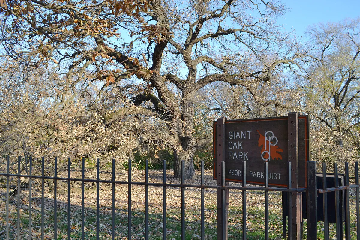
Glen Oak Park clusters three major family attractions together: the Peoria Zoo, Luthy Botanical Garden, and the Peoria PlayHouse Children's Museum.
Snow and ice accumulation can make steep bluff incline roads like Main Street and Knoxville Avenue slippery, while bridge crossings over the Illinois River are prone to freezing, causing localized traffic delays.
Source transparency
Official and locally relevant sources used to verify the practical information presented in this Peoria decision guide.
Peoria decision engine
Tell Adventria what kind of experience you want, set your practical limits, and turn the options in Peoria into one workable plan.
Choose a Peoria Plan