Downtown Roanoke
Best for
First-timers, museum-goers, rail transit, and nightlife
 AdventriaLocalOpen App
Roanoke, Virginia Decision Guide
Trying to decide what to do in Roanoke? Adventria helps you cut through the options and choose a good-enough plan without endless scrolling. Navigating Roanoke requires balancing mountain terrain with historic urban hubs. Whether you are heading to the top of Mill Mountain, navigating street-level rail crossings downtown, or looking for low-cost indoor options like Center in the Square, this guide helps residents and visitors make informed, efficient choices.
The local decision problem
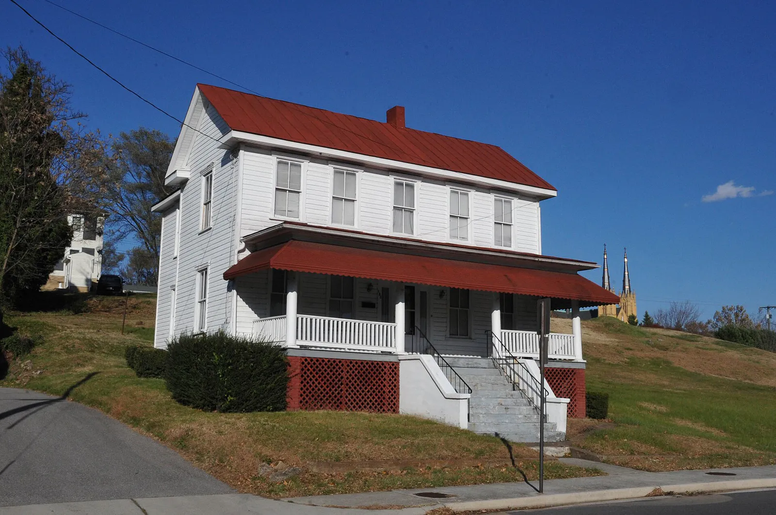
Navigating day-to-day choices across Roanoke's mountain topography, active rail lines, and historic neighborhood hubs without running into unexpected venue closures or access restrictions.
That is where Adventria comes in. Adventria helps narrow the options in Roanoke around practical factors like location, distance, budget, vibe, who you are with, and the kind of experience you actually want, so research can turn into a decision.
Let Adventria narrow the optionsPick the right part of town
Different parts of Roanoke work for different kinds of plans. Start with the experience you want, then narrow the map.
Best for
First-timers, museum-goers, rail transit, and nightlife
Best for
Indie film, walkable retail, families, and casual dining
Best for
Cyclists, outdoor recreation, river access, and taprooms
Best for
Architecture lovers, quiet strolls, and historic park access
Best for
Medical access, quick mountain trail entry, and quiet dining
Best for
African American heritage and historic library research
This is a quick starting point. The full guide covers 7 local neighborhoods and districts in Roanoke.
Eat & drink
When the decision is less about what to do and more about where to eat or grab a drink, start here. These local cues narrow the food and drink decision without turning dinner or a night out into another hour of comparison.
Because the historic City Market Building food hall is closed on Sundays, focus on standalone Downtown taprooms like Big Lick Brewing Company or Golden Cactus Brewing, local diners, or head across the river to Wasena for spots like Bloom or Wasena City Tap Room.
Walk up to the counter at Texas Tavern at 114 Church Ave SW, operating 24/7 with 10 stools, and order a signature Cheesy Western or Bowl of Chile. Afterward, drive up JB Fishburn Parkway to the Mill Mountain Park overlook to see the 88.5-foot Roanoke Star illuminated over the valley, open daily until 11:00 PM.
Still comparing options? Adventria can narrow the choice around budget, distance, vibe, and who you are with.
Decide with AdventriaPlan by situation
Start with the kind of plan you are actually trying to make. These city-specific ideas narrow the choice around who you are with, what you want to spend, the weather, and the kind of outing you want.
For a day trip from Roanoke, compare Boone and Greensboro. More options are listed in the trip section below.
For an outdoor plan from Roanoke, compare trails, state parks, national parks within trip range, and scenic drives. Options in the current city guide include Smith Mountain Lake State Park and New River Gorge National Park and Preserve.
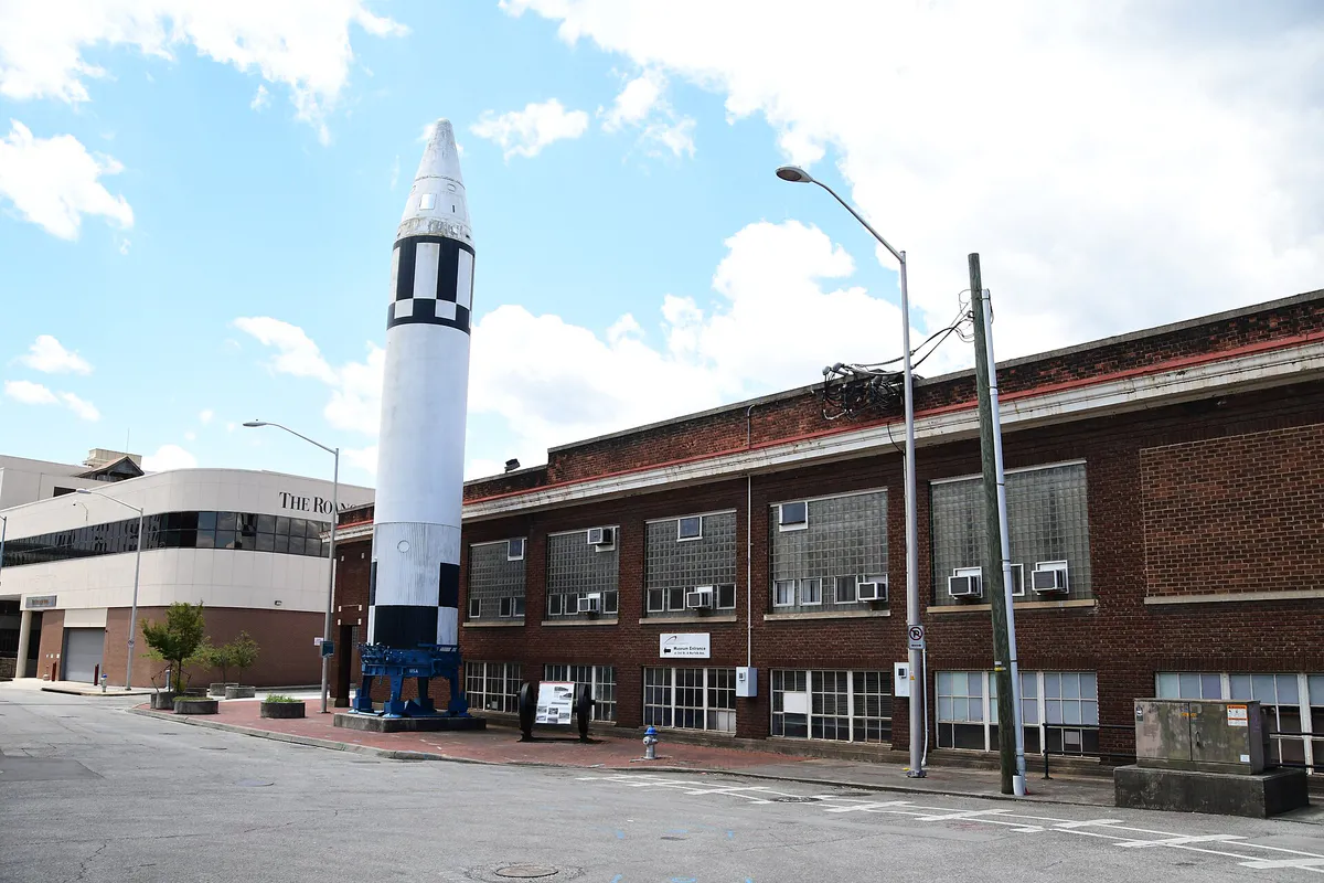
Head straight to Center in the Square at 1 Market Square SE. Inside, kids can explore hands-on exhibits at Kids Square on the 3rd floor, interact with STEM displays at the Science Museum of Western Virginia on the 4th and 5th floors, or play vintage pinball machines on free-play admission at the Roanoke Pinball Museum on the 2nd floor. Alternatively, cross the Railwalk to the covered train shed at the Virginia Museum of Transportation.
Spend the morning riding or walking the paved Roanoke River Greenway through Wasena Park and Smith Park. Pack a disc golf round at Highland Park's free 9-hole course in Old Southwest. For broad views, hike the 3.3-mile Mill Mountain Greenway from Elmwood Park to the summit, or purchase a daily $7 vehicle pass to access Carvins Cove's trail system at Bennett Springs.
Grab morning coffee and bakery items at Bread Craft downtown or RND Coffee, work remotely from dynamic community hubs like the Grandin Co-Lab, and take mid-day outdoor breaks along the David R. & Susan S. Goode Railwalk.
Outdoors nearby
Use these nearby outdoor options when the plan calls for a trail, protected landscape, park, or drive instead of another indoor stop. Proximity here is geographic, not a promise about driving time.
Get out of town
When staying in town is not the answer, these nearby destinations give you a smaller starting set for a day trip, overnight escape, or weekend away.
Destination relationships are screened geographically. Straight-line proximity is not presented as road mileage or estimated travel time.
Local landmarks & attractions
These notable destinations offer a starting point when you want something specific to see, visit, or build into a day around Roanoke. Distances are approximate from the city area.
zoo in Virginia, United States
transport museum in Roanoke, Virginia
historic district in Roanoke, Virginia, United States
224 acres managed by the U.S. National Park Service
American football stadium on the Virginia Tech campus in Blacksburg, VA, US
movie theater in Buchanan, Virginia, United States
War memorial in Bedford, Virginia, United States
on the campus of Virginia Tech University
Notable places are selected from structured public destination data and ranked for relevance, prominence, proximity, and variety.
Local decision signals
A useful local recommendation depends on how the city actually works. These conditions affect where to go, what to do, and whether a plan makes sense right now.
The historic Market Building food hall in Downtown Roanoke is closed on Sundays. Plan Sunday dining around independent taprooms or standalone eateries in Wasena and Grandin Village.
Norfolk Southern freight mainline tracks divide Downtown horizontally. Using 2nd Street SW or 5th Street SW elevated bridges prevents unexpected delays at street-level crossings.
Carvins Cove is a protected municipal water supply. Swimming, camping, and gasoline engines over 10 HP are strictly prohibited, and a daily or annual vehicle pass is required for access.
Street meters require entering your full license plate. The first hour is free, and all street meters are free after 5:00 PM on weekdays, all day Saturday and Sunday, and on official city holidays.
During humid July afternoons in the valley, ascending Mill Mountain Park or accessing higher Blue Ridge Parkway points offers cooler ambient temperatures.
Southbound I-581 / US-220 near Elm Avenue and the Roy L. Webber Expressway experiences peak friction during Carilion Roanoke Memorial Hospital shift changes in morning and evening windows.
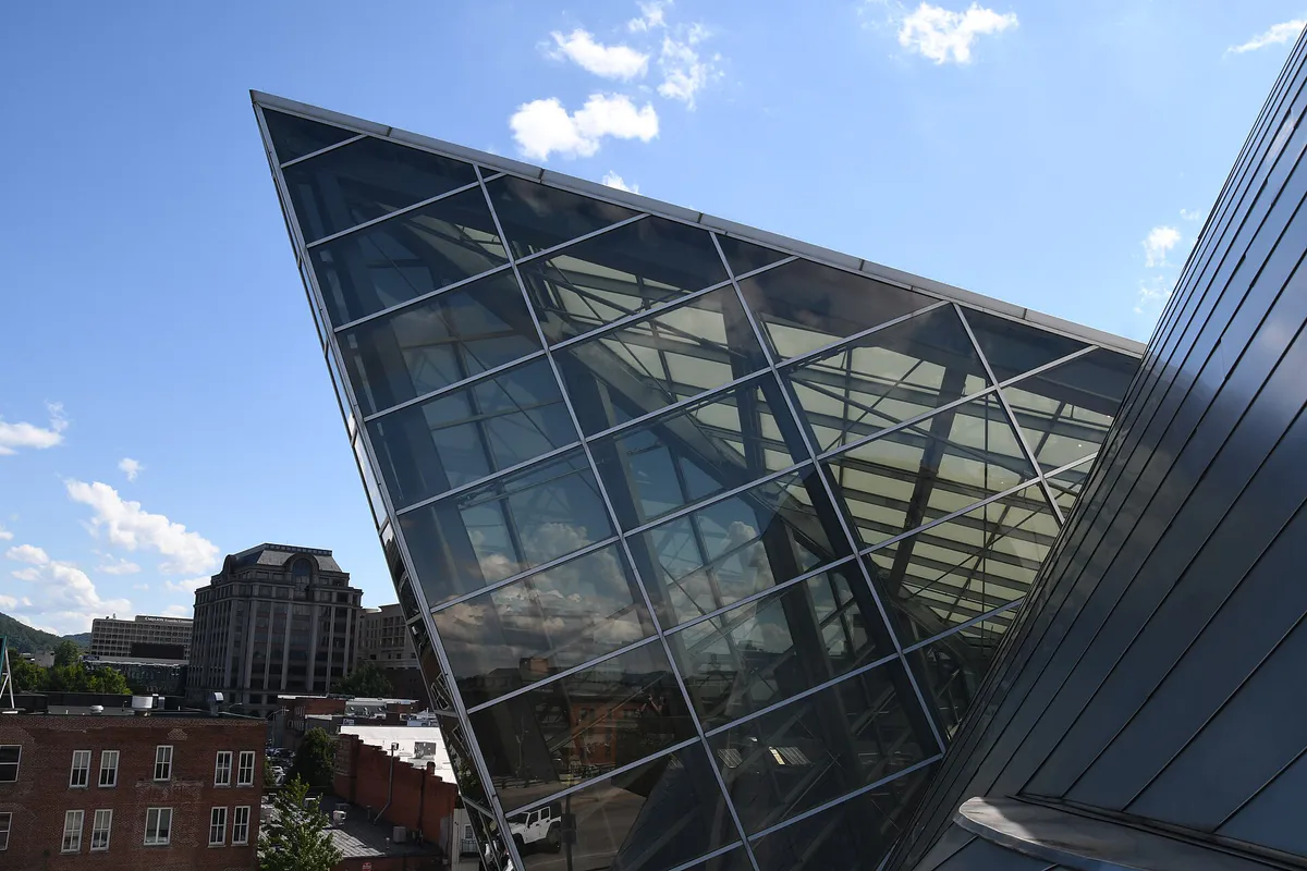
The Taubman Museum of Art offers free general admission to its permanent collections and regional art exhibits in its modern downtown building.
Neighborhood context
Neighborhoods are not interchangeable. Each area offers a different balance of atmosphere, transportation, food, nightlife, activities, and planning friction.
Best for: First-timers, museum-goers, rail transit, and nightlife
The historic core encompassing Market Square, cultural hubs like Center in the Square and Taubman Museum, craft breweries, and the main Valley Metro and Amtrak transit stations.
Best for: Indie film, walkable retail, families, and casual dining
A historic commercial district southwest of Downtown anchored by the 1932 Art Deco Grandin Theatre, local co-ops, and neighborhood dining along Grandin Road.
Best for: Cyclists, outdoor recreation, river access, and taprooms
Situated south of the Roanoke River, this active district features Wasena Park, direct greenway access, indoor rock climbing, and adaptive-reuse dining.
Best for: Architecture lovers, quiet strolls, and historic park access
A tree-lined historic residential district featuring Victorian, Queen Anne, and Craftsman architecture, alongside Highland Park's disc golf and dog park.
Best for: Medical access, quick mountain trail entry, and quiet dining
Adjacent to Carilion Roanoke Memorial Hospital and Virginia Western Community College, offering direct proximity to Mill Mountain road and trail access points.
Best for: African American heritage and historic library research
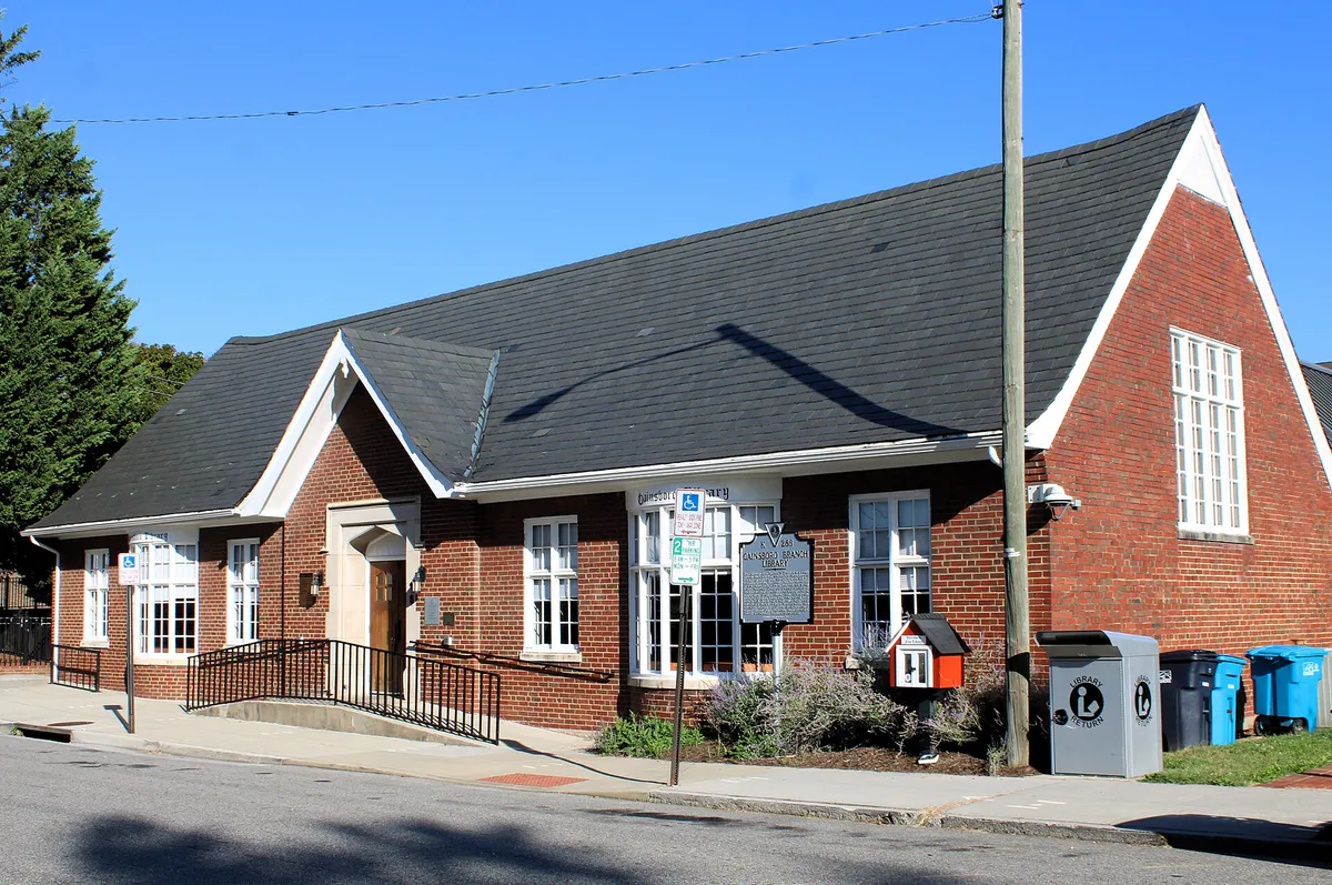
Located just north of the rail mainline, this historic African American community holds significant cultural history around Henry Street and the Gainsboro Branch Library.
Best for: International markets and diverse dining options
A major commercial strip stretching north from Downtown toward the airport, known for its wide selection of international markets and eateries.
Roanoke local guide
Roanoke sits framed by the Blue Ridge Mountains to the east and the Allegheny Mountains to the west, with the Roanoke River meandering through the valley floor. The city's primary internal physical landmark is Mill Mountain, a 568-to-600-acre city park that rises over 800 feet within city limits, separating South Roanoke from Southeast Roanoke. Navigating the city effectively requires understanding how this topography interacts with major road and rail infrastructure.
The active Norfolk Southern rail corridor bisects Downtown horizontally. While street-level crossings can cause brief delays when freight trains pass, motorists can easily bypass train activity by crossing on elevated bridges located at 2nd Street SW, 5th Street SW, and Franklin Road. Major regional highway traffic centers on Interstate 581 (a spur of US-220), which runs north-south through the center of the city. Drivers should expect localized friction on southbound I-581 near Elm Avenue during peak morning and late-afternoon shift changes at Carilion Roanoke Memorial Hospital.
Public transit links key hubs through Valley Metro's central hub at Third Street Station on Salem Avenue. In addition to local fixed-route buses and the MetroFLX microtransit shuttle, regional travelers can utilize the Smart Way commuter bus to connect Downtown Roanoke, Roanoke-Blacksburg Regional Airport (ROA), and Virginia Tech in Blacksburg. Passenger rail operates daily from the Roanoke Amtrak Station on Norfolk Avenue SW, offering direct northbound connection along the Northeast Corridor.
Explore your options
Each key district in Roanoke provides distinct practical functions for dining, culture, and outdoor recreation.
The urban core containing cultural venues, historic market heritage, and primary transit stations.
A walkable historic commercial center southwest of downtown centered on independent business and arts.
An active, outdoor-focused neighborhood built along the Roanoke River Greenway.
Historic residential neighborhoods bordering major parks and medical anchor facilities.
Practical local guidance
Roanoke offers multiple immediate options for flexible planning that require no advance booking or high entrance fees.
A simpler way to decide
Carvins Cove Natural Reserve covers 12,700 acres, requiring specific advance preparation due to municipal reservoir protection rules.
Select Bennett Springs on Route 311 or Timberview for mountain biking and hiking trails, or use the Boat Landing trailhead off Reservoir Road if you plan to launch non-motorized watercraft.
Purchase a daily $7 vehicle pass or present a $50 annual pass. Verify pass payment procedures at the trailhead kiosk or managing authority before setting out.
Keep in mind that swimming, wading, camping, and pets in the water are prohibited to protect the municipal water supply. Gasoline engines over 10 HP are also restricted.
If launching on the water, arrange kayak, rowboat, or SUP rentals at the Boat Landing or bring approved personal non-motorized equipment.
Carvins Cove operates as a protected natural watershed; follow leave-no-trace practices and yield appropriately on multi-use singletrack trails.
Common local questions
These are common situations people face when trying to decide where to eat, what to do, where to get drinks, or how to spend their time in Roanoke.
Roanoke planning questions
Practical answers for people deciding where to eat, what to do, where to go, or how to make plans in Roanoke.
Downtown Roanoke is walkable with a grid system, wide sidewalks, and paved pedestrian paths like the David R. & Susan S. Goode Railwalk and Mill Mountain Greenway. For local bus transit, Valley Metro operates out of Third Street Station on Salem Avenue. For on-demand service, MetroFLX provides microtransit coverage.
Yes. City on-street parking meters managed by PARK Roanoke are free all day Saturday and Sunday, after 5:00 PM on weekdays, and on official city holidays. Additionally, select municipal facilities like the Elmwood Park Garage offer free weekend parking.
The historic Roanoke City Market Building food hall operates Monday through Saturday and is closed on Sundays. Visitors looking for Sunday dining can explore standalone restaurants in Downtown, Wasena, or Grandin Village.
No. Swimming, wading, and bringing pets into the water are strictly prohibited at Carvins Cove because it serves as a municipal drinking water reservoir for the Western Virginia Water Authority.
Visiting the Roanoke Star and the scenic overlooks on Mill Mountain Park is free. Mill Mountain Park is a city park open daily until 11:00 PM.
Yes. General admission to the Taubman Museum of Art's permanent collections and regional exhibitions is free of charge.
The Smart Way regional bus connects Downtown Roanoke (Third Street Station and Hotel Roanoke) to the Virginia Tech campus in Blacksburg, stopping at the Roanoke-Blacksburg Regional Airport along the route. Boarding requires $4.00 cash each way.
A Cheesy Western is Texas Tavern's famous signature burger, topped with a fried egg, American cheese, sweet mustard-based relish, and chopped onions. The landmark 10-stool diner at 114 Church Ave SW has served it since 1930.
Use grade-separated bridges at 2nd Street SW, 5th Street SW, or Franklin Road to cross over the Norfolk Southern rail lines without being stopped at street-level crossings.
Mill Mountain Park features over 15 miles of multi-use singletrack trails right within city limits. Nearby Carvins Cove Natural Reserve offers an additional 60+ miles of mountain bike trails.
Source transparency
Official and locally relevant sources used to verify the practical information presented in this Roanoke decision guide.
Roanoke decision engine
Tell Adventria what kind of experience you want, set your practical limits, and turn the options in Roanoke into one workable plan.
Choose a Roanoke Plan