Historic Downtown Suffolk
Best for
Walkable historic touring, local dining, arts, and civic sites
 AdventriaLocalOpen App
Local Decision Guide
Trying to decide what to do in Suffolk? Adventria helps you cut through the options and choose a good-enough plan without endless scrolling. Spanning nearly 400 square miles of land, Suffolk presents a unique geographical layout combining vibrant historic districts, sprawling northern suburban hubs, waterfront hamlets, and vast agricultural landscapes. Use this guide to make smart decisions on dining, outdoor outings, family trips, transit, and seasonal planning.
The local decision problem
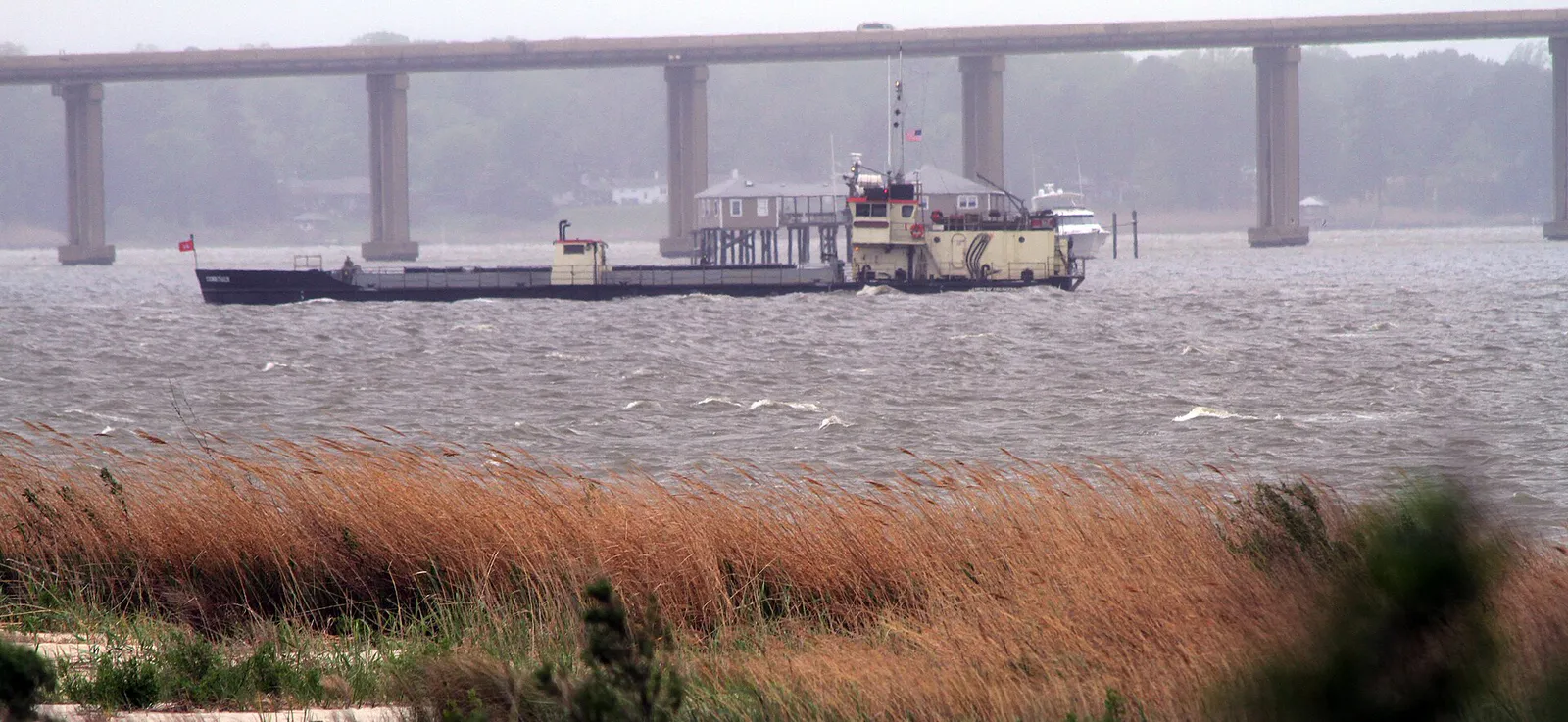
Navigating travel friction across 400 square miles while balancing historic downtown culture, suburban commercial hubs, and seasonal wetland conditions.
That is where Adventria comes in. Adventria helps narrow the options in Suffolk around practical factors like location, distance, budget, vibe, who you are with, and the kind of experience you actually want, so research can turn into a decision.
Let Adventria narrow the optionsPick the right part of town
Different parts of Suffolk work for different kinds of plans. Start with the experience you want, then narrow the map.
Best for
Walkable historic touring, local dining, arts, and civic sites
Best for
Modern shopping plazas, upscale steakhouses, and regional medical facilities
Best for
General store browsing, antiques, and community fall festivals
Best for
Waterfront recreation, public boat launches, and fishing piers
Best for
Freshwater lake access, kayak launching, and rural trail pursuits
Best for
Quiet waterfront views and seafood heritage
This is a quick starting point. The full guide covers 7 local neighborhoods and districts in Suffolk.
Eat & drink
When the decision is less about what to do and more about where to eat or grab a drink, start here. These local cues narrow the food and drink decision without turning dinner or a night out into another hour of comparison.
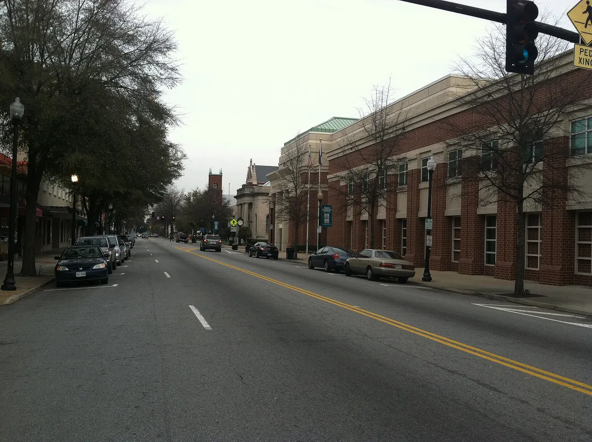
For independent, chef-driven Southern dining and locally sourced cuisine set in historic architecture, head to Historic Downtown along North Main Street to visit spots like Harper's Table. If you prefer high-end steakhouses, regional comfort food, and polished dining near modern commercial centers, focus on the Harbour View corridor along Route 17 for venues like River Stone Chophouse or Vintage Tavern.
Evening options center on relaxed, non-club entertainment. Enjoy craft beers, trivia, or live music at Nansemond Brewing Station inside its historic 1914 building downtown. Alternatively, check performance schedules at the Suffolk Center for Cultural Arts for theatrical productions and musical showcases in their restored 500-seat theater.
Still comparing options? Adventria can narrow the choice around budget, distance, vibe, and who you are with.
Decide with AdventriaPlan by situation
Start with the kind of plan you are actually trying to make. These city-specific ideas narrow the choice around who you are with, what you want to spend, the weather, and the kind of outing you want.
Plan a date night in Historic Downtown with dinner at Harper's Table followed by a show at the Suffolk Center for Cultural Arts. For a cozy, upscale date in North Suffolk, reserve a table at Vintage Tavern or River Stone Chophouse in Harbour View, followed by nightcaps at a nearby lounge.
For quiet solo activity, bring a gravel bicycle to the Great Dismal Swamp and ride unpaved, flat ditch roads surrounded by thick forest. If you prefer indoor solitude, stroll through free art exhibitions at the Suffolk Art Gallery on Bosley Avenue or browse the TowneBank and Norfolk Foundation galleries inside the Suffolk Center for Cultural Arts.
For a day trip from Suffolk, compare Nags Head and Richmond. More options are listed in the trip section below.
Families with young children can visit the restored Seaboard Station Railroad Museum to view the HO-scale model train layout showing historic Suffolk. Afterward, head to Bennett’s Creek Park or Sleepy Hole Park to let kids play on waterfront playgrounds, walk nature trails, or drop crab pots off the public pier.
Construct an all-indoor itinerary within Historic Downtown. Explore Civil War artifacts at Riddick’s Folly, examine train history at the Seaboard Station Railroad Museum, browse art exhibits at the Suffolk Art Gallery, and stop inside the Suffolk Visitor Center inside the restored 1839 Nansemond County Courthouse.
Explore Suffolk affordably by riding Suffolk Transit using a $3.00 All-Day Pass. Enjoy free entry at the Seaboard Station Railroad Museum, free admission to the Suffolk Art Gallery, or spend the day hiking and wildlife watching throughout the Great Dismal Swamp National Wildlife Refuge.
Large groups can reserve covered outdoor picnic shelters at Sleepy Hole Park or Bennett’s Creek Park for private waterfront cookouts and disc golf. For indoor group outings, contact Riddick’s Folly in advance to schedule private group tours of the historic mansion.
Outdoors nearby
Use these nearby outdoor options when the plan calls for a trail, protected landscape, park, or drive instead of another indoor stop. Proximity here is geographic, not a promise about driving time.
Get out of town
When staying in town is not the answer, these nearby destinations give you a smaller starting set for a day trip, overnight escape, or weekend away.
Destination relationships are screened geographically. Straight-line proximity is not presented as road mileage or estimated travel time.

Local landmarks & attractions
These notable destinations offer a starting point when you want something specific to see, visit, or build into a day around Suffolk. Distances are approximate from the city area.
art museum in Norfolk, Virginia
53-acre (21 ha) zoo
multi-purpose hall complex in Norfolk, Virginia, United States
casino in Virginia, United States
historic district in Virginia, USA
non-profit organization in the USA
museum
arena in Hampton, Virginia
Notable places are selected from structured public destination data and ranked for relevance, prominence, proximity, and variety.
Local decision signals
A useful local recommendation depends on how the city actually works. These conditions affect where to go, what to do, and whether a plan makes sense right now.
At roughly 400 square miles of total land area, cross-city drives between southern rural hamlets and northern suburban corridors take 30 to 40 minutes.
Commuters traveling north across the I-664 Monitor-Merrimac Memorial Bridge-Tunnel or US-17 James River Bridge face significant peak-hour delays.
The permanent 2005 closure of the Kings Highway Bridge (SR 125) eliminated direct crossing over the Nansemond River between Driver and Chuckatuck.
Proximity to the Great Dismal Swamp creates dense mosquito, midge, fly, and tick populations from May through September, favoring early morning or cold-weather visits.
Suffolk Transit fixed routes operate daytime through early evening Monday through Saturday, with no Sunday service available.
Rooted in peanut processing since 1916, freshly roasted Virginia peanuts remain actively crafted in Downtown Suffolk daily.
Neighborhood context
Neighborhoods are not interchangeable. Each area offers a different balance of atmosphere, transportation, food, nightlife, activities, and planning friction.
Best for: Walkable historic touring, local dining, arts, and civic sites
Centered around North Main Street and Washington Street, featuring 19th-century architecture, independent chef-driven restaurants, craft beer, and cultural venues.
Best for: Modern shopping plazas, upscale steakhouses, and regional medical facilities
A rapidly grown suburban and commercial sector positioned along I-664 and Route 17, ideal for fine dining and quick arterial road access.
Best for: General store browsing, antiques, and community fall festivals
A historic village-style crossroads community known for its old-fashioned storefront charm, specialty shops, and annual local gatherings.
Best for: Waterfront recreation, public boat launches, and fishing piers
A northern residential community built around deep-water creeks flowing into the Nansemond River, featuring park facilities and crabbing.
Best for: Freshwater lake access, kayak launching, and rural trail pursuits
A northwestern rural gateway located near Chuckatuck Creek, serving as the home of Lone Star Lakes Park.
Best for: Quiet waterfront views and seafood heritage
Historic watermen hamlets nestled along the Nansemond and James rivers with deep roots in local oystering and crab fishing history.
Best for: Open countryside, farmlands, and agricultural quiet
Extensive rural agricultural communities in southern and western Suffolk dominated by farm fields, timberland, and low-density living.
Suffolk local guide
Suffolk is the largest city in Virginia by total land mass, encompassing roughly 400 square miles. Because it was formed by consolidating the historic city core with Nansemond County and several outlying towns, the city spans distinctly urban, suburban, waterfront, and deeply rural environments. Understanding this geography is essential for organizing efficient outings.
Driving between the far southern communities like Whaleyville or Holland and the northern suburban hub of Harbour View requires 30 to 40 minutes of transit time under normal traffic conditions. Similarly, traveling between Historic Downtown and Harbour View spans 15 to 20 miles. Plan activities within a single geographical node rather than crisscrossing the city multiple times in one day.
Waterways and bridge infrastructure also dictate local routes. The permanent 2005 closure of the Kings Highway Bridge across the Nansemond River permanently severed direct transit between Driver and Chuckatuck, requiring drivers to detour via primary arterial routes like Route 10 or Route 125. Regional travelers heading north toward the Virginia Peninsula must also monitor traffic conditions at the I-664 Monitor-Merrimac Memorial Bridge-Tunnel and the US-17 James River Bridge.
Explore your options
Match your interests with the appropriate sector of the city to minimize transit time and maximize your experience.
Concentrated along North Main Street and West Washington Street, ideal for walkable historic touring, independent dining, and arts venues.
Modern, arterial commercial sector perfect for polished dining, major shopping, and convenient access along Interstate 664.
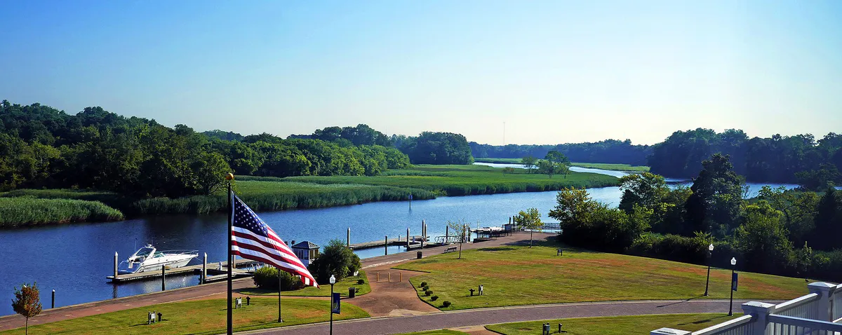
Expansive natural environments offering freshwater lakes, wetlands, wildlife viewing, and water launch points across northern and central sectors.
Practical local guidance
Keep these local operational guidelines in mind when planning your itinerary.
A simpler way to decide
Follow this step-by-step framework to build a seamless outing in Suffolk.
Decide whether your day will center on Historic Downtown, the northern Harbour View commercial area, or rural parks like Lone Star Lakes to avoid spending half your day driving.
If visiting swamp trails or wetland parks during warm months, schedule outdoor activities for sunrise hours and pack appropriate bug deterrents.
Confirm operating schedules for local museums and galleries, keeping in mind that many facilities have specific afternoon operating windows or closed days.
Map your driving route avoiding closed historic bridge corridors, or review color-coded Suffolk Transit route maps if using local public buses.
Pair morning outdoor trips at Bennett's Creek or Great Dismal Swamp with lunch or dinner in nearby Downtown or Harbour View dining corridors.
Common local questions
These are common situations people face when trying to decide where to eat, what to do, where to get drinks, or how to spend their time in Suffolk.
Suffolk planning questions
Practical answers for people deciding where to eat, what to do, where to go, or how to make plans in Suffolk.
Suffolk Transit operates local fixed-route bus service along color-coded routes (Green, Orange, Red, Yellow, Pink, Purple) alongside regional express routes. Adult single fares are $1.50 and All-Day Passes are $3.00, with reduced fares available for seniors (55+) and Medicare cardholders. Bicycles can be loaded onto front bike racks, and regional connections link to Hampton Roads Transit (HRT) at designated transit hubs.
Historic Downtown and Harbour View are approximately 15 to 20 miles apart via Route 58 and Route 17 or Nansemond Parkway. Under typical driving conditions, commuting between the two sectors takes 20 to 25 minutes.
Historic Downtown offers free public surface parking lots, including parking adjacent to the Seaboard Station Railroad Museum, City Hall, and the Suffolk Center for Cultural Arts, alongside timed free street parking along North Main Street.
Late autumn through early spring (October to April) offers mild temperatures and minimal insect activity. Late spring (April to May) is ideal for migratory bird watching. If visiting during summer, plan your trip around sunrise.
Indoor options include visiting the Seaboard Station Railroad Museum to see the HO-scale model layout, taking a guided house tour of Riddick’s Folly, viewing art exhibits at the Suffolk Art Gallery or Suffolk Center for Cultural Arts, or catching a film in Harbour View.
The permanent closure of the Kings Highway Bridge (SR 125) in 2005 cut off direct access across the Nansemond River between Driver and Chuckatuck. Drivers must use Route 10 or Route 125 detours to travel between northwestern and central-northern communities.
Suffolk hosts the annual Suffolk Peanut Fest every October at Suffolk Executive Airport, featuring demolition derbies, concerts, and carnival rides. The annual Driver Days Fall Festival takes place in mid-October in historic Driver, featuring classic cars, crafts, and parades.
Bennett’s Creek Park offers three public boat ramps providing deep-water access to Bennett's Creek and the Nansemond River. Sleepy Hole Park features a canoe and kayak launch on the Nansemond River, while Lone Star Lakes Park provides dirt/gravel boat ramps and a kayak dock for non-gasoline boats.
Source transparency
Official and locally relevant sources used to verify the practical information presented in this Suffolk decision guide.
Suffolk decision engine
Tell Adventria what kind of experience you want, set your practical limits, and turn the options in Suffolk into one workable plan.
Choose a Suffolk Plan