Heart of Missoula (Downtown)
Best for
Walkable dining, historic venues, and riverfront parks
 AdventriaLocalOpen App
Montana Valley Decision Guide
Trying to decide what to do in Missoula? Adventria helps you cut through the options and choose a good-enough plan without endless scrolling. Whether you are catching a show at The Wilma, floating the Clark Fork River, or navigating home games at Washington-Grizzly Stadium, Missoula's unique valley geography requires smart local planning. Use this guide to handle transit, weather inversions, and neighborhood choices without wasted effort.
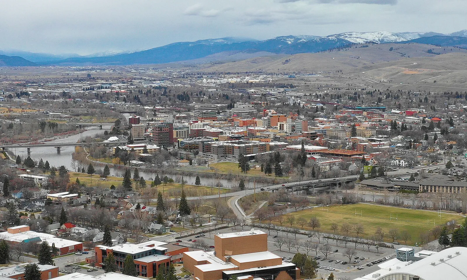
The local decision problem
Navigating local transit, seasonal river conditions, game day disruptions, and neighborhood trade-offs in Missoula.
That is where Adventria comes in. Adventria helps narrow the options in Missoula around practical factors like location, distance, budget, vibe, who you are with, and the kind of experience you actually want, so research can turn into a decision.
Let Adventria narrow the optionsPick the right part of town
Different parts of Missoula work for different kinds of plans. Start with the experience you want, then narrow the map.
Best for
Walkable dining, historic venues, and riverfront parks
Best for
Bohemian boutiques, indie cinema, and casual eateries
Best for
Craftsman architecture, stadium access, and trailhead gateways
Best for
Neighborhood craft breweries and creative community spaces
Best for
Quiet residential living with foothill wilderness access
Best for
Paved trail networks, aquatic centers, and park activities
This is a quick starting point. The full guide covers 7 local neighborhoods and districts in Missoula.
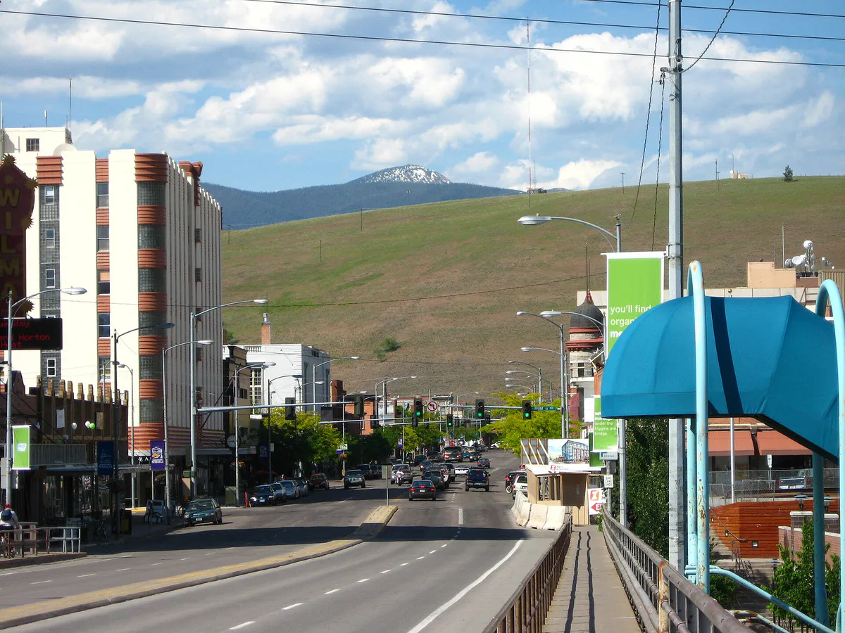
Eat & drink
Trying to decide where to eat in Missoula? Start with the local dining context below and narrow the decision around the kind of meal or experience you actually want.
Combine dinner at Biga Pizza or Scotty's Table with craft cocktails at Plonk or Montgomery Distillery. Add a sunset stroll along the Kim Williams Trail or an indie screening at The Roxy Theater.
Still comparing options? Adventria can narrow the choice around budget, distance, vibe, and who you are with.
Decide with AdventriaPlan by situation
Start with the kind of plan you are actually trying to make. These city-specific ideas narrow the choice around who you are with, what you want to spend, the weather, and the kind of outing you want.
For an outdoor plan from Missoula, compare trails, state parks, national parks within trip range, and scenic drives. Options in the current city guide include Montana Fish, Wildlife and Parks and Milltown State Park.
For a day trip from Missoula, compare Whitefish and Helena. More options are listed in the trip section below.
Head to Caras Park to ride A Carousel for Missoula and play at Dragon Hollow Playground. If the weather is warm or rainy, swim at Currents Aquatic Center in McCormick Park or explore interactive exhibits at the Montana Natural History Center.
Spend the morning exploring the Historical Museum at Fort Missoula or the free Missoula Art Museum. Follow up with hands-on displays at the Montana Natural History Center, indoor climbing at Freestone, or an indie movie at The Roxy Theater.
Take advantage of Mountain Line's 100% zero-fare city buses. Tour the Missoula Art Museum and the Rocky Mountain Elk Foundation Visitor Center (both offering free admission), walk or bike Ron's River Trail, and watch kayakers at Brennan's Wave in Caras Park.
Outdoors nearby
Use these nearby outdoor options when the plan calls for a trail, protected landscape, park, or drive instead of another indoor stop. Proximity here is geographic, not a promise about driving time.
Get out of town
When staying in town is not the answer, these nearby destinations give you a smaller starting set for a day trip, overnight escape, or weekend away.
Destination relationships are screened geographically. Straight-line proximity is not presented as road mileage or estimated travel time.
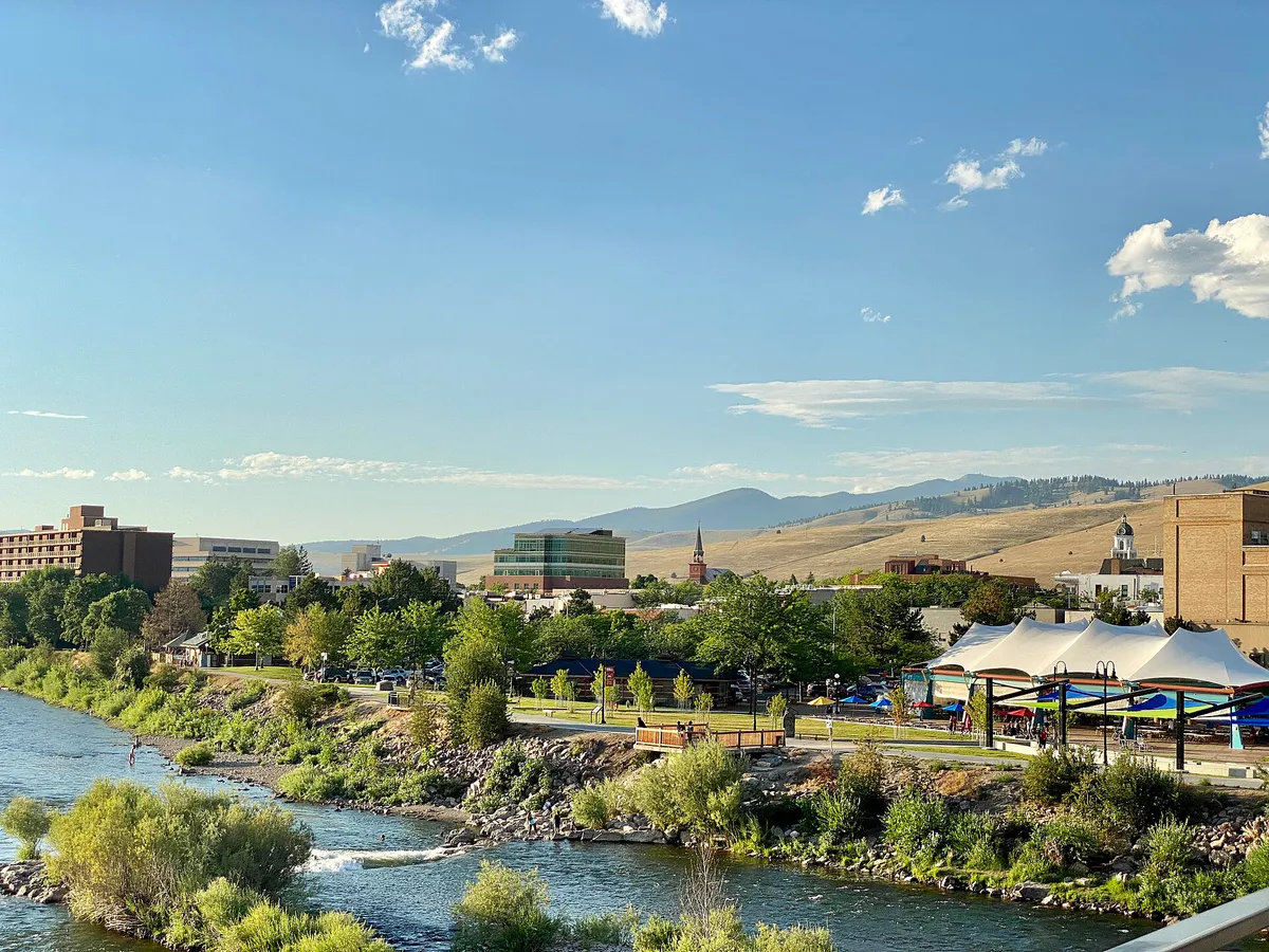
Local landmarks & attractions
These notable destinations offer a starting point when you want something specific to see, visit, or build into a day around Missoula. Distances are approximate from the city area.
contemporary art museum in Missoula, Montana
music venue and movie theater in Missoula, Montana, United States
art museum in Missoula, Montana
ice arena in Missoula, Montana, United States
historic district in Missoula, Montana, United States
park in Missoula County, Montana, United States of America
multi-purpose Arena in Missoula, Montana, United States
Notable places are selected from structured public destination data and ranked for relevance, prominence, proximity, and variety.
Local decision signals
A useful local recommendation depends on how the city actually works. These conditions affect where to go, what to do, and whether a plan makes sense right now.
Mountain Line operates 12 fixed routes throughout Missoula with 100% zero-fare access, including high-frequency BOLT! service on Routes 1 and 2 and Route 11 directly to Missoula Montana Airport.
Washington-Grizzly Stadium hosts over 25,000 fans on football Saturdays, clogging Higgins Avenue and river bridges. Free UDASH shuttles operate from downtown garages to bypass drive time.
Clark Fork River inner tubing opens around late June once spring runoff drops. State law requires a Montana Conservation License for adults using access sites like Sha-Ron.
Valley geography funnels traffic into Hellgate Canyon and across a few Clark Fork bridges, making North Reserve Street and rail grade crossings peak congestion points.
Summer wildfire smoke and winter fog trap air in the valley bowl. Winter inversion layers can be bypassed by ascending to higher elevations at Montana Snowbowl.
From May through October, three separate outdoor markets take place side by side along Higgins Avenue, Pine Street, and Pattee Street every Saturday morning.
On-street meters are enforced Monday through Friday, 9:00 AM to 5:00 PM. City garages offer the first hour free and remain free on evenings and weekends.
Neighborhood context
Neighborhoods are not interchangeable. Each area offers a different balance of atmosphere, transportation, food, nightlife, activities, and planning friction.
Best for: Walkable dining, historic venues, and riverfront parks
Anchored by Higgins Avenue and the Clark Fork River, housing retail shops, restaurants, craft brewpubs, the Missoula Art Museum, the Wilma Theatre, and Caras Park.
Best for: Bohemian boutiques, indie cinema, and casual eateries
Located south of Beartracks Bridge along South Higgins Avenue between 4th and 6th Streets, featuring boutique shopping, The Roxy Theater, and GILD brewpub.
Best for: Craftsman architecture, stadium access, and trailhead gateways
Adjacent to the University of Montana south of the river, with tree-lined streets, craftsman homes, Bonner Park, and direct access to Mount Sentinel.
Best for: Neighborhood craft breweries and creative community spaces
Historic neighborhoods north of the rail lines featuring Burns Street Community Center, local brewpubs like Draught Works, and footbridges into downtown.
Best for: Quiet residential living with foothill wilderness access
Extends north along Rattlesnake Creek from Greenough Park into foothills bordering the Rattlesnake Wilderness, serving as an active human-wildlife interface.
Best for: Paved trail networks, aquatic centers, and park activities
Spans both banks west of downtown, featuring McCormick Park, Currents Aquatic Center, Boone and Crockett Club, and multi-use paved river trails.
Best for: Midtown retail shopping, regional athletic fields, and history
West-central midtown hub containing the Southgate Mall commercial corridor, historic Fort Missoula, and Fort Missoula Regional Park.
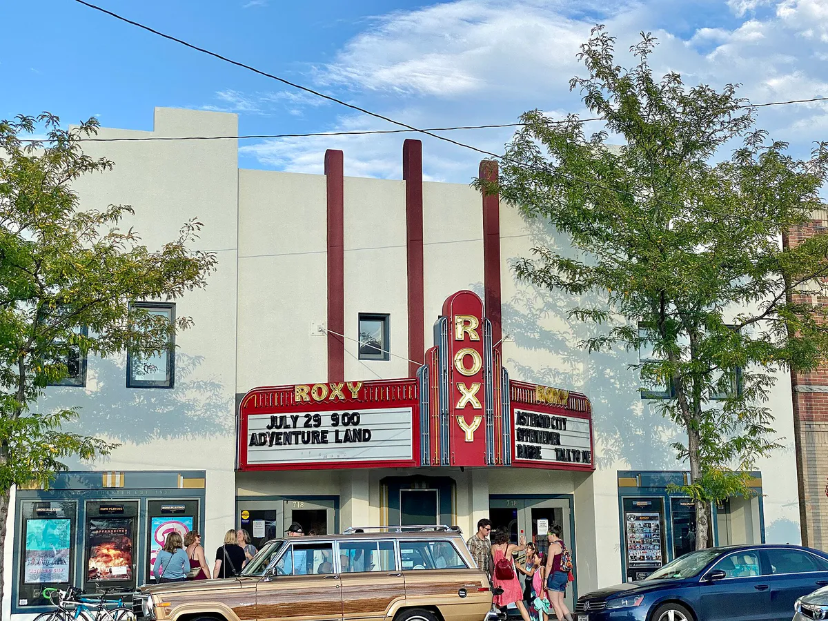
Missoula local guide
Known as the 'Hub of Five Valleys,' Missoula sits at the flat basin confluence of the Bitterroot, Clark Fork, Blackfoot, Flathead, and Jocko drainages. Framed by Mount Sentinel, Mount Jumbo, Waterworks Hill, and Blue Mountain, the valley floor offers effortless navigation on a grid system, but physical geographic choke points create distinct travel patterns.
The Clark Fork River bisects the city from east to west, channeling vehicular traffic toward a few major bridges, including Beartracks Bridge on Higgins Avenue, Orange Street, Reserve Street, and Madison Street. Meanwhile, active Montana Rail Link tracks separate the Northside and Westside neighborhoods from downtown, making grade crossings potential traffic bottlenecks when freight trains move through.
Understanding these natural and structural boundaries ensures smoother travel across town. Choosing non-motorized trail networks like the Milwaukee Trail or relying on Mountain Line zero-fare transit allows residents and visitors alike to bypass driver stress during peak morning and evening hours.
Explore your options
Missoula's distinct neighborhoods each carry a defined character, trade-offs, and activity focus.
The commercial and cultural engine north of the river, ideal for dining, arts, and waterfront gatherings.
A compact two-block stretch immediately south of Beartracks Bridge known for indie culture.
Historic rail-worker neighborhoods converted into vibrant creative and residential corridors.
Residential hubs providing immediate gateways to mountain foothills and wilderness trails.
Practical local guidance
Keep these verified rules and operational guidelines in mind when planning activities in Missoula.
A simpler way to decide
Follow these steps to safely enjoy Missoula's popular summer inner-tubing routine.
Ensure spring runoff has passed and streamflows have reached safe levels, which typically occurs around late June or early July.
Purchase a Montana Conservation License online or via an authorized vendor for every float participant aged 12 and older before heading to state access sites.
Avoid parking congestion at the Sha-Ron access in East Missoula by taking the zero-fare summer UDASH River Shuttle or booking a local private shuttle service.
Bring suitable flotation gear and shoes. Glass containers are strictly illegal on the river; pack non-glass beverage options and secure all trash.
Stay river-left when approaching downtown to bypass the Brennan's Wave white-water feature, then pull out at designated take-out points at Caras Park or McCormick Park.
Common local questions
These are common situations people face when trying to decide where to eat, what to do, where to get drinks, or how to spend their time in Missoula.
Missoula planning questions
Practical answers for people deciding where to eat, what to do, where to go, or how to make plans in Missoula.
Yes, Mountain Line operates a 100% Zero-Fare public transit system across all 12 fixed routes, funded through voter-approved community support. This includes Route 11 to Missoula Montana Airport and BOLT! routes running every 15 minutes during peak hours.
On-street parking meters are enforced Monday through Friday from 9:00 AM to 5:00 PM. Parking is free on weeknights after 5:00 PM, all day Saturday and Sunday, and on state and federal holidays. Garages offer the first hour free.
Every Saturday morning from May through October, three adjacent outdoor markets run simultaneously downtown: the Missoula Farmers' Market at the north end of Higgins Avenue, the Missoula People's Market at Pine and Higgins, and the Clark Fork River Market on Pattee Street.
Yes, state law requires anyone aged 12 and older to hold a Montana Conservation License ($8 resident / $10 non-resident) when using state Fishing Access Sites such as the Sha-Ron put-in in East Missoula.
The 'M' Trail climbs 620 vertical feet over 0.75 miles across 13 steep switchbacks starting from the University of Montana campus, offering panoramic views of the Missoula Valley at the top.
Avoid driving near campus due to extreme congestion. Park in downtown garages like Central Park or Park Place and take the free UDASH Football Shuttle, which drops off right at the Van Buren Footbridge near the stadium.
Both the Missoula Art Museum (MAM) in downtown and the Rocky Mountain Elk Foundation (RMEF) Elk Country Visitor Center in North Reserve offer 100% free admission year-round.
Drive up to higher elevations above the valley inversion. Montana Snowbowl, located 12 miles north of downtown, often sits above the cloud deck in clear sunshine.
Brennan's Wave, located directly adjacent to Caras Park on the north bank of the Clark Fork River, is an engineered river feature where kayakers and river surfers practice year-round.
Walk or ride across Beartracks Bridge on South Higgins Avenue. The Hip Strip sits directly on the south side of the bridge, just two blocks from the heart of downtown.
Source transparency
Official and locally relevant sources used to verify the practical information presented in this Missoula decision guide.
Missoula decision engine
Tell Adventria what kind of experience you want, set your practical limits, and turn the options in Missoula into one workable plan.
Choose a Missoula Plan