Historic Downtown & Market Square
Best for
Craft cocktails, tapas, late-night dining, and architectural walking tours
 AdventriaLocalOpen App
Local Decision Guide
Trying to decide what to do in Brownsville? Adventria helps you cut through the options and choose a good-enough plan without endless scrolling. Comprehensive local guide for choosing where to go, what to eat, and how to navigate Brownsville's distinct culture, natural resacas, and border-region dynamics.
The local decision problem
Navigating international border geography, subtropical summer heat, and coastal logistics while deciding where to eat, explore nature, or spend an evening in Brownsville.
That is where Adventria comes in. Adventria helps narrow the options in Brownsville around practical factors like location, distance, budget, vibe, who you are with, and the kind of experience you actually want, so research can turn into a decision.
Let Adventria narrow the optionsPick the right part of town
Different parts of Brownsville work for different kinds of plans. Start with the experience you want, then narrow the map.
Best for
Craft cocktails, tapas, late-night dining, and architectural walking tours
Best for
Family outings, zoo visits, museums, and green park spaces
Best for
Tranquil history walks, 19th-century military architecture, and river views
Best for
Authentic borderland taquerias, panaderías, and access to Sabal Palm
Best for
Suburban shopping, chain dining, modern hotels, and multiplex cinema
Best for
Suburban dining, golf, and access to nature trails
This is a quick starting point. The full guide covers 8 local neighborhoods and districts in Brownsville.
Eat & drink
When the decision is less about what to do and more about where to eat or grab a drink, start here. These local cues narrow the food and drink decision without turning dinner or a night out into another hour of comparison.
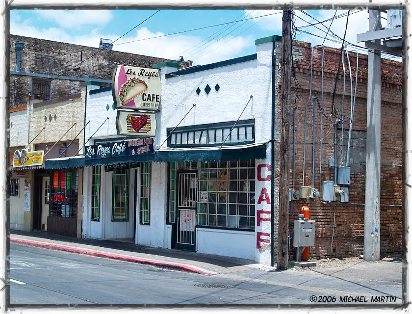
For places to eat in Brownsville, start with Historic Downtown & Market Square or North Expressway & Morrison Road depending on the kind of stop you want. Start with Historic Downtown & Market Square for craft cocktails, tapas, late-night dining, and architectural walking tours. North Expressway & Morrison Road works for suburban shopping, chain dining, modern hotels, and multiplex cinema.
Head to Historic Downtown around Market Square. Start with brick-oven Neapolitan pizza on the garden patio at Dodici, followed by James Beard-nominated craft cocktails at Las Ramblas or fine wine at Boqueron. Finish the night with live acoustic acoustic music at El Hueso de Fraile.
Still comparing options? Adventria can narrow the choice around budget, distance, vibe, and who you are with.
Decide with AdventriaPlan by situation
Start with the kind of plan you are actually trying to make. These city-specific ideas narrow the choice around who you are with, what you want to spend, the weather, and the kind of outing you want.
Park once near Dean Porter Park. Spend the morning viewing natural animal habitats at the Gladys Porter Zoo, enjoy hands-on creative play at the Children's Museum of Brownsville, and end the afternoon at Sam's Memorial Pool and splash park.
Arrive at Sabal Palm Sanctuary right at opening time. Walk quiet forest paths through native Sabal palms to reach the Rio Grande river overlook and birding blinds, where migratory species gather before the midday heat.
Gather a group for a taco crawl along Southmost Road (FM 1419) to sample taquerias and panaderías, or head to Malachela where self-pour taps make paying separately for big groups effortless.
For an outdoor plan from Brownsville, compare trails, state parks, and scenic drives. Options in the current city guide include Resaca de la Palma State Park and Boca Chica.
For a weekend getaway from Brownsville, compare San Antonio and Galveston. More options are listed in the trip section below.
Visit Palo Alto Battlefield National Historical Park for free trail walks and battlefield exhibits. Afterward, walk or ride a bike along the paved Historic Battlefield Trail or tour the historic Fort Brown grounds at the UTRGV campus.
Outdoors nearby
Use these nearby outdoor options when the plan calls for a trail, protected landscape, park, or drive instead of another indoor stop. Proximity here is geographic, not a promise about driving time.
Get out of town
When staying in town is not the answer, these nearby destinations give you a smaller starting set for a day trip, overnight escape, or weekend away.
Destination relationships are screened geographically. Straight-line proximity is not presented as road mileage or estimated travel time.
Local landmarks & attractions
These notable destinations offer a starting point when you want something specific to see, visit, or build into a day around Brownsville. Distances are approximate from the city area.
in Brownsville, Texas
historic site in Brownsville (vicinity), Cameron County, Texas
Mexican Agrarianism Museum
Baseball venue in Brownsville, Texas, US
stadium in Mexico
historic site in Brownsville (vicinity), Cameron County, Texas
Notable places are selected from structured public destination data and ranked for relevance, prominence, proximity, and variety.
Local decision signals
A useful local recommendation depends on how the city actually works. These conditions affect where to go, what to do, and whether a plan makes sense right now.
Former oxbow channels of the Rio Grande cut across the city, forming urban water features that channel driving routes across specific bridge bottlenecks.
State Highway 4 to Boca Chica Beach experiences periodic closures for SpaceX testing and requires passing a U.S. Border Patrol checkpoint returning west.
Four international ports of entry into Matamoros create localized traffic slow-downs along Interstate 69E and downtown during shift changes and holidays.
High dew points and daily summer highs above 90°F create heat indices exceeding 100°F, requiring outdoor recreation to be scheduled before 10:00 AM.
Peak avian migrations in Spring (March–May) and Fall (September–November) draw high birder volume to local state parks and wildlife sanctuaries.
The annual late-February binational festival closes Elizabeth Street and downtown arteries for parades, street dances, and cultural events.
BMetro operates a free downtown circulator service Thursday through Saturday nights, connecting peripheral parking directly to Market Square.
Neighborhood context
Neighborhoods are not interchangeable. Each area offers a different balance of atmosphere, transportation, food, nightlife, activities, and planning friction.
Best for: Craft cocktails, tapas, late-night dining, and architectural walking tours
Centering on Elizabeth and Washington streets, this district features over a century of Creole brick and Spanish Colonial Revival architecture undergoing a craft cocktail and culinary resurgence.
Best for: Family outings, zoo visits, museums, and green park spaces
A 25-plus acre civic park district wrapping around Town Resaca, housing top family attractions like the Gladys Porter Zoo and Children's Museum.
Best for: Tranquil history walks, 19th-century military architecture, and river views
Occupying the original 1846 grounds of Fort Brown along a Rio Grande bend, shared by UTRGV Brownsville and Texas Southmost College.
Best for: Authentic borderland taquerias, panaderías, and access to Sabal Palm
A dense, historic residential area along FM 1419, famous for neighborhood taco spots and leading directly to the Sabal Palm Sanctuary.
Best for: Suburban shopping, chain dining, modern hotels, and multiplex cinema
The city's northern commercial growth corridor along I-69E, anchored by shopping centers, big-box stores, and convenient vehicle access.
Best for: Suburban dining, golf, and access to nature trails
An established residential and commercial hub along Ruben M. Torres Boulevard, providing direct routes to Resaca de la Palma State Park.
Best for: Gulf maritime access, heavy logistics, and drive to South Padre Island
A heavy industrial seaport corridor northeast of central Brownsville connecting inland traffic to Laguna Madre and coastal highways.
Best for: Coastal prairie driving, viewing rocket builds, and remote beach visits
Stretching 20-plus miles east along Highway 4, transitioning from suburban development to tidal flats, SpaceX launch facilities, and Boca Chica Beach.
Explore your options
Match your day's objectives with the correct district character to avoid unnecessary driving and traffic friction.
Best for walkable culinary exploring, architecture enthusiasts, and late-night social scenes.
Best for concentrated family entertainment, civic parks, and daytime recreation.
Best for traditional borderland foods, historic neighborhoods, and dense native forest trails.
Best for suburban conveniences, fast shopping, modern hotel stays, and multi-screen cinema.
Practical local guidance
Essential outings that highlight the distinctive culture, history, and natural environment of the city.
A simpler way to decide
Visiting the eastern coastal prairie to view rocket manufacturing facilities and Boca Chica Beach requires advance planning.
Check Cameron County official advisories online to ensure State Highway 4 and Boca Chica Beach are open to public traffic and not closed for testing operations.
Ensure every passenger carries valid state ID, passports, or legal documentation. Returning west requires passing a mandatory U.S. Border Patrol checkpoint.
Bring adequate drinking water, sunscreen, and food. The 20-mile stretch along Highway 4 has very limited commercial facilities beyond central suburban limits.
Depart early in the morning to beat intense coastal humidity, secure parking near viewing areas, and leave time for beach walking.
Factor in brief potential wait times at the Border Patrol checkpoint around Mile 15 when planning your return trip into central Brownsville.
Common local questions
These are common situations people face when trying to decide where to eat, what to do, where to get drinks, or how to spend their time in Brownsville.
Brownsville planning questions
Practical answers for people deciding where to eat, what to do, where to go, or how to make plans in Brownsville.
You do not need a passport to drive east to Boca Chica Beach. However, returning west back into central Brownsville requires passing a mandatory U.S. Border Patrol checkpoint at Mile 15 on Highway 4. U.S. citizens should carry valid state driver's licenses or passports, and non-U.S. citizens must carry valid immigration documentation.
November through April offers the most comfortable weather, with mild daily temperatures around 70°F–75°F and low humidity. Late February is particularly popular for the binational Charro Days Fiesta.
Check official Cameron County press releases or social media pages. Cameron County issues temporary road closure orders for State Highway 4 and Boca Chica Beach during flight tests and security operations.
Yes, the historic core around Market Square, Elizabeth Street, and Washington Street is highly walkable with pedestrian sidewalks and short blocks once you park your vehicle.
Vera's Backyard Bar-B-Que on Southmost Boulevard is world-famous for traditional barbacoa cooked in an underground brick pit over mesquite wood, served on weekend mornings.
Yes, BMetro operates a Free Downtown Circulator pilot shuttle on Thursday, Friday, and Saturday evenings from 7:00 PM to Midnight, connecting public parking lots directly to Market Square dining and nightlife.
South Padre Island is roughly 40 minutes (approx. 28–30 miles) northeast of central Brownsville via State Highway 48 and the Queen Isabella Causeway.
Held in late February, Charro Days is a multi-day festival celebrating binational heritage with street parades, traditional attire, mariachi music, street dances, and food stalls centered around Downtown Elizabeth Street.
Yes. Private motorized vehicles are prohibited past the visitor center, making the 8-plus miles of paved and dirt trails safe for cycling and walking. Bike rentals are available on-site.
Source transparency
Official and locally relevant sources used to verify the practical information presented in this Brownsville decision guide.
Brownsville decision engine
Tell Adventria what kind of experience you want, set your practical limits, and turn the options in Brownsville into one workable plan.
Choose a Brownsville Plan