Downtown Mission / Historic Conway District
Best for
Historic exploration, municipal services, local dining, and parade events
 AdventriaLocalOpen App
Local Planning & Logistics Guide
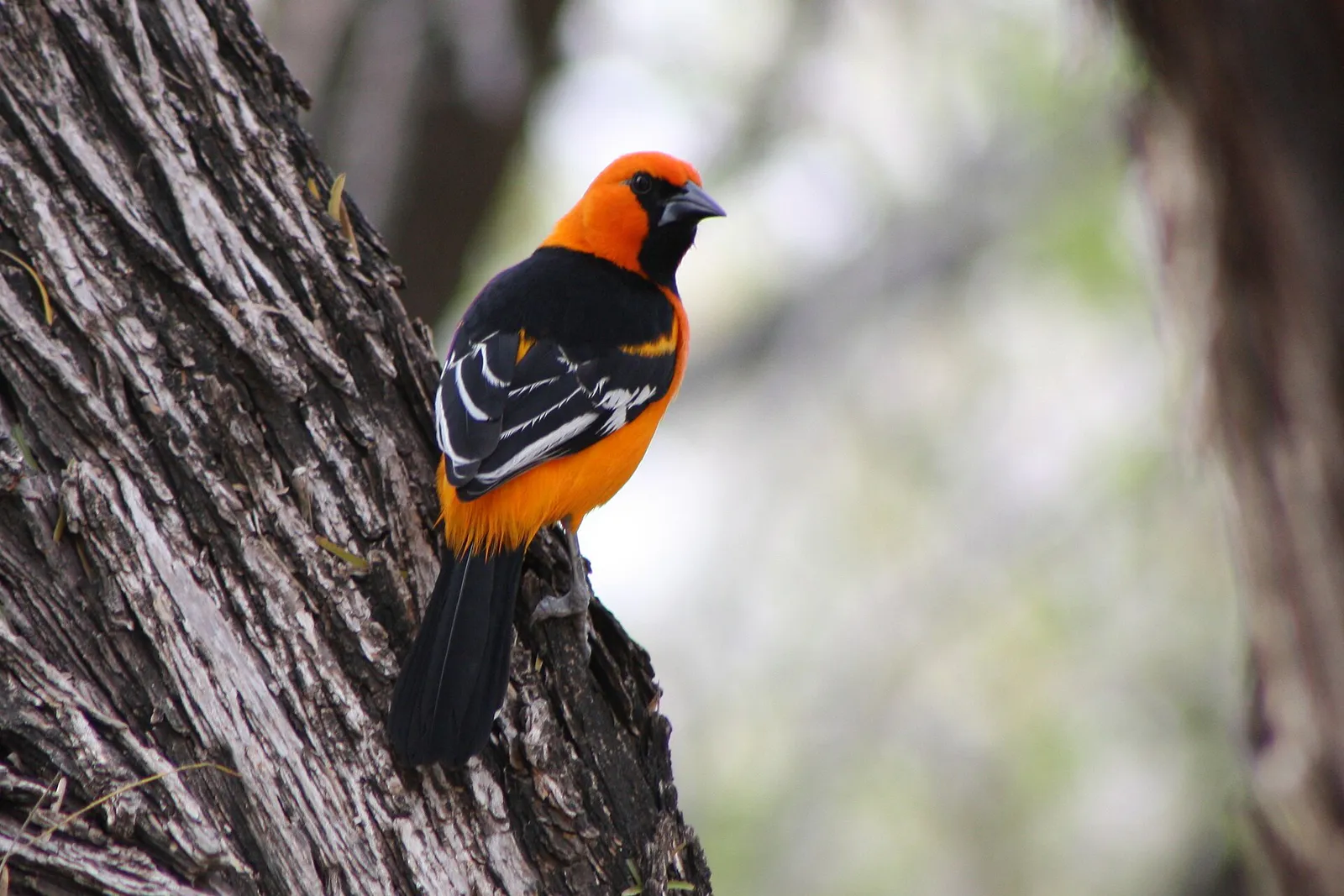
Trying to decide what to do in Mission? Adventria helps you cut through the options and choose a good-enough plan without endless scrolling. Whether you are navigating midday summer heat, planning a birding outing at Bentsen-Rio Grande Valley State Park, or looking for authentic Valley botana platters along Expressway 83, this guide provides clear, factual logic for every daily decision in Mission.
The local decision problem
How to plan outdoor excursions, family gatherings, and daily logistics in Mission while navigating seasonal extreme heat, park access rules, and border geography.
That is where Adventria comes in. Adventria helps narrow the options in Mission around practical factors like location, distance, budget, vibe, who you are with, and the kind of experience you actually want, so research can turn into a decision.
Let Adventria narrow the optionsPick the right part of town
Different parts of Mission work for different kinds of plans. Start with the experience you want, then narrow the map.
Best for
Historic exploration, municipal services, local dining, and parade events
Best for
Master-planned living, shopping corridors, business parks, and family dining
Best for
Ecotourism, trail access, active adult living, and nature sanctuary access
Best for
Golf course living and convenient commuting toward McAllen
Best for
Agricultural heritage, historical architecture, and scenic riverfront proximity
Best for
Semi-rural residential living, historic estates, and orchard views
This is a quick starting point. The full guide covers 7 local neighborhoods and districts in Mission.
Eat & drink
Trying to decide where to eat in Mission? Start with the local dining context below and narrow the decision around the kind of meal or experience you actually want.
Order an authentic RGV botana platter at Taco Ole Sharyland or Theresita's Mexican Restaurant & Grill. These multi-person platters come loaded with skirt steak fajitas, chips, melted cheese, beans, and guacamole, making them ideal for family style dining without needing separate individual entrees.
Still comparing options? Adventria can narrow the choice around budget, distance, vibe, and who you are with.
Decide with AdventriaPlan by situation
Start with the kind of plan you are actually trying to make. These city-specific ideas narrow the choice around who you are with, what you want to spend, the weather, and the kind of outing you want.
For an outdoor plan from Mission, compare trails, state parks, national parks within trip range, and scenic drives. Options in the current city guide include Bentsen - Rio Grande Valley State Park and Estero Llano Grande State ParK.
Spend time indoors browsing the historical archives and William Jennings Bryan exhibit at Speer Memorial Library, tour the Mission Historical Museum, or make the short 10-minute drive east to McAllen to visit the International Museum of Art & Science (IMAS).
Visit the historic La Lomita Chapel and surrounding park for free during daylight hours, explore regional artifacts at the Mission Historical Museum inside the 1939 Shary Building (free entry Wednesday through Friday), or walk the paved Mission Hike & Bike Trail.
For a short escape from Mission, compare South Padre Island and Brownsville. More options are listed in the trip section below.
Outdoors nearby
Use these nearby outdoor options when the plan calls for a trail, protected landscape, park, or drive instead of another indoor stop. Proximity here is geographic, not a promise about driving time.
Get out of town
When staying in town is not the answer, these nearby destinations give you a smaller starting set for a day trip, overnight escape, or weekend away.
Destination relationships are screened geographically. Straight-line proximity is not presented as road mileage or estimated travel time.
Local landmarks & attractions
These notable destinations offer a starting point when you want something specific to see, visit, or build into a day around Mission. Distances are approximate from the city area.
city-operated nature preserve in McAllen, Texas
Multi-purpose arena in Hildago, Texas
historic place in Mission, Hidalgo County, Texas
non-profit organization in the USA
indoor arena in Edinburg, Texas
Notable places are selected from structured public destination data and ranked for relevance, prominence, proximity, and variety.
Local decision signals
A useful local recommendation depends on how the city actually works. These conditions affect where to go, what to do, and whether a plan makes sense right now.
Vehicles are strictly prohibited past headquarters inside Bentsen-Rio Grande Valley State Park. Visitors must explore on foot, rent a bicycle on-site, or take the scheduled open-air tram tour.
From late May through September, heat indices frequently exceed 105°F by midday. Outdoor hiking, birding, and cycling should be completed before 10:00 AM.
Between November and March, population increases noticeably with seasonal residents. Expect busier early-evening dining hours and higher park visitation.
Local Mexican restaurants serve large family-style botana platters meant for sharing, stacked with tortilla chips, cheese, fajita meat, carnitas, beans, and guacamole.
Traveling along Military Highway or Anzalduas Dam Road involves visible law enforcement presence, including U.S. Customs and Border Protection and DPS patrols.
Speer Memorial Library offers a Community Tool Shed where local residents can check out lawn and hand tools alongside standard public library amenities.
Valley Metro Route 20 provides bus connectivity to McAllen, supplemented by a flexible curbside pickup service within a half-mile radius when requested 24 hours ahead.
Neighborhood context
Neighborhoods are not interchangeable. Each area offers a different balance of atmosphere, transportation, food, nightlife, activities, and planning friction.
Best for: Historic exploration, municipal services, local dining, and parade events
Centered along Conway Avenue between Interstate 2 and 12th Street. Houses City Hall, Speer Memorial Library, Mission Historical Museum in the 1939 Shary Building, and traditional commercial storefronts.
Best for: Master-planned living, shopping corridors, business parks, and family dining
Eastern and Southeastern Mission along Shary Road. Features a 6,000-acre master-planned community, Grove Town Center retail, Sharyland Business Park, and top-rated schools.
Best for: Ecotourism, trail access, active adult living, and nature sanctuary access
Southwestern Mission along South Bentsen Palm Drive, directly adjoining Bentsen State Park and the National Butterfly Center. Includes master-planned sub-neighborhoods like Sendero, Tanglewood, and Retama Village (55+).
Best for: Golf course living and convenient commuting toward McAllen
East-Central Mission bordering McAllen along Glasscock and Shary Roads. Centered around Cimarron Country Club with single-family homes and townhomes.
Best for: Agricultural heritage, historical architecture, and scenic riverfront proximity
Southern Mission along FM 1016 and Military Highway near the Rio Grande. Home to the historic 1865 La Lomita Chapel and La Lomita Historical Park.
Best for: Semi-rural residential living, historic estates, and orchard views
Northern Mission along Griffin Parkway (FM 495), 2 Mile Line, and 3 Mile Line. Characterized by citrus groves, newer subdivisions, and historic properties like The Bryan House.
Best for: Mid-century residential architecture, boulevard streetscapes, and quiet neighborhoods
Historic subdivision created in 1945 off Conway Avenue and Lomita Boulevard, known for boulevard esplanades and agricultural lineage.
Mission local guide
Mission is situated in southern Hidalgo County within the Lower Rio Grande Valley, directly bounded by McAllen to the east, Palmhurst and Palmview to the north and west, and the Rio Grande to the south. Central navigation revolves around Interstate 2 (U.S. Route 83) running east-west across the southern portion of the city, intersecting primary north-south corridors including Conway Avenue (SH 107 / FM 1016) in the historic center and Shary Road (FM 494) to the east.
The city spans distinct activity zones. Downtown Mission around Conway Avenue maintains a traditional civic and historic grid housing municipal offices, Speer Memorial Library, and local shops. Moving east along Shary Road leads to master-planned retail hubs, corporate business parks, and residential neighborhoods. Southwest Mission along South Bentsen Palm Drive forms an ecological corridor home to major state and private wildlife preserves.
Explore your options
Mission balances world-class nature conservation, deep agricultural heritage, and modern suburban amenities across several distinct venue types.
Mission sits along major international bird and butterfly migration corridors, offering world-renowned sanctuaries.
Preserving over a century of borderland heritage, citrus innovation, and presidential connections.
Modern civic facilities supporting corporate gatherings, trade shows, and regional celebrations.
Corridors anchored by iconic local eateries, RGV botana spots, and shopping centers.
Practical local guidance
Keep these practical rules and operational nuances in mind when organizing your day across Mission.
A simpler way to decide
Follow this step-by-step sequence to maximize wildlife observation and avoid extreme heat when visiting Southwest Mission's nature preserves.
Confirm opening hours for Bentsen-Rio Grande Valley State Park or the National Butterfly Center before departing, especially during seasonal migration months or emergency maintenance.
Bring sun protection, insect repellent, plenty of water, and valid photo identification, which may be needed when driving along border-adjacent roadways like South Bentsen Palm Drive.
Aim to arrive between 7:00 AM and 8:00 AM to enjoy cooler temperatures and active wildlife before midday heat sets in.
At Bentsen State Park, park your vehicle at headquarters and decide whether to hike the trails on foot, rent an adult bicycle at the park store, or board the scheduled open-air tram.
Make your way directly to the two-story Hawk Observation Tower or wheelchair-accessible Rio Grande Trail for prime raptor and songbird viewing opportunities.
Conclude your outdoor loop around 10:30 AM and head to a local restaurant along Business 83 or Shary Road for breakfast or early lunch.
Common local questions
These are common situations people face when trying to decide where to eat, what to do, where to get drinks, or how to spend their time in Mission.
Mission planning questions
Practical answers for people deciding where to eat, what to do, where to go, or how to make plans in Mission.
The primary outdoor season runs from October through April, when temperatures are mild with daily highs typically in the 60s to 80s°F. Fall brings peak butterfly migrations, while spring features raptor migrations overhead.
No. Personal motor vehicles cannot enter the main park area. Visitors park at the entrance visitor center and explore via walking, bicycle rentals, or the park tram tour.
An RGV botana is an iconic family-style platter served in Rio Grande Valley Mexican restaurants. It consists of corn tortilla chips topped with melted cheese, grilled skirt steak fajitas, chicken, carnitas, refried beans, guacamole, and grilled onions, meant for sharing among 2 to 8 people.
Mission directly borders McAllen to the east. Driving takes about 10 to 15 minutes via Interstate 2 / US Highway 83 or major east-west arterials like Griffin Parkway (FM 495) and Business 83. Valley Metro Route 20 also provides bus transit between Mission and McAllen Central Station.
Valley Metro operates fixed bus routes like Route 20 connecting Mission to McAllen. Valley Metro also provides flexible demand-response curbside pickups within half a mile of routes when booked 24 hours in advance. South Texas College operates the Jag Express shuttle network for students.
Visit the Mission Historical Museum located in the 1939 Shary Building on Doherty Avenue, explore the 1865 La Lomita Chapel along FM 1016, or view historic artifacts and William Jennings Bryan exhibits at Speer Memorial Library.
The Texas Citrus Fiesta takes place every late January, featuring the Parade of Oranges along Conway Avenue, the Product Costume Style Show at the Mission Event Center, and a multi-day community Fun Fair.
Speer Memorial Library offers free entry to explore historical exhibits, access public computer labs, use private study rooms, and access a Community Tool Shed where local residents can check out lawn and hand tools.
Military Highway and southern riverfront roads run adjacent to the U.S.–Mexico border. U.S. Customs and Border Protection and Texas Department of Public Safety conduct routine patrols and checkpoints in this corridor.
Mission CEED on Bryan Road provides dedicated coworking spaces, small business incubators, and high-speed infrastructure. Speer Memorial Library also offers free wifi and eight private study rooms.
Source transparency
Official and locally relevant sources used to verify the practical information presented in this Mission decision guide.
Mission decision engine
Tell Adventria what kind of experience you want, set your practical limits, and turn the options in Mission into one workable plan.
Choose a Mission Plan