Downtown / Franklin Street Corridor
Best for
Walkable dining, student energy, coffee shops, and nightlife
 AdventriaLocalOpen App
Local Mobility & Activity Guide
Trying to decide what to do in Chapel Hill? Adventria helps you cut through the options and choose a good-enough plan without endless scrolling. Whether you are navigating the university academic calendar, looking for fare-free transit, planning a date night on West Franklin Street, or dodging game day traffic on South Road, this guide helps you make practical mobility and activity decisions across Chapel Hill and Carrboro.
The local decision problem
How to navigate Chapel Hill dining, transit, campus events, and distinct districts across changing academic calendars and athletic schedules.
That is where Adventria comes in. Adventria helps narrow the options in Chapel Hill around practical factors like location, distance, budget, vibe, who you are with, and the kind of experience you actually want, so research can turn into a decision.
Let Adventria narrow the optionsPick the right part of town
Different parts of Chapel Hill work for different kinds of plans. Start with the experience you want, then narrow the map.
Best for
Walkable dining, student energy, coffee shops, and nightlife
Best for
Historic quads, art galleries, science exhibits, and athletic venues
Best for
Quiet historic residential walks and African American heritage
Best for
Craft taprooms, food trucks, and post-grad gathering spots
Best for
Retail plaza shopping, high-density housing, and grocery access
Best for
Family outings, green plaza spaces, and park-and-ride bus links
This is a quick starting point. The full guide covers 8 local neighborhoods and districts in Chapel Hill.
Eat & drink
When the decision is less about what to do and more about where to eat or grab a drink, start here. These local cues narrow the food and drink decision without turning dinner or a night out into another hour of comparison.
Between late May and mid-August, roughly 30,000 UNC students leave the area, creating the 'Summer Shift.' During these months, popular Franklin Street and West End restaurants that usually require advance planning offer easy walk-in seating, downtown street parking meters are far less competitive, and local bus routes run with reduced traffic delays.
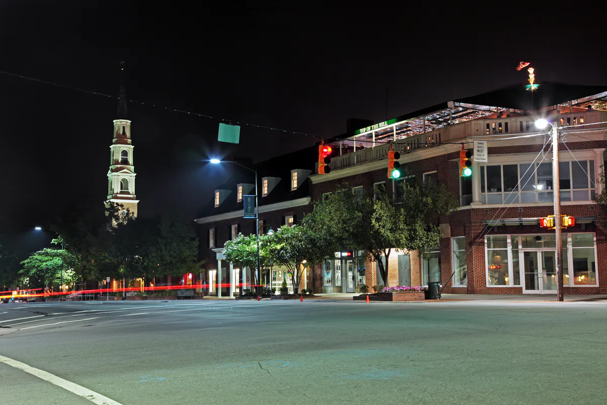
Start with an afternoon walk through Coker Arboretum or the Ackland Art Museum. Head to West Franklin Street for high-end craft cocktails at The Crunkleton or The Lantern Bar, followed by farm-to-table Asian dining at Lantern or wood-fired pizza at Pizzeria Mercato near the Midway. Finish the evening with a live performance at Cat's Cradle or a show at PlayMakers Repertory Company.
Still comparing options? Adventria can narrow the choice around budget, distance, vibe, and who you are with.
Decide with AdventriaPlan by situation
Start with the kind of plan you are actually trying to make. These city-specific ideas narrow the choice around who you are with, what you want to spend, the weather, and the kind of outing you want.
For an outdoor plan from Chapel Hill, compare trails, state parks, national parks within trip range, and scenic drives. Options in the current city guide include Eno River State Park and Occoneechee Mountain State Natural Area.
Spend the morning at Morehead Planetarium and Science Center on East Franklin Street to explore interactive labs and catch a fulldome star show in the GSK Theater. Afterwards, walk over to the nearby Carolina Basketball Museum near the Dean Dome to view Michael Jordan artifacts and championship trophies, or explore free indoor exhibits at the Ackland Art Museum.
Take advantage of 100% fare-free transit on Chapel Hill Transit buses to visit free cultural institutions. Walk through the Ackland Art Museum's 21,000-work collection, tour display gardens at the North Carolina Botanical Garden (suggested $5 donation), explore the 5-acre Coker Arboretum, and walk the gravel trails at Carolina North Forest without paying admission.
Grab a coffee at the historic Carolina Coffee Shop on East Franklin Street, browse exhibits at the Ackland Art Museum, and walk through the stone pathways of Coker Arboretum. Afterwards, head west toward the Midway to read on the patio at Franklin Motors Beer Garden or pick up a book from nearby independent retailers.
For a short escape from Chapel Hill, compare Greensboro and Pinehurst. More options are listed in the trip section below.
Outdoors nearby
Use these nearby outdoor options when the plan calls for a trail, protected landscape, park, or drive instead of another indoor stop. Proximity here is geographic, not a promise about driving time.
Get out of town
When staying in town is not the answer, these nearby destinations give you a smaller starting set for a day trip, overnight escape, or weekend away.
Destination relationships are screened geographically. Straight-line proximity is not presented as road mileage or estimated travel time.
Local landmarks & attractions
These notable destinations offer a starting point when you want something specific to see, visit, or build into a day around Chapel Hill. Distances are approximate from the city area.
botanical garden in Chapel Hill, North Carolina, USA
museum in Chapel Hill, North Carolina
indoor arena, located in Raleigh, North Carolina
state capitol building of the U.S. state of North Carolina
state art museum in Raleigh, North Carolina
theatre building on the campus of the University of North Carolina at Chapel Hill, originally a social venue
green space at Duke University in Durham, North Carolina
historic site in Chapel Hill, North Carolina
Notable places are selected from structured public destination data and ranked for relevance, prominence, proximity, and variety.
Local decision signals
A useful local recommendation depends on how the city actually works. These conditions affect where to go, what to do, and whether a plan makes sense right now.
Chapel Hill Transit operates over 20 local routes connecting Chapel Hill, Carrboro, and UNC campus with no fares, passes, or student IDs required.
UNC home football and men's basketball games trigger mandatory closures and diversions on South Road, Stadium Drive, and Manning Drive, converting visitor lots to permit-only event access.
Between late May and mid-August, the departure of roughly 30,000 UNC students drastically eases local road congestion, meter demand, and restaurant seating waits.
UNC campus permit restrictions lift after 5:00 PM on weekdays, allowing visitor parking for $1.00 in unreserved lots using ParkMobile Zone 4500.
Clay-based mountain bike trails at Carolina North Forest close after heavy rainfall to prevent erosion, directing outdoor users to the gravel Pumpkin Loop or paved greenways.
Transitioning west along West Franklin Street into East Main Street seamlessly links downtown Chapel Hill to independent venues, taprooms, and market lawns in Carrboro.
Neighborhood context
Neighborhoods are not interchangeable. Each area offers a different balance of atmosphere, transportation, food, nightlife, activities, and planning friction.
Best for: Walkable dining, student energy, coffee shops, and nightlife
The civic and commercial heart running parallel to UNC campus. Divided into legacy cafes on East Franklin Street, destination dining and bars on West Franklin Street, and mid-rise developments along Rosemary Street.
Best for: Historic quads, art galleries, science exhibits, and athletic venues
Encompasses historic McCorkle Place and Polk Place, the South Campus athletic facilities including Kenan Stadium and the Dean E. Smith Center, and the UNC Hospitals complex along Manning Drive.
Best for: Quiet historic residential walks and African American heritage
Historically Black neighborhoods established in the 19th century directly north and west of downtown, centered around historic preservation and community organizing.
Best for: Craft taprooms, food trucks, and post-grad gathering spots
The transitional district bridging West Franklin Street in Chapel Hill and East Main Street in Carrboro, featuring converted auto-repair venues and neighborhood bars.
Best for: Retail plaza shopping, high-density housing, and grocery access
A commercial redevelopment zone along US 15-501 and Ephesus Church Road featuring shopping hubs like Eastgate Crossing and Rams Plaza alongside modern mid-rise apartments.
Best for: Family outings, green plaza spaces, and park-and-ride bus links
A southern master-planned community centered on Market Street and a village green, incorporating retail, dining, a cinema, and a major Chapel Hill Transit Park & Ride terminal.
Best for: Piedmont trails, suburban dining, and RTP commuter access
A planned community on the eastern edge off NC 54 near I-40, featuring village retail, townhomes, a YMCA, and multi-use trail connections.
Best for: Bohemian markets, independent live music, and local food culture
An independent municipality bordering Chapel Hill to the west, sharing transit and schools while featuring a compact downtown around Weaver Street and Main Street.
Chapel Hill local guide
Chapel Hill occupies the southwestern corner of North Carolina's Research Triangle, situated primarily in Orange County with small eastern fringes extending into Durham and Chatham counties. Downtown Durham lies 15 to 20 minutes northeast via US 15-501 or Interstate 40, Research Triangle Park is 15 to 20 minutes east via NC 54 and I-40, and Raleigh-Durham International Airport (RDU) sits roughly 20 to 30 minutes east off I-40.
Set within the rolling hills of the North Carolina Piedmont, Chapel Hill's topography is heavily forested and intersected by natural stream corridors including Bolin Creek, Morgan Creek, and Booker Creek. These natural buffers separate distinct development clusters, funneling vehicle traffic onto a handful of primary arterial corridors.
Major peak-hour bottlenecks regularly occur along NC 54 (Raleigh Road) connecting toward I-40, US 15-501 (Fordham Boulevard) around the Blue Hill District, Martin Luther King Jr. Boulevard (NC 86), and the Manning Drive/South Road axis through central campus and UNC Hospitals. Planning travel around shift changes at the hospital complex and class transition periods on campus helps minimize transit delays.
Explore your options
Explore Chapel Hill's premier art collections, historic campus spaces, science facilities, and expansive natural preserves.
Located on campus at 101 S Columbia Street, featuring a permanent collection of over 21,000 works spanning Asian art, European masterworks, and North Carolina pottery.
Historic facility at 250 E Franklin Street that trained NASA Apollo astronauts, housing the GSK Fulldome Theater and interactive science exhibition labs.
Major native plant conservation centers encompassing 1,200+ managed acres at Old Mason Farm Road alongside the historic 5-acre Coker Arboretum on campus.
A 750-acre timber preserve managed by UNC off MLK Jr Boulevard, featuring 23+ miles of multi-use doubletrack and singletrack trails.
Practical local guidance
Keep these transit policies, parking rates, and event rules in mind when navigating town and campus.
A simpler way to decide
Follow these practical steps to structure a smooth trip into Chapel Hill and Carrboro.
Determine whether UNC is in session or hosting a home football or basketball game, as game days trigger road diversions and restricted campus parking.
Decide whether to park in a downtown municipal deck like 125 E Rosemary or use free outer Park & Ride lots linked to fare-free Chapel Hill Transit trunk routes.
If planning outdoor recreation after rain, head to paved greenways or the gravel Pumpkin Loop at Carolina North Forest rather than soft dirt singletracks.
Choose East Franklin Street for historic cafes, West Franklin and the Midway for upscale dining and taprooms, or Carrboro for independent music venues and local markets.
Take advantage of $1.00 weeknight campus parking after 5:00 PM via ParkMobile Zone 4500, or park for free in town lots on Sundays.
Common local questions
These are common situations people face when trying to decide where to eat, what to do, where to get drinks, or how to spend their time in Chapel Hill.
Chapel Hill planning questions
Practical answers for people deciding where to eat, what to do, where to go, or how to make plans in Chapel Hill.
Yes. Chapel Hill Transit operates over 20 local routes connecting Chapel Hill, Carrboro, and UNC campus completely fare-free. No tickets, passes, or student IDs are needed to board.
Monday through Thursday after 5:00 PM, visitors can park in unreserved campus permit lots for $1.00 total for the night by paying through the ParkMobile app using Zone code 4500.
Home football and basketball games cause heavy congestion along South Road, Manning Drive, and NC 54. Campus visitor lots switch to permit-only event access, and temporary road diversions take effect.
Park at the Friday Center or Southern Village Park & Ride lot and take the Chapel Hill Transit Tar Heel Express shuttle directly to the stadium or arena. Round-trip passes cost $10.00 per person.
East Franklin Street borders central campus and is filled with historic student cafes, legacy counters, and institutional buildings. West Franklin Street serves as a broader culinary and nightlife hub featuring destination dining, cocktail lounges, and craft taprooms.
The Ackland Art Museum, Coker Arboretum, North Carolina Botanical Garden (suggested $5 donation), and Carolina Basketball Museum all offer free admission to visitors.
Carrboro borders Chapel Hill directly to the west, seamlessly continuing West Franklin Street into East Main Street. It shares the same fare-free public bus network and public school system, offering independent music venues, taprooms, and farmer market lawns.
Use the 2.5-mile crushed gravel Pumpkin Loop at Carolina North Forest, or paved municipal paths like the Bolin Creek Trail, Morgan Creek Trail, or Libba Cotten Bikeway, as dirt singletrack trails close to prevent clay erosion.
The Summer Shift refers to the period between late May and mid-August when roughly 30,000 UNC students depart campus. Local road traffic drops significantly, downtown street parking opens up, and reservations or wait times at popular Franklin Street restaurants ease.
Source transparency
Official and locally relevant sources used to verify the practical information presented in this Chapel Hill decision guide.
Chapel Hill decision engine
Tell Adventria what kind of experience you want, set your practical limits, and turn the options in Chapel Hill into one workable plan.
Choose a Chapel Hill Plan