Central Area / Downtown Historic District
Best for
Walkable dining, architectural tours, civic landmarks, and riverfront parks
 AdventriaLocalOpen App
Salem Local Decision Engine
Trying to decide what to do in Salem? Adventria helps you cut through the options and choose a good-enough plan without endless scrolling. Whether you are dodging river bridge traffic between West Salem and Downtown, steering clear of state legislative lunch rushes, or seeking rain-proof weekend plans, this guide helps you choose where to eat, explore, and relax across Salem without common timing and parking headaches.
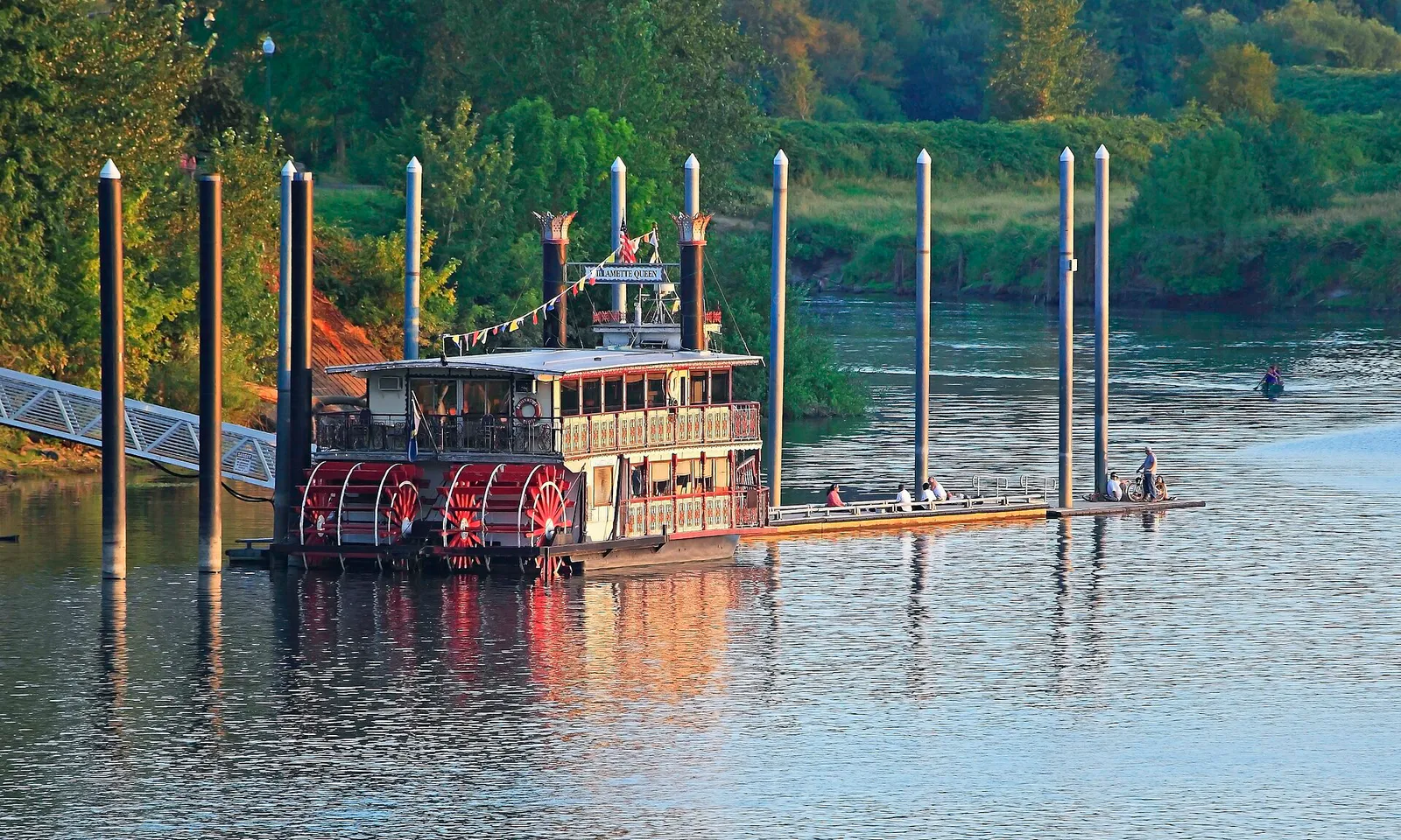
The local decision problem
Navigating Salem's river-divided topography, legislative seasonal surges, and parking rules while identifying local dining, historic sites, and outdoor trail networks.
That is where Adventria comes in. Adventria helps narrow the options in Salem around practical factors like location, distance, budget, vibe, who you are with, and the kind of experience you actually want, so research can turn into a decision.
Let Adventria narrow the optionsPick the right part of town
Different parts of Salem work for different kinds of plans. Start with the experience you want, then narrow the map.
Best for
Walkable dining, architectural tours, civic landmarks, and riverfront parks
Best for
Historic homes, garden strolls, rose gardens, and quiet residential walking
Best for
Latin-inspired craft beer, international food carts, and riverfront athletics
Best for
Family food cart pods, suburban park hikes, and disc golf
Best for
Multicultural food parks, community college events, and commercial retail
Best for
Mexican street food, state fair events, and historic medical history
Eat & drink
Trying to decide where to eat in Salem? Start with the local dining context below and narrow the decision around the kind of meal or experience you actually want.
Head to Fork Forty Food Hall in Downtown Salem for walk-up counters offering diverse cuisines, then walk two blocks to The Coin Jam for retro arcade games and local draft beer. If you prefer live entertainment, check the nightly lineup at The Infinity Room for stand-up comedy or acoustic sets.
Still comparing options? Adventria can narrow the choice around budget, distance, vibe, and who you are with.
Decide with AdventriaPlan by situation
Start with the kind of plan you are actually trying to make. These city-specific ideas narrow the choice around who you are with, what you want to spend, the weather, and the kind of outing you want.
For an outdoor plan from Salem, compare trails, state parks, national parks within trip range, and scenic drives. Options in the current city guide include Geer Park and Waldo Park.
Begin with an early evening stroll through the gardens at Gaiety Hollow or Deepwood Museum, followed by dinner at Taproot Lounge & Cafe or Amadeus. Cap off the night with live jazz at Christo's Pizzeria & Lounge or a classic film or touring concert at the historic Tudor Gothic Elsinore Theatre.
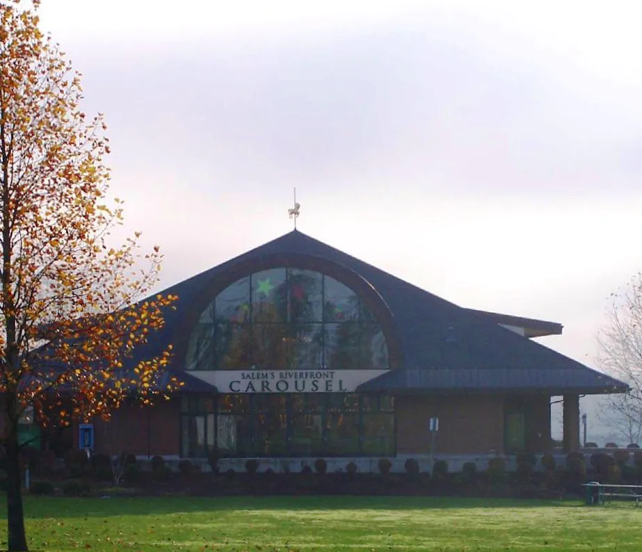
Start Saturday morning at the Salem Saturday Market (May through October) near the Capitol Mall area. Next, walk to Riverfront Park for a carousel ride and interactive outdoor play at Gilbert House Children's Museum, followed by a casual lunch at Beehive Station or The Yard Food Park.
Explore the grounds of Bush's Pasture Park Rose Garden, Deepwood Gardens, and Minto-Brown Island Park at zero cost. You can also take self-guided architecture walks through the Downtown Historic District and State Capitol grounds, while parking for free in city parkades on Chemeketa, Marion, or Liberty streets.
Spend the morning exploring the preserved 1889 Thomas Kay Woolen Mill at the Willamette Heritage Center, then visit the Hallie Ford Museum of Art on the Willamette University campus. Families can transition to the Gilbert House Children's Museum or ride the indoor, hand-carved Salem Riverfront Carousel.
Grab a coffee at The Gov Cup downtown, then walk across the Peter Courtney Bridge into Minto-Brown Island Park. Explore over 29 miles of quiet paved and dirt trails winding through river sloughs and oak savannas. Alternatively, tour the rose gardens and historic grounds of Bush's Pasture Park.
Choose one of Salem's main food cart pods based on your location: Beehive Station in South Salem (15+ carts and a taphouse), Checkpoint 221 in West Salem, or The Yard Food Park in East Salem (18 carts, indoor seating, full bar, and kids' play area). All offer shared seating and wide culinary variety.
Outdoors nearby
Use these nearby outdoor options when the plan calls for a trail, protected landscape, park, or drive instead of another indoor stop. Proximity here is geographic, not a promise about driving time.
Get out of town
When staying in town is not the answer, these nearby destinations give you a smaller starting set for a day trip, overnight escape, or weekend away.
Destination relationships are screened geographically. Straight-line proximity is not presented as road mileage or estimated travel time.
Local landmarks & attractions
These notable destinations offer a starting point when you want something specific to see, visit, or build into a day around Salem. Distances are approximate from the city area.
museum in Salem, Oregon
state capitol building of the U.S. state of Oregon
botanical garden in Salem, Oregon
amusement park in Turner, Oregon, United States
movie theater in Salem, Oregon, USA
museum in Oregon
public park and botanical garden in Salem, Oregon
stadium in Salem, Oregon, US
Notable places are selected from structured public destination data and ranked for relevance, prominence, proximity, and variety.
Local decision signals
A useful local recommendation depends on how the city actually works. These conditions affect where to go, what to do, and whether a plan makes sense right now.
The Center Street Bridge (OR-22 Eastbound) and Marion Street Bridge (OR-22 Westbound) serve as the sole river crossings between Marion and Polk counties, creating predictable gridlock from 7:00–9:00 AM and 4:00–6:30 PM.
On-street parking in the Downtown Parking District requires payment via street pay stations or the Beep Beep Salem app ($1.50/hr, Mon–Sat), whereas city parkades on Chemeketa, Marion, and Liberty Streets remain free for short-term visits.
During odd-year long legislative sessions (January to June), downtown dining, Capitol-area parking, and hotel availability experience significant weekday surges driven by lawmakers, lobbyists, and state agency staff.
The Union Street Railroad Bridge and Peter Courtney Minto Island Bridge connect Riverfront Park directly to West Salem's Wallace Marine Park and the 1,200+ acre Minto-Brown Island Park without car traffic.
Salem's casual food scene centers on decentralized neighborhood pods featuring covered outdoor seating, heated enclosures, and draft taps: Beehive Station (South), Checkpoint 221 (West), The Yard (East), and Fork Forty (Downtown).
The multi-year Center Street Bridge Seismic Retrofit Project (2026–2030) introduces localized traffic detours and intermittent pedestrian access shifts around Riverfront Park and Wallace Marine Park approaches.
Neighborhood context
Neighborhoods are not interchangeable. Each area offers a different balance of atmosphere, transportation, food, nightlife, activities, and planning friction.
Best for: Walkable dining, architectural tours, civic landmarks, and riverfront parks
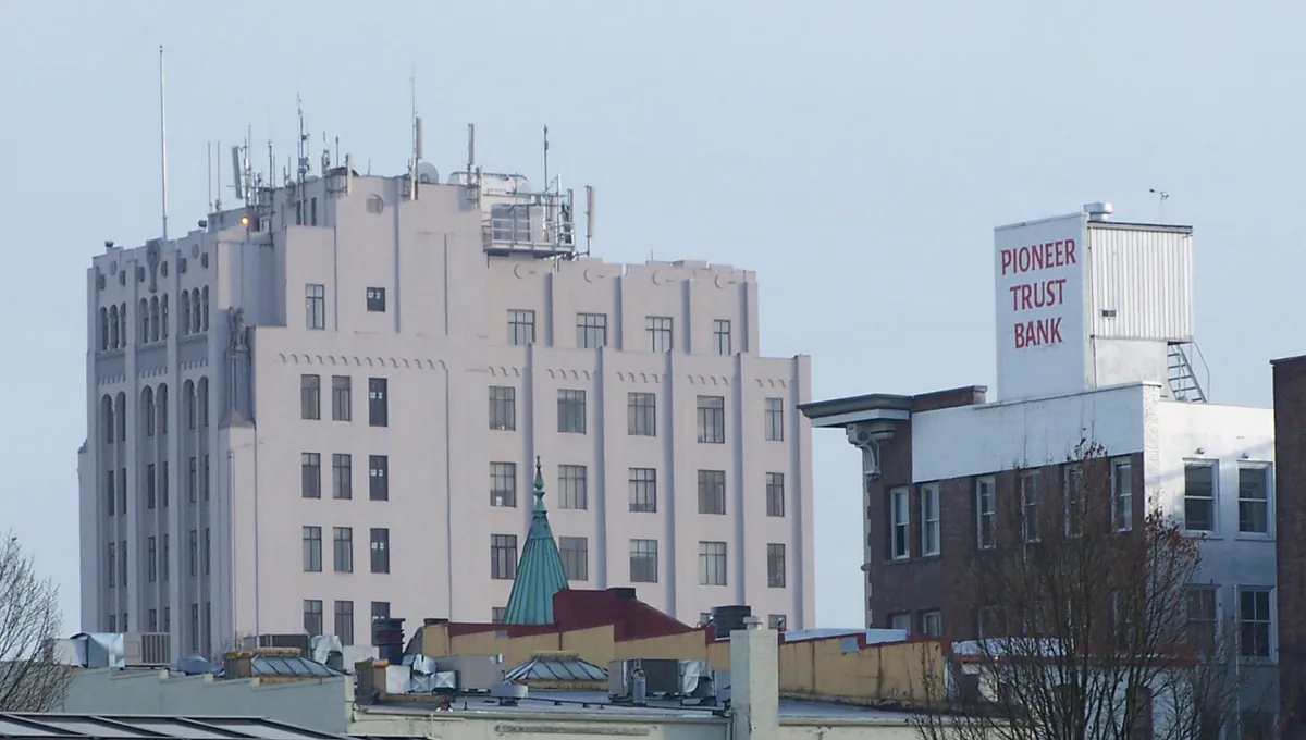
The political and cultural heart of Salem. It houses the Oregon State Capitol, historic Willamette University, late 19th-century storefronts along Court and Liberty Streets, and waterfront access at Riverfront Park.
Best for: Historic homes, garden strolls, rose gardens, and quiet residential walking
Located directly south of downtown, SCAN features tree-canopied avenues, historic Victorian estates, Bush's Pasture Park, Gaiety Hollow, and the Deepwood Museum & Gardens.
Best for: Latin-inspired craft beer, international food carts, and riverfront athletics
Situated across the Willamette River in Polk County, West Salem combines riverfront access at Wallace Marine Park with residential hills, Checkpoint 221 food carts, and Xicha Brewing.
Best for: Family food cart pods, suburban park hikes, and disc golf
Far South Salem's commercial and residential expanse. Highlights include Beehive Station food cart pod, Woodmansee Park's 9-hole disc golf course, and nature trails through Battle Creek Park.
Best for: Multicultural food parks, community college events, and commercial retail
Anchored by Lancaster Drive and Chemeketa Community College, this eastern commercial hub features high-density retail options and major food venues like The Yard Food Park.
Best for: Mexican street food, state fair events, and historic medical history
Historic mixed-use and industrial neighborhoods north of downtown housing the Oregon State Fair & Expo Center, the Oregon State Hospital Museum of Mental Health, and food corridors along Portland Road NE.
Salem local guide
Salem's geographic character is defined by the Willamette River, which separates the civic and commercial center in Marion County from the expanding residential slopes of West Salem in Polk County. Because vehicle movement across the river relies entirely on two single-direction bridges—the Center Street Bridge heading east into downtown and the Marion Street Bridge heading west—traffic flow creates a distinct local commute pattern. Morning peak hours push heavy traffic into downtown, while evening rush hours reverse the flow toward West Salem. Planning trips across the river outside of these commute windows, or taking advantage of pedestrian bridge connections, saves significant time.
The city's rhythm also swings noticeably with the state government calendar. During odd-numbered years when the Oregon State Legislature holds its five-month long session, downtown Salem experiences a surge in weekday activity. Lunchtime tables along Court, State, and Liberty Streets fill rapidly with public officials, advocacy groups, and agency staff, while local hotels and Capitol-adjacent parking operate near capacity. During legislative interims and weekends, downtown transforms back into a relaxed local commerce zone focused on farm-to-table dining, craft taprooms, and arts events.
Seasonal shifts in the Mid-Willamette Valley further influence where locals gather. From July through September, dry weather encourages outdoor programming at the Gerry Frank Salem Rotary Amphitheater, patio dining at local breweries, and long trail runs through Minto-Brown Island Park. Winter months bring persistent drizzle and valley fog, prompting a seasonal shift toward historic indoor venues, art museums, food cart pods with heated enclosures, and performing arts schedules at the historic Elsinore and Grand Theatres.
Explore your options
Rather than relying on a single entertainment district, Salem's culinary scene is spread across specialized neighborhood pods and downtown clusters.
Concentrated along Court, State, Liberty, and Commercial Streets, downtown offers walkable fine dining, farm-to-table cafes, and indoor food hall spaces.
Suburban corridors along Commercial Street SE host spacious family-friendly food cart pods and casual neighborhood brewhouses.
Located across the river, West Salem mixes Latin-inspired craft brews with riverfront dining options.
Major transit arteries on Lancaster Drive and Portland Road showcase regional food parks and authentic Mexican street food.
Practical local guidance
Keep these local practicalities in mind to avoid common timing and parking friction across the city.
A simpler way to decide
Follow this step-by-step progression to experience Salem's natural beauty, history, and dining scene in a single day.
Start with a hand-poured coffee at The Gov Cup downtown, then walk to the Salem Saturday Market (Summer St NE) to browse local produce, crafts, and baked goods.
Stroll through the Oregon State Capitol State Park grounds to view historic monuments, then cross State Street onto Willamette University's canopy-lined campus to visit the Hallie Ford Museum of Art.
Head west into the Downtown Historic District for lunch at Taproot Lounge & Cafe, or take a short drive to Beehive Station or Checkpoint 221 for diverse food cart options.
Park at Riverfront Park, ride the Salem Riverfront Carousel, and walk across the Peter Courtney Bridge into Minto-Brown Island Park for an afternoon hike along the Willamette River sloughs.
Head south into the SCAN neighborhood to explore the formal rose gardens at Bush's Pasture Park and walk the Victorian grounds surrounding the Deepwood Museum.
Conclude your day with dinner and Latin-inspired craft beer at Xicha Brewing in West Salem or British cask ales at Santiam Brewing, followed by a live performance or movie at the historic Elsinore Theatre.
Common local questions
These are common situations people face when trying to decide where to eat, what to do, where to get drinks, or how to spend their time in Salem.
Salem planning questions
Practical answers for people deciding where to eat, what to do, where to go, or how to make plans in Salem.
On-street parking in downtown Salem costs $1.50 per hour Monday through Saturday via pay stations or the Beep Beep Salem app. However, free short-term parking remains available in three city-owned parking structures: Chemeketa Parkade, Marion Parkade, and Liberty Square Parkade.
Avoid driving across the Center Street Bridge (eastbound) from 7:00–9:00 AM and the Marion Street Bridge (westbound) from 4:00–6:30 PM. Alternatively, walk or bike across the pedestrianized Union Street Railroad Bridge to cross the Willamette River without traffic.
Minto-Brown Island Park features over 29 miles of paved and unpaved trails along with a dedicated 30-acre off-leash dog park. Bush's Pasture Park and Wallace Marine Park also offer wide open grassy spaces suitable for leashed walks.
During odd-year long legislative sessions (January to June), downtown dining venues experience heavy weekday lunch traffic, hotel room rates increase, and parking near the State Capitol fills quickly. Planning dining reservations in advance is recommended.
Top rainy-day destinations include the Willamette Heritage Center (Thomas Kay Woolen Mill), Gilbert House Children's Museum, Hallie Ford Museum of Art, Oregon State Hospital Museum of Mental Health, and indoor dining at Fork Forty Food Hall.
Salem's top food cart pods include Beehive Station in South Salem (Fabry Rd SE), Checkpoint 221 in West Salem (Edgewater St), The Yard Food Park in East Salem (Lancaster Dr), and Fork Forty Food Hall in Downtown Salem.
Public transit is operated by Cherriots. Local bus routes cover Salem and Keizer, centered at the Downtown Transit Center (555 Court St NE). Cherriots Regional express buses connect Salem to neighboring valley cities such as Wilsonville, Woodburn, Dallas, and Monmouth.
The Salem Saturday Market runs weekly on Saturdays from May through October, located near the Capitol Mall area on Summer Street NE. It features regional produce, artisan crafts, hot food stalls, and local plant nurseries.
Minto-Brown Island Park spans over 1,200 acres—larger than New York City's Central Park. It includes over 29 miles of trails, a 30-acre off-leash dog area, wildlife conservation zones, and direct pedestrian access to Riverfront Park.
The Oregon Department of Transportation is executing the Center Street Bridge Seismic Retrofit Project (2026–2030). Work on river supports and bridge approaches will cause localized detours around Riverfront Park and Wallace Marine Park.
Source transparency
Official and locally relevant sources used to verify the practical information presented in this Salem decision guide.
Salem decision engine
Tell Adventria what kind of experience you want, set your practical limits, and turn the options in Salem into one workable plan.
Choose a Salem Plan