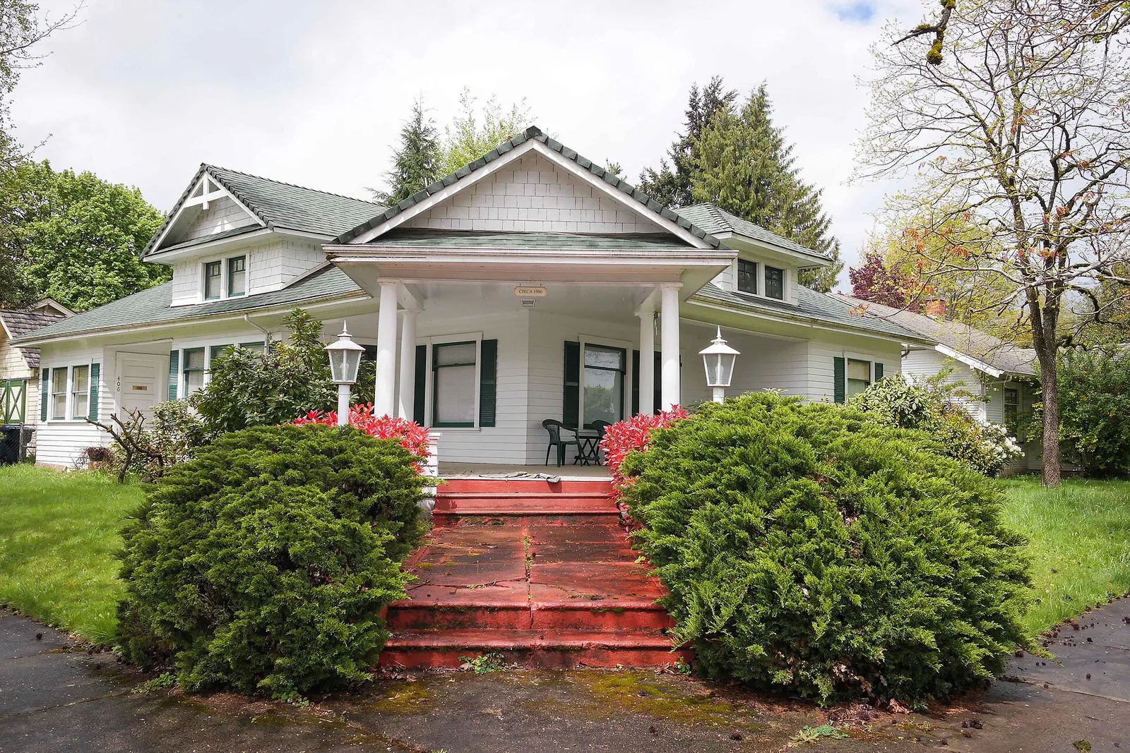
Washburne Historic District
Best for
Historic architecture, quiet neighborhood strolls, and proximity to downtown dining.
 AdventriaLocalOpen App
Springfield City Content Record
Trying to decide what to do in Springfield? Adventria helps you cut through the options and choose a good-enough plan without endless scrolling. Springfield offers a distinct alternative to neighboring university districts, defined by historic timber town heritage, craft food hubs, expansive parklands, and access to the Cascade foothills. This guide provides clear, practical advice for choosing where to eat, how to navigate event traffic, and where to recreate across every season.
The local decision problem
How to choose dining, outdoor recreation, event transit, and district navigation across Springfield, Oregon.
That is where Adventria comes in. Adventria helps narrow the options in Springfield around practical factors like location, distance, budget, vibe, who you are with, and the kind of experience you actually want, so research can turn into a decision.
Let Adventria narrow the optionsPick the right part of town
Different parts of Springfield work for different kinds of plans. Start with the experience you want, then narrow the map.
Best for
Historic architecture, quiet neighborhood strolls, and proximity to downtown dining.
Best for
Craft beer, food halls, local theater, art tours, and walkable shopping.
Best for
Hotel accommodations, regional shopping, medical services, and highway transit.
Best for
Suburban family living, indoor waterparks, and single-track mountain bike trails.
Best for
Everyday service errands, grocery runs, and central residential access.
Best for
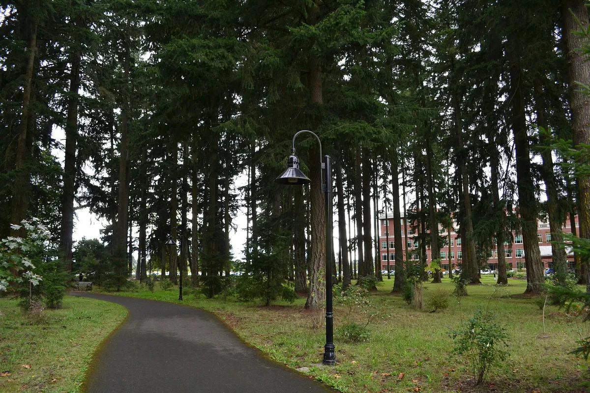
Paved riverfront walking, timber heritage, and outdoor community events.
This is a quick starting point. The full guide covers 7 local neighborhoods and districts in Springfield.
Eat & drink
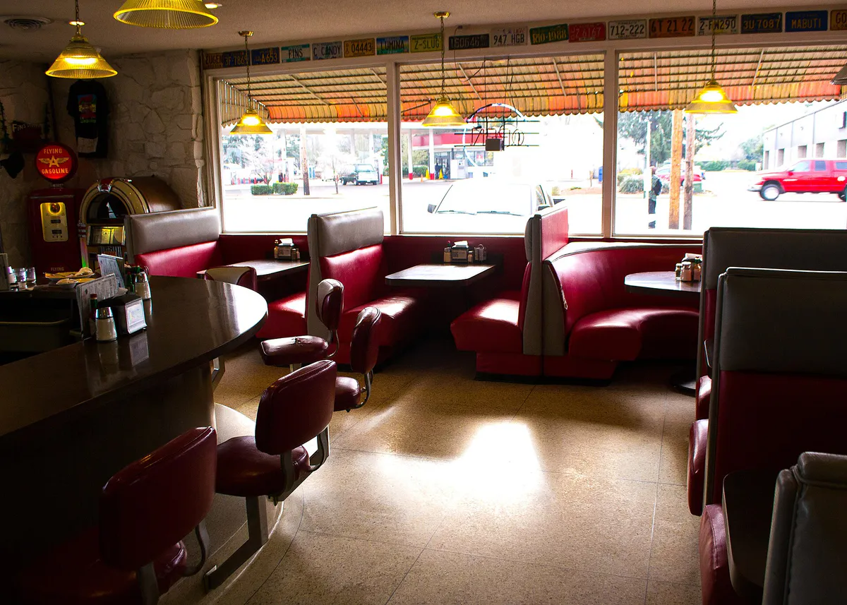
When the decision is less about what to do and more about where to eat or grab a drink, start here. These local cues narrow the food and drink decision without turning dinner or a night out into another hour of comparison.
For places to eat in Springfield, start with Historic Downtown / Main Street Corridor or Washburne Historic District depending on the kind of stop you want. Start with Historic Downtown / Main Street Corridor for craft beer, food halls, local theater, art tours, and walkable shopping.. Washburne Historic District works for historic architecture, quiet neighborhood strolls, and proximity to downtown dining..
Head to Historic Downtown along Main Street and A Street. Start with craft beer and timber gastropub fare at Plank Town Brewing Company, or explore PublicHouse—a repurposed historic church housing multiple food vendors like The Nave Kitchen, Shalosh Mediterranean, and Moi Poki Grill alongside an outdoor Arbor Bar and Whisk(e)y Lab lounge. End with a show at the nearby Richard E. Wildish Community Theater.
Still comparing options? Adventria can narrow the choice around budget, distance, vibe, and who you are with.
Decide with AdventriaPlan by situation
Start with the kind of plan you are actually trying to make. These city-specific ideas narrow the choice around who you are with, what you want to spend, the weather, and the kind of outing you want.
On Sundays between June and October, visit the Springfield Farmers Market in the City Hall parking lot (225 5th St), where admission is free, LTD offers Umo app promo codes for free bus rides, and SNAP matching is available. Combine it with a free walk through the historic hazelnut orchards and river trails at Dorris Ranch.
Park for free in Downtown Springfield and walk through the Washburne Historic District to view late-Victorian and Craftsman homes built between 1890 and 1930. Then follow Main Street to see the Official Simpsons Mural at 5th & Main on the Emerald Art Center building, along with scattered character art and the Springfield History Museum in the 1911 substation.
For food and drinks, PublicHouse at 418 A Street allows individuals in a group to order separately from different food vendors and assemble in the indoor church hall or outdoor Arbor Bar. For outdoor group gatherings, reserve picnic shelters at Clearwater Park or Island Park.
For an outdoor plan from Springfield, compare trails, state parks, national parks within trip range, and scenic drives. Options in the current city guide include Rodakowski Park and Bellinger Park.
For a day trip from Springfield, compare Lincoln City and Sisters. More options are listed in the trip section below.
Visit Splash! at Lively Park in Thurston, which offers an indoor wave pool, 144-foot waterslide, lap lanes, and warm play areas. Alternatively, head to the 97,000-square-foot Bob Keefer Center on 32nd Street for indoor drop-in court games and climbing wall sessions.
Outdoors nearby
Use these nearby outdoor options when the plan calls for a trail, protected landscape, park, or drive instead of another indoor stop. Proximity here is geographic, not a promise about driving time.
Get out of town
When staying in town is not the answer, these nearby destinations give you a smaller starting set for a day trip, overnight escape, or weekend away.
Destination relationships are screened geographically. Straight-line proximity is not presented as road mileage or estimated travel time.
Local landmarks & attractions
These notable destinations offer a starting point when you want something specific to see, visit, or build into a day around Springfield. Distances are approximate from the city area.
museum in Eugene, Oregon
zoo in Oregon, United States
track and field stadium, located in the northwest United States in Eugene, Oregon
theater and music venue in Eugene, Oregon, United States, a former movie theater
history museum in Eugene, Oregon
near Eugene, Oregon
historic house in Eugene, Oregon, USA
stadium in Oregon, USA
Notable places are selected from structured public destination data and ranked for relevance, prominence, proximity, and variety.
Local decision signals
A useful local recommendation depends on how the city actually works. These conditions affect where to go, what to do, and whether a plan makes sense right now.
UO football home games severely clog Centennial Blvd, Pioneer Pkwy, Gateway St, and I-105. Riding the $5 LTD Autzen Express shuttle from Springfield Station or PacificSource in Gateway bypasses stadium parking bottlenecks.
Mountain bike trails at Thurston Hills Natural Area close to bicycles during wet winter months to prevent soil erosion, shifting riders to paved alternatives like the Middle Fork Path.
Cascade snowmelt keeps the McKenzie and Middle Fork Willamette Rivers high and swift during spring. Life jacket loaner kiosks at Clearwater Park open Memorial Day through Labor Day.
Unlike neighboring campuses and downtowns, Springfield offers free two-hour street parking along Main Street and S A Street, plus free public lots at City Hall and municipal parks.
LTD’s Emerald Express (EmX) bus rapid transit links Springfield Station to Pioneer Parkway, Gateway, Sacred Heart Medical Center at RiverBend, and Downtown Eugene every 10–15 minutes on weekdays.
Late August and September can bring Cascade wildfire smoke into the valley. Monitoring AirNow AQI guides when to shift outdoor recreation to indoor facilities like the Bob Keefer Center or Splash!.
Neighborhood context
Neighborhoods are not interchangeable. Each area offers a different balance of atmosphere, transportation, food, nightlife, activities, and planning friction.
Best for: Historic architecture, quiet neighborhood strolls, and proximity to downtown dining.
An 84-acre historic residential neighborhood north of Downtown Springfield, featuring late-Victorian, Craftsman, and vernacular homes built during the 1890–1930 logging boom.
Best for: Craft beer, food halls, local theater, art tours, and walkable shopping.
Centered along Main Street and A Street, this walkable civic hub features craft breweries, repurposed historic churches, the Springfield History Museum, and the Wildish Community Theater.
Best for: Hotel accommodations, regional shopping, medical services, and highway transit.
Located near I-5 and Highway 126, Gateway houses PeaceHealth Sacred Heart Medical Center at RiverBend, The Shoppes at Gateway, chain dining, and primary lodging options.
Best for: Suburban family living, indoor waterparks, and single-track mountain bike trails.
The easternmost suburban neighborhood along Highway 126, serving as the gateway to the Cascade foothills, Thurston Hills Natural Area, and Lively Park.
Best for: Everyday service errands, grocery runs, and central residential access.
A central commercial and residential connector linking Downtown, Gateway, and Thurston along Mohawk Boulevard and Q Street.
Best for: Paved riverfront walking, timber heritage, and outdoor community events.
Situated south of Downtown along the historic mill pond, featuring Island Park, the 3-mile Mill Race Path, and historic timber industry sites.
Best for: Riverbank trail connections to Eugene and industrial corridor access.
An industrial and commercial district along Franklin Boulevard connecting Downtown Springfield to the University of Oregon and the Ruth Bascom Riverbank Path.
Explore your options
Understand how Springfield's core neighborhoods differ in land use, travel friction, and activity options.
The historical and cultural center of Springfield, combining turn-of-the-century architecture with active craft food and beverage hubs.
The primary commercial, hotel, and medical hub situated at the junction of I-5 and Highway 126.
Eastern suburban residential district serving as the launching pad for foothill trails and family aquatics.
Former logging mill lands repurposed into historic timber greenways and public riverside parkland.
Practical local guidance
Keep these seasonal, transit, and environmental factors in mind when planning outings in Springfield.
A simpler way to decide
Follow this step-by-step itinerary to experience Springfield's historic downtown, paved greenways, and craft dining without logistics friction.
Park for free near Main Street or A Street and grab morning espresso and baked goods at Washburne Cafe, or sit down for classic diner portions at Addi's Diner.
Take a walking tour of the Washburne Historic District to view 1890s-1930s homes, then walk along Main Street to see the Official Simpsons Mural at 5th & Main on the Emerald Art Center.
Step inside the restored 1911 Oregon Power Company substation at 225 5th Street to view exhibits detailing Kalapuya heritage and Springfield's industrial logging history.
Drive south to Dorris Ranch on Dorris Street and walk through the historic filbert orchards down to the 4-mile paved Middle Fork Path.
Return downtown to PublicHouse in a converted historic church at 418 A Street, where everyone can pick their own meal from vendors like Moi Poki Grill or Shalosh Mediterranean.
Finish your evening with a live show or history presentation at the 275-seat Richard E. Wildish Community Theater on Main Street.
Common local questions
These are common situations people face when trying to decide where to eat, what to do, where to get drinks, or how to spend their time in Springfield.
Springfield planning questions
Practical answers for people deciding where to eat, what to do, where to go, or how to make plans in Springfield.
Lane Transit District (LTD) operates the Emerald Express (EmX) bus rapid transit system, running in dedicated lanes from Springfield Station (355 S A St) through Pioneer Parkway and Gateway directly to UO campus and Downtown Eugene every 10–15 minutes on weekdays.
Yes, Downtown Springfield offers free street parking with typical two-hour limits along Main Street and S A Street, as well as free public surface parking at the City Hall lot (225 5th St).
Splash! at Lively Park in Thurston features an indoor wave pool and 144-foot waterslide. Additionally, the Bob Keefer Center offers indoor sports courts and a climbing wall.
The Official Simpsons Mural, unveiled in 2014 with backing from creator Matt Groening, is located on the exterior wall of the Emerald Art Center at the corner of 5th and Main Street in Downtown Springfield.
Thurston Hills Natural Area off McKenzie Highway provides dedicated single-track downhill mountain bike trails like Cedar Shark, Acer Spades, and Yew Haw. Note that dirt trails close to bicycles during heavy winter rains to prevent erosion.
The 4-mile Middle Fork Path runs between Dorris Ranch and Clearwater Park along the Middle Fork Willamette River, while the 3-mile Mill Race Path connects through the historic timber mill grounds.
PublicHouse is a popular food hall located in a repurposed historic church at 418 A Street. Guests order independently from various food vendors (such as The Nave Kitchen, Moi Poki Grill, and Shalosh Mediterranean) and sit in shared indoor spaces, the outdoor Arbor Bar, or the Whisk(e)y Lab.
On Oregon Duck home game days, up to 60,000 visitors impact traffic near the Eugene-Springfield border. Heavy congestion occurs on Centennial Blvd, Pioneer Pkwy, Gateway St, and I-105. Riding the $5 LTD Autzen Express shuttle from Springfield Station avoids stadium parking congestion.
The Springfield Sunday Farmers Market takes place on Sundays from June through October between 9:00 AM and 2:00 PM in the Springfield Public Library and City Hall parking lot at 225 5th Street.
Clearwater Park provides a free life jacket loaner kiosk operated in partnership with Eugene-Springfield Fire, available from Memorial Day through Labor Day at the Middle Fork Willamette River boat launch.
Source transparency
Official and locally relevant sources used to verify the practical information presented in this Springfield decision guide.
Springfield decision engine
Tell Adventria what kind of experience you want, set your practical limits, and turn the options in Springfield into one workable plan.
Choose a Springfield Plan