West Centennial (SouthGlenn Hub)
Best for
Walkable open-air dining, shopping, movie nights, and local gathering.
 AdventriaLocalOpen App
Local Decision Guide
Trying to decide what to do in Centennial? Adventria helps you cut through the options and choose a good-enough plan without endless scrolling. Centennial spans fifteen miles east-to-west across south metro Denver, combining quiet HOA subdivisions, regional light rail stations, aviation hubs, and distinct park districts. Use this guide to navigate local trade-offs, avoid I-25 rush-hour bottlenecks, and choose the right activities for every group.
The local decision problem
How to efficiently plan dining, recreation, and local outings across Centennial's 15-mile suburban footprint while managing I-25 traffic friction and recreation district boundaries.
That is where Adventria comes in. Adventria helps narrow the options in Centennial around practical factors like location, distance, budget, vibe, who you are with, and the kind of experience you actually want, so research can turn into a decision.
Let Adventria narrow the optionsPick the right part of town
Different parts of Centennial work for different kinds of plans. Start with the experience you want, then narrow the map.
Best for
Walkable open-air dining, shopping, movie nights, and local gathering.
Best for
Quiet leafy subdivisions, trail access, and community parks.
Best for
Civic gatherings, aviation attractions, golf driving bays, and corporate hubs.
Best for
Light rail commuting, corporate stays, and quick regional access.
Best for
Expansive residential neighborhoods, library access, and state park proximity.
Best for
Large event space, regional tollway connections, and wide open spaces.
Eat & drink
When the decision is less about what to do and more about where to eat or grab a drink, start here. These local cues narrow the food and drink decision without turning dinner or a night out into another hour of comparison.
Head to The Streets at SouthGlenn for walk-in options like Bad Daddy's Burger Bar or Pho 95. Alternatively, visit local microbrewery taprooms along Arapahoe Road or Yosemite Street, such as Resolute Brewing Company or Halfpenny Brewing Company, which host rotating food trucks on a walk-in basis.
Start with early evening drinks or dinner at Indulge Bistro & Wine Bar or Mici Italian at The Streets at SouthGlenn. Follow it up with an evening film at the 14-screen Regal cinema, capped off with dessert from Heaven Creamery.
Still comparing options? Adventria can narrow the choice around budget, distance, vibe, and who you are with.
Decide with AdventriaPlan by situation
Start with the kind of plan you are actually trying to make. These city-specific ideas narrow the choice around who you are with, what you want to spend, the weather, and the kind of outing you want.
For an outdoor plan from Centennial, compare trails, state parks, national parks within trip range, and scenic drives. Options in the current city guide include Cherry Creek Reservior / State Park and Cherry Creek State Park.
Take visitors to Wings Over the Rockies Exploration of Flight to watch general aviation traffic take off from Centennial Airport while exploring hands-on displays. Afterwards, visit Family Sports Center to grab a meal at Avalanche Grill overlooking two indoor ice rinks where the NHL Colorado Avalanche practice.
Spend the afternoon at Wings Over the Rockies Exploration of Flight at Centennial Airport to view interactive flight simulators inside the Boeing Blue Sky Aviation Gallery. Alternatively, head to Family Sports Center for indoor ice skating, climbing wall, laser tag, and arcade games.
Walk or jog along the crushed-gravel High Line Canal Trail, or explore restored wetland habitats along the paved Cherry Creek Trail at Parker Jordan Centennial Open Space. Entry to Centennial Center Park and its educational statehood walk is also entirely free.
Set up a workspace at Koelbel Library, which features an on-site cafe, study rooms, and a secondhand bookstore run by Friends of Arapahoe Libraries. Later, take a peaceful solo walk or gravel bike ride along the adjacent High Line Canal Trail.
Reserve climate-controlled hitting bays at Topgolf Centennial off Arapahoe Road, or gather a group for food trucks and craft beers at Resolute Brewing Company. For sports fans, book tables at Avalanche Grill overlooking local hockey action.
For a short escape from Centennial, compare Manitou Springs and Estes Park. More options are listed in the trip section below.
Outdoors nearby
Use these nearby outdoor options when the plan calls for a trail, protected landscape, park, or drive instead of another indoor stop. Proximity here is geographic, not a promise about driving time.
Get out of town
When staying in town is not the answer, these nearby destinations give you a smaller starting set for a day trip, overnight escape, or weekend away.
Destination relationships are screened geographically. Straight-line proximity is not presented as road mileage or estimated travel time.
Local landmarks & attractions
These notable destinations offer a starting point when you want something specific to see, visit, or build into a day around Centennial. Distances are approximate from the city area.
museum in Denver, Colorado, United States
zoo
indoor arena in Denver, Colorado, USA
state capitol building of the U.S. state of Colorado
concert venue near Morrison, Colorado, United States of America
nonprofit organization in United States of America
non-profit organization in the USA
family-owned amusement park in Lakeside, Colorado adjacent to Denver
Notable places are selected from structured public destination data and ranked for relevance, prominence, proximity, and variety.
Local decision signals
A useful local recommendation depends on how the city actually works. These conditions affect where to go, what to do, and whether a plan makes sense right now.
Interstate 25 cuts vertically through Centennial, dividing West Centennial subdivisions from East Centennial master-planned communities. Crossing via Arapahoe Road during peak hours adds significant travel friction.
Centennial relies on independent special districts rather than a municipal parks department. West addresses align with South Suburban Parks and Recreation (SSPRD), while East addresses fall under Arapahoe Park and Recreation District (APRD).
Centennial Airport (KAPA) sits in the central district, creating an active visual aviation corridor and physical boundary for surrounding commercial zones.
At 5,800 feet elevation, intense sun exposure requires year-round hydration and UV care. Summer afternoons frequently bring sudden microburst rain and hail storms.
Most dining kitchens across Centennial close by 9:00 PM or 10:00 PM, with microbrewery taprooms wrapping up between 10:00 PM and 11:00 PM.
The Streets at SouthGlenn serves as West Centennial's walkable lifestyle center, integrating retail, dining, housing, and entertainment options.
Neighborhood context
Neighborhoods are not interchangeable. Each area offers a different balance of atmosphere, transportation, food, nightlife, activities, and planning friction.
Best for: Walkable open-air dining, shopping, movie nights, and local gathering.
Anchored by The Streets at SouthGlenn at University Blvd and Arapahoe Rd, this area features lifestyle retail, apartments, central green spaces, and high pedestrian access.
Best for: Quiet leafy subdivisions, trail access, and community parks.
Established residential enclaves developed in the 1970s through 1990s, boasting mature tree canopies and direct connections to the High Line Canal Trail.
Best for: Civic gatherings, aviation attractions, golf driving bays, and corporate hubs.
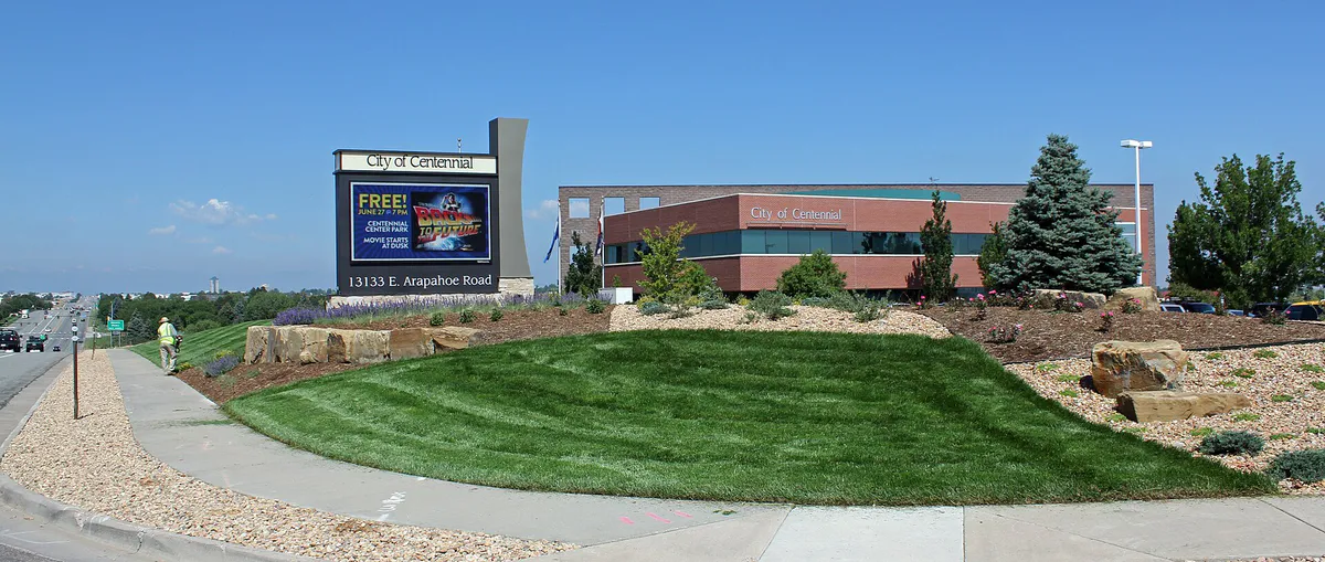
Located between I-25 and Jordan Road, this district houses City Hall, Centennial Center Park, Topgolf, Family Sports Center, and Centennial Airport.
Best for: Light rail commuting, corporate stays, and quick regional access.
Flanking Interstate 25, this transit-focused commercial district provides direct light rail access via Dry Creek Station alongside nearby Inverness office parks.
Best for: Expansive residential neighborhoods, library access, and state park proximity.
Master-planned residential developments built from the 1980s onward, featuring wider street grids, mountain vistas, Smoky Hill Library, and quick access to Cherry Creek State Park.
Best for: Large event space, regional tollway connections, and wide open spaces.
The far eastern edge of the city offering straightforward access to Denver International Airport via E-470 and hosting regional expos at the Arapahoe County Fairgrounds.
Centennial local guide
Incorporated in 2001 by uniting more than 100 distinct homeowners associations, Centennial stretches over 15 miles from east to west across south metro Denver while remaining just a few miles wide north to south. Because of this unique ribbon layout, the city wraps around adjacent municipalities including Littleton, Greenwood Village, Englewood, Lone Tree, Highlands Ranch, Parker, and Aurora. Understanding how to navigate this layout is essential for planning daily trips.
The primary geographical divide in Centennial is Interstate 25, which cuts vertically through the center of town. West Centennial is characterized by mature tree canopies, 1970s–1990s subdivisions, direct access to the High Line Canal Trail, and the open-air lifestyle hub at The Streets at SouthGlenn. East Centennial consists of master-planned developments built from the 1980s through the 2000s, featuring wider street grids, elevated views of the Front Range, and immediate proximity to Cherry Creek State Park and E-470.
Traveling across the city during peak commuting hours requires passing through major east-west arteries such as Arapahoe Road (CO-88) or County Line Road. The interchange at I-25 and Arapahoe Road experiences substantial morning and evening rush hour congestion. Locals planning evening dining, recreational activities, or errands often choose venues on their immediate side of I-25 to bypass 15 to 25 minutes of travel friction.
Explore your options
Centennial houses regional recreational centers, flight exhibits, and expansive park complexes across its commercial and civic districts.
Located at Centennial Airport on an active tarmac, this 15-acre aviation gallery offers interactive flight simulators, air traffic chatter listening stations, and aircraft displays.
A multi-sport venue featuring two indoor ice sheets, a heated outdoor driving range, executive golf course, laser tag, climbing wall, arcade, and full-service dining.
The city's flagship 11-to-16-acre civic park situated next to City Hall, designed around educational walking loops and family play amenities.
A three-level entertainment facility featuring climate-controlled hitting bays, microchipped golf balls, full restaurant service, and a high-definition sports lounge.
Practical local guidance
Centennial's culinary landscape centers around lifestyle development nodes, craft taprooms, and coffee shops suitable for casual meetings or remote work.
A simpler way to decide
Follow these simple steps to ensure a smooth excursion across Centennial without getting caught in commuter bottlenecks or missing facility operational hours.
Determine whether your destination falls under South Suburban Parks and Recreation (SSPRD) in West Centennial or Arapahoe Park and Recreation District (APRD) in East Centennial to verify potential resident discounts.
At 5,800 feet, UV intensity is strong year-round. Pack sun protection and layers, and note that summer outdoor splash pad visits should be planned earlier in the day to avoid late afternoon microburst storms.
If you must travel between West Centennial and East Centennial, schedule your crossing outside the peak 4:00 PM to 6:30 PM rush hour window to avoid delays along Arapahoe Road.
Suburban dining kitchens generally close by 9:00 PM or 10:00 PM. Confirm kitchen schedules for restaurants at SouthGlenn or local microbreweries before departing late in the evening.
For high-demand venues like Topgolf or seasonal weekend events at Wings Over the Rockies Exploration of Flight, use online waitlists or purchase entry tickets in advance.
Common local questions
These are common situations people face when trying to decide where to eat, what to do, where to get drinks, or how to spend their time in Centennial.
Centennial planning questions
Practical answers for people deciding where to eat, what to do, where to go, or how to make plans in Centennial.
If crossing Interstate 25 between West and East Centennial during peak commuter hours (7:00–9:00 AM or 4:00–6:30 PM), avoid the heavily congested E. Arapahoe Rd (CO-88) interchange whenever possible. Use alternative perimeter routes such as E. County Line Rd to the south, or consider using RTD Light Rail lines if traveling north-south near the highway.
Recreation district boundaries in Centennial depend on your specific home address. West Centennial addresses generally belong to the South Suburban Parks and Recreation District (SSPRD), while East Centennial addresses usually belong to the Arapahoe Park and Recreation District (APRD). Check your local property tax statement or look up your address on the respective district websites before booking facilities.
The interactive water splash pad at Centennial Center Park operates seasonally from Memorial Day weekend through Labor Day, generally running daily from 10:00 AM to 8:00 PM, subject to severe weather or maintenance updates.
Yes, Family Sports Ice Arena serves as an official practice facility for the NHL Colorado Avalanche. Practice sessions held on the public-facing ice sheets are often viewable from the bleachers or from the glass windows inside the Avalanche Grill.
Wings Over the Rockies Exploration of Flight, located on the tarmac at Centennial Airport (KAPA), features flight simulators, air traffic control listening stations, and aircraft on display in the Boeing Blue Sky Aviation Gallery. They also host popular monthly Saturday morning Breakfast Fly-Ins.
Yes, surface parking is abundant and free across Centennial's public parks, civic centers, and commercial strip malls. The Streets at SouthGlenn provides free structured parking garages alongside street-level parking.
The RTD Light Rail E Line and R Line serve the city. Dry Creek Station is located directly within Centennial along I-25, while Arapahoe at Village Center Station and County Line Station sit right on the municipal border.
Koelbel Library (5955 S. Holly St) offers a quiet work environment with an on-site cafe, free Wi-Fi, study rooms, and public seating. Huckleberry Roasters at The Streets at SouthGlenn is another popular local coffee option.
The Streets at SouthGlenn features dining options including Snooze (An A.M. Eatery), Bad Daddy's Burger Bar, Pho 95, Mici Italian, Heaven Creamery, Huckleberry Roasters, and Indulge Bistro & Wine Bar.
West Centennial is crossed by the historic High Line Canal Trail, a 71-mile crushed-gravel pathway ideal for walking, running, and gravel cycling. It connects to deKoevend Park and local neighborhoods via the paved 2.95-mile Centennial Link Trail.
Source transparency
Official and locally relevant sources used to verify the practical information presented in this Centennial decision guide.
Centennial decision engine
Tell Adventria what kind of experience you want, set your practical limits, and turn the options in Centennial into one workable plan.
Choose a Centennial Plan