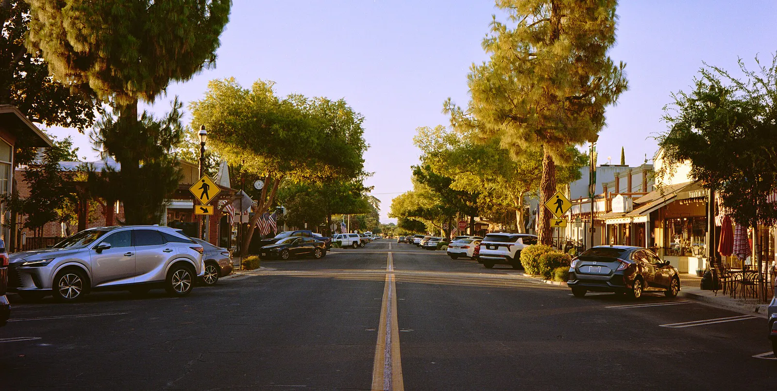
Old Town Clovis
Best for
Walkable dining, vintage retail, street festivals, historic markers
 AdventriaLocalOpen App
Central Valley Municipal Planning Guide
Trying to decide what to do in Clovis? Adventria helps you cut through the options and choose a good-enough plan without endless scrolling. Whether you are timing trail rides along the Sierra foothills, planning date nights in Old Town, or navigating summer heat and fare-free transit routes, this guide delivers practical, neighborhood-level decisions for Clovis residents and visitors.
The local decision problem
Navigating daily activities, recreation, transit options, and seasonal planning friction across Clovis, California.
That is where Adventria comes in. Adventria helps narrow the options in Clovis around practical factors like location, distance, budget, vibe, who you are with, and the kind of experience you actually want, so research can turn into a decision.
Let Adventria narrow the optionsPick the right part of town
Different parts of Clovis work for different kinds of plans. Start with the experience you want, then narrow the map.
Best for
Walkable dining, vintage retail, street festivals, historic markers
Best for
Master-planned residential living, community parks, walking trails
Best for
Modern family housing, interconnected greenbelts, school proximity
Best for
Luxury semi-custom homes, foothill access, trail staging
Best for
Unincorporated mid-century housing, large lots, airport proximity
Best for
Suburban neighborhoods, athletic events, trail connections
This is a quick starting point. The full guide covers 7 local neighborhoods and districts in Clovis.
Eat & drink
When the decision is less about what to do and more about where to eat or grab a drink, start here. These local cues narrow the food and drink decision without turning dinner or a night out into another hour of comparison.
For places to eat in Clovis, start with Old Town Clovis or Shaw Avenue Commercial Corridor / Sierra Vista depending on the kind of stop you want. Start with Old Town Clovis for walkable dining, vintage retail, street festivals, historic markers. The historic city core centered around Pollasky and Clovis Avenues, defined by brick storefronts, Western aesthetic touches, independent cafes, and antique stores. Shaw Avenue Commercial Corridor / Sierra Vista is another area to consider. The commercial retail spine anchored by Sierra Vista Mall, housing indoor entertainment complexes, big-box shopping centers, and national restaurant options.
Reserve a fine dining table at Trelio Food & Wine on Clovis Avenue for farm-to-table seasonal dishes, followed by an evening walk beneath the street lights on Pollasky Avenue or an outdoor craft beer at Out of the Barrel Taproom.
Still comparing options? Adventria can narrow the choice around budget, distance, vibe, and who you are with.
Decide with AdventriaPlan by situation
Start with the kind of plan you are actually trying to make. These city-specific ideas narrow the choice around who you are with, what you want to spend, the weather, and the kind of outing you want.
In summer, visit Wild Water Adventure Park on East Shaw Avenue for wave pools and water slides. For year-round indoor recreation, visit K1 Speed for electric kart racing or No Surrender Adventure Park inside Sierra Vista Mall.
When summer highs top 100°F or winter rain hits, move indoors to Sierra Vista Cinemas 16, visit the indoor karting track at K1 Speed, or tour local exhibits at the Clovis Big Dry Creek Museum and Community Heritage Center.
Ride the entire Clovis Transit Stageline bus system for $0 fare, explore interactive military displays at the Community Heritage Center, walk the Dry Creek Trail network, or attend seasonal street events without admission fees.
Enjoy a morning espresso at On the Edge Coffeehouse or Rodeo Coffee Co., take a solo bike ride on the 8-mile paved Old Town Trail, or stroll through the Mediterranean displays at the Clovis Botanical Garden.
Book group karting packages at K1 Speed, participate in the biannual Clovis Taco & Taps Trail shuttle crawl, or gather at Crow & Wolf Brewing Co. on Spruce Avenue for spacious indoor/outdoor seating and food truck dining.
For an outdoor plan from Clovis, compare trails, state parks, national parks within trip range, and scenic drives. Options in the current city guide include Wassama Round House State Historic Park and Colonel Allensworth State Historic Park.
For a day trip from Clovis, compare Cambria and Salinas. More options are listed in the trip section below.
Outdoors nearby
Use these nearby outdoor options when the plan calls for a trail, protected landscape, park, or drive instead of another indoor stop. Proximity here is geographic, not a promise about driving time.
Get out of town
When staying in town is not the answer, these nearby destinations give you a smaller starting set for a day trip, overnight escape, or weekend away.
Destination relationships are screened geographically. Straight-line proximity is not presented as road mileage or estimated travel time.
Local landmarks & attractions
These notable destinations offer a starting point when you want something specific to see, visit, or build into a day around Clovis. Distances are approximate from the city area.
zoo in California, United States
historic house museum in California , United States
park in Fresno, California
arena in California, United States
movie theater in Fresno, California, United States
tourist attraction in California, United States
casino in Auberry, California
multi-purpose arena in Fresno, California
Notable places are selected from structured public destination data and ranked for relevance, prominence, proximity, and variety.
Local decision signals
A useful local recommendation depends on how the city actually works. These conditions affect where to go, what to do, and whether a plan makes sense right now.
Clovis Transit Stageline fixed routes and Round Up paratransit run completely fare-free across the city through Measure C funding, though buses do not operate on Sundays.
Positioned along Highway 168 directly east of Fresno, Clovis functions as the primary staging area for Central Valley transit into the Sierra Nevada foothill and mountain corridors.
More than 25 miles of paved, vehicle-separated trails link central districts, including the 8-mile Clovis Old Town Trail and its connection to Fresno's Sugar Pine Trail.
July and August temperatures frequently average between 93°F and 99°F with peaks over 100°F, forcing midday outdoor recreation into climate-controlled indoor venues.
Ground-layer radiation fog between November and February can reduce highway visibility below 200 feet, occasionally triggering CUSD foggy day transportation schedules.
Downtown vehicle access features complimentary public parking lots along Woodworth Avenue, behind Tarpey Depot, and in designated alley lots off Clovis Avenue.
Pollasky Avenue closes between 3rd and 7th Streets for seasonal Friday Night Farmers Markets, while late April rodeo events shift traffic across Bullard and Clovis Avenues.
Neighborhood context
Neighborhoods are not interchangeable. Each area offers a different balance of atmosphere, transportation, food, nightlife, activities, and planning friction.
Best for: Walkable dining, vintage retail, street festivals, historic markers
The historic city core centered around Pollasky and Clovis Avenues, defined by brick storefronts, Western aesthetic touches, independent cafes, and antique stores.
Best for: Master-planned residential living, community parks, walking trails
A northeast master-planned district built around a central town green, craftsman-style homes, tree-lined walking loops, and Reagan Elementary School.
Best for: Modern family housing, interconnected greenbelts, school proximity
A rapidly developing urban expansion zone in Southeast Clovis structured around neighborhood greenbelt paseos and the Clovis East Educational Center.
Best for: Luxury semi-custom homes, foothill access, trail staging
An expansion corridor north of Shepherd Avenue offering semi-custom residential communities against a foothill transition landscape near the Dry Creek Trailhead.
Best for: Unincorporated mid-century housing, large lots, airport proximity
A quiet county island enclave near Clovis and Ashlan Avenues known for mid-century single-family ranch homes, mature shade trees, and no HOA restrictions.
Best for: Suburban neighborhoods, athletic events, trail connections
An established residential area surrounding Willow and Teague Avenues, marked by manicured subdivisions and direct links to the Sugar Pine Trail network.
Best for: Retail shopping, indoor entertainment, multiplex movies
The commercial retail spine anchored by Sierra Vista Mall, housing indoor entertainment complexes, big-box shopping centers, and national restaurant options.
Explore your options
Explore key historic centers, water-wise botanical displays, and entertainment hubs across Clovis.
Situated in the historic 1912 First State Bank building in the heart of Old Town, this venue preserves agricultural, pioneer, and municipal artifacts.
A 3-acre water-wise demonstration garden featuring Mediterranean and California-native plants, adjacent to a major municipal park facility.
A modern 5,000-square-foot facility operated by the Clovis Veterans Memorial District showcasing local veteran history and community exhibits.
The main commercial and indoor recreation hub featuring dining options, retail stores, and major entertainment venues.
Practical local guidance
Adjust your activity timing based on San Joaquin Valley climate windows and major community calendar events.
A simpler way to decide
Follow these steps to navigate the city's paved Class I trail system cleanly from south to north.
Park your vehicle at the free Tarpey Depot lot (4th Street & Clovis Avenue) or board a fare-free Clovis Transit Stageline bus equipped with front bike racks.
Head north along the paved San Joaquin Valley Railroad right-of-way, passing through the historic core of Old Town Clovis.
Near Fire Station 5 at Herndon and Villa Avenues, veer onto the shaded Dry Creek Trail segment.
Take a short rest at Clovis Avenue and Alluvial Avenue to explore the water-wise plant gardens or access public restrooms.
Finish your ride at Shepherd and Sunnyside Avenues, utilizing the dedicated 3-acre rest facility's bicycle repair station, shaded seating walls, and water fountains.
Common local questions
These are common situations people face when trying to decide where to eat, what to do, where to get drinks, or how to spend their time in Clovis.
Clovis planning questions
Practical answers for people deciding where to eat, what to do, where to go, or how to make plans in Clovis.
No. All Clovis Transit Stageline fixed routes and Round Up paratransit services are completely fare-free for all passengers, funded by local Measure C sales tax dollars.
Free public parking is available in street spaces along Pollasky and Woodworth Avenues, in public lots on Woodworth (300 and 400 blocks), in the public lot behind Tarpey Depot at 4th and Clovis, and in designated alleyway lots.
The Saturday Morning Farmers Market operates year-round on Pollasky Avenue. The Friday Night Farmers Market runs seasonally from May through September along Pollasky Avenue between 3rd and 7th Streets.
From November through February, dense Tule fog can drop roadway visibility under 200 feet along Highway 168 and arterial roads, leading to delayed school bus schedules and requiring slow, cautious driving.
Yes. All Clovis Transit Stageline fixed-route buses come equipped with front-mounted exterior bike racks, allowing riders to combine transit with cycling along the city's trail network.
Rodeo week brings heavy downtown congestion and street closures near 4th/5th Streets, Bullard Avenue, and Clovis Avenue. Shuttle services from Sierra Vista Mall provide convenient transport directly to the Rodeo Grounds.
Both the Clovis Big Dry Creek Museum on Pollasky Avenue and the Community Heritage Center on Veterans Parkway offer free admission to the public, though donations are welcomed.
Because summer temperatures frequently rise above 100°F during July and August, outdoor exercise on the Clovis Old Town Trail or Dry Creek Trail is best planned for early morning hours before 10:00 AM.
Sierra Vista Mall on Shaw Avenue houses several indoor options, including Sierra Vista Cinemas 16, K1 Speed indoor electric go-karting, and No Surrender Adventure Park.
Source transparency
Official and locally relevant sources used to verify the practical information presented in this Clovis decision guide.
Clovis decision engine
Tell Adventria what kind of experience you want, set your practical limits, and turn the options in Clovis into one workable plan.
Choose a Clovis Plan