Stateline / Heavenly Village
Best for
Nightlife, skiing access, high walkability, and direct microtransit connections.
 AdventriaLocalOpen App
South Lake Tahoe Local Planning Guide
Trying to decide what to do in South Lake Tahoe? Adventria helps you cut through the options and choose a good-enough plan without endless scrolling. Whether you are navigating winter snowplow parking bans, managing afternoon wind shifts on the water, or avoiding highway bottlenecks at The Y, making practical choices in South Lake Tahoe requires local awareness. This guide outlines how to move, dine, and explore across California and Nevada state lines without logistical friction.
The local decision problem
Navigating seasonal logistics, travel bottlenecks, parking rules, and microclimate timing to plan daily activities in South Lake Tahoe.
That is where Adventria comes in. Adventria helps narrow the options in South Lake Tahoe around practical factors like location, distance, budget, vibe, who you are with, and the kind of experience you actually want, so research can turn into a decision.
Let Adventria narrow the optionsPick the right part of town
Different parts of South Lake Tahoe work for different kinds of plans. Start with the experience you want, then narrow the map.
Best for
Nightlife, skiing access, high walkability, and direct microtransit connections.
Best for
Waterfront dining, boat charters, and central corridor access.
Best for
Historic central living, public beach access, and civic cultural stops.
Best for
Pine forest scenery, community park recreation, and local golf.
Best for
Private dock access, canal boating, and luxury vacation stays.
Best for
Quiet residential streets, bike path access, and beach proximity.
This is a quick starting point. The full guide covers 8 local neighborhoods and districts in South Lake Tahoe.
Eat & drink
Trying to decide where to eat in South Lake Tahoe? Start with the local dining context below and narrow the decision around the kind of meal or experience you actually want.
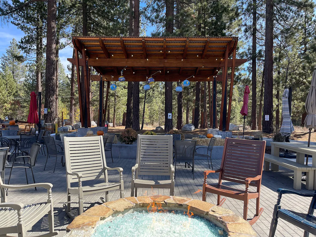
Head to the pedestrian plaza at Heavenly Village, where casual eateries offer outdoor firepits and acoustic music without advance table bookings. Alternatively, visit craft brewery taprooms around The Y or Sierra Tract, such as South Lake Brewing Company or Cold Water Brewery & Grill, for relaxed walk-in dining.
Still comparing options? Adventria can narrow the choice around budget, distance, vibe, and who you are with.
Decide with AdventriaPlan by situation
Start with the kind of plan you are actually trying to make. These city-specific ideas narrow the choice around who you are with, what you want to spend, the weather, and the kind of outing you want.
For an outdoor plan from South Lake Tahoe, compare trails, state parks, national parks within trip range, and scenic drives. Options in the current city guide include Washoe Meadows State Park and Emerald Bay State Park.
Take the flat, vehicle-free Pope-Baldwin Bike Path to Camp Richardson for ice cream, then explore the underground Stream Profile Chamber at the Taylor Creek Visitor Center. For shallow swim areas and playground amenities, plan a stop at Regan Beach or El Dorado Beach.
Explore local history at the Lake Tahoe Historical Society Museum on Lake Tahoe Boulevard, browse rotating regional exhibits at the Haldan Art Gallery on the Lake Tahoe Community College campus, or check the schedule for performing arts at the Duke Theatre. For indoor events, review showtimes at the Tahoe Blue Event Center or visit the Stateline resort centers.
Park or walk into Van Sickle Bi-State Park right behind Stateline for free pedestrian entry to granite boulder trails and lake views. Continue along the interpretive nature paths at the Taylor Creek Visitor Center and Historic Tallac Site, or attend seasonal outdoor events like the Live at Lakeview concert series at Lakeview Commons.
Start with a morning walk around the historic grounds of the Tallac Historic Site, followed by an easy hike up the Van Sickle Trail to view the lake skyline. Finish the evening with lakeside dining or drinks along Ski Run Marina, or reserve seats for an event at the Tahoe Blue Event Center.
Rent a bike and ride the paved Pope-Baldwin Bike Path out to Baldwin Beach, or hit forested single-track networks via the Powerline Trail. Later, relax with a book or regional craft beer at a local brewery taproom near Harrison Avenue or Sierra Tract.
Book group tickets for a minor league hockey game or concert at the Tahoe Blue Event Center, arrange a private boat charter out of Ski Run Marina or Camp Richardson during the day, or reserve an outdoor dining area along Heavenly Village.
Outdoors nearby
Use these nearby outdoor options when the plan calls for a trail, protected landscape, park, or drive instead of another indoor stop. Proximity here is geographic, not a promise about driving time.
Get out of town
When staying in town is not the answer, these nearby destinations give you a smaller starting set for a day trip, overnight escape, or weekend away.
Destination relationships are screened geographically. Straight-line proximity is not presented as road mileage or estimated travel time.
Local landmarks & attractions
These notable destinations offer a starting point when you want something specific to see, visit, or build into a day around South Lake Tahoe. Distances are approximate from the city area.
state capitol building of the U.S. state of Nevada
museum in Carson City, Nevada
casino hotel in Nevada, United States
place in Nevada listed on National Register of Historic Places
casino hotel in Nevada, United States
museum in Carson City, Nevada
Notable places are selected from structured public destination data and ranked for relevance, prominence, proximity, and variety.
Local decision signals
A useful local recommendation depends on how the city actually works. These conditions affect where to go, what to do, and whether a plan makes sense right now.
Afternoon thermal winds regular building after midday create high water chop on Lake Tahoe. Non-motorized watercraft operations should be scheduled for early morning hours.
Between November 1 and May 1, on-street parking is prohibited citywide and across El Dorado County public roads whenever snow removal is active.
Crossing the state line at Stateline shifts municipal governance, moving from California city codes to Nevada resort zones where 24/7 casino gaming operates.
Parking lots at US Forest Service beaches and Emerald Bay State Park often reach capacity during summer morning hours, making microtransit or bike path travel practical alternatives.
Drivers frequently utilize Pioneer Trail as a parallel forested route to bypass heavy resort transit along US Highway 50 between Meyers and Stateline.
Displayed permits are mandatory on designated residential streets near Heavenly base zones from November 1 to May 1 to prevent resort overflow parking.
Neighborhood context
Neighborhoods are not interchangeable. Each area offers a different balance of atmosphere, transportation, food, nightlife, activities, and planning friction.
Best for: Nightlife, skiing access, high walkability, and direct microtransit connections.
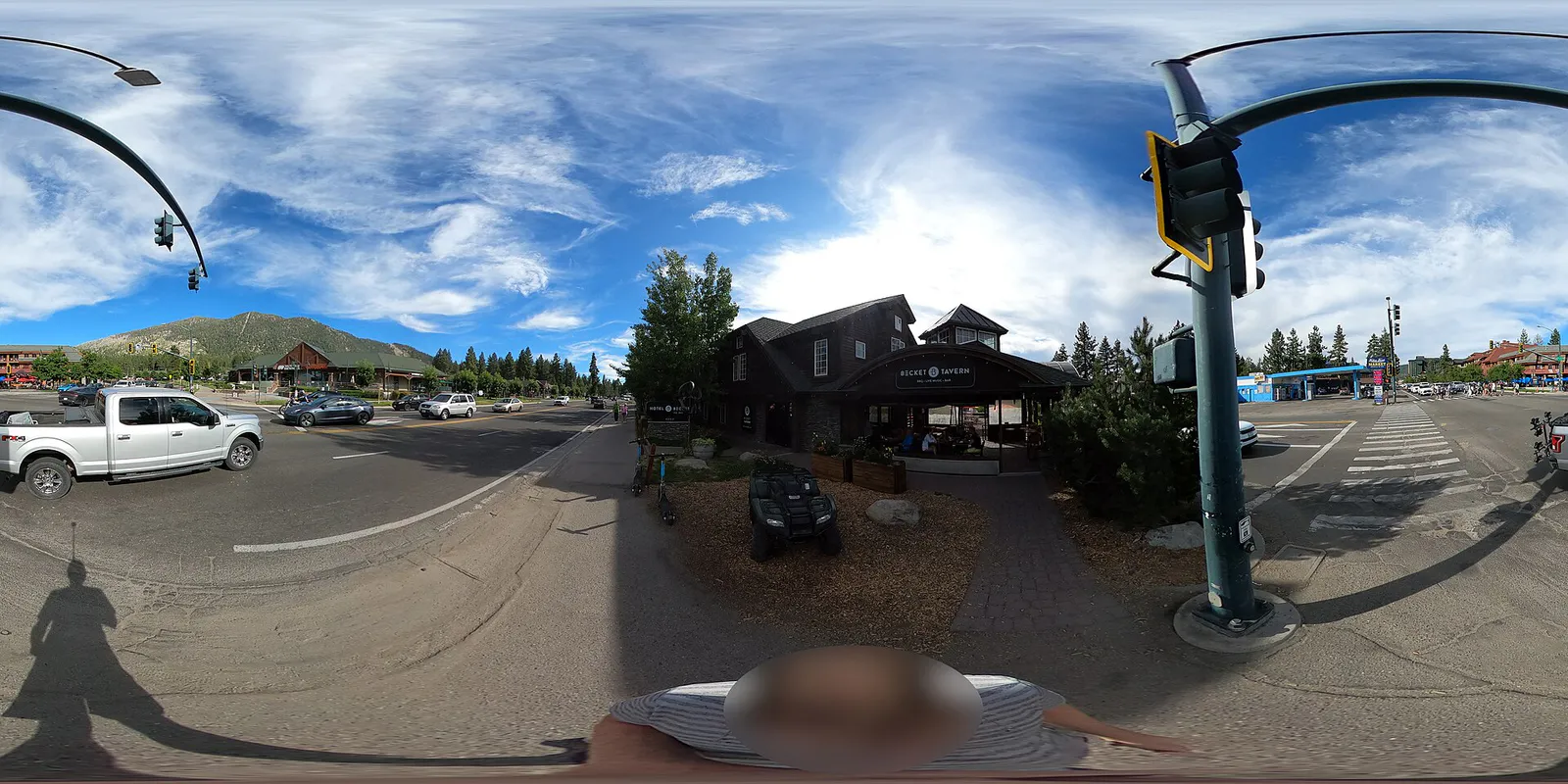
Located on the California–Nevada border, this district functions as the dense resort and pedestrian core, featuring the Heavenly Mountain Resort Gondola, retail plazas, dining, and adjacent Nevada casinos.
Best for: Waterfront dining, boat charters, and central corridor access.
Stretching from US Highway 50 north to Ski Run Marina and south toward Heavenly's California Base Lodge, this area offers lakefront dining, water sport rentals, and lodging.
Best for: Historic central living, public beach access, and civic cultural stops.
One of South Lake Tahoe's historic residential areas, Al Tahoe borders Lakeview Commons, El Dorado Beach, Regan Beach, and the Trout Creek meadow area.
Best for: Pine forest scenery, community park recreation, and local golf.
A classic Tahoe neighborhood south of US 50 featuring historic cabins, pine groves, the municipal Bijou Golf Course, and Bijou Community Park.
Best for: Private dock access, canal boating, and luxury vacation stays.
A master-planned waterfront community constructed along engineered waterways where most residences include private deep-water docks leading into Lake Tahoe.
Best for: Quiet residential streets, bike path access, and beach proximity.
Situated near The Y on the city's western side, these wooded neighborhoods offer direct pedal access to the Pope-Baldwin Bike Path, Pope Beach, and Camp Richardson.
Best for: Retail supply runs, craft breweries, and transit connections.
The commercial junction of US 50 and SR 89, home to grocery hubs, outdoor gear shops, craft breweries, and the South Y Transit Center.
Best for: Gateway mountain access, trailheads, and rural tranquility.
Located south of the city limits along US 50 and SR 89 in unincorporated El Dorado County, offering alpine trailheads and golf courses.
South Lake Tahoe local guide
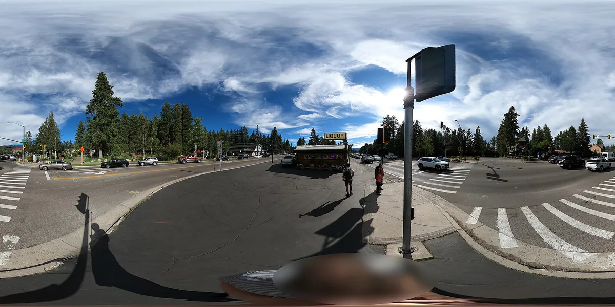
Operating smoothly in South Lake Tahoe requires adapting to alpine elevation, shifting weather patterns, and mountain corridor geography. Sitting at 6,237 feet above sea level, the city stretches along US Highway 50 (Lake Tahoe Boulevard), anchored by the commercial hub at The Y on the west and the Stateline casino corridor on the east. During peak summer and winter periods, heavy traffic often forms at major intersections along Highway 50 and State Route 89. Residents regularly use Pioneer Trail—a scenic route running through pine forests—to move between Meyers and Stateline while bypassing mid-town congestion.
Getting around town without a personal vehicle has become increasingly simple thanks to connected transit networks. The Lake Link microtransit service provides free, app-based on-demand shuttles across key districts including Stateline, Al Tahoe, Tahoe Keys, and Gardner Mountain. For longer trips along Highway 50, Tahoe Transportation District Route 50 links the South Y Transit Center directly to the Stateline Transit Center. During summer months, dedicated shuttles connect passengers to Emerald Bay, helping travelers avoid narrow roadside parking challenges along SR 89.
Seasonal factors dictate outdoor plans. Winter brings heavy snowfall across Sierra mountain passes like Echo Summit, requiring tire chains or all-wheel drive and triggering strict municipal street parking bans so plows can clear roads. In summer, water safety depends heavily on morning timing: thermal 'Zephyr' winds regularly pick up after midday, turning calm morning lake waters into choppy swells that can pose risks for small watercraft, kayaks, and paddleboards.
Explore your options
Select your daily itinerary based on district walkability, transportation access, and seasonal conditions.
Focus on flat, protected trail corridors and public parks equipped with family amenities.
Concentrate on pedestrian-friendly resort zones straddling the California–Nevada border.
Explore regional heritage sites, historic architecture, and local arts venues.
Experience the relaxed taproom circuit concentrated around Sierra Tract and The Y.
Practical local guidance
Keep these practical rules in mind to avoid municipal citations, traffic delays, and unexpected route closures.
A simpler way to decide
Follow this step-by-step approach to navigate parking lot capacity and afternoon weather shifts.
Launch kayaks, paddleboards, or small craft early in the morning when water surfaces are typically calmest before afternoon winds develop.
Aim to reach popular beach entry points like Pope, Baldwin, or Emerald Bay early in the morning, as lots frequently fill by mid-morning on summer weekends.
If beach parking lots reach capacity, park near Gardner Mountain or The Y and access the shoreline via the Pope-Baldwin Bike Path or Lake Link shuttle.
When lake chop increases after midday, move inland to shaded forest trails like the Powerline Trail or Van Sickle Bi-State Park.
Arrange return trips via TTD Route 50 or Lake Link microtransit before late evening service windows end.
Common local questions
These are common situations people face when trying to decide where to eat, what to do, where to get drinks, or how to spend their time in South Lake Tahoe.
South Lake Tahoe planning questions
Practical answers for people deciding where to eat, what to do, where to go, or how to make plans in South Lake Tahoe.
Lake Link is a free, app-based on-demand shuttle operating ADA-accessible vans equipped with bike racks. It serves districts including Stateline, Al Tahoe, Tahoe Keys, Gardner Mountain, and Zephyr Cove year-round.
Visitors can park in the city-operated Bellamy Parking Garage located at 1 Bellamy Court, adjacent to Heavenly Village. Standard daytime rates apply per 20-minute interval up to a daily maximum, with reduced rates offered in the evening.
On-street parking is strictly prohibited on city and county roads from November 1 to May 1 whenever snow removal operations are active. Vehicles blocking plows are subject to immediate fines and towing.
During summer months, the Tahoe Transportation District operates a seasonal Emerald Bay Shuttle daily from the South Y Transit Center directly to Emerald Bay State Park, eliminating the need to search for roadside parking along SR 89.
You can visit Van Sickle Bi-State Park with free pedestrian access year-round, tour the Haldan Art Gallery on the LTCC campus, or visit the Lake Tahoe Historical Society Museum (where donations are accepted).
Thermal 'Zephyr' winds regularly build after midday, generating chop and swells on Lake Tahoe that make paddleboarding and kayaking challenging or unsafe for inexperienced paddlers.
Pioneer Trail is a scenic bypass road running parallel to US Highway 50 through pine forests, allowing drivers to skip commercial stoplights and congestion between Meyers and Stateline.
Reaching Vikingsholm in Emerald Bay requires walking down a steep 1-mile dirt trail that drops roughly 500 vertical feet. Visitors must hike back up the same steep trail to return to the parking lot.
Indoor arena events, concerts, and minor league ice hockey take place at the 5,200-seat Tahoe Blue Event Center in Stateline, while outdoor summer concerts take place at Harveys Outdoor Arena.
Source transparency
Official and locally relevant sources used to verify the practical information presented in this South Lake Tahoe decision guide.
South Lake Tahoe decision engine
Tell Adventria what kind of experience you want, set your practical limits, and turn the options in South Lake Tahoe into one workable plan.
Choose a South Lake Tahoe Plan