Downtown (Grand Avenue Corridor)
Best for
Walkable dining, local bakeries, and historic streetscapes
 AdventriaLocalOpen App
Peninsula Outing & Transit Planning
Trying to decide what to do in South San Francisco? Adventria helps you cut through the options and choose a good-enough plan without endless scrolling. Planning an outing in South San Francisco requires navigating unique transit barriers, microclimates, and shift-dependent schedules. From historic taquerias on Grand Avenue to windy coastal trails at Oyster Point, this guide helps you structure seamless days across the city.
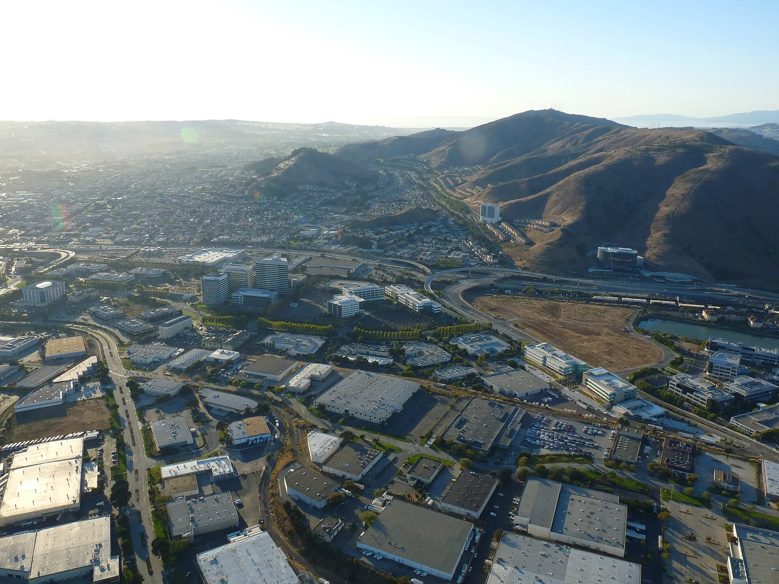
The local decision problem
How to efficiently plan dining, transit, and weather-sensitive outdoor activities across South San Francisco's residential grid, mountain trails, and isolated biotech waterfront.
That is where Adventria comes in. Adventria helps narrow the options in South San Francisco around practical factors like location, distance, budget, vibe, who you are with, and the kind of experience you actually want, so research can turn into a decision.
Let Adventria narrow the optionsPick the right part of town
Different parts of South San Francisco work for different kinds of plans. Start with the experience you want, then narrow the map.
Best for
Walkable dining, local bakeries, and historic streetscapes
Best for
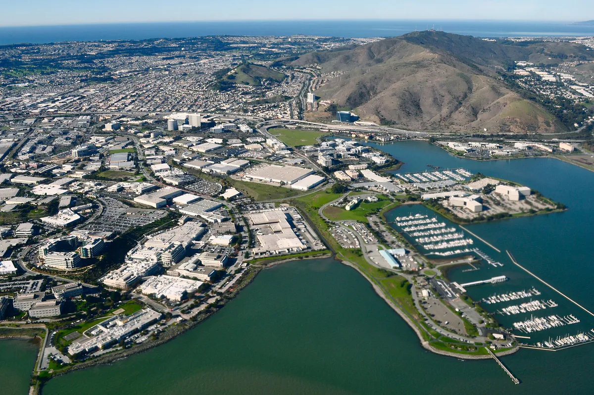
Waterfront recreation, bay views, and weekday commuter ferry transit
Best for
Family outings, aquatic sports, and recreation paths
Best for
Asian dining, grocery runs, and quick I-280 access
Best for
Commercial plazas, BART transit, and civic services
Best for
Industrial services and transit-oriented redevelopment
This is a quick starting point. The full guide covers 8 local neighborhoods and districts in South San Francisco.
Eat & drink
When the decision is less about what to do and more about where to eat or grab a drink, start here. These local cues narrow the food and drink decision without turning dinner or a night out into another hour of comparison.
Head to the Grand Avenue Corridor downtown for a concentration of long-standing Mexican taquerias like Taqueria El Farolito and Taqueria La Morena, or stop by La Torta Sabrosa for sandwiches. For regional Asian dining, head west to the Westborough Shopping Center off Westborough Boulevard.
South San Francisco's evening scene is centered on informal dining. Enjoy a late dinner along Grand Avenue at a local taqueria or neighborhood bar. Keep in mind that late-night entertainment is limited, so confirm operating hours before heading out.
Still comparing options? Adventria can narrow the choice around budget, distance, vibe, and who you are with.
Decide with AdventriaPlan by situation
Start with the kind of plan you are actually trying to make. These city-specific ideas narrow the choice around who you are with, what you want to spend, the weather, and the kind of outing you want.
For an outdoor plan from South San Francisco, compare trails, state parks, national parks within trip range, and scenic drives. Options in the current city guide include Montara State Beach and Gray Whale Cove State Beach.
For a short escape from South San Francisco, compare Sonoma and Santa Cruz. More options are listed in the trip section below.
Take a late-afternoon stroll along the Oyster Point Marina pier, watching boats and coastal birds against the backdrop of the bay. Follow your walk with a relaxed dinner at a waterfront establishment like Dominic's at Oyster Point or head downtown for casual Mexican fare.
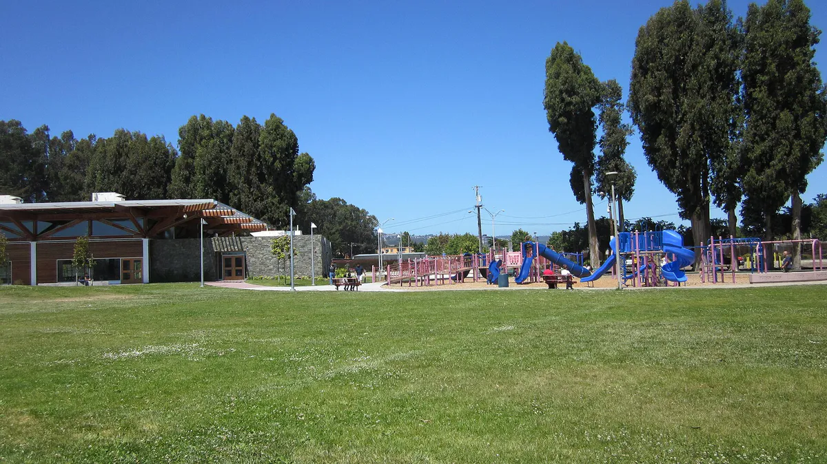
Take kids to Orange Memorial Park to utilize the playgrounds and family splash areas at the Aquatic Center. Alternatively, explore the STEAM Makerspace and youth programs at the 901 Civic Campus Way library branch.
Visit the 83,000-square-foot facility at 901 Civic Campus Way to explore community exhibits and read in comfortable indoor lounges. Alternatively, schedule indoor lap swimming at the Orange Memorial Park Aquatic Center or check out local history exhibits at the Plymire-Schwarz House on open Saturdays.
Explore Sign Hill Park's unpaved trails, bike the Bay Trail, watch planes at Point San Bruno Park, or drop into free public programs at the Grand Avenue or Civic Campus libraries—all without admission fees.
Bring a book or laptop to the modern Library | Parks and Recreation Center at 901 Civic Campus Way. Later, jog or ride a bike along the continuous paved San Francisco Bay Trail near Oyster Point or walk the Centennial Way Trail.
Outdoors nearby
Use these nearby outdoor options when the plan calls for a trail, protected landscape, park, or drive instead of another indoor stop. Proximity here is geographic, not a promise about driving time.
Get out of town
When staying in town is not the answer, these nearby destinations give you a smaller starting set for a day trip, overnight escape, or weekend away.
Destination relationships are screened geographically. Straight-line proximity is not presented as road mileage or estimated travel time.
Local landmarks & attractions
These notable destinations offer a starting point when you want something specific to see, visit, or build into a day around South San Francisco. Distances are approximate from the city area.
modern art museum in San Francisco, California, USA
zoo in San Francisco
indoor arena located in Daly City, California, USA
indoor arena in San Francisco, California, USA
natural history museum in San Francisco
historic district in San Francisco, California, United States
botanical garden
theme park in Santa Clara, California
Notable places are selected from structured public destination data and ranked for relevance, prominence, proximity, and variety.
Local decision signals
A useful local recommendation depends on how the city actually works. These conditions affect where to go, what to do, and whether a plan makes sense right now.
The East Grand Avenue and Oyster Point Boulevard overpasses experience heavy congestion during shift changes from 7:30 AM to 9:00 AM and 4:30 PM to 6:30 PM.
Cool fog and late-afternoon ocean winds funnel through coastal range gaps, making the eastern waterfront significantly chillier than inland residential areas.
Passenger ferry service at Oyster Point Marina operates exclusively on weekdays for commuters, with no service on weekends.
The historic downtown grid centered on Grand Avenue offers dense, walkable access to Mexican taquerias, bakeries, and civic spots.
The biotech employment district east of Highway 101 is active on weekdays but exceptionally quiet on weekends.
A paved multi-use linear park follows the underground BART right-of-way, connecting transit stations through Orange Memorial Park.
Neighborhood context
Neighborhoods are not interchangeable. Each area offers a different balance of atmosphere, transportation, food, nightlife, activities, and planning friction.
Best for: Walkable dining, local bakeries, and historic streetscapes
The city's historic core centered along Grand Avenue, packed with long-standing Mexican taquerias, bakeries, Italian spots, and civic venues like the Grand Avenue Library.
Best for: Waterfront recreation, bay views, and weekday commuter ferry transit
A major life sciences district housing biotech campuses, Oyster Point Marina, the SF Bay Ferry terminal, and scenic multi-use paths along the bay.
Best for: Family outings, aquatic sports, and recreation paths
A central residential neighborhood anchored by Orange Memorial Park, featuring sports fields, a modern all-electric aquatic center, and access to the Centennial Way Trail.
Best for: Asian dining, grocery runs, and quick I-280 access
A suburban hillside neighborhood on the city's western edge, known for multi-family homes and the Westborough Shopping Center, a primary hub for regional Asian cuisine.
Best for: Commercial plazas, BART transit, and civic services
The main north-south commercial artery linking multi-modal transit at the South San Francisco BART station to shopping centers and the modern 901 Civic Campus Way facility.
Best for: Industrial services and transit-oriented redevelopment
Located south of Downtown and west of Highway 101, this light-industrial sector is transitioning into a mixed-use neighborhood near Caltrain and BART under a long-term specific plan.
Best for: Hillside hiking, panoramic Peninsula views, and quiet living
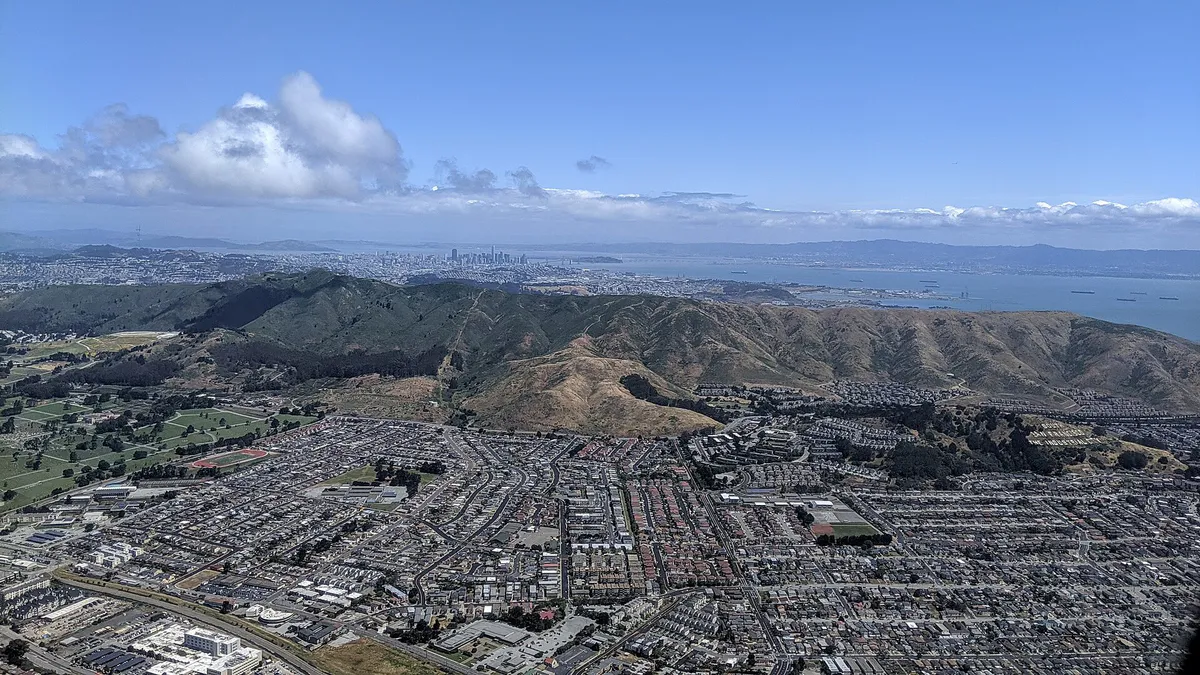
Elevated residential areas along the slopes of Sign Hill offering access to grassland hiking trails beneath the iconic hillside letters.
Best for: Quiet suburban streets and local park visits
A southwestern residential sub-area tucked between I-280 and El Camino Real, anchored by neighborhood parks and local schools.
Explore your options
Match your group's goals to the right district and transit setup in South San Francisco.
Position yourself near major transit hubs to move easily across the Peninsula.
Capitalize on open-space trails and elevated views across the Bay Area.
Focus on central civic amenities and community recreation facilities.
Practical local guidance
Essential operational details to help you avoid travel friction and local planning missteps.
A simpler way to decide
Follow these steps to coordinate a smooth trip to the Oyster Point waterfront without getting stuck in biotech commuter traffic.
Plan weekday trips if you intend to arrive via the SF Bay Ferry or use employer shuttles. Schedule weekend visits if you prefer quieter streets and easier waterfront parking.
Avoid crossing Highway 101 overpasses at East Grand Avenue or Oyster Point Boulevard during peak shift changes (7:30 AM–9:00 AM and 4:30 PM–6:30 PM).
Bring thermal layers and windbreakers regardless of inland sunshine, as coastal wind along the Bay Trail accelerates in the late afternoon.
Head to Oyster Point Marina for pier walking and dining, or drive slightly north to Point San Bruno Park for direct plane-watching along SFO approach paths.
Park in designated day-use stalls near the ferry terminal or marina, taking note that overnight parking is prohibited in ferry terminal lots.
Common local questions
These are common situations people face when trying to decide where to eat, what to do, where to get drinks, or how to spend their time in South San Francisco.
South San Francisco planning questions
Practical answers for people deciding where to eat, what to do, where to go, or how to make plans in South San Francisco.
Highway 101 divides the city into western residential neighborhoods and the eastern biotech waterfront. Crossing overpasses like East Grand Avenue during morning and evening shift changes can cause significant travel delays due to heavy commuter traffic.
No. San Francisco Bay Ferry operations out of the South San Francisco Ferry Terminal at Oyster Point run exclusively on weekdays for commuters connecting to Oakland and Alameda.
The South San Francisco BART station provides direct rail connections to San Francisco International Airport (SFO). SamTrans bus routes also serve corridors along El Camino Real.
Sign Hill Park offers unpaved hiking trails (such as the Iris Hill Trail and Ridge Trail) leading to panoramic views. For flat, paved routes, use the Centennial Way Trail or the San Francisco Bay Trail near Oyster Point.
The 83,000-square-foot Library | Parks and Recreation Center at 901 Civic Campus Way offers indoor lounges, community rooms, and a STEAM Makerspace. The Orange Memorial Park Aquatic Center also features an indoor recreation and therapy pool.
Tree planting on Sign Hill is intentionally restricted to protect native grassland habitats and to preserve the clear visibility of the historic 1920s concrete letters.
The Historical Society Museum at 80 Chestnut Avenue and the restored 1905 Plymire-Schwarz House at 519 Grand Avenue are both open to visitors on Saturdays from 1:00 PM to 4:00 PM.
The City operates the free South City Shuttle (Blue and Green lines) connecting residential neighborhoods to downtown shopping. Additionally, Commute.org provides free last-mile shuttles linking BART, Caltrain, and Ferry stations to East of 101 employment sites.
Source transparency
Official and locally relevant sources used to verify the practical information presented in this South San Francisco decision guide.
South San Francisco decision engine
Tell Adventria what kind of experience you want, set your practical limits, and turn the options in South San Francisco into one workable plan.
Choose a South San Francisco Plan