The Bridge District
Best for
Riverfront urban living, stadium sports, outdoor beer gardens, and French wine bar dining.
 AdventriaLocalOpen App
West Sacramento Local Decision Framework
Trying to decide what to do in West Sacramento? Adventria helps you cut through the options and choose a good-enough plan without endless scrolling. From professional baseball games in the Bridge District to quiet trail loops along the Barge Canal and morning coffee under the trees in Broderick, West Sacramento offers distinct experiences separated by major waterways and transport bottlenecks. Use this local decision guide to navigate bridge lifts, heat timing, Mello-Roos zones, and event-day logistics.
The local decision problem
Navigating West Sacramento's distinct riverfront districts, suburban corridors, event traffic, and seasonal delta climate to plan activities, dining, and transit efficiently.
That is where Adventria comes in. Adventria helps narrow the options in West Sacramento around practical factors like location, distance, budget, vibe, who you are with, and the kind of experience you actually want, so research can turn into a decision.
Let Adventria narrow the optionsPick the right part of town
Different parts of West Sacramento work for different kinds of plans. Start with the experience you want, then narrow the map.
Best for
Riverfront urban living, stadium sports, outdoor beer gardens, and French wine bar dining.
Best for
Historic riverfront walks, garden cafes, and modern housing infill.
Best for
Classic drive-in dining, deep community roots, and historic single-family character.
Best for
Master-planned suburban neighborhoods, spray grounds, and levee trail recreation.
Best for
Civic services, classic diners, local black box theater, and central microtransit routes.
Best for
Craft breweries, winery taprooms, and non-motorized canal boating.
Eat & drink
When the decision is less about what to do and more about where to eat or grab a drink, start here. These local cues narrow the food and drink decision without turning dinner or a night out into another hour of comparison.
Visit Carol's Restaurant on West Capitol Avenue, a family-owned neighborhood institution since 1988 known for classic diner comfort food, hearty breakfasts, and unpretentious service.
Head to the Bridge District to Drake's The Barn, a two-acre open-air riverfront landmark. You can grab wood-fired pizza from Pizza Smith, sip craft beers or cocktails, and sit around fire pits on the lawn while taking in the late-afternoon Delta Breeze.
Still comparing options? Adventria can narrow the choice around budget, distance, vibe, and who you are with.
Decide with AdventriaPlan by situation
Start with the kind of plan you are actually trying to make. These city-specific ideas narrow the choice around who you are with, what you want to spend, the weather, and the kind of outing you want.
Book a ride using the Via app or phone line for Via West Sac, an on-demand microtransit service using Mercedes passenger vans. It provides flat-rate intracity rides ($3.50 regular, $1.75 for seniors 62+ and riders with disabilities) across all local districts.
For an outdoor plan from West Sacramento, compare trails, state parks, national parks within trip range, and scenic drives. Options in the current city guide include Old Sacramento State Historic Park and Leland Stanford Mansion State Historic Park.
For a day trip from West Sacramento, compare South Lake Tahoe and Half Moon Bay. More options are listed in the trip section below.
Grab classic burgers and seasonal fresh peach milkshakes (available starting each July) at Whitey's Jolly Kone on Jefferson Blvd, then head south to Bridgeway Lakes Park in Southport to enjoy the public spray ground and scenic walking paths around the lake.
Head to The BLVD on West Capitol Avenue for indoor bowling, arcade games, and billiards, or check the West Sacramento Community Center schedule for local theater productions at the Black Box Theatre.
Ride or jog along the paved northern section of the Clarksburg Branch Line Trail, then wrap up your trip at Bike Dog Brewing's industrial taproom on Industrial Boulevard for a pint and weekly trivia nights.
Coordinate group ticket packages at Sutter Health Park for River Cats or Athletics games (Saturday nights include fireworks), or rent The Boathouse at Bridgeway Lakes Park for private gatherings accommodating up to 75–100 guests.
Outdoors nearby
Use these nearby outdoor options when the plan calls for a trail, protected landscape, park, or drive instead of another indoor stop. Proximity here is geographic, not a promise about driving time.
Get out of town
When staying in town is not the answer, these nearby destinations give you a smaller starting set for a day trip, overnight escape, or weekend away.
Destination relationships are screened geographically. Straight-line proximity is not presented as road mileage or estimated travel time.
Local landmarks & attractions
These notable destinations offer a starting point when you want something specific to see, visit, or build into a day around West Sacramento. Distances are approximate from the city area.
zoo in the United States
art museum in Sacramento, California
state capitol building of the U.S. state of California
an indoor arena, located in downtown Sacramento, California
association football stadium in Sacramento, California
railroad museum in Sacramento, California
Casino in Placer County, California, United States
arboretum and public garden at University of California, Davis
Notable places are selected from structured public destination data and ranked for relevance, prominence, proximity, and variety.
Local decision signals
A useful local recommendation depends on how the city actually works. These conditions affect where to go, what to do, and whether a plan makes sense right now.
As host stadium for the Triple-A River Cats and Major League Baseball's Athletics, event days dramatically increase traffic along Tower Bridge Gateway and inflate area parking pricing.
Caltrans operates vertical lifts on Tower Bridge (SR-275) for river traffic, halting all vehicular, bike, and foot traffic across the bridge for 10 to 15 minutes per lift.
In late afternoon and early evening, marine air flows inland through the Delta, dropping summer daily high temperatures of 90°F–100°F+ by 10°F to 20°F for comfortable night outdoor dining.
The city's largest park facility is undergoing a $48 million overhaul and is completely closed to the public through summer 2029.
Major winter atmospheric rivers flood the 59,000-acre Yolo Bypass floodway, submerging the Vic Fazio Wildlife Area 6-mile auto tour loop.
Subdivisions in master-planned Southport carry Mello-Roos special assessment taxes on property bills, differing from older central and northern neighborhoods.
Neighborhood context
Neighborhoods are not interchangeable. Each area offers a different balance of atmosphere, transportation, food, nightlife, activities, and planning friction.
Best for: Riverfront urban living, stadium sports, outdoor beer gardens, and French wine bar dining.
A high-density 188-acre waterfront neighborhood along the Sacramento River featuring Sutter Health Park, Drake's The Barn, Franquette, and Mill Street Pier.
Best for: Historic riverfront walks, garden cafes, and modern housing infill.
Located directly north of Tower Bridge along 3rd Street, blending historic 19th-century history with modern infill like Washington Commons and local icons like Tree House Cafe.
Best for: Classic drive-in dining, deep community roots, and historic single-family character.
Historic northern working-class neighborhoods along the river characterized by single-family homes on deep lots, active community networks, and Whitey's Jolly Kone.
Best for: Master-planned suburban neighborhoods, spray grounds, and levee trail recreation.
A large suburban expansion south of the Barge Canal containing Bridgeway Lakes, Stonegate, Newport Estates, Southport Town Center, and Washington Unified schools.
Best for: Civic services, classic diners, local black box theater, and central microtransit routes.
The civic spine along West Capitol Avenue housing City Hall, the Community Center, Black Box Theatre, Carol's Restaurant, Vince's Ristorante, and SCC West Sac Center.
Best for: Craft breweries, winery taprooms, and non-motorized canal boating.
Industrial zone along Seaport and Industrial Boulevards featuring Bike Dog Brewing Company, Baker Family Wines, and public water access to the Barge Canal.
West Sacramento local guide
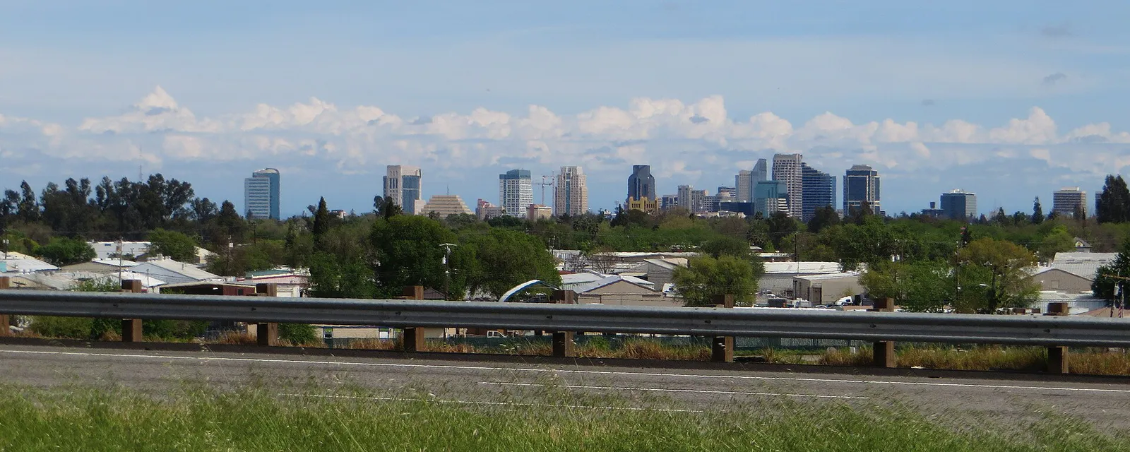
West Sacramento's urban landscape is fundamentally defined by its water boundaries and transport spines. Bounded by the Sacramento River to the north and east, the Yolo Bypass floodway to the west, and the agricultural lands of Clarksburg to the south, the city is divided horizontally by the Deep Water Ship Channel and Barge Canal. Jefferson Boulevard (SR-84) serves as the primary north-south artery bridging the urban waterfront north with the suburban master-planned developments of Southport in the south.
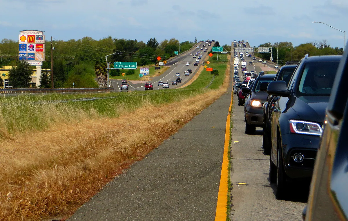
Movement between West Sacramento and Downtown Sacramento requires crossing historic bridges, each with distinct operational characteristics. The SR-275 Tower Bridge links West Capitol Avenue directly to Capitol Mall but is subject to 10-to-15-minute Caltrans vertical lift operations that halt all automobile, bike, and foot traffic. Meanwhile, the historic 1911 double-deck I Street Bridge connects northern Broderick to Sacramento while replacement bridge projects advance. For uninterrupted vehicle traffic, the Pioneer Memorial Bridge on US-50/I-80 provides high-capacity freeway transit, though commute-hour backups frequently form heading eastbound.
For internal circulation, residents and visitors rely heavily on Via West Sac, an on-demand microtransit system providing affordable point-to-point rides in Mercedes passenger vans. Fixed-route regional bus transit is provided by Yolobus, with Route 240 connecting key hubs like Sutter Health Park and West Capitol Avenue to Downtown Sacramento, while Routes 42A/42B offer loops connecting West Sacramento to Davis, Woodland, Downtown Sacramento, and Sacramento International Airport.
Explore your options
Choose your destination based on your preferred atmosphere, active pursuits, or dining style.
The city's high-density urban waterfront district, blending professional sports, modern architecture, and sweeping river views.
A blend of 19th-century history, modern housing infill, and long-standing neighborhood food icons.
Master-planned residential neighborhoods centered around scenic lakes, spray parks, and levee trailheads.
Commercial and light-industrial corridors hosting local craft beverage producers and calm water recreation.
Practical local guidance
Use these straightforward activity pairings based on your daily schedule and weather conditions:
A simpler way to decide
Avoid traffic gridlock and maximize your evening when attending baseball games or riverfront concerts in the Bridge District.
Check game times for the Sacramento River Cats or MLB Athletics at Sutter Health Park, and verify Caltrans Tower Bridge notifications to ensure vertical lift operations won't interrupt your transit window.
If driving, pre-book stadium lot parking or prepare for metered street parking rules. Alternatively, use Via West Sac or take Yolobus Route 240 across the river to skip driving entirely.
Head to the Bridge District two hours prior to game time to secure a table or lawn spot at Drake's The Barn, or grab coffee and wine at Franquette.
Take the short, scenic walk along the Riverwalk Park Promenade or Mill Street Pier to access stadium gates while taking in views of the Sacramento skyline.
Expect heavy traffic on Tower Bridge Gateway immediately following the game. Relax at nearby fire pits or exit towards US-50 Pioneer Memorial Bridge for a smoother freeway departure.
Common local questions
These are common situations people face when trying to decide where to eat, what to do, where to get drinks, or how to spend their time in West Sacramento.
West Sacramento planning questions
Practical answers for people deciding where to eat, what to do, where to go, or how to make plans in West Sacramento.
Via West Sac is an on-demand public microtransit service utilizing Mercedes passenger vans. Bookings are made via the Via app or phone call for a flat rate of $3.50 per intracity ride ($1.75 for seniors 62+ and riders with disabilities), covering all districts in West Sacramento.
The Delta Breeze is a marine airflow from San Francisco Bay that reaches West Sacramento in late afternoon and early evening, dropping daily summer temperatures by 10°F to 20°F. It makes outdoor evening venues like Drake's The Barn and Sutter Health Park comfortable during hot summer months.
Public non-motorized water access is available along the calm waters of the Barge Canal via Locks Drive near the Port of West Sacramento, serving kayakers, paddleboarders, and rowers.
On-street parking in the Bridge District is metered with strict enforcement on event days. Designated stadium surface lots charge event pricing ($10 to $20+ depending on the event), so arriving early or taking public transit is recommended.
No. Bryte Park is fully closed for a comprehensive $48 million overhaul through summer 2029. Upon reopening, it will feature a new outdoor amphitheater, splash pads, community pool, and renovated sports fields.
During major winter atmospheric rivers, floodwaters spill into the 59,000-acre Yolo Bypass floodway to protect local cities from flooding, which temporarily submerges and closes the 6-mile auto tour loop.
When Caltrans operates vertical lifts on Tower Bridge (SR-275) to allow river traffic to pass, all vehicle, bicycle, and pedestrian crossings are halted for approximately 10 to 15 minutes.
Whitey's Jolly Kone, located on Jefferson Boulevard, serves its legendary house-made fresh peach milkshakes seasonally, starting every July alongside classic burgers and taco meat dishes.
Yolobus Routes 42A and 42B operate intercity loops connecting West Sacramento directly with Downtown Sacramento, Davis, Woodland, and Sacramento International Airport (SMF).
Sutter Health Park hosts the Triple-A Sacramento River Cats (San Francisco Giants affiliate) and serves as the temporary home venue for Major League Baseball's Athletics from 2025 through 2027.
Source transparency
Official and locally relevant sources used to verify the practical information presented in this West Sacramento decision guide.
West Sacramento decision engine
Tell Adventria what kind of experience you want, set your practical limits, and turn the options in West Sacramento into one workable plan.
Choose a West Sacramento Plan