Cannery Row / Waterfront District
Best for
First-time visitors, aquarium access, and oceanfront hotel stays
 AdventriaLocalOpen App
Local Decision Guide
Trying to decide what to do in Monterey? Adventria helps you cut through the options and choose a good-enough plan without endless scrolling. Whether you are navigating the Lighthouse Tunnel corridor, timing seafood dinners before early kitchen closures, or escaping coastal summer fog, this guide provides practical, location-specific instructions for living in or visiting Monterey.
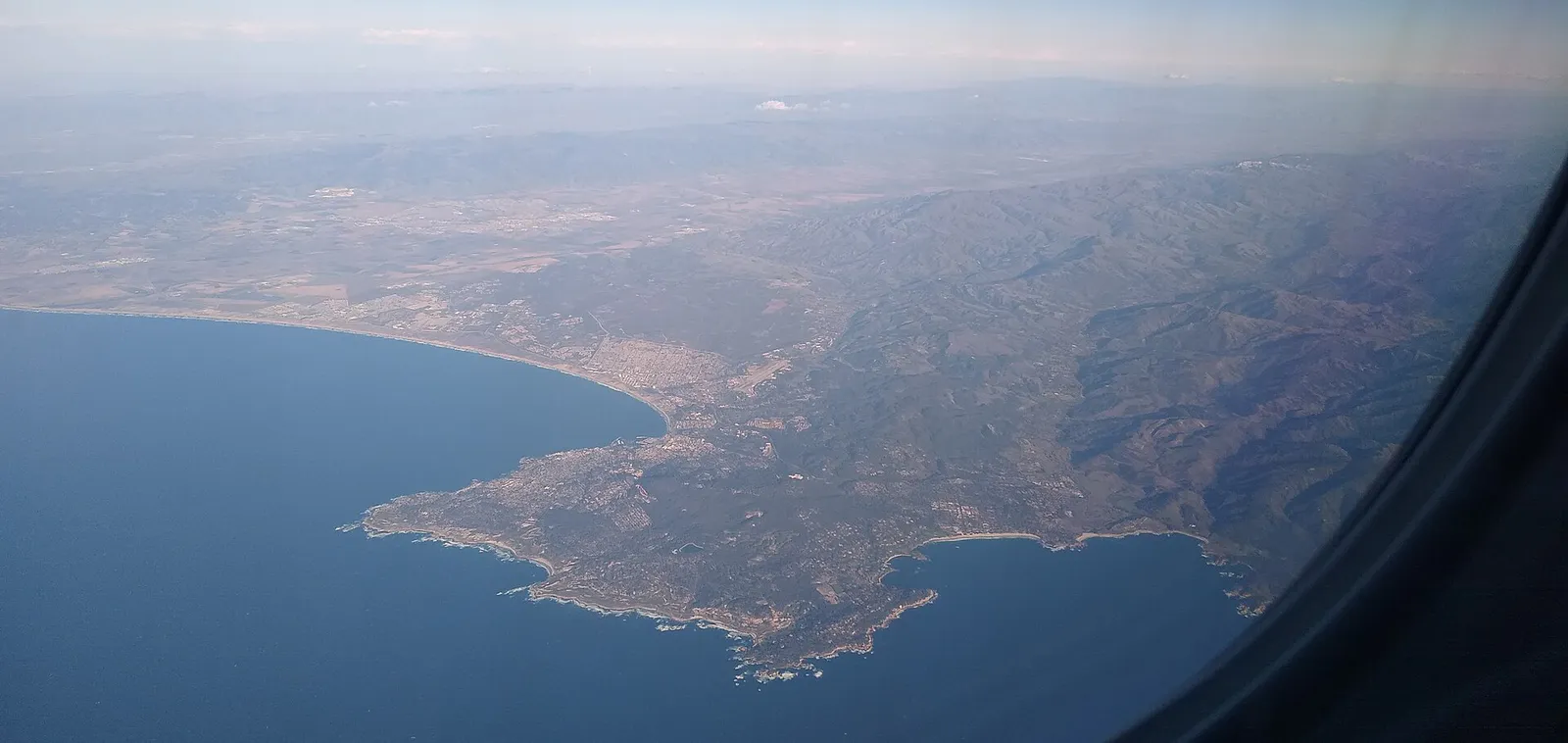
The local decision problem
Navigating Monterey's geographical choke points, early dining hours, microclimatic fog shifts, and parking logistics to build efficient daily plans across historic downtown, waterfront, and surrounding peninsula districts.
That is where Adventria comes in. Adventria helps narrow the options in Monterey around practical factors like location, distance, budget, vibe, who you are with, and the kind of experience you actually want, so research can turn into a decision.
Let Adventria narrow the optionsPick the right part of town
Different parts of Monterey work for different kinds of plans. Start with the experience you want, then narrow the map.
Best for
First-time visitors, aquarium access, and oceanfront hotel stays
Best for
Historic adobes, craft breweries, civic services, and central dining
Best for
Clam chowder tastings, whale-watching excursions, and fish markets
Best for
Walkable neighborhood cafes, independent shops, and casual local dining
Best for
Beachcombing, sunset walks, dune trails, and coastal relaxation
Best for
Hillside residential quiet, forested views, and sunnier microclimates
This is a quick starting point. The full guide covers 8 local neighborhoods and districts in Monterey.
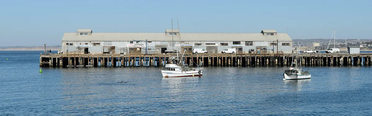
Eat & drink
Trying to decide where to eat in Monterey? Start with the local dining context below and narrow the decision around the kind of meal or experience you actually want.
Head to Old Fisherman's Wharf for traditional seafood houses and sourdough chowder bowls. Choose Alvarado Street in Downtown for craft breweries, elevated Mexican, hearth dining, and farm-to-table cuisine. For casual local bakeries, ramen, and pubs, explore Lighthouse Avenue in New Monterey.
Still comparing options? Adventria can narrow the choice around budget, distance, vibe, and who you are with.
Decide with AdventriaPlan by situation
Start with the kind of plan you are actually trying to make. These city-specific ideas narrow the choice around who you are with, what you want to spend, the weather, and the kind of outing you want.
For an outdoor plan from Monterey, compare trails, state parks, national parks within trip range, and scenic drives. Options in the current city guide include Monterey State Beach and Monterey State Historic Park.
For a short escape from Monterey, compare Half Moon Bay and Capitola. More options are listed in the trip section below.
Spend hours inside the indoor exhibits at the Monterey Bay Aquarium, tour the historic Colton Hall Museum, visit the Monterey Museum of Art, or drive 10 to 15 minutes inland along Highway 68 to escape coastal fog.
Rent an e-bike or run along the Monterey Bay Coastal Recreation Trail, visit Colton Hall Museum and the Pacific House Museum for self-guided history tours, and grab counter seating at Downtown brewpubs.
Stroll through the gardens at Cooper-Molera Adobe in Downtown, followed by dinner at a historic adobe restaurant like Stokes Adobe or Cella. End the night with wine tasting on Cannery Row or craft cocktails in New Monterey.
Combine a morning at the Monterey Bay Aquarium with an afternoon at El Estero Park to explore Dennis the Menace Playground and rent pedal boats on Lake El Estero.
Take the self-guided Path of History tour past Downtown adobes, explore Dennis the Menace Playground, stroll Del Monte Beach, and visit the Custom House and Colton Hall Museum with free admission.
Outdoors nearby
Use these nearby outdoor options when the plan calls for a trail, protected landscape, park, or drive instead of another indoor stop. Proximity here is geographic, not a promise about driving time.
Get out of town
When staying in town is not the answer, these nearby destinations give you a smaller starting set for a day trip, overnight escape, or weekend away.
Destination relationships are screened geographically. Straight-line proximity is not presented as road mileage or estimated travel time.
Local landmarks & attractions
These notable destinations offer a starting point when you want something specific to see, visit, or build into a day around Monterey. Distances are approximate from the city area.
motorsport track in the United States
natural history museum in Pacific Grove, California
theater in Carmel-by-the-Sea, California
amusement park in Santa Cruz, California
non-profit organization in the USA
World War I Memorial Arch is a World War I memorial designed in 1919 by architect Charles Sumner Green and located at Ocean Avenue and San Carlos Street center median divider in Carmel-by-the-Sea, California.
movie theater in Monterey, California, United States
Notable places are selected from structured public destination data and ranked for relevance, prominence, proximity, and variety.
Local decision signals
A useful local recommendation depends on how the city actually works. These conditions affect where to go, what to do, and whether a plan makes sense right now.
The Custom House Tunnel connects Del Monte Avenue directly to Lighthouse Avenue. It is the single high-capacity transit funnel connecting Downtown and Highway 1 to New Monterey, Cannery Row, and Pacific Grove.
Most restaurant kitchens in Monterey close between 8:30 p.m. and 9:30 p.m. Late-night dining options after 10:00 p.m. are concentrated along Alvarado Street and Lighthouse Avenue.
Summer months bring morning fog ('May Gray' / 'June Gloom') that often clears by 1:00 p.m. Driving 10 to 15 minutes inland along Highway 68 toward Salinas or Carmel Valley typically yields clear skies and temperatures 15°F to 25°F warmer.
Residential streets rising above Lighthouse Avenue and around Downtown strictly enforce permit-only parking to prevent visitor overflow from commercial zones.
The Monterey City Council ended passenger landing services for cruise liners in 2023. Harbor visitor flows are driven by domestic tourism, local commercial fishing, and regional events.
An 18-mile paved multi-use trail built along the former Southern Pacific Railroad right-of-way connects Del Monte Beach, Fisherman's Wharf, San Carlos Beach, and Cannery Row.
Neighborhood context
Neighborhoods are not interchangeable. Each area offers a different balance of atmosphere, transportation, food, nightlife, activities, and planning friction.
Best for: First-time visitors, aquarium access, and oceanfront hotel stays
Running along the shoreline between San Carlos Beach and Pacific Grove, this historic sardine canning strip is anchored by the Monterey Bay Aquarium, waterfront dining, transformed cannery buildings, and hotels.
Best for: Historic adobes, craft breweries, civic services, and central dining
Centered on Alvarado Street, Calle Principal, and Pacific Street. Features 19th-century adobes along Monterey State Historic Park, the Golden State Theatre, craft breweries, and government offices.
Best for: Clam chowder tastings, whale-watching excursions, and fish markets
Comprises Municipal Wharf I (pedestrian dining and gift shops) and Municipal Wharf II (a working commercial fishing pier with wholesale markets and local seafood spots).
Best for: Walkable neighborhood cafes, independent shops, and casual local dining
Slopes upward behind Cannery Row along Lighthouse Avenue and Foam Street. High walkability with diverse eateries, bakeries, services, and neighborhood pubs.
Best for: Beachcombing, sunset walks, dune trails, and coastal relaxation
Residential coastal enclave east of the harbor with soft sand beaches, dunes, oceanfront condos, and access to the Coastal Recreation Trail.
Best for: Hillside residential quiet, forested views, and sunnier microclimates
Elevated residential neighborhoods on the ridge above Downtown and the Presidio, featuring pine and oak canopies, winding streets, and exposure to afternoon sun above the marine layer.
Best for: Historic charm, student life, and proximity to Downtown
A residential sub-neighborhood directly behind Middlebury Institute of International Studies, historically settled by Italian fishing families and featuring cottages and student rentals.
Best for: Medical services, regional business offices, and airport access
Commercial park district located on the eastern edge of the city along Highway 68 near Monterey Regional Airport and the Salinas border.
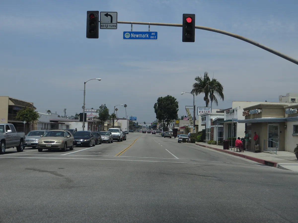
Monterey local guide
Monterey is situated along the southern curve of Monterey Bay, creating a linear transit structure where coastal geography directly shapes traffic flow. Highway 1 serves as the primary north-south regional spine, but key exits like Del Monte Avenue (Exit 402) and Munras Avenue experience heavy slowdowns during summer weekends and major event periods. The principal choke point connecting Highway 1 and Downtown to New Monterey, Cannery Row, and Pacific Grove is the Lighthouse Tunnel (Custom House Tunnel) underlying Custom House Plaza. Drivers attempting to travel west toward the aquarium during peak hours will encounter significant queueing entering and exiting the tunnel corridor.
Topography also introduces physical travel friction. While the shoreline along Cannery Row and Del Monte Beach sits at sea level, residential districts like New Monterey, Spaghetti Hill, and Monterey Vista rise steeply up hillside slopes. Walking upward from Alvarado Street or Lighthouse Avenue requires navigating steep inclines. Understanding these micro-geographic shifts allows visitors and residents to choose appropriate parking nodes rather than battling incline and bottleneck friction.
Explore your options
Each commercial corridor in Monterey serves distinct practical functions depending on your schedule, parking preferences, and dining needs.
Best for aquarium visits, oceanfront lodging, and coastal retail.
Best for craft dining, historic sites, local services, and night venues.
Best for casual neighborhood dining, cafes, and late-night lounges.
Best for seafood dining, marine excursions, and coastal views.
Practical local guidance
Keep these location-specific operational factors in mind when building daily schedules across the city.
A simpler way to decide
Follow this step-by-step sequence to handle transit, parking, and timing without unnecessary delays.
Secure timed-entry tickets online for the Monterey Bay Aquarium and make dinner reservations before 7:30 p.m. to align with early local kitchen schedules.
Bypass waterfront lot queues by parking in the Downtown West Garage (340 Tyler St) or the Cannery Row Garage (601 Foam St) based on your primary morning activity.
Walk or ride bicycles along the paved 18-mile Coastal Recreation Trail, or board the free summer MST Trolley to move between Downtown, the Harbor, and Cannery Row.
Carry a windproof jacket or outer layer to adjust for morning ocean fog ('May Gray' / 'June Gloom') and strong coastal breezes near headlands.
Explore historic 19th-century adobes along the Path of History in Downtown before heading to Alvarado Street for early evening craft dining and drinks.
Common local questions
These are common situations people face when trying to decide where to eat, what to do, where to get drinks, or how to spend their time in Monterey.
Monterey planning questions
Practical answers for people deciding where to eat, what to do, where to go, or how to make plans in Monterey.
The Custom House Tunnel (Lighthouse Tunnel) connects Del Monte Avenue to Lighthouse Avenue and routinely backs up during peak summer afternoons and weekends. To minimize delays, park in Downtown garages (such as 340 Tyler Street) and walk or ride the free MST Trolley or Coastal Recreation Trail to reach Cannery Row.
The primary multi-level parking facility serving Cannery Row is the Cannery Row Garage located at 601 Foam Street. Alternatively, surface pay lots exist at Lot 7 (160 Irving St) and Lot 21 (32 Cannery Row), though they fill quickly on weekends.
Most restaurant kitchens in Monterey close early, typically between 8:30 p.m. and 9:30 p.m. Late-night food and drink options after 10:00 p.m. are limited and mainly concentrated at brewpubs and bars along Alvarado Street and Lighthouse Avenue.
The free Monterey-Salinas Transit (MST) Trolley operates daily from Memorial Day weekend through Labor Day (and weekends off-season), running roughly every 10 to 15 minutes between 10:00 a.m. and 6:00 p.m. It loops continuously through Downtown Monterey, Old Fisherman's Wharf, Cannery Row, and the Monterey Bay Aquarium.
If coastal fog ('May Gray' or 'June Gloom') stays locked along the waterfront, drive 10 to 15 minutes inland along Highway 68 toward Ryan Ranch or Carmel Valley. Inland areas sit above or beyond the fog deck, often presenting clear sun and temperatures 15°F to 25°F warmer.
No. In 2023, the Monterey City Council voted to terminate passenger landing services for cruise ships. As a result, major cruise lines no longer tender passengers onto city docks, reducing sudden waterfront crowds.
You can follow the self-guided Path of History tour through Downtown Monterey to see historic adobes. Colton Hall Museum (where California's first Constitution was drafted) offers free admission on Pacific Street, as do several Monterey State Historic Park structures like the Custom House.
You can walk or ride a bicycle along the 18-mile Monterey Bay Coastal Recreation Trail, which offers a dedicated car-free paved route along the waterfront. During summer months, you can also ride the free MST Trolley.
Street parking meters are generally enforced from 9:00 a.m. to 8:00 p.m. seven days a week, with hourly rates ranging between $1.00 and $1.50 per hour. Mobile payments can be made using the ParkMobile app across city zones.
Families frequently combine a trip to the Monterey Bay Aquarium on Cannery Row with a visit to Dennis the Menace Playground in the El Estero Park Complex, which features climbing structures, a suspension bridge, and paddle boat rentals on Lake El Estero.
Source transparency
Official and locally relevant sources used to verify the practical information presented in this Monterey decision guide.
Monterey decision engine
Tell Adventria what kind of experience you want, set your practical limits, and turn the options in Monterey into one workable plan.
Choose a Monterey Plan