Point Richmond (The Point)
Best for
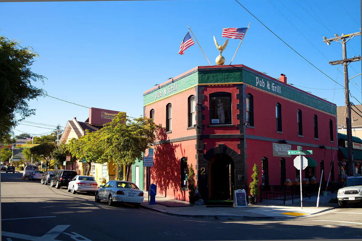
Historic small-town village atmosphere, independent eateries, historic architecture, and local theater.
 AdventriaLocalOpen App
Richmond, California Local Decision Guide
Trying to decide what to do in Richmond? Adventria helps you cut through the options and choose a good-enough plan without endless scrolling. From historic maritime landmarks along San Francisco Bay to foothill trails overlooking three bridges, Richmond offers distinct coastal microclimates, deep industrial heritage, and diverse culinary hubs. Use this practical decision guide to navigate cross-town transit friction, verify active venues, and match plans to local conditions.
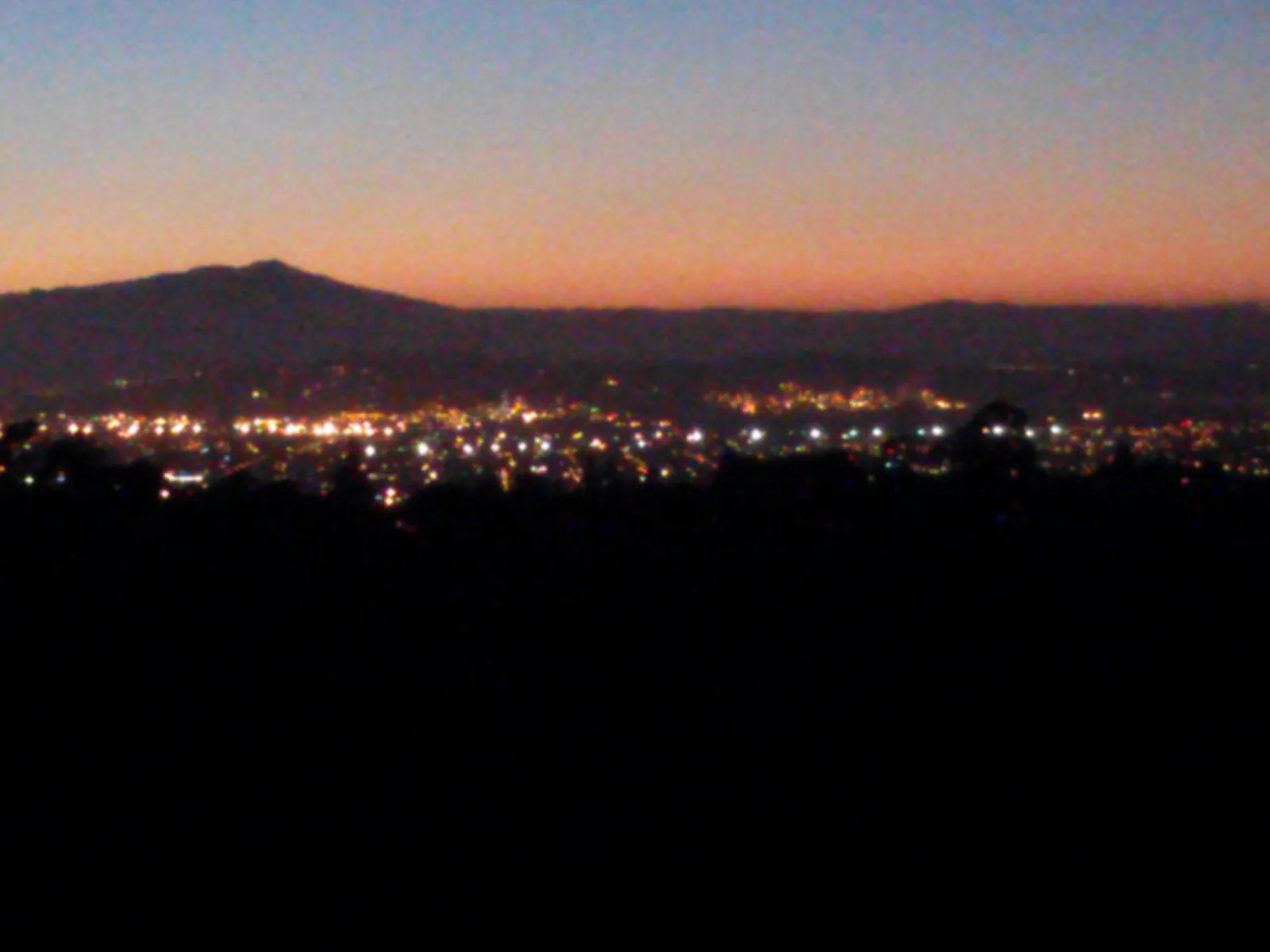
The local decision problem
Navigating geographic barriers, transit friction, venue closures, and microclimates when planning activities in Richmond, California.
That is where Adventria comes in. Adventria helps narrow the options in Richmond around practical factors like location, distance, budget, vibe, who you are with, and the kind of experience you actually want, so research can turn into a decision.
Let Adventria narrow the optionsPick the right part of town
Different parts of Richmond work for different kinds of plans. Start with the experience you want, then narrow the map.
Best for
Historic small-town village atmosphere, independent eateries, historic architecture, and local theater.
Best for
Modern waterfront walks, yacht harbor views, paved Bay Trail access, and outdoor taprooms.
Best for
Regional transit connections, civic services, visual arts galleries, and local history.
Best for
Bungalow-lined residential streets, inland microclimate warmth, and direct foothill park access.
Best for
Asian dining, regional grocery shopping, and easy access to El Cerrito BART stations.
Best for
Rustic maritime dining, live weekend acoustic outdoor music, coastal glamping, and harbor views.
This is a quick starting point. The full guide covers 7 local neighborhoods and districts in Richmond.
Eat & drink
When the decision is less about what to do and more about where to eat or grab a drink, start here. These local cues narrow the food and drink decision without turning dinner or a night out into another hour of comparison.
For regional Asian cuisine, dim sum, or bakery goods under one roof, head to the Pacific East Mall in the Richmond Annex. If you want historic village dining, Point Richmond offers long-standing establishments along Washington Avenue like Hotel Mac, Raymond's Pizzeria, and KAO Sarn. For coastal fare right on the harbor, visit Sailing Goat at Point San Pablo Harbor (open Friday through Sunday).
Evening activity in Richmond focuses on relaxed craft beverage taprooms and local dining. Grab dinner in Point Richmond or check out East Brother Beer Co. on Canal Boulevard for classic lagers, board games, and food truck options. Alternatively, visit Armistice Brewing Company near Marina Bay for IPAs in their outdoor beer garden.
Still comparing options? Adventria can narrow the choice around budget, distance, vibe, and who you are with.
Decide with AdventriaPlan by situation
Start with the kind of plan you are actually trying to make. These city-specific ideas narrow the choice around who you are with, what you want to spend, the weather, and the kind of outing you want.
Plan a date starting with a hike up Nicholl Knob at Miller/Knox Regional Shoreline for panoramic views of San Francisco Bay and regional bridges. Afterward, head down into Point Richmond village for dinner at Hotel Mac, or catch a community theater production at Masquers Playhouse.
Take children to the historic Richmond Plunge in Point Richmond for indoor pool swimming, including dedicated 'Tot Splash' hours for younger kids. Follow up with a picnic around the saltwater lagoon and playground at Miller/Knox Regional Shoreline, or head to Point Pinole Pier where kids can try casual saltwater fishing without requiring a state license.
When rain arrives, swim in the heated saltwater pool at the Richmond Plunge, explore regional heritage indoors at the Richmond Museum of History & Culture in the Carnegie library building, or browse the galleries at the Richmond Art Center. You can also explore dining and markets inside Pacific East Mall without worrying about wet conditions.
You can spend a full day in Richmond without major spending. Admission is completely free at the Rosie the Riveter Visitor Education Center, the Richmond Art Center, and the NIAD Art Center gallery. The Richmond Museum of History operates on a pay-what-you-can donation basis, and public waterfront access along the Bay Trail costs nothing.
Richmond is ideally suited for solo recreation. Ride your bike along the paved San Francisco Bay Trail from Marina Bay to Point Isabel, visit the gallery spaces at the NIAD Art Center on 23rd Street, or bring binoculars for peaceful birdwatching along the Dotson Family Marsh trail at Point Pinole Regional Shoreline.
For casual group gatherings, East Brother Beer Co. offers large indoor and outdoor tables, ping-pong, cornhole, a bocce court, and rotating food trucks. For dining groups, Asian Pearl Seafood Restaurant inside Pacific East Mall accommodates multi-course dim sum family-style meals.
For an outdoor plan from Richmond, compare trails, state parks, national parks within trip range, and scenic drives. Options in the current city guide include China Camp State Park and Angel Island State Park.
Outdoors nearby
Use these nearby outdoor options when the plan calls for a trail, protected landscape, park, or drive instead of another indoor stop. Proximity here is geographic, not a promise about driving time.
Get out of town
When staying in town is not the answer, these nearby destinations give you a smaller starting set for a day trip, overnight escape, or weekend away.
Destination relationships are screened geographically. Straight-line proximity is not presented as road mileage or estimated travel time.
Local landmarks & attractions
These notable destinations offer a starting point when you want something specific to see, visit, or build into a day around Richmond. Distances are approximate from the city area.
prison in the San Francisco Bay
zoo in San Francisco
architectural structure in Oakland, California, USA
indoor arena located in Daly City, California, USA
modern art museum in San Francisco, California, USA
amusement park in California
structure in San Francisco
observation tower
Notable places are selected from structured public destination data and ranked for relevance, prominence, proximity, and variety.
Local decision signals
A useful local recommendation depends on how the city actually works. These conditions affect where to go, what to do, and whether a plan makes sense right now.
Active freight lines (Union Pacific and BNSF) intersect key access routes along Canal Boulevard, Harbour Way South, and Cutting Boulevard, causing localized motorist delays of 10 to 15 minutes during train switching.
The Potrero Ridge physically separates Point Richmond, Brickyard Cove, and port zones from inland districts, requiring travel through the Garrard Boulevard tunnel or I-580.
Shoreline areas along Marina Bay, Point San Pablo, and Point Isabel experience strong sea breezes and cool marine conditions, often running 5°F to 10°F cooler than inland North & East neighborhoods during summer afternoons.
The Richmond Ferry Terminal at Harbour Way South provides direct 35-minute passenger catamaran connections to the San Francisco Ferry Terminal, featuring free daily parking for transit patrons.
Richmond features over 30 contiguous miles of the San Francisco Bay Trail, connecting regional waterfront parks from Point Isabel to Point Pinole.
Northbound I-80 experiences high commuter traffic during evening peak hours, particularly around the Richmond Parkway interchange.
The downtown Richmond Transit Center brings together BART Red and Orange lines, regional Amtrak routes, and AC Transit bus lines at 1700 Nevin Avenue.
Neighborhood context
Neighborhoods are not interchangeable. Each area offers a different balance of atmosphere, transportation, food, nightlife, activities, and planning friction.
Best for: Historic small-town village atmosphere, independent eateries, historic architecture, and local theater.
Nestled west of the Potrero Hills and accessed via Garrard Boulevard or I-580, Point Richmond features early 20th-century storefronts along Washington Avenue, the historic Richmond Plunge, and proximity to Miller/Knox Regional Shoreline.
Best for: Modern waterfront walks, yacht harbor views, paved Bay Trail access, and outdoor taprooms.
A master-planned residential and maritime community built around a deep-water harbor. Highlights include paved walking loops, Lucretia Edwards Shoreline Park, and Rosie the Riveter Memorial.
Best for: Regional transit connections, civic services, visual arts galleries, and local history.
The city's urban core centered along Macdonald Avenue. Home to the Richmond Transit Center, City Hall, Kaiser Permanente Medical Center, Richmond Art Center, and the Richmond Museum of History & Culture.
Best for: Bungalow-lined residential streets, inland microclimate warmth, and direct foothill park access.
A sprawling residential grid situated north of Macdonald Avenue and east of San Pablo Avenue, offering 1920s–1950s homes and quick access to Wildcat Canyon Regional Park.
Best for: Asian dining, regional grocery shopping, and easy access to El Cerrito BART stations.
The city's southernmost neighborhood cluster bordering Albany and El Cerrito. Commercial activity centers around the Pacific East Mall and 99 Ranch Market along Pierce Street.
Best for: Rustic maritime dining, live weekend acoustic outdoor music, coastal glamping, and harbor views.
An isolated, bohemian outpost located at the far northwestern tip of the city, accessible via Stenmark Drive past the historic Winehaven complex.
Best for: World War II era architectural history and quiet garden-style cooperative living.
A historic defense-housing cooperative constructed in 1941 to house Kaiser Shipyard workers, listed on the National Register of Historic Places.
Richmond local guide
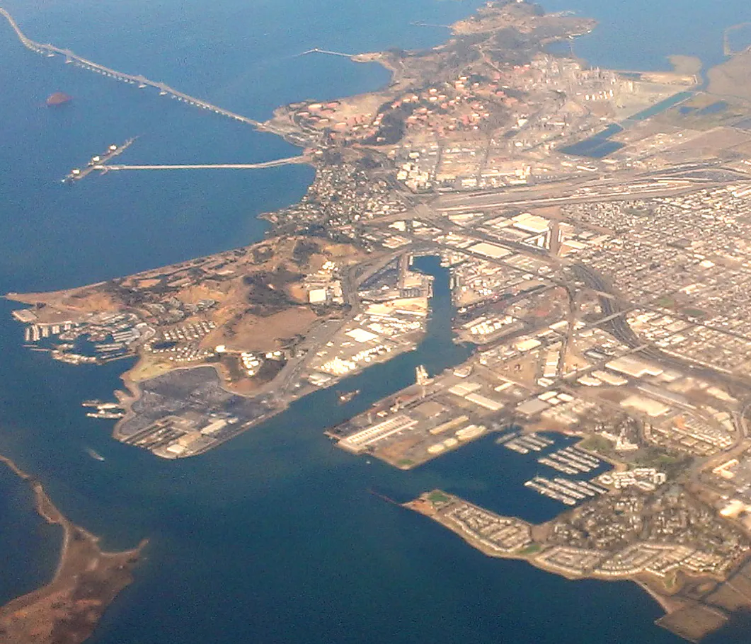
Richmond spans more than 30 miles of shoreline along Contra Costa County's coast, creating distinct micro-geographies that behave differently depending on time of day, wind patterns, and transport mode. Navigating the city effectively requires understanding how natural physical barriers separate major commercial and residential hubs. The Potrero Hills form a central topographic spine that cuts off Point Richmond, Brickyard Cove, and the port zones from inland neighborhoods like Downtown, North & East, and Hilltop. Travel between these pockets relies heavily on passing through the Garrard Boulevard tunnel or taking Interstate 580.
Ground transportation planning must account for active freight rail corridors operated by Union Pacific and BNSF. Heavy industrial freight switching frequently leads to temporary delays at key at-grade street crossings, particularly along Canal Boulevard, Harbour Way South, and Cutting Boulevard. Driver routes should build in extra travel time when heading to shipyard historic sites or waterfront parks. For highway drivers, Interstate 80 experiences heavy commuter congestion northbound toward Vallejo during weekday evening rush hours, making the Richmond Parkway a valuable bypass route for reaching northern shoreline spots.
Regional transit connectivity centers on two major multi-modal transit nodes. Downtown's Richmond Transit Center at 1700 Nevin Avenue integrates BART rail services, regional Amtrak lines, and local AC Transit bus routes. Further south along the shoreline, the Richmond Ferry Terminal at Harbour Way South provides passenger ferry service directly into Downtown San Francisco. Understanding these movement corridors helps residents and visitors move between waterfront parks, cultural institutions, and dining districts with minimal friction.
Explore your options
Choose your destination based on party size, interest, weather conditions, and travel preferences across Richmond.
Ideal for active days along San Francisco and San Pablo Bays, featuring paved paths, off-leash park space, and fishing piers.
Explore Richmond's central role in World War II home front manufacturing, shipbuilding, and industrial history.
Relaxed industrial gathering spaces offering local brews, food trucks, outdoor seating, and regional dishes.
Rainy day alternatives and creative spaces centered around community arts, local history, and heated swimming.
Practical local guidance
Keep these operational constraints and travel factors in mind when building your schedule in Richmond:
A simpler way to decide
Follow these steps to coordinate transit, maritime sites, and local dining without getting caught in rail delays or unexpected closures.
Decide whether you are arriving via BART at the Richmond Transit Center, taking the SF Bay Ferry to Harbour Way South, or driving via I-580 or I-80.
Verify current operating hours for weekend-only destinations like the SS Red Oak Victory ship, or midweek schedules for the Richmond Art Center.
If driving to waterfront sites in the Port or Point Richmond area, build in a 15-minute buffer to accommodate slow-moving BNSF or Union Pacific freight trains.
Pack light fleece or windbreaker jackets even on clear days, as breeze off San Francisco Bay keeps the shoreline cooler than inland valleys.
Plan meals around local gathering spots such as Point Richmond's historic village eateries, the taproom at East Brother Beer Co., or Asian dining at Pacific East Mall.
Note that while parking is free at Miller/Knox and Point Isabel, seasonal weekend parking fees apply at Point Pinole.
Common local questions
These are common situations people face when trying to decide where to eat, what to do, where to get drinks, or how to spend their time in Richmond.
Richmond planning questions
Practical answers for people deciding where to eat, what to do, where to go, or how to make plans in Richmond.
The San Francisco Bay Ferry operates daily from the Richmond Ferry Terminal located at 1453 Harbour Way South. The catamaran ride takes 35 minutes to reach the Downtown San Francisco Ferry Terminal. Fares can be paid using a Clipper Card, the SF Bay Ferry mobile application, or paper tickets. A free 362-space public parking lot is available adjacent to the terminal on a first-come, first-served basis.
Located at 1700 Nevin Avenue in Downtown Richmond, the transit center serves as the terminal for BART Red Line (Richmond–Millbrae) and Orange Line (Richmond–Berryessa) trains. It also connects to Amtrak passenger routes (Capitol Corridor, San Joaquins, California Zephyr) and multiple AC Transit local bus lines like Route 72 and Route 74.
Point Isabel Regional Shoreline is a 50-acre park dedicated to off-leash dog exercise. It features paved shoreline paths, access to San Francisco Bay, dedicated dog washing facilities, and an adjacent cafe. Parking and park entry are free.
Yes, admission to the Rosie the Riveter WWII Home Front National Historical Park Visitor Education Center at 1414 Harbour Way South is free. The nearby Rosie the Riveter Memorial in Lucretia Edwards Shoreline Park is an open public park space accessible at no charge.
The SS Red Oak Victory, located at Berth 5 / Shipyard No. 3 (1337 Canal Blvd), is open for public tours on Saturdays and Sundays. Visitors can purchase self-guided audio tour passes or docent-guided tours on site. Access involves gangways and steep maritime staircases.
Top rainy-day options include swimming at the historic indoor heated Richmond Plunge, viewing exhibits at the Richmond Art Center or NIAD Art Center, exploring permanent regional displays at the Richmond Museum of History & Culture, and dining inside the covered Pacific East Mall.
Active Union Pacific and BNSF tracks cross key surface streets leading to the industrial port, Point Richmond, and Shipyard No. 3. Slow freight movements at grade crossings on Canal Boulevard, Cutting Boulevard, and Harbour Way South can cause temporary motorist delays of 10 to 15 minutes.
No state fishing license is required when fishing from public fishing piers in California, including the 1,250-foot pier at Point Pinole Regional Shoreline. Standard species size and catch limits still apply.
No, Riggers Loft Wine Company is permanently closed following a legal dispute over back rent and property lease terms with the city.
Waterfront neighborhoods like Marina Bay, Point Richmond, and Point San Pablo experience direct ocean breezes and marine fog off San Francisco and San Pablo Bays. Summer afternoon temperatures along the coast are routinely 5°F to 10°F cooler than inland districts like North & East or Hilltop.
Source transparency
Official and locally relevant sources used to verify the practical information presented in this Richmond decision guide.
Richmond decision engine
Tell Adventria what kind of experience you want, set your practical limits, and turn the options in Richmond into one workable plan.
Choose a Richmond Plan