Sonoma Plaza Historic Core
Best for
Walkable historic site visits, French and California dining, and boutique wine tasting.
 AdventriaLocalOpen App
Sonoma Valley Decision Guide
Trying to decide what to do in Sonoma? Adventria helps you cut through the options and choose a good-enough plan without endless scrolling. Whether you are spending an afternoon walking around Sonoma Plaza, navigating wine tasting room zoning rules, riding free local transit through The Springs, or hiking regional trails in Glen Ellen, this guide provides clear, practical details to help you choose what to do today, tonight, and this weekend.
The local decision problem
Navigating Sonoma's distinct valley geography, downtown parking regulations, early business closing times, and wine tasting ordinance rules to build an ideal daily or weekend itinerary.
That is where Adventria comes in. Adventria helps narrow the options in Sonoma around practical factors like location, distance, budget, vibe, who you are with, and the kind of experience you actually want, so research can turn into a decision.
Let Adventria narrow the optionsPick the right part of town
Different parts of Sonoma work for different kinds of plans. Start with the experience you want, then narrow the map.
Best for
Walkable historic site visits, French and California dining, and boutique wine tasting.
Best for
Quiet walks, bed-and-breakfast stays, and quick pedestrian access to downtown.
Best for
Essential road trip supplies, grocery stops, and civic service visits.
Best for
Authentic Mexican taquerias, thermal hot spring spas, and casual dining.
Best for
Local residential character and historical agricultural ties.
Best for
State park trail hiking, creekside dining, and rustic oak landscape exploration.
This is a quick starting point. The full guide covers 8 local neighborhoods and districts in Sonoma.
Eat & drink
Trying to decide where to eat in Sonoma? Start with the local dining context below and narrow the decision around the kind of meal or experience you actually want.
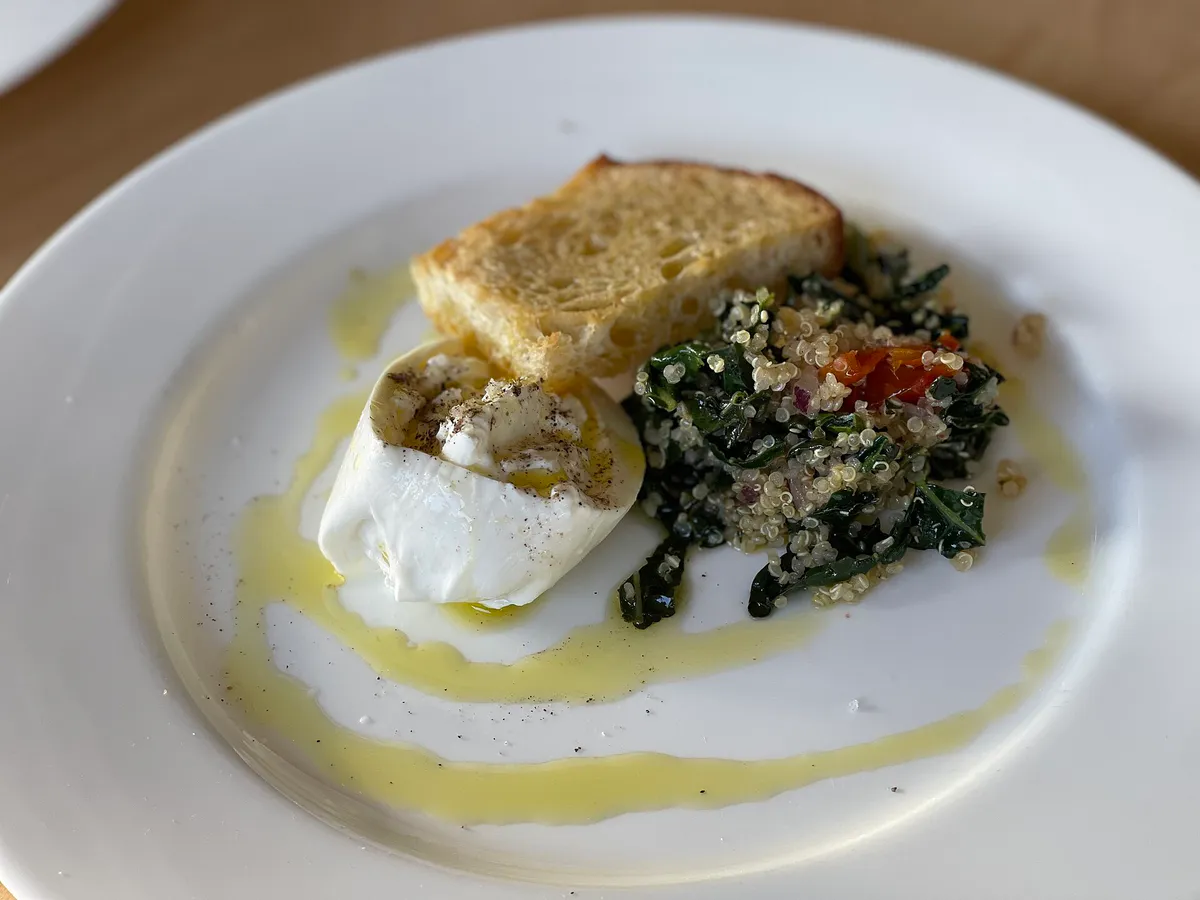
Because most winery tasting rooms shut down around 5:00 PM, head to Roche Winery Downtown on West Spain Street, which stays open for tastings until 7:30 PM. Afterward, walk to dinner nearby at The Girl & the Fig, El Dorado Kitchen, or Plaza Bistro (aiming to order before kitchens close between 8:30 PM and 9:30 PM), followed by a movie or performance at the historic 1933 Sebastiani Theatre.
Still comparing options? Adventria can narrow the choice around budget, distance, vibe, and who you are with.
Decide with AdventriaPlan by situation
Start with the kind of plan you are actually trying to make. These city-specific ideas narrow the choice around who you are with, what you want to spend, the weather, and the kind of outing you want.
For an outdoor plan from Sonoma, compare trails, state parks, national parks within trip range, and scenic drives. Options in the current city guide include Sonoma State Historic Park and Jack London State Historic Park.
Begin late morning with a walk around the manicured rose gardens and historic grounds of General Vallejo's Home (Lachryma Montis). Walk into the Plaza core for a wine flight at a boutique downtown lounge, then secure an outdoor courtyard table for dinner at El Dorado Kitchen or French country cuisine at The Girl & the Fig.
Skip the adult-only wine tasting lounges and head to Maxwell Farms Regional Park, where kids can use the modern playgrounds and wide woodland trails along Sonoma Creek. You can also visit Bartholomew Park, where children are welcome to walk the forest trails and run on the Castle Lawn, or stop by the Sonoma Plaza duck pond before catching a matinee at the Sebastiani Theatre.
On rainy days, tour the sheltered courtyard and interior museum exhibits of Mission San Francisco Solano and the Sonoma Barracks. Afterward, visit the indoor galleries at the Sonoma Valley Museum of Art, watch an independent film inside the historic Sebastiani Theatre, or book an indoor hot spring soak in Boyes Hot Springs.
Take advantage of Sonoma County Transit Route 32 (Sonoma Shuttle), which is completely free to ride between Agua Caliente, Sonoma Plaza, and Temelec. Spend $3 for an adult state park pass that covers three historic sites, hike the fee-free Sonoma Overlook Trail or Bartholomew Park, and grab high-value, authentic meals at taquerias along Highway 12 in The Springs.
Take a quiet pedestrian tour along East and West Spain Street. Spend an hour browsing contemporary exhibits at the Sonoma Valley Museum of Art on Broadway, bike along the Class I Sonoma City Trail, and grab a relaxed, walk-up lunch at an authentic taqueria in The Springs corridor.
When traveling with a group, keep in mind that municipal rules restrict wine tasting room group sizes (often capping reservation areas at 15 people). Park larger passenger vans or group vehicles in the unlimited Casa Grande Lot behind the Barracks off First Street East, then explore the surrounding Plaza block faces on foot.
Outdoors nearby
Use these nearby outdoor options when the plan calls for a trail, protected landscape, park, or drive instead of another indoor stop. Proximity here is geographic, not a promise about driving time.
Get out of town
When staying in town is not the answer, these nearby destinations give you a smaller starting set for a day trip, overnight escape, or weekend away.
Destination relationships are screened geographically. Straight-line proximity is not presented as road mileage or estimated travel time.
Local landmarks & attractions
These notable destinations offer a starting point when you want something specific to see, visit, or build into a day around Sonoma. Distances are approximate from the city area.
city park and historic landmark in Santa Rosa, California
art museum in Sonoma, California
motorsport track in the United States
amusement park in California
American family-owned, sixth-generation winery
historic house in Sonoma, California, USA
Indian casino and hotel
museum located in Santa Rosa, California
Notable places are selected from structured public destination data and ranked for relevance, prominence, proximity, and variety.
Local decision signals
A useful local recommendation depends on how the city actually works. These conditions affect where to go, what to do, and whether a plan makes sense right now.
On-street parking surrounding the 8-acre Sonoma Plaza enforces a 3-hour limit from 9:00 AM to 5:00 PM, Monday through Saturday, but remains unlimited on Sundays.
Drivers can avoid 3-hour street parking tickets by using the Casa Grande Lot behind the Sonoma Barracks or the Sebastiani Theatre Lot off East Napa Street.
Sonoma County Transit Route 32 (Sonoma Shuttle) runs fare-free connecting Agua Caliente and The Springs through Sonoma Plaza down to Temelec.
A single state park admission ticket grants same-day access to Mission San Francisco Solano, the Sonoma Barracks, and General Vallejo's Home (Lachryma Montis).
City Ordinance #01-2019 caps wine tasting facilities at 25 within the Plaza Overlay District and allows a maximum of two tasting rooms per block face.
While most wine tasting venues close by 5:00 PM, Roche Winery Downtown on West Spain Street stays open daily until 7:30 PM for early evening drinks.
The 2.4-mile Sonoma Overlook Trail loop strictly prohibits dogs and bicycles to protect native wildlife and delicate mountain vegetation.
Neighborhood context
Neighborhoods are not interchangeable. Each area offers a different balance of atmosphere, transportation, food, nightlife, activities, and planning friction.
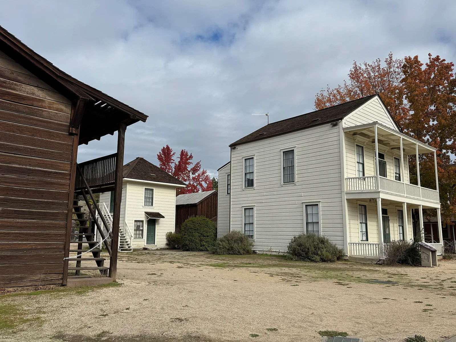
Best for: Walkable historic site visits, French and California dining, and boutique wine tasting.
An 8-acre town square laid out in 1835 by General Mariano Guadalupe Vallejo. It is lined with 19th-century adobes, shaded park grounds, tasting rooms, boutique shops, and established restaurants.
Best for: Quiet walks, bed-and-breakfast stays, and quick pedestrian access to downtown.
Tree-lined streets extending along East and West Napa and Spain streets. Features Victorian, Craftsman, and Spanish Revival homes within short walking distance of the central square.
Best for: Essential road trip supplies, grocery stops, and civic service visits.
Stretches south along Highway 12 (Broadway) toward Leveroni Road, housing practical commercial services, grocery stores, local art institutions, and light commercial zoning.
Best for: Authentic Mexican taquerias, thermal hot spring spas, and casual dining.
Located one to three miles north of downtown along Highway 12. A multicultural corridor historically known for hot spring resorts, now featuring vibrant taquerias, bakeries, and wellness spas.
Best for: Local residential character and historical agricultural ties.
A residential district located west of the City of Sonoma and south of Boyes Hot Springs, with deep roots in early agricultural settlement and railroad history.
Best for: State park trail hiking, creekside dining, and rustic oak landscape exploration.
A rustic hamlet roughly seven miles north of Sonoma Plaza along Arnold Drive and Highway 12, anchored by Jack London State Historic Park and Sonoma Valley Regional Park.
Best for: Spacious vineyard estate tastings and mountain trail views.
Situated at the far northern tip of Sonoma Valley near Sugarloaf Ridge State Park, recognized for foothill vineyard estates and quiet mountain views.
Best for: Carneros region vineyard drives and agricultural landscapes.
Unincorporated rural land south and southeast of the city dominated by dairy ranches, lower-elevation Carneros vineyards, and motorsport venues further south at Sears Point.
Sonoma local guide
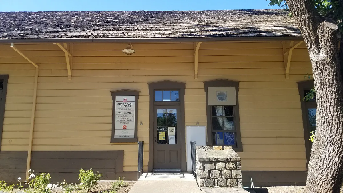
Sonoma is situated in an elongated north-south valley flanked by the Mayacamas Mountains to the east and the Sonoma Mountain Range to the west. While visitors often talk about Sonoma as a single destination, travel logistics differ significantly between the incorporated City of Sonoma—centered around its historic 8-acre Plaza—and outlying valley hamlets like Boyes Hot Springs, Glen Ellen, and Kenwood.
Highway 12 (Valley of the Moon Highway) serves as the main artery running north and south through the entire valley. Traffic bottlenecks predictably develop through The Springs district, where the road narrows around pedestrian crossings and small storefronts, and around Sonoma Plaza during peak weekend hours. Visitors traveling east toward Napa or west toward Petaluma must navigate SR 116 and SR 121, two-lane rural corridors that slow down during evening commute windows and event weekends at Sonoma Raceway.
While the central Plaza is exceptionally walkable, reaching spread-out wineries, regional trails, or higher education institutions like Sonoma State University (located approximately 19 miles west in Rohnert Park) requires driving or taking regional transit. Planning your daily route by cluster prevents spending unnecessary time stuck on narrow two-lane roads.
Explore your options
Select your base based on whether you prefer historic pedestrian access, authentic food corridors, or rustic outdoor scenery.
Best for travelers who want to park their car once and access historic sites, dining, and wine tasting on foot.
Ideal for wellness seekers, low-cost food lovers, and travelers wanting quick access to both downtown and northern valley parks.
Perfect for outdoor enthusiasts and hikers looking for a quiet, wooded atmosphere away from city traffic.
Practical local guidance
Avoid local fines and unexpected closures by keeping these municipal and park guidelines in mind:
A simpler way to decide
Follow these steps to make the most of your day while managing parking, historic site visits, and wine tasting hours.
Arrive mid-morning and bypass 3-hour street parking spaces by heading straight to the Casa Grande Lot behind the Barracks (off First Street East) or the Sebastiani Lot (off East Napa Street).
Buy a $3.00 adult museum pass at Mission San Francisco Solano or the Sonoma Barracks. Explore the mission chapel, adobe barracks, and Toscano Hotel.
Walk half a mile west along Spain Street or take a brief stroll to Lachryma Montis, General Vallejo's 1852 Gothic Revival home, using your same state park pass for entry.
Dine at a Plaza bistro like Sunflower Caffé or The Girl & the Fig, or pick up picnic supplies to eat on the central park lawns near the duck pond.
Explore downtown tasting rooms on foot. Remember that most close by 5:00 PM, so transition to Roche Winery Downtown on West Spain Street if you want an early evening flight until 7:30 PM.
Have an early dinner at El Dorado Kitchen or Plaza Bistro, then head to the historic 1933 Sebastiani Theatre on First Street East for a film or community performance.
Common local questions
These are common situations people face when trying to decide where to eat, what to do, where to get drinks, or how to spend their time in Sonoma.
Sonoma planning questions
Practical answers for people deciding where to eat, what to do, where to go, or how to make plans in Sonoma.
You can park without time restrictions in two primary municipal lots: the Casa Grande Lot behind the Sonoma Barracks (accessed via First Street East) and the Sebastiani Theatre Lot (accessed via East Napa Street). On-street parking surrounding the Plaza enforces a 3-hour limit Monday through Saturday from 9:00 AM to 5:00 PM, but is unlimited on Sundays.
A single $3.00 adult pass ($2.00 for youth ages 6–17; free under 6) provides same-day admission to three non-contiguous historic sites around town: Mission San Francisco Solano, the Sonoma Barracks, and General Vallejo's Home (Lachryma Montis).
Yes, local travel within the valley on Sonoma County Transit Route 32 (the Sonoma Shuttle) is completely fare-free. It connects Agua Caliente and The Springs through Sonoma Plaza down to the Temelec area.
You can take Sonoma County Transit Route 40 from Sonoma Plaza to the Petaluma Transit Mall, where you can transfer directly to the Petaluma SMART train station.
No. Dogs and bicycles are strictly prohibited on the Sonoma Overlook Trail to protect native wildlife and delicate trail soils. If you are traveling with a dog, head instead to Bartholomew Park (leashed) or Sonoma Valley Regional Park in Glen Ellen.
The City of Sonoma enforces Ordinance #01-2019 within the Plaza Overlay District. This ordinance caps total wine tasting facilities at 25 and limits them to no more than two per block face to prevent alcohol storefronts from crowding out general retail.
While most wine tasting venues close at 4:30 PM or 5:00 PM, Roche Winery Downtown (located at 122 West Spain Street) remains open daily until 7:30 PM.
Sonoma State University (SSU) is not located within the City of Sonoma. It is located approximately 19 miles west in Rohnert Park along East Cotati Avenue, accessible via SR 116 or Petaluma Hill Road.
Source transparency
Official and locally relevant sources used to verify the practical information presented in this Sonoma decision guide.
Sonoma decision engine
Tell Adventria what kind of experience you want, set your practical limits, and turn the options in Sonoma into one workable plan.
Choose a Sonoma Plan