Bear Brand Ranch
Best for
Gated privacy, custom architectural estates, ocean ridge views
 AdventriaLocalOpen App
South Orange County Local Planning Guide
Trying to decide what to do in Laguna Niguel? Adventria helps you cut through the options and choose a good-enough plan without endless scrolling. Laguna Niguel is a master-planned community in the coastal San Joaquin Hills, structured around suburban neighborhoods and plaza centers rather than a historic downtown core. Whether you are navigating peak I-5 commute friction, coordinating rain-closure rules for canyon wilderness trails, or looking for evening spots at Ocean Ranch Village, this guide provides practical structure for every outing.
The local decision problem
Navigating a master-planned, HOA-centric suburban landscape without a traditional downtown grid to find outdoor recreation, coastal views, local dining plazas, and daily activities.
That is where Adventria comes in. Adventria helps narrow the options in Laguna Niguel around practical factors like location, distance, budget, vibe, who you are with, and the kind of experience you actually want, so research can turn into a decision.
Let Adventria narrow the optionsPick the right part of town
Different parts of Laguna Niguel work for different kinds of plans. Start with the experience you want, then narrow the map.
Best for
Gated privacy, custom architectural estates, ocean ridge views
Best for
Coastal elevation, marine breezes, ocean trailhead access
Best for
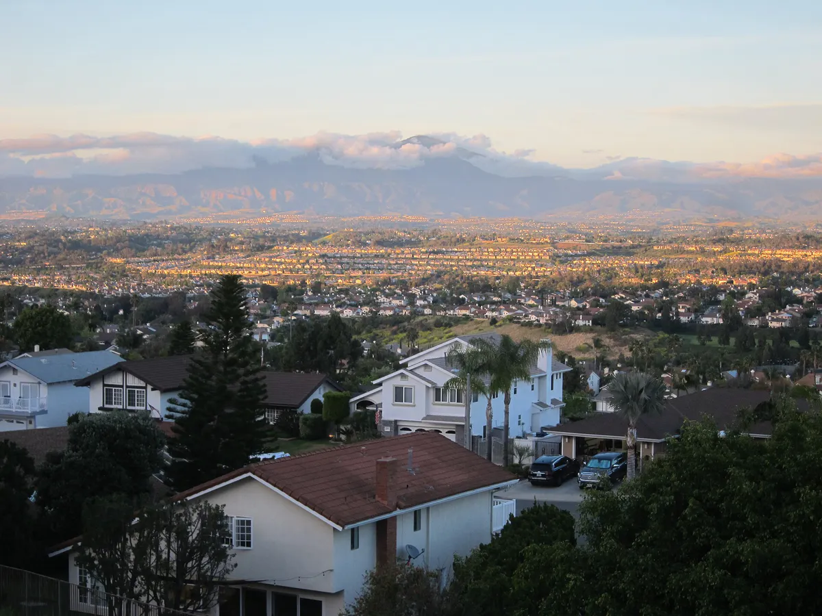
Townhouses, ridge top vistas, Aliso Canyon overlooks
Best for
Cape Cod architecture, walkability to ocean paths, HOA amenities
Best for
Central location, greenbelts, direct Salt Creek Trail connection
Best for
Highway and rail commute access, family-focused retail plazas
This is a quick starting point. The full guide covers 8 local neighborhoods and districts in Laguna Niguel.
Eat & drink
When the decision is less about what to do and more about where to eat or grab a drink, start here. These local cues narrow the food and drink decision without turning dinner or a night out into another hour of comparison.
Laguna Niguel dining is strictly early-closing, with most local plaza kitchens shutting between 9:00 PM and 10:00 PM. For late-night drinks, Salt Creek Wine Company offers evening flights, but for late-night dining or lively bar scenes, residents usually travel south to Dana Point Harbor or north to Irvine Spectrum.
Start with an afternoon or sunset stroll along Seaview Park or Badlands Park ridges overlooking the coastline. Follow with dinner on the patio at Bottega Angelina in Ocean Ranch Village or a wine flight at Salt Creek Wine Company in the Laguna Niguel Town Center, followed by a luxury reclining movie screening at Cinépolis.
Still comparing options? Adventria can narrow the choice around budget, distance, vibe, and who you are with.
Decide with AdventriaPlan by situation
Start with the kind of plan you are actually trying to make. These city-specific ideas narrow the choice around who you are with, what you want to spend, the weather, and the kind of outing you want.
For an outdoor plan from Laguna Niguel, compare trails, state parks, national parks within trip range, and scenic drives. Options in the current city guide include Doheny State Beach and Crystal Cove State Park.
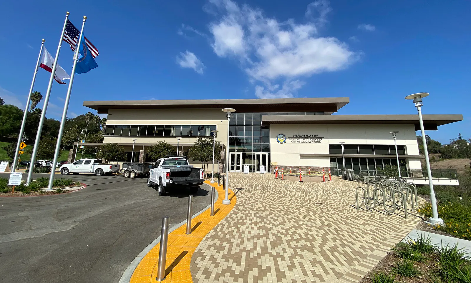
Head to Crown Valley Community Park, the city's civic hub. Kids can enjoy the playground, splash pad, or open fields, while parents can explore the adjacent Niguel Botanical Preserve. On warm days, check public lap and recreational swimming times at the Laguna Niguel Aquatics Center.
Catch a film at Cinépolis Luxury Cinemas in Ocean Ranch Village or Regency Theatres in Rancho Niguel, drop by the Laguna Niguel Public Library, or book an indoor workout class at local plaza studios in Plaza de La Paz or Ocean Ranch.
Use the Salt Creek Trail, a paved multi-use pathway stretching nearly 7 miles from inland Laguna Niguel down to Salt Creek Beach in Dana Point. Its grade-separated underpasses beneath thoroughfares like Niguel Road and PCH allow for continuous movement without waiting at street intersections.
Explore the Niguel Botanical Preserve with zero entrance fees, or visit Aliso and Wood Canyons Wilderness Park for a nominal vehicle parking fee to access over 30 miles of wilderness trails, including historic Dripping Cave and the 2,600-square-foot Visitor Center.
For a short escape from Laguna Niguel, compare Escondido and Avalon. More options are listed in the trip section below.
Outdoors nearby
Use these nearby outdoor options when the plan calls for a trail, protected landscape, park, or drive instead of another indoor stop. Proximity here is geographic, not a promise about driving time.
Get out of town
When staying in town is not the answer, these nearby destinations give you a smaller starting set for a day trip, overnight escape, or weekend away.
Destination relationships are screened geographically. Straight-line proximity is not presented as road mileage or estimated travel time.
Local landmarks & attractions
These notable destinations offer a starting point when you want something specific to see, visit, or build into a day around Laguna Niguel. Distances are approximate from the city area.
American theme park in California owned by The Walt Disney Company
library, museum, and campus in Yorba Linda, California, USA
multi-purpose indoor arena in Anaheim, California, USA
zoo in Santa Ana, California
theme park in California, part of Disneyland Resort
museum in Laguna Beach, California
concert venue in Costa Mesa, Orange County, California, United States of America
zoo in California, United States
Notable places are selected from structured public destination data and ranked for relevance, prominence, proximity, and variety.
Local decision signals
A useful local recommendation depends on how the city actually works. These conditions affect where to go, what to do, and whether a plan makes sense right now.
Incorporated in 1989 across 14.7 square miles with over 120 HOAs, the city relies on commercial plazas rather than a central downtown main street.
Coastal ridges (Niguel Summit, Laguna Sur) often experience marine layer morning fog and cooler mid-70s summer temperatures, while inland valleys (Rancho Niguel) clear early and reach the 80s to 90s.
OC Parks enforces a strict 72-hour trail closure across Aliso and Wood Canyons Wilderness Park after rainfall to prevent erosion and trail damage.
Crown Valley Parkway serves as the primary spine linking I-5 to Pacific Coast Highway, experiencing heavy commuter traffic during morning and evening windows and summer weekend beach drives.
A paved 5.7 to 6.8-mile multi-use trail features grade-separated underpasses under major thoroughfares like Niguel Road and PCH, providing continuous off-street access down to Salt Creek Beach.
Ongoing Moulton Niguel Water District pipeline work through Spring 2027 impacts the East Trail and makes shelter rentals first-come, first-served at Laguna Niguel Regional Park.
Neighborhood context
Neighborhoods are not interchangeable. Each area offers a different balance of atmosphere, transportation, food, nightlife, activities, and planning friction.
Best for: Gated privacy, custom architectural estates, ocean ridge views
A premier 24-hour guard-gated estate enclave on southern ridges featuring large custom lots and coastal canyon panoramas.
Best for: Coastal elevation, marine breezes, ocean trailhead access
Elevated hilltop neighborhoods overlooking Dana Point and the Pacific Ocean, offering distinct coastal weather and ridge trails.
Best for: Townhouses, ridge top vistas, Aliso Canyon overlooks
High-ridge subdivisions along the northwestern crest providing sweeping views down Aliso Canyon to the ocean.
Best for: Cape Cod architecture, walkability to ocean paths, HOA amenities
An established western master-planned community known for coastal-inspired homes, multiple pools, and pedestrian trail connections.
Best for: Central location, greenbelts, direct Salt Creek Trail connection
A large-scale central subdivision structured around greenbelts, an Olympic-sized community pool, and direct access to Salt Creek Trail.
Best for: Highway and rail commute access, family-focused retail plazas
Northern/northeast district offering convenient connections to I-5, SR-73, the Metrolink station, and shopping at The Center at Rancho Niguel.
Best for: Golf course surroundings, central suburban positioning
Single-family pockets surrounding the private 18-hole El Niguel Country Club golf course along Crown Valley Parkway.
Best for: Gated northern privacy, SR-73 toll road convenience
An elevated, gated northern master-planned area offering fast access to the SR-73 toll corridor toward Irvine.

Laguna Niguel local guide
Laguna Niguel was established as one of South Orange County’s premier master-planned communities, officially incorporating in 1989 across 14.7 square miles. Designed around the rolling topography of the San Joaquin Hills, the city is defined by over 120 homeowner associations, hillside subdivisions, and dedicated open space corridors rather than a traditional downtown grid.
Commercial life centers on distinct suburban shopping plazas distributed along major arterials like Crown Valley Parkway, Alicia Parkway, and Golden Lantern. Plazas such as Ocean Ranch Village, The Center at Rancho Niguel, and Laguna Niguel Town Center serve as community anchors hosting grocery outlets, fitness centers, and locally owned restaurants.
To address the historic lack of a downtown core, the city has approved the 24-acre Laguna Niguel City Center mixed-use project at Crown Valley Parkway and Alicia Parkway. Planned for groundbreaking in 2026, this hub will introduce chef-driven restaurants, retail, residential units, a civic plaza, and a new branch of the Orange County Public Library.
Explore your options
Laguna Niguel offers extensive acreage dedicated to public parks, coastal wilderness, and botanical collections.
The city's central 18-acre recreational complex featuring a multi-use community center, aquatics facility, splash pad, and outdoor amphitheater.
A 4,500-acre regional wilderness reserve providing over 30 miles of multi-use trails through sycamore woodlands and canyon terrain.
A 227-acre County-managed park surrounding a stocked 44-acre lake, providing green space, hiking paths, and sports facilities.
Practical local guidance
Essential operational realities and microclimate conditions for organizing trips in Laguna Niguel.
A simpler way to decide
Follow these practical steps to navigate the continuous paved Salt Creek Trail from inland Laguna Niguel directly to the beach.
Begin your ride at Chapparosa Park or the trailhead near Golden Lantern, where off-street neighborhood parking and direct trail access are available.
Ensure your bicycle or walking gear is suitable for paved paths with subtle rolling changes in elevation along the Salt Creek Valley.
Follow the main multi-use trail beneath major roadway crossings—including Niguel Road and Camino Del Avion—without needing to stop for traffic signals.
Pass beneath Pacific Coast Highway through the designated pedestrian and cyclist tunnel to transition directly into Salt Creek Beach Park.
Keep in mind that the return leg inland climbs gradually back up the canyon grade, so budget sufficient energy and hydration for the climb.
Common local questions
These are common situations people face when trying to decide where to eat, what to do, where to get drinks, or how to spend their time in Laguna Niguel.
Laguna Niguel planning questions
Practical answers for people deciding where to eat, what to do, where to go, or how to make plans in Laguna Niguel.
Laguna Niguel is located 2 to 5 miles inland in the San Joaquin Hills and does not have direct ocean frontage. However, Salt Creek Beach and Monarch Beach sit immediately adjacent in Dana Point and can be accessed via a short drive or by following the continuous Salt Creek Trail.
The Niguel Botanical Preserve inside Crown Valley Park offers 18 acres of Mediterranean garden trails with no admission fee. Badlands Park and Seaview Park also provide free blufftop views of the Pacific coastline.
City-managed parks (such as Crown Valley Park and Chapparosa Park) offer free parking. County-operated parks (Laguna Niguel Regional Park and Aliso and Wood Canyons Wilderness Park) charge a daily vehicle parking fee ($3 on weekdays, $5 on weekends).
The Laguna Niguel / Mission Viejo Metrolink station on Forbes Road provides rail access along the Orange County Line and Inland Empire–Orange County Line. OCTA bus routes 85 and 91, along with OC Flex microtransit, connect the rail station to major local plazas and neighboring college campuses.
Local dining is concentrated in major shopping plazas, including Ocean Ranch Village (coastal Italian, casual bites), The Center at Rancho Niguel (family eateries and casual chains), and Laguna Niguel Town Center (neighborhood spots and wine bars).
OC Parks enforces a strict 72-hour closure rule for all unpaved dirt trails post-rainfall to protect fragile coastal canyon ecosystems, prevent trail erosion, and ensure user safety.
The iconic stepped-pyramid federal building was sold in July 2026 to Hoag Memorial Hospital Presbyterian for $207 million, with plans to convert the 89-acre property into a health and wellness village.
Residents use indoor workout studios at Plaza de La Paz and Ocean Ranch Village, utilize the Crown Valley Community Center multi-purpose rooms, or swim laps at the heated Laguna Niguel Aquatics Center.
Due to ongoing Moulton Niguel Water District force main replacement construction through Spring 2027, park shelter rentals are currently non-reservable and operate on a first-come, first-served basis.
Source transparency
Official and locally relevant sources used to verify the practical information presented in this Laguna Niguel decision guide.
Laguna Niguel decision engine
Tell Adventria what kind of experience you want, set your practical limits, and turn the options in Laguna Niguel into one workable plan.
Choose a Laguna Niguel Plan