The BLVD Cultural District (Downtown)
Best for
Walkable dining, contemporary art, craft beer, and evening entertainment.
 AdventriaLocalOpen App
Antelope Valley Local Planning Guide
Trying to decide what to do in Lancaster? Adventria helps you cut through the options and choose a good-enough plan without endless scrolling. Lancaster spans over 94 square miles of the western Mojave Desert, where wide grid thoroughfares, intense seasonal shifts, and stark suburban-versus-rural splits shape daily plans. Whether you are seeking walkable dining along The BLVD, looking for heat-conscious outdoor trips, or planning a weekend around local arts, this guide gives you real decision frameworks for making the most of your time in Lancaster.
The local decision problem
Navigating distance, extreme High Desert weather, and distinct district boundaries to plan activities in Lancaster, California.
That is where Adventria comes in. Adventria helps narrow the options in Lancaster around practical factors like location, distance, budget, vibe, who you are with, and the kind of experience you actually want, so research can turn into a decision.
Let Adventria narrow the optionsPick the right part of town
Different parts of Lancaster work for different kinds of plans. Start with the experience you want, then narrow the map.
Best for
Walkable dining, contemporary art, craft beer, and evening entertainment.
Best for
Quiet suburban stays, top-rated schools, nature walks, and higher education.
Best for
Transit-oriented travel and convenient rail access.
Best for
Regional sports, historic streetscapes, and community parks.
Best for
Roadside novelties, lakeside picnics, and aviation heritage.
Best for
Expositions, RV camping, and large-scale regional events.
This is a quick starting point. The full guide covers 7 local neighborhoods and districts in Lancaster.

Eat & drink
Trying to decide where to eat in Lancaster? Start with the local dining context below and narrow the decision around the kind of meal or experience you actually want.
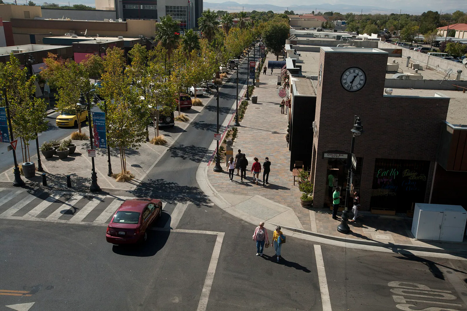
Head directly to The BLVD Cultural District. Park for free in the municipal lot behind W. Lancaster Blvd and walk between 10th St W and Sierra Highway. Enjoy craft burgers and house beers at Lucky Luke Brewpub, or head slightly west to 8th St West for wood-fired pizza and barrel-aged pours at Bravery Brewing Company. Wrap up the night with dessert along the ramblas promenade.
Still comparing options? Adventria can narrow the choice around budget, distance, vibe, and who you are with.
Decide with AdventriaPlan by situation
Start with the kind of plan you are actually trying to make. These city-specific ideas narrow the choice around who you are with, what you want to spend, the weather, and the kind of outing you want.
For an outdoor plan from Lancaster, compare trails, state parks, national parks within trip range, and scenic drives. Options in the current city guide include Arthur B. Ripley Desert Woodland State Park and Saddleback Butte State Park.
Book evening theater or comedy tickets at the Lancaster Performing Arts Center (LPAC). Arrive early to stroll through Boeing Plaza to see the F-4 Phantom jet, enjoy dinner at a local gastropub on W. Lancaster Blvd, and grab drinks at Lucky Luke Brewpub post-show. For a low-key outdoor alternative, attend a evening Moon Walk guided astronomy trail walk at Prime Desert Woodland Preserve.
Take kids to Apollo Community Regional Park to walk around the lakes and watch waterfowl. Head to the Elyze Clifford Interpretive Center inside Prime Desert Woodland Preserve for hands-on animal displays and touch tables. Finish the outing with a quick pass down the Musical Road on Avenue G for a fun, interactive driving experience.
Accessing nature and culture in Lancaster is easy on a budget. Prime Desert Woodland Preserve offers completely free trail access and admission to its interpretive center. Admission to MOAH and MOAH:CEDAR operates on a low-cost or donation-appreciated model. You can also play open pickleball at Sgt. Steve Owen Memorial Park or take a free walking tour of BLVD murals.
Enjoy a quiet morning hiking the dirt paths at Prime Desert Woodland Preserve before heat builds up. Afterward, spend a self-paced hour exploring three floors of modern art at MOAH on W. Lancaster Blvd. Sit at the counter taproom at Bravery Brewing or Lucky Luke for casual conversation with local brewers and patrons.
Reserve a picnic pavilion shelter at Sgt. Steve Owen Memorial Park or Apollo Regional Park for large family or community gatherings. For group dining and drinks, book large group tables at Bravery Brewing Co. on 8th St West or coordinate event space at the Antelope Valley Fair & Event Center.
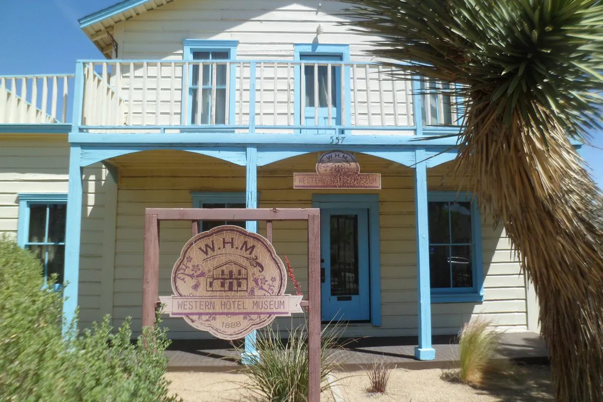
When summer temps soar above 100°F, stay inside air-conditioned cultural spaces. Explore the visual art galleries at MOAH, visit MOAH:CEDAR, or explore pioneer exhibits inside the air-conditioned 1888 Western Hotel Museum. Catch a matinee or evening performance inside the 758-seat mainstage auditorium at LPAC.
Outdoors nearby
Use these nearby outdoor options when the plan calls for a trail, protected landscape, park, or drive instead of another indoor stop. Proximity here is geographic, not a promise about driving time.
Get out of town
When staying in town is not the answer, these nearby destinations give you a smaller starting set for a day trip, overnight escape, or weekend away.
Destination relationships are screened geographically. Straight-line proximity is not presented as road mileage or estimated travel time.
Local landmarks & attractions
These notable destinations offer a starting point when you want something specific to see, visit, or build into a day around Lancaster. Distances are approximate from the city area.
building in Lancaster, California, United States
animal sactuary near Acton, California, United States
natural Area Park in California, United States
waterpark in Palmdale, California
state historic park in California, USA
motor racing circuit in Kern County, California, U.S.
stadium in Lancaster, California
County park in Santa Clarita, California
Notable places are selected from structured public destination data and ranked for relevance, prominence, proximity, and variety.
Local decision signals
A useful local recommendation depends on how the city actually works. These conditions affect where to go, what to do, and whether a plan makes sense right now.
State Route 14 is the primary highway link to Los Angeles. Southbound traffic jams heavily from 5:30 AM to 8:30 AM, while northbound return traffic bottlenecks between 3:30 PM and 7:00 PM.
Lancaster uses a strict mile-grid system with lettered avenues (north/south) and numbered streets (east/west). Crossing from West Lancaster to East Lancaster venues often takes 20+ minutes.
Summer midday temperatures regularly surpass 100°F between June and September. Outdoor plans at unshaded spots must wrap up by 10:00 AM or wait until evening.
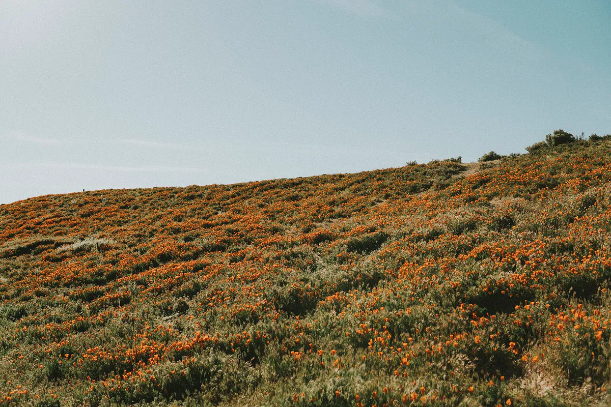
Spring brings wind gusts exceeding 35 mph. Wind and heavy overcast cause wild California poppies to close, making high-wind days bad for reserve visits.
The BLVD offers central street parking and free municipal lots directly behind W. Lancaster Blvd between 10th St W and Sierra Highway.
The Antelope Valley Transit Authority operates a fully electric local bus fleet, anchored by hubs at Sgt. Steve Owen Park and the Lancaster Metrolink station.
Neighborhood context
Neighborhoods are not interchangeable. Each area offers a different balance of atmosphere, transportation, food, nightlife, activities, and planning friction.
Best for: Walkable dining, contemporary art, craft beer, and evening entertainment.
Centered on W. Lancaster Boulevard, this pedestrian-friendly district features tree-lined strolls, patio dining, MOAH, LPAC, and the Aerospace Walk of Honor.
Best for: Quiet suburban stays, top-rated schools, nature walks, and higher education.
Located west of SR-14, this sector features master-planned neighborhoods, Antelope Valley College, and the peaceful Prime Desert Woodland Preserve.
Best for: Transit-oriented travel and convenient rail access.
Surrounding the Lancaster Metrolink Station and eastern downtown edge, this developing transit hub links regional commuters to the civic center.
Best for: Regional sports, historic streetscapes, and community parks.
The established historic core east of Sierra Highway houses the massive Lancaster National Soccer Center, community facilities, and quiet residential streets.
Best for: Roadside novelties, lakeside picnics, and aviation heritage.
Surrounding General William J. Fox Airfield along Avenue G, this northern hub features Apollo Regional Park and the famous rumble-strip Musical Road.
Best for: Expositions, RV camping, and large-scale regional events.
Home to the 160-acre Antelope Valley Fair & Event Center along Avenue H West, hosting major conventions, agricultural fairs, and derbies.
Best for: Equestrian living, open desert views, and quiet stargazing.
Semi-rural unincorporated communities on the far northern and northwestern outskirts with low light pollution and sprawling lot parcels.
Lancaster local guide
Lancaster sits at an elevation between 2,350 and 3,000 feet in the western Mojave Desert, nestled in a flat basin framed by the San Gabriel and Tehachapi mountain ranges. Operating on an extensive mile-grid system, the city stretches over 94 square miles. Avenues lettered A through N run east to west, while numbered streets run north to south relative to Division Street and Sierra Highway. Crossing from residential West Lancaster to sports facilities on the east side often requires 20 minutes of driving across multi-lane arterials.
Regional travel requires careful timing around State Route 14 (the Antelope Valley Freeway), which serves as the primary route south into Santa Clarita and Los Angeles. Heavy commuter congestion routinely slows SR-14 southbound between 5:30 AM and 8:30 AM, while northbound return traffic bottlenecks between 3:30 PM and 7:00 PM. Visitors and locals planning trips into or out of the valley should schedule travel outside these peak windows.
Weather introduces another layer of planning friction. Summers bring intense dry heat with daily highs frequently topping 100°F, making shaded or indoor venues essential after midday. Conversely, spring brings strong High Desert wind gusts exceeding 35 mph, which can affect outdoor plans and cause poppy blossoms to close at the reserve. Winter temperatures drop near freezing overnight, making seasonal planning vital.
Explore your options
Lancaster features several key landmark hubs that define its cultural, recreational, and civic life.
The vibrant downtown core of Lancaster, transformed with pedestrian ramblas, patio dining, and outdoor public art.
A 120-acre protected High Desert sanctuary preserving native Joshua trees, juniper stands, and desert wildlife.
A 54-acre county park named in honor of the Apollo 11 astronauts, featuring open water and recreation space.
The largest sports venue of its kind in the Western United States, hosting regional tournaments year-round.
Practical local guidance
Enjoy these flexible, no-reservation activities across Lancaster without spending heavily.
A simpler way to decide
Follow this step-by-step itinerary sequence to maximize your time while accounting for heat and travel distance.
Begin your morning at 8:00 AM at Prime Desert Woodland Preserve in West Lancaster. Enjoy cool temperatures while hiking 3 miles of dirt trails among native Joshua trees before daytime heat sets in.
Drive north up 35th St West to Avenue G and head east. Drive your vehicle at exactly 55 mph in the left lane between 30th and 40th Street West to hear the rumble strips play the Musical Road melody.
Park in the free surface lot behind W. Lancaster Blvd. Spend late morning exploring three floors of modern art at MOAH, or visit the historic 1888 Western Hotel Museum.
Walk along the pedestrian ramblas for lunch at a local gastropub or head to Lucky Luke Brewpub for locally brewed craft beer, burgers, and plant-based options.
Check the schedule at the Lancaster Performing Arts Center (LPAC) for evening music, theatrical shows, or national comedy tours to complete your day.
Common local questions
These are common situations people face when trying to decide where to eat, what to do, where to get drinks, or how to spend their time in Lancaster.
Lancaster planning questions
Practical answers for people deciding where to eat, what to do, where to go, or how to make plans in Lancaster.
Downtown Lancaster offers dedicated angle-in street parking along W. Lancaster Blvd as well as free municipal surface lots directly behind the shops on both the north and south sides of W. Lancaster Blvd between 10th St W and Sierra Highway.
The Musical Road is located on Avenue G between 30th Street West and 40th Street West in northern Lancaster. Drive westbound in the far left lane at precisely 55 mph to hear the rumble strips play the tune of the William Tell Overture.
Fall (September through November) offers the most comfortable weather, with clear warm days between 67°F and 85°F, low wind, and cool nights. Spring is also popular for wildflower blooms, though wind conditions can be intense.
Lancaster is roughly 70 miles north of Downtown Los Angeles via State Route 14 and Interstate 5. Avoid southbound commute traffic on SR-14 between 5:30 AM and 8:30 AM, and northbound return traffic between 3:30 PM and 7:00 PM.
The BLVD Cultural District features the Lancaster Museum of Art and History (MOAH), Lancaster Performing Arts Center (LPAC), MOAH:CEDAR, the historic Western Hotel Museum, Boeing Plaza, and the Aerospace Walk of Honor.
Yes. The Antelope Valley Transit Authority (AVTA) operates local electric buses and commuter routes to Los Angeles. Metrolink passenger rail service runs out of Lancaster Station on Sierra Highway, connecting to LA Union Station.
The Lancaster Museum of Art and History (MOAH) operates on a general admission model that is free or donation-appreciated, making high-quality art accessible to all visitors.
Sgt. Steve Owen Memorial Park (located at 10th Street West) features eight dedicated, fully lit outdoor pickleball courts available for open community play.
Lancaster is home to Bravery Brewing Company on 8th Street West (known for barrel-aged beers and wood-fired pizza) and Lucky Luke Brewpub on W. Lancaster Blvd in downtown.
Source transparency
Official and locally relevant sources used to verify the practical information presented in this Lancaster decision guide.
Lancaster decision engine
Tell Adventria what kind of experience you want, set your practical limits, and turn the options in Lancaster into one workable plan.
Choose a Lancaster Plan