Old Town Victorville (Historic District)
Best for
Route 66 history, civic centers, and public transit connections.
 AdventriaLocalOpen App
Local Planning & Activity Guide
Trying to decide what to do in Victorville? Adventria helps you cut through the options and choose a good-enough plan without endless scrolling. Whether you are managing High Desert thermal extremes, navigating Friday Cajon Pass gridlock, or finding family recreation along the Bear Valley corridor, smart decisions in Victorville require understanding local terrain and travel friction.

The local decision problem
Navigating extreme desert weather, Cajon Pass transit bottlenecks, and sprawling commercial corridors to find local dining, entertainment, and outdoor recreation.
That is where Adventria comes in. Adventria helps narrow the options in Victorville around practical factors like location, distance, budget, vibe, who you are with, and the kind of experience you actually want, so research can turn into a decision.
Let Adventria narrow the optionsPick the right part of town
Different parts of Victorville work for different kinds of plans. Start with the experience you want, then narrow the map.
Best for
Route 66 history, civic centers, and public transit connections.
Best for
Shopping, national chain dining, and central commercial access.
Best for
Master-planned suburban living and quick park access.
Best for
Golf access and central suburban neighborhood amenities.
Best for
Semi-rural space, large lots, and quiet desert terrain.
Best for
Aviation, industrial operations, and freight distribution.
This is a quick starting point. The full guide covers 7 local neighborhoods and districts in Victorville.
Eat & drink
When the decision is less about what to do and more about where to eat or grab a drink, start here. These local cues narrow the food and drink decision without turning dinner or a night out into another hour of comparison.
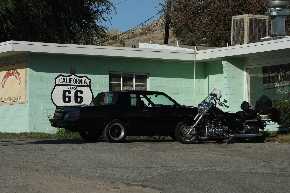
For iconic classic fare, visit Emma Jean's Holland Burger Cafe on North D Street for breakfast or early lunch. If dining along the primary shopping strip, head to Down Home Grill on Bear Valley Road for organic scrambles or explore the chain options along Mariposa Road's Restaurant Row near I-15.
Catch a movie at Cinemark 16 XD inside The Mall of Victor Valley or arrange bowling, billiards, and arcade games at Monarch Fun Zone / Victor Bowl. For casual nightlife and sports broadcasts, visit Cosmos Taverna on Mariposa Road.
Still comparing options? Adventria can narrow the choice around budget, distance, vibe, and who you are with.
Decide with AdventriaPlan by situation
Start with the kind of plan you are actually trying to make. These city-specific ideas narrow the choice around who you are with, what you want to spend, the weather, and the kind of outing you want.
Pair a late-afternoon stroll at Sunset Ridge Park during dusk with a sit-down dinner along Mariposa Road's Restaurant Row, followed by a film at Cinemark 16 XD.
Visit Sunset Ridge Park or Hook Community Park for playgrounds and open grass. During hot summer months, use the splash pad at Mojave Narrows Regional Park or retreat indoors to Monarch Fun Zone for laser tag and arcade games.
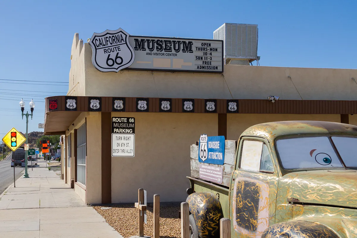
Visit the California Route 66 Museum, which offers free entry (donations accepted). Free local walking tracks and playgrounds are available at Hook Park and Doris Davies Park.
Play a solo round of disc golf across the water hazards at Mojave Narrows Regional Park, read at Barnes & Noble near the mall, or take a self-guided artifact tour inside the California Route 66 Museum.
For an outdoor plan from Victorville, compare trails, state parks, national parks within trip range, and scenic drives. Options in the current city guide include Saddleback Butte State Park and Joshua Tree National Park.
For a short escape from Victorville, compare Lake Elsinore and Lancaster. More options are listed in the trip section below.
When summer temperatures surpass 100°F, stay inside conditioned spaces such as The Mall of Victor Valley, the California Route 66 Museum, or Victor Bowl.
Outdoors nearby
Use these nearby outdoor options when the plan calls for a trail, protected landscape, park, or drive instead of another indoor stop. Proximity here is geographic, not a promise about driving time.
Get out of town
When staying in town is not the answer, these nearby destinations give you a smaller starting set for a day trip, overnight escape, or weekend away.
Destination relationships are screened geographically. Straight-line proximity is not presented as road mileage or estimated travel time.
Local landmarks & attractions
These notable destinations offer a starting point when you want something specific to see, visit, or build into a day around Victorville. Distances are approximate from the city area.
Museum in Victorville, California
American amusement park
65,000-capacity amphitheater located in the hills of Glen Helen Regional Park in San Bernardino, California, United States
state historic park in California, USA
home and studio complex in Rancho Cucamonga, California, USA
Baseball stadium in Adelanto, California, U.S.
California Historic Landmark
arena in San Bernardino, California, US
Notable places are selected from structured public destination data and ranked for relevance, prominence, proximity, and variety.
Local decision signals
A useful local recommendation depends on how the city actually works. These conditions affect where to go, what to do, and whether a plan makes sense right now.
Friday evening northbound and Sunday afternoon southbound I-15 traffic frequently causes multi-hour delays through the pass.
Summer daytime temperatures regularly exceed 100°F, requiring outdoor plans to conclude before 10:00 AM or shift to night hours.
Seasonal Santa Ana winds and spring desert gusts exceeding 30–40 mph reduce visibility on open highways like US-395 and I-15.
The Victor Valley Transportation Center in Old Town serves as the regional hub for local VVTA buses, Greyhound, and Amtrak Thruway lines.
Mojave Narrows Regional Park is managed by San Bernardino County and requires per-vehicle entry fees and fishing permits, unlike free city parks.
Historic Route 66 dining spots like Emma Jean's Holland Burger Cafe operate on classic morning-to-early-afternoon hours.
Brightline West electric high-speed rail broke ground along the I-15 median, connecting the High Desert to Las Vegas and Rancho Cucamonga.
Neighborhood context
Neighborhoods are not interchangeable. Each area offers a different balance of atmosphere, transportation, food, nightlife, activities, and planning friction.
Best for: Route 66 history, civic centers, and public transit connections.
The historic core along 7th and D Streets housing the California Route 66 Museum and the Victor Valley Transportation Center.
Best for: Shopping, national chain dining, and central commercial access.
The retail epicenter surrounding The Mall of Victor Valley and Mariposa Road's Restaurant Row.
Best for: Master-planned suburban living and quick park access.
Residential tracts located south of Bear Valley Road with modern local parks and arterial connections to Amargosa Road.
Best for: Golf access and central suburban neighborhood amenities.
Established mid-century to 1980s housing community centered around the municipal Green Tree Golf Course.
Best for: Semi-rural space, large lots, and quiet desert terrain.
Low-density residential area west of US Highway 395 featuring open landscape and custom lots.
Best for: Aviation, industrial operations, and freight distribution.
Global industrial hub situated on the former George Air Force Base site in northwestern Victorville.
Best for: Waterway views, regional park access, and outdoor trails.
Eastern boundary district offering proximity to the Mojave River basin and Mojave Narrows Regional Park.
Victorville local guide
Victorville sits at an elevation between 2,870 and 2,900 feet in the Mojave Desert plateau of San Bernardino County. Built around a major arterial road grid, the city relies heavily on private vehicle travel. Free, unmetered parking is standard at public parks, retail plazas, and commercial hubs.
The primary regional travel friction point is the Cajon Pass on Interstate 15. Commuter traffic, heavy freight trucking, high-wind events, and winter conditions regularly block this mountain pass. Delays peak northbound on Friday afternoons and southbound on Sunday evenings. Within city limits, major congestion occurs along Bear Valley Road, Palmdale Road (State Route 18), and US Highway 395 during morning and evening rush hours.
Explore your options
Match your outing to the appropriate local venue based on activity style and functional location.
An 840-acre county oasis situated along the Mojave River basin.
The historic core showcasing mid-century roadside culture and transit infrastructure.
The central commercial strip for casual dining, retail, and indoor entertainment.
Practical local guidance
Keep these operational realities in mind when building an itinerary in Victorville.
A simpler way to decide
Follow these steps to build an efficient day plan that avoids traffic delays and heat exposure.
Check highway reports along Interstate 15 before traveling into or out of the Victor Valley, adjusting departure times around peak commuter windows.
Arrive at outdoor locations like Mojave Narrows Regional Park or Green Tree Golf Course by early morning during warm months to avoid peak midday sun.
Verify operating times for legacy Route 66 eateries in Old Town before arriving, as several close mid-afternoon.
Transition to climate-controlled indoor venues like The Mall of Victor Valley or California Route 66 Museum during peak afternoon heat.
Conclude your day along Mariposa Road or Civic Drive, where concentrated dining and evening sports viewing venues are situated close to highway ramps.
Common local questions
These are common situations people face when trying to decide where to eat, what to do, where to get drinks, or how to spend their time in Victorville.
Victorville planning questions
Practical answers for people deciding where to eat, what to do, where to go, or how to make plans in Victorville.
Driving is the most practical transportation method in Victorville due to wide arterial roads and sprawling commercial layout. Free parking is available at nearly all shopping plazas, civic centers, and public parks. Local public bus transit is provided by the Victor Valley Transit Authority (VVTA), centered at the Victor Valley Transportation Center on D Street.
Traffic gridlock through the Cajon Pass occurs northbound on Friday afternoons and evenings as travelers head toward Las Vegas and the High Desert, and southbound on Sunday afternoons and evenings as travelers return to Greater Los Angeles.
Yes, admission to the California Route 66 Museum in Old Town Victorville is free, though donations are accepted. Free outdoor amenities include neighborhood municipal parks like Sunset Ridge Park, Hook Community Park, and Doris Davies Park.
Summer temperatures routinely exceed 100°F between June and September, requiring morning outdoor activities or indoor retreats. Strong wind events with gusts over 30–40 mph occur periodically, causing blowing dust and low visibility on open roads.
The commercial hub is centered around Civic Drive and Bear Valley Road near Interstate 15, anchored by The Mall of Victor Valley and retail developments along Mariposa Road and Amargosa Road.
Mojave Narrows is operated by San Bernardino County Regional Parks. Unlike free municipal city parks, it charges per-vehicle entry fees. Fishing in Pelican or Horseshoe Lake requires a standard California fishing license plus a daily county fishing permit.
Historic Route 66 runs along 7th Street and D Street in Old Town Victorville. Key landmarks include the California Route 66 Museum and legacy eateries like Emma Jean's Holland Burger Cafe on North D Street.
Options include golfing at the municipal Green Tree Golf Course, bowling and arcade gaming at Victor Bowl / Monarch Fun Zone, movies at Cinemark 16 XD, and 18-hole disc golf at Mojave Narrows.
Source transparency
Official and locally relevant sources used to verify the practical information presented in this Victorville decision guide.
Victorville decision engine
Tell Adventria what kind of experience you want, set your practical limits, and turn the options in Victorville into one workable plan.
Choose a Victorville Plan