North Pico Rivera / Whittier Narrows Fringe
Best for
Concertgoers, rodeo spectators, golfers, and trail access.
 AdventriaLocalOpen App
Gateway Cities Local Planning Guide
Trying to decide what to do in Pico Rivera? Adventria helps you cut through the options and choose a good-enough plan without endless scrolling. Pico Rivera sits 11 miles southeast of Downtown Los Angeles in the Gateway Cities region, bounded by the Rio Hondo and San Gabriel River channels. Whether you are searching for mid-century fine dining, authentic regional Mexican gastronomy, multi-use river trails, or weekend event planning near major venues, this guide outlines practical decision factors for local residents and visitors.
The local decision problem
Navigating transit bottlenecks, event schedules, and neighborhood dining options to plan day, evening, and weekend activities in Pico Rivera.
That is where Adventria comes in. Adventria helps narrow the options in Pico Rivera around practical factors like location, distance, budget, vibe, who you are with, and the kind of experience you actually want, so research can turn into a decision.
Let Adventria narrow the optionsPick the right part of town
Different parts of Pico Rivera work for different kinds of plans. Start with the experience you want, then narrow the map.
Best for
Concertgoers, rodeo spectators, golfers, and trail access.
Best for
Civic services, open-air retail shopping, museum visits, and central park recreation.
Best for
Established residential neighborhood feel, local park access, and neighborhood dining.
Best for
Indoor gym sports, batting cages, and direct eastern river trail access.
Best for
Logistics connections, roadside services, and freeway access.
Eat & drink
When the decision is less about what to do and more about where to eat or grab a drink, start here. These local cues narrow the food and drink decision without turning dinner or a night out into another hour of comparison.
For fine dining with historic mid-century atmosphere, book a booth at Dal Rae Restaurant on Washington Boulevard for classic steakhouse fare and tableside service. If seeking authentic CDMX-style tacos and chilaquiles, head to Taquearte California on Rosemead Boulevard. Fresh pan dulce is available at La Espiga Mexican Bakery, while fresh masa and corn tortillas are made daily at La Mano Tortilleria. Dozens of casual taquerias and mariscos establishments line Washington and Whittier Boulevards.
For live music and dancing, A Mi Hacienda de Pico Rivera on Whittier Boulevard hosts regional Mexican genres including banda, norteño, and cumbia on weekends. For an elegant dinner out, Dal Rae provides live lounge piano accompaniment alongside traditional cocktails. Moviegoers can check evening listings at Cinepolis on Whittier Boulevard.
Still comparing options? Adventria can narrow the choice around budget, distance, vibe, and who you are with.
Decide with AdventriaPlan by situation
Start with the kind of plan you are actually trying to make. These city-specific ideas narrow the choice around who you are with, what you want to spend, the weather, and the kind of outing you want.
Admission to the Pico Rivera Historical Museum is free. Running, walking, or biking along the Rio Hondo and San Gabriel River trails costs nothing. Public open play hours for pickleball are available at Rivera Park, and Smith Park offers free access to playground equipment and skate facilities.
For an outdoor plan from Pico Rivera, compare trails, state parks, national parks within trip range, and scenic drives. Options in the current city guide include Pío Pico State Historic Park and Los Angeles State Historic Park.
Plan a classic date night in a dark-wood booth at Dal Rae Restaurant, ordering tableside Caesar salad and martinis while listening to live piano music. Alternatively, pair evening tacos at Taquearte California with a movie screening at Cinepolis, or enjoy a weekend dance night at A Mi Hacienda.
Smith Park features playgrounds, outdoor handball courts, and a skatepark. Rivera Park offers open fields and batting cages. Families can also stop by local bakeries like La Espiga for afternoon treats, or combine outdoor time with errands at the Pico Rivera Towne Center.
Visit the indoor exhibits at the Pico Rivera Historical Museum inside the restored 1887 Southern Pacific Railway depot. Browse collections or attend quiet workshops at the Pico Rivera Public Library. For indoor sports, check open facility hours at the Rivera Park gymnasium or catch a film at Cinepolis.
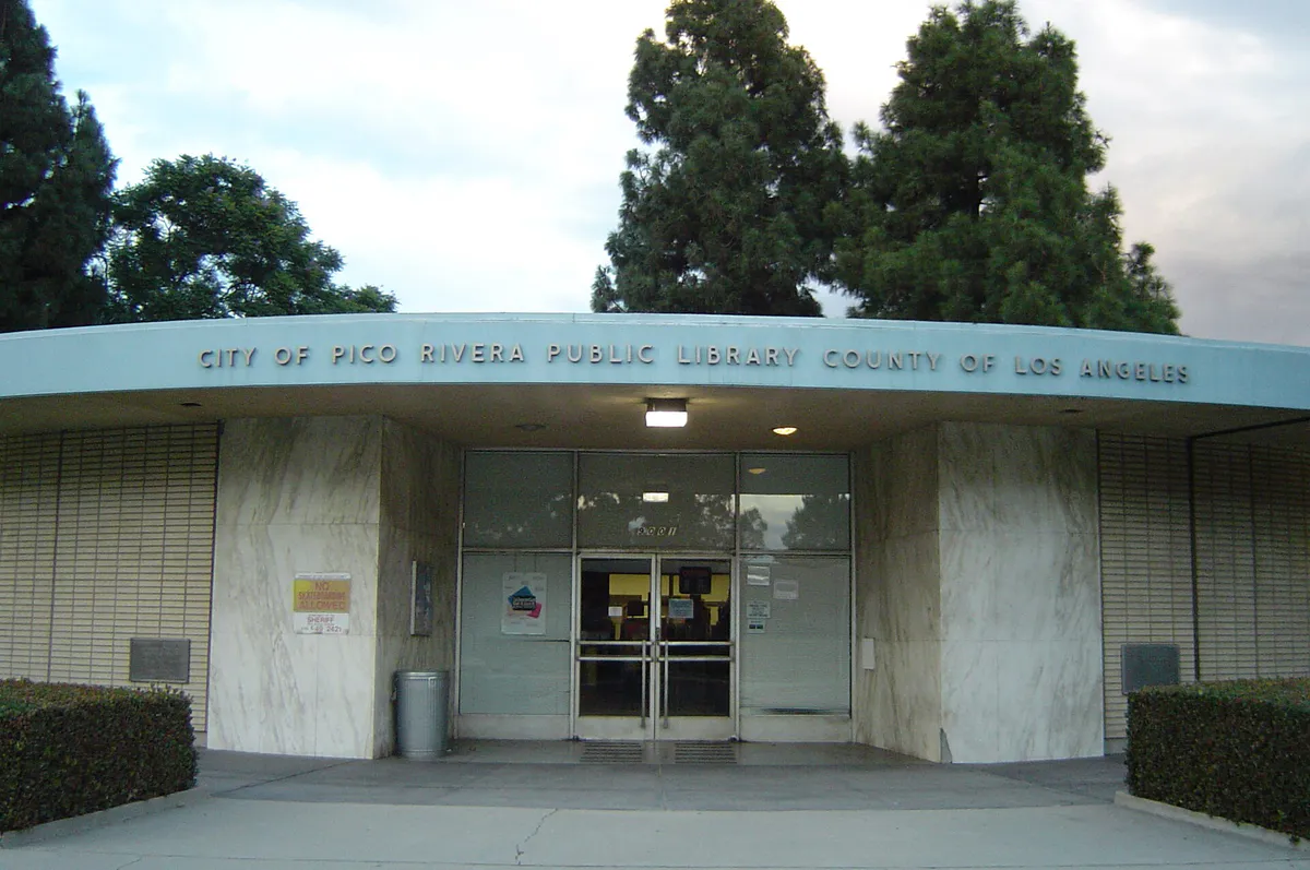
Cycle the Class I paved paths along the San Gabriel River or Rio Hondo trails. Solo golfers can drop by the lit driving range at Pico Rivera Municipal Golf Course or play 9 holes on the executive course. For quiet reading, visit the modernized Pico Rivera Public Library on Mine Avenue.
Reserve space or gather for live shows and dancing at A Mi Hacienda or attend a concert event at the Pico Rivera Sports Arena. Private gatherings can utilize banquet spaces like the Vista Room at Pico Rivera Golf Course, while casual group meals fit easily into the large dining plazas along Washington Boulevard.
Outdoors nearby
Use these nearby outdoor options when the plan calls for a trail, protected landscape, park, or drive instead of another indoor stop. Proximity here is geographic, not a promise about driving time.
Get out of town
When staying in town is not the answer, these nearby destinations give you a smaller starting set for a day trip, overnight escape, or weekend away.
Destination relationships are screened geographically. Straight-line proximity is not presented as road mileage or estimated travel time.
Local landmarks & attractions
These notable destinations offer a starting point when you want something specific to see, visit, or build into a day around Pico Rivera. Distances are approximate from the city area.
sign reading "HOLLYWOOD" located in Los Angeles, California, United States
library and art museum in San Marino, California
American theme park in California owned by The Walt Disney Company
protected area
live entertainment theatre in Los Angeles, California, United States
multi-purpose arena in Los Angeles, California, United States
more than 2,700 five-pointed terrazzo and brass stars embedded in the sidewalks along 15 blocks of Hollywood Boulevard and three blocks of Vine Street in Hollywood, California
cemetery in Los Angeles, California
Notable places are selected from structured public destination data and ranked for relevance, prominence, proximity, and variety.
Local decision signals
A useful local recommendation depends on how the city actually works. These conditions affect where to go, what to do, and whether a plan makes sense right now.
Framed by the Rio Hondo to the west and the San Gabriel River to the east, providing direct access to Class I paved multi-use paths.
Rosemead Boulevard (SR 19) serves as the main north-south axis, intersecting major east-west corridors including Washington, Beverly, and Whittier Boulevards.
East-west Union Pacific and BNSF freight lines bisect the city, with active grade separation construction occasionally altering local cross-town routing.
Heavy commercial truck traffic concentrates along Telegraph Road and Washington Boulevard due to neighboring industrial centers in Commerce and Santa Fe Springs.
Incorporated in 1958 from two unincorporated agricultural communities: Pico (named for Pío Pico) and Rivera.
Local routes are served by Montebello Bus Lines (Line 20) and LA Metro Bus (Lines 265 and 266), alongside municipal Dial-a-Ride services.
Neighborhood context
Neighborhoods are not interchangeable. Each area offers a different balance of atmosphere, transportation, food, nightlife, activities, and planning friction.
Best for: Concertgoers, rodeo spectators, golfers, and trail access.
Situated near the northern border along Durfee and Rooks Roads near the Whittier Narrows dam complex. Home to major regional venues including the Pico Rivera Sports Arena, Bicentennial Park, Streamland Park, and the municipal golf course.
Best for: Civic services, open-air retail shopping, museum visits, and central park recreation.
Anchored around Rosemead, Washington, and Passons Boulevards. Contains City Hall, the public library, Smith Park, the Pico Rivera Historical Museum, and the Pico Rivera Towne Center.
Best for: Established residential neighborhood feel, local park access, and neighborhood dining.
Located west of Rosemead Boulevard along Beverly Boulevard. Features Pico Park, established single-family housing tracts, and long-standing small businesses.
Best for: Indoor gym sports, batting cages, and direct eastern river trail access.
Stretches east of Rosemead Boulevard toward the San Gabriel River channel, centered around Telegraph Road, Slauson Avenue, and Shade Lane. Features Rivera Park and light industrial corridors.
Best for: Logistics connections, roadside services, and freeway access.
Runs parallel to Telegraph Road and the I-5 freeway corridor bordering Downey and Santa Fe Springs, featuring retail plazas and industrial parks.
Pico Rivera local guide
Pico Rivera occupies 8.3 square miles in Southeast Los Angeles County, bordered naturally and structurally by the Rio Hondo channel on the west and the San Gabriel River channel on the east. Navigating the city effectively requires understanding the arterial street grid. Major north-south traffic moves along Rosemead Boulevard (State Route 19) and Paramount Boulevard, while east-west traffic flows via Beverly, Washington, Whittier, and Telegraph Roads.
Travel friction occurs primarily during morning and evening rush hours (7:30–9:00 AM and 4:30–6:30 PM). Key intersections, particularly Rosemead at Washington and Rosemead at Whittier, experience regular back-ups. Freight transportation adds another layer of complexity: active Union Pacific and BNSF rail lines cross the city, and ongoing grade separation initiatives can result in temporary street diversions. Additionally, heavy semi-truck traffic is common along Telegraph Road and Washington Boulevard due to neighboring industrial activity in Commerce and Santa Fe Springs.
Regional freeway access is straightforward via Interstate 605 along the eastern border, with on- and off-ramps at Beverly, Washington, Whittier, and Telegraph. Interstate 5 sits just past the southern boundary, accessible via Telegraph Road or Paramount Boulevard. Transit riders can utilize Montebello Bus Lines (Line 20) and LA Metro Bus routes (Lines 265 and 266), while municipal Dial-a-Ride shuttles serve qualified local seniors and disabled residents.
Explore your options
Pico Rivera's primary attractions, recreational assets, and shopping areas cluster into distinct functional zones across the city.
Located along Durfee and Rooks Roads near the Whittier Narrows border, this cluster houses major cultural and sports venues.
Centered on Washington and Rosemead Boulevards, serving as the commercial and municipal core of the community.
Positioned east of Rosemead Boulevard toward the San Gabriel River, focusing on sports facilities and neighborhood parks.
Practical local guidance
When organizing outdoor activities or attending events in Pico Rivera, consider these climate patterns throughout the year:
A simpler way to decide
Major concerts, charreadas, and festivals at the Pico Rivera Sports Arena generate heavy localized traffic. Follow these steps to keep your schedule running smoothly.
Verify whether a weekend event is scheduled at the Pico Rivera Sports Arena before planning trips along Durfee Road, Rooks Road, or Rosemead Boulevard.
If attending an arena event, arrive early to secure venue parking and navigate entry queues without missing show starts.
If visiting the golf course or nearby northern parks on an event day, bypass Rooks Road congestion by utilizing secondary access points or arriving via CA-60.
Avoid immediate post-event traffic congestion near the venue by heading south toward Washington or Whittier Boulevard corridors for late dining.
Common local questions
These are common situations people face when trying to decide where to eat, what to do, where to get drinks, or how to spend their time in Pico Rivera.
Pico Rivera planning questions
Practical answers for people deciding where to eat, what to do, where to go, or how to make plans in Pico Rivera.
Pico Rivera is located approximately 11 miles southeast of Downtown Los Angeles in the Gateway Cities region.
Montebello Bus Lines (Line 20) connects Pico Rivera to neighboring cities. LA Metro Bus operates Lines 265 and 266 along Paramount and Rosemead Boulevards. Qualified seniors and disabled residents can also use the municipal Pico Rivera Pass Dial-a-Ride shuttle.
Pico Rivera features access to two major paved, Class I multi-use trails: the San Gabriel River Trail along its eastern border and the Rio Hondo River Trail along its western border.
Pico Rivera was formed in January 1958 through the merger of two unincorporated communities: Pico (named after Pío Pico, the last governor of Alta California under Mexican rule) and Rivera.
Opened in 1979, the 5,000 to 6,250 capacity arena is recognized as the largest Mexican-style rodeo ring (lienzo charro) in the United States, hosting charreadas, jaripeos, music festivals, and sports events.
Housed in a restored 1887 Southern Pacific Railway depot relocated in 1974, the museum exhibits historical photographs, documents, and artifacts detailing Tongva history, citrus and walnut agriculture, and early municipal growth.
Yes, the Pico Rivera Municipal Golf Course offers an executive 9-hole, par-29 course designed by William F. Bell, featuring a lit driving range, practice greens, and banquet facilities.
Smith Park features a public skatepark, outdoor handball courts, athletic fields, picnic gazebos with BBQs, a multi-purpose auditorium, and the Smith Park Aquatic Center.
Traffic delays peak weekdays between 7:30–9:00 AM and 4:30–6:30 PM, primarily along Rosemead, Washington, and Whittier Boulevards.
Source transparency
Official and locally relevant sources used to verify the practical information presented in this Pico Rivera decision guide.
Pico Rivera decision engine
Tell Adventria what kind of experience you want, set your practical limits, and turn the options in Pico Rivera into one workable plan.
Choose a Pico Rivera Plan