Central Richland / Historic Core
Best for
Walkability to downtown, riverfront access, mid-century architectural interest
 AdventriaLocalOpen App
Local Decision Guide
Trying to decide what to do in Richland? Adventria helps you cut through the options and choose a good-enough plan without endless scrolling. Whether you are looking for riverfront dining, planning a trip to Manhattan Project historical landmarks, navigating local traffic corridors, or choosing between central historic neighborhoods and modern suburban developments, this guide provides practical, fact-based insights for decision-making in Richland.
The local decision problem
How to navigate Richland's neighborhoods, outdoor spaces, dining corridors, and nuclear history sites based on specific operational constraints, travel friction, and seasonal weather.
That is where Adventria comes in. Adventria helps narrow the options in Richland around practical factors like location, distance, budget, vibe, who you are with, and the kind of experience you actually want, so research can turn into a decision.
Let Adventria narrow the optionsPick the right part of town
Different parts of Richland work for different kinds of plans. Start with the experience you want, then narrow the map.
Best for
Walkability to downtown, riverfront access, mid-century architectural interest
Best for
Shaded neighborhood walks, historic home architecture, immediate trail access
Best for
Pedestrian dining, local bakeries, independent boutique shopping
Best for
Vintage browsing, international dining, independent music venues
Best for
Waterfront dining, luxury lodging, golf, boat marina access
Best for
Scientific institution visits, educational campus facilities, Hanford history
This is a quick starting point. The full guide covers 9 local neighborhoods and districts in Richland.
Eat & drink
When the decision is less about what to do and more about where to eat or grab a drink, start here. These local cues narrow the food and drink decision without turning dinner or a night out into another hour of comparison.
Head to The Parkway, a dedicated pedestrian downtown block off Lee Boulevard. It features independent bakeries like Ethos Bakery, casual eateries like Foodies, Miss Tamale, Amon Eatz, and Endive Eatery. Alternatively, visit the Uptown Shopping Center along Jadwin Avenue for retro antique shopping, international restaurants like Dovetail Joint and Emerald of Siam, and craft brew options.
The Uptown Shopping Center is Richland's primary night music cluster, featuring Ray's Golden Lion for rock and indie acts, alongside Emerald of Siam for live performances. For outdoor summer shows, check the performance calendar at the HAPO Community Stage in John Dam Plaza. For craft beers, visit Atomic Ale Brewpub or Tap & Barrel.
Still comparing options? Adventria can narrow the choice around budget, distance, vibe, and who you are with.
Decide with AdventriaPlan by situation
Start with the kind of plan you are actually trying to make. These city-specific ideas narrow the choice around who you are with, what you want to spend, the weather, and the kind of outing you want.
Reserve a table along the waterfront at Columbia Point. Restaurants like Anthony's, LuLu Craft Bar & Kitchen, and Riva offer riverside outdoor seating and regional cuisine. Follow dinner with craft cocktails at The Bradley or an evening theater performance by the Richland Players on Swift Boulevard.
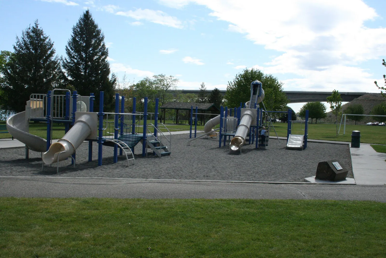
Visit Howard Amon Park for free playground equipment, paved trails, and a children's wading pool. Pack a lunch and swim along the sandy riverfront beach at Leslie Groves Park. Families can also walk or bike sections of the 23-mile Sacagawea Heritage Trail or attend free ranger programs at the Manhattan Project NPS Visitor Center.
For an outdoor plan from Richland, compare trails, state parks, national parks within trip range, and scenic drives. Options in the current city guide include River State Park and Sacajawea.
For a day trip from Richland, compare Moscow and Chelan. More options are listed in the trip section below.
Spend the afternoon at the REACH Museum exploring interactive Ice Age Floods and Hanford history exhibits. Browse the local art displays at Gallery at the Park (89 Lee Blvd), hunt for vintage items inside the Uptown Antique Market, or attend a stage play presented by the Richland Players.
Outdoors nearby
Use these nearby outdoor options when the plan calls for a trail, protected landscape, park, or drive instead of another indoor stop. Proximity here is geographic, not a promise about driving time.
Get out of town
When staying in town is not the answer, these nearby destinations give you a smaller starting set for a day trip, overnight escape, or weekend away.
Destination relationships are screened geographically. Straight-line proximity is not presented as road mileage or estimated travel time.
Local landmarks & attractions
These notable destinations offer a starting point when you want something specific to see, visit, or build into a day around Richland. Distances are approximate from the city area.
Museum in Richland, Washington, US
multi-use indoor arena in Kennewick, Washington
historic district in Washington, United States
baseball stadium in Pasco, Washington
park in Washington, United States of America, United States of America
recreational park in Tri-Cities, Washington comprising two public city parks—one in Richland, and the other in Kennewick
Notable places are selected from structured public destination data and ranked for relevance, prominence, proximity, and variety.
Local decision signals
A useful local recommendation depends on how the city actually works. These conditions affect where to go, what to do, and whether a plan makes sense right now.
Heavy commuter congestion affects George Washington Way and State Route 240 during shift changes, northbound from 6:30 AM to 8:00 AM and southbound from 4:00 PM to 5:30 PM.
Physical tours inside the historic B Reactor structure are fully suspended through May 2028 for Department of Energy construction. Visitors must rely on visitor center programs and historic bus tours.
Richland experiences summer daily highs averaging 92°F to 93°F with surges past 100°F. Outdoor exposed activities on desert trails should be planned before 10:00 AM.
City ordinance caps bicycle speeds on shared waterfront paths at 8 mph in congested or populated park sections and 15 mph on clear, non-congested stretches.
Residential landscape irrigation sources differ by area: South Richland utilizes the Benton-Franklin Irrigation District seasonal canals, whereas Columbia Point and Horn Rapids utilize municipal systems.
WSU Tri-Cities students, faculty, and staff can ride all Ben Franklin Transit fixed routes and CONNECT service at no cost using a valid Cougar Card pass sticker.
Public parking is free across Richland, with dedicated lots at Howard Amon Park, Leslie Groves Park, Columbia Point Marina, The Parkway, and the Uptown Shopping Center.
Neighborhood context
Neighborhoods are not interchangeable. Each area offers a different balance of atmosphere, transportation, food, nightlife, activities, and planning friction.
Best for: Walkability to downtown, riverfront access, mid-century architectural interest
The original planned city core built during the 1940s Manhattan Project to house Hanford workers. Features 25 standardized 'Alphabet House' home designs created by architect Gustav Albin Pehrson.
Best for: Shaded neighborhood walks, historic home architecture, immediate trail access
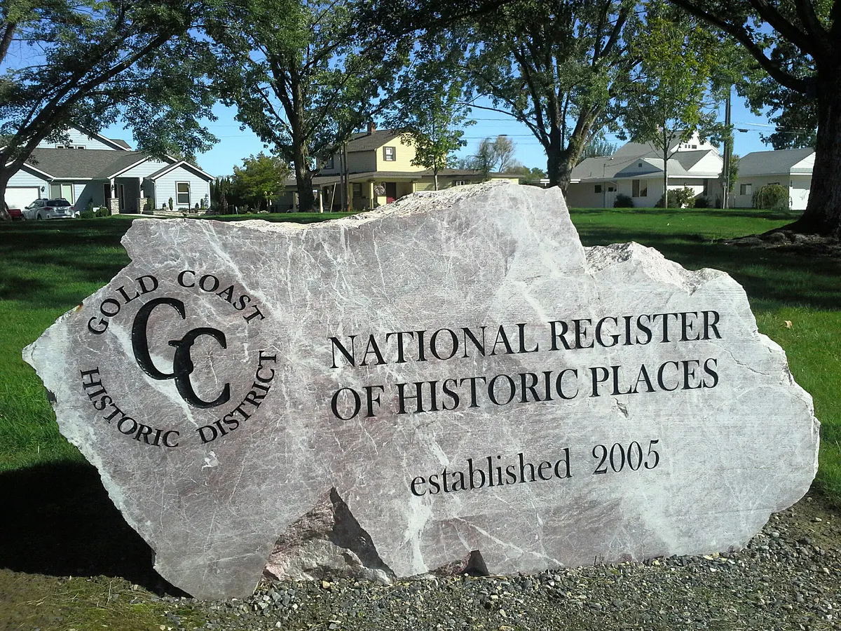
A district listed on the National Register of Historic Places, bounded roughly by Willis Street, Davison Avenue, Hunt Avenue, and George Washington Way. Built in 1948–1949 during Cold War expansion.
Best for: Pedestrian dining, local bakeries, independent boutique shopping
A dedicated pedestrian-friendly downtown center located off George Washington Way and Lee Boulevard, occupied entirely by independent cafes, restaurants, bakeries, and retail storefronts.
Best for: Vintage browsing, international dining, independent music venues
A historic 1950s commercial strip along George Washington Way and Jadwin Avenue known for its retro feel, vintage antique stores, tattoo shops, and eclectic dining venues.
Best for: Waterfront dining, luxury lodging, golf, boat marina access
Situated where I-182 and SR 240 converge near the Columbia River, featuring riverfront hotels, fine dining, the Columbia Point Golf Course, and marina facilities.
Best for: Scientific institution visits, educational campus facilities, Hanford history
The northern corridor along Stevens Drive and George Washington Way housing WSU Tri-Cities, Pacific Northwest National Laboratory (PNNL), and the Manhattan Project NPS Visitor Center.
Best for: Suburban shopping, suburban housing, access to Badger Mountain trails
A modern commercial and residential retail hub south of I-182 featuring big-box stores, medical facilities, roundabouts, and master-planned neighborhoods like Westcliffe and Badger Mountain South.
Best for: Golf course living, master-planned neighborhood amenities, quiet Northwest residential space
An 835-acre master-planned community in northwest Richland built around a public 18-hole golf course, offering HOA pools, tennis courts, and neighborhood park spaces.
Best for: Established residential streets, private golf club proximity
A mature neighborhood along the southern boundary with Kennewick centered around the private Meadow Springs Country Club (founded in 1973), featuring ranch-style homes and custom builds.
Explore your options
Richland's food and beverage options are grouped into distinct geographic hubs, each offering a specific atmosphere and culinary focus.
Located off I-182 at the river's edge, this district focuses on polished riverfront dining with scenic patio seating overlooking the marina.
A walkable, tree-lined pedestrian center populated by independent, local food producers and casual neighborhood dining options.
A retro 1950s strip center known for international cuisine, vintage shopping, and alternative evening music venues.
Establishments highlighting Pacific Northwest craft beers, microbrews, and local Washington wines across the city.
Practical local guidance
Richland offers a wide range of public parks, preserved desert ridges, and civic cultural institutions accessible without steep admission costs.
A simpler way to decide
Because physical access rules for nuclear historical sites in Richland depend on Department of Energy facility maintenance, follow these steps to organize your tour itinerary.
Verify current site status before traveling. Physical entry inside the B Reactor building is fully suspended through May 2028 due to major construction projects.
Start at the Manhattan Project National Historical Park Visitor Center in North Richland. Admission is free and no advance reservations are needed to view exhibits.
Join free ranger-led talks offered at the visitor center Monday through Saturday at scheduled afternoon times between May and September.
If visiting between May and September, book a seat on the 4-hour guided bus tour in advance. This tour visits pre-war structures like Bruggemann Warehouse, White Bluffs Bank, and Hanford High School, and drives past the B Reactor exterior.
Complete your historical tour by visiting the REACH Museum near Columbia Point to explore exhibits detailing the Ice Age Floods, regional agriculture, and Cold War history.
Common local questions
These are common situations people face when trying to decide where to eat, what to do, where to get drinks, or how to spend their time in Richland.
Richland planning questions
Practical answers for people deciding where to eat, what to do, where to go, or how to make plans in Richland.
No. Tours inside the physical B Reactor building are fully suspended through May 2028 due to Department of Energy facility construction. Visitors can attend free ranger talks at the visitor center or reserve seats on Pre-Manhattan Project historic bus tours that drive past the exterior.
Alphabet Houses are 25 standardized home designs (designated by letters A through Z) created by architect Gustav Albin Pehrson in the 1940s. They were built by the U.S. government during the Manhattan Project to rapidly house Hanford site workers.
City ordinance enforces an 8 mph speed limit on bicycles in congested or populated sections of waterfront park paths, and a 15 mph speed limit on clear, non-congested stretches.
Commuter traffic peaks during Hanford and PNNL shift changes along George Washington Way and SR 240, running northbound from 6:30 AM to 8:00 AM and southbound from 4:00 PM to 5:30 PM.
Richland has a cold semi-arid climate with summer daily high temperatures averaging 92°F to 93°F, and frequent heat waves pushing past 100°F. Outdoor desert hiking should be scheduled early in the morning.
Yes. Students, faculty, and staff can ride all Ben Franklin Transit fixed routes (including Route 26) and BFT CONNECT on-demand service at no charge by showing a valid Cougar Card pass sticker.
Public parking is generally free throughout Richland. Dedicated free lots are located at Howard Amon Park, Leslie Groves Park, Columbia Point Marina, The Parkway, and the Uptown Shopping Center.
Irrigation sourcing depends on the neighborhood. South Richland residential properties rely on canal delivery from the Benton-Franklin Irrigation District with seasonal turn-on/turn-off dates, while districts like Columbia Point and Horn Rapids receive municipal-serviced irrigation.
Leslie Groves Park, located along the northern waterfront at 40 Park Street, offers wide sandy beaches, designated swimming areas, shade trees, and volleyball courts.
Source transparency
Official and locally relevant sources used to verify the practical information presented in this Richland decision guide.
Richland decision engine
Tell Adventria what kind of experience you want, set your practical limits, and turn the options in Richland into one workable plan.
Choose a Richland Plan