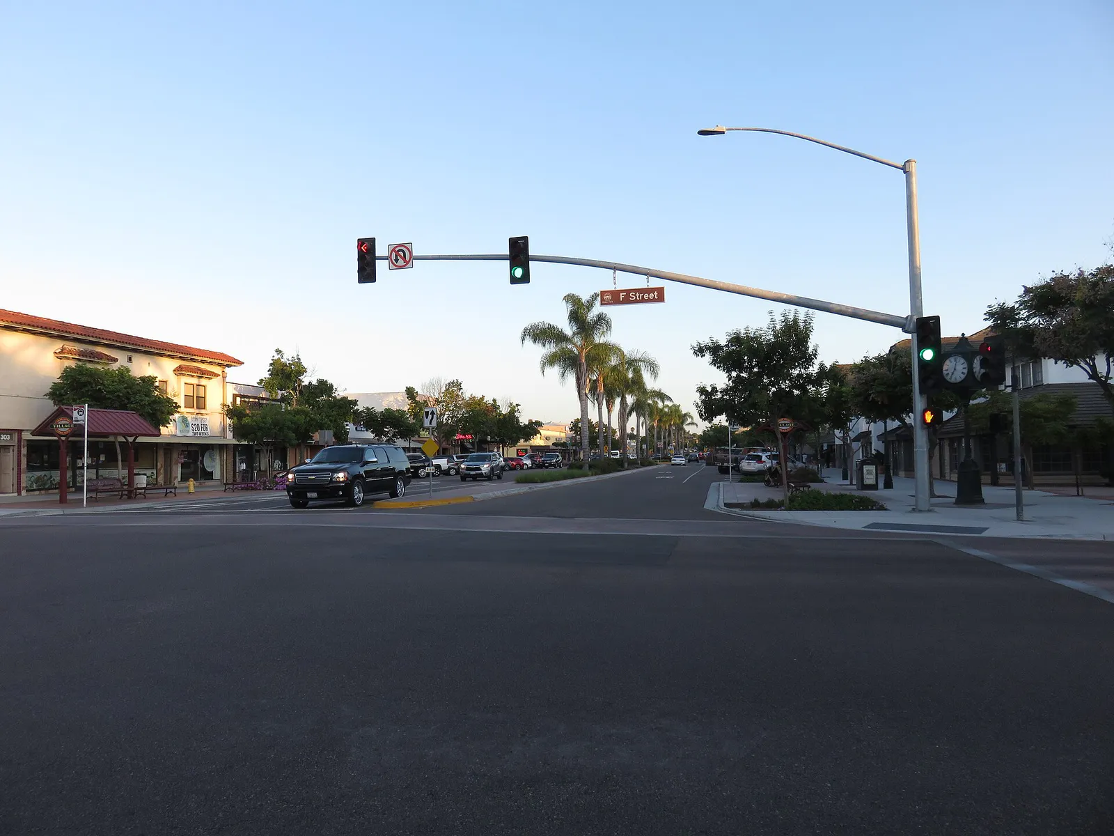
Downtown Chula Vista / Third Avenue Village
Best for
Craft brewery hopping, walkable dining, local cultural events, historic character.
 AdventriaLocalOpen App
South Bay San Diego Decision Guide
Trying to decide what to do in Chula Vista? Adventria helps you cut through the options and choose a good-enough plan without endless scrolling. Spanning 52 square miles from the coastal wetlands of San Diego Bay to the foothill slopes near San Miguel Mountain, Chula Vista is a city defined by two distinct halves. West Chula Vista offers historic streetscapes, local Latino culture, craft taprooms, and coastal marine air. East Chula Vista features sprawling master-planned villages, modern shopping centers, elevated lake views, and warm foothill sunshine. Use this decision guide to navigate local microclimates, transit connections, east-west travel friction, and neighborhood-specific entertainment.
The local decision problem
Navigating Chula Vista's microclimates, east-west commute friction, and distinct local neighborhoods to find the right dining, entertainment, and outdoors plans.
That is where Adventria comes in. Adventria helps narrow the options in Chula Vista around practical factors like location, distance, budget, vibe, who you are with, and the kind of experience you actually want, so research can turn into a decision.
Let Adventria narrow the optionsPick the right part of town
Different parts of Chula Vista work for different kinds of plans. Start with the experience you want, then narrow the map.
Best for
Craft brewery hopping, walkable dining, local cultural events, historic character.
Best for
Waterfront strolls, wildlife viewing, marina activities, resort dining.
Best for
Suburban lake strolls, golf course living, family park outings, established retail.
Best for
Pedestrian-friendly village trails, open-air shopping, suburban family amenities.
Best for
Modern high-density living, walkable urban park spaces, direct bus transit.
Best for
Hillside residential streets, Southwestern College access, central convenience.
This is a quick starting point. The full guide covers 8 local neighborhoods and districts in Chula Vista.
Eat & drink
When the decision is less about what to do and more about where to eat or grab a drink, start here. These local cues narrow the food and drink decision without turning dinner or a night out into another hour of comparison.
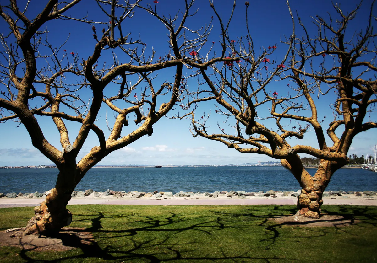
For places to eat in Chula Vista, start with Downtown Chula Vista / Third Avenue Village or Chula Vista Bayfront & Harbor District depending on the kind of stop you want. Start with Downtown Chula Vista / Third Avenue Village for craft brewery hopping, walkable dining, local cultural events, historic character.. Features tree-lined sidewalks, local Latino-owned eateries, craft breweries, community murals, and historic Memorial Park. Chula Vista Bayfront & Harbor District works for waterfront strolls, wildlife viewing, marina activities, resort dining..
When winter rains hit, take the family bowling and play arcade games at Lucky Strike Chula Vista, solve escape rooms at Escapology inside Westfield Plaza Bonita, catch a movie with reclining seating at AMC Otay Ranch Town Center, or stay in West Chula Vista for craft brew tastings inside the covered taprooms along Third Avenue.
Still comparing options? Adventria can narrow the choice around budget, distance, vibe, and who you are with.
Decide with AdventriaPlan by situation
Start with the kind of plan you are actually trying to make. These city-specific ideas narrow the choice around who you are with, what you want to spend, the weather, and the kind of outing you want.
For an outdoor plan from Chula Vista, compare trails, state parks, national parks within trip range, and scenic drives. Options in the current city guide include Border Field State Park and Silver Strand State Beach.
Spend a full day at Sesame Place San Diego, a 17-acre theme and water park with Sesame Street rides, interactive neighborhoods, and character parades (and a Certified Autism Center). For a low-cost outdoor option, bring water toys to Mountain Hawk Park overlooking Lower Otay Reservoir to let kids use the free splash pad and playground structures.
Grab a specialty coffee or burrito at Mujer Divina Brunch Café or Dark Horse Coffee Roasters, then work using public Wi-Fi at Otay Ranch Town Center's open-air plazas. In the afternoon, grab binoculars for quiet coastal birdwatching along the Sweetwater Marsh trails near San Diego Bay.
For a short escape from Chula Vista, compare Oceanside and Encinitas. More options are listed in the trip section below.
Reserve a table for intimate Italian dining at Acqua e Farina on Third Avenue or Savoie Italian Eatery in Otay Ranch. Afterward, stroll under the string lights of Third Avenue Village for a craft cocktail at Tender Hooligan or Cask & Crown, or take a sunset walk along the Chula Vista Marina pier before drinks at Galley at the Marina.
Outdoors nearby
Use these nearby outdoor options when the plan calls for a trail, protected landscape, park, or drive instead of another indoor stop. Proximity here is geographic, not a promise about driving time.
Get out of town
When staying in town is not the answer, these nearby destinations give you a smaller starting set for a day trip, overnight escape, or weekend away.
Destination relationships are screened geographically. Straight-line proximity is not presented as road mileage or estimated travel time.
Local landmarks & attractions
These notable destinations offer a starting point when you want something specific to see, visit, or build into a day around Chula Vista. Distances are approximate from the city area.
zoo in Balboa Park, San Diego, California, United States
art museum in San Diego, California
stadium in San Diego, California
arena in San Diego, California, United States
theme park
United States Navy aviation base in San Diego, California, USA
amusement park in San Diego
art museum in California, United States
Notable places are selected from structured public destination data and ranked for relevance, prominence, proximity, and variety.
Local decision signals
A useful local recommendation depends on how the city actually works. These conditions affect where to go, what to do, and whether a plan makes sense right now.
Interstate 805 splits Chula Vista down the middle. Commuting across major east-west corridors (H Street, Otay Lakes Road, Telegraph Canyon Road, Palomar Street) causes severe delay during morning (7–9 AM) and evening (4–6:30 PM) rush hours.
Inland communities like Eastlake, Otay Ranch, and Millenia are consistently 5°F to 12°F warmer in the summer than the ocean-moderated Chula Vista Bayfront and Downtown sectors.
Concert nights at North Island Credit Union Amphitheatre (20,500 capacity) clog Heritage Road, Main Street, and Entertainment Circle in East Otay Mesa. Plan alternate routes or arrive early.
Lower Otay Reservoir boat rentals, kayak launches, and fishing concessions operate strictly on Wednesdays, Saturdays, and Sundays.
Southbound I-5 and I-805 experience localized slowdowns on Friday afternoons and weekend evenings from border-bound traffic heading toward San Ysidro.
The UC San Diego Blue Line Trolley runs along West Chula Vista (E Street, H Street, Palomar Street), offering 15-minute direct connections to Downtown San Diego, UTC, and the U.S.–Mexico border.
West Chula Vista features older non-HOA homes with grid parking, whereas East Chula Vista neighborhoods (Otay Ranch, Millenia, Eastlake) are bound by HOA guidelines and Mello-Roos special assessments.
Neighborhood context
Neighborhoods are not interchangeable. Each area offers a different balance of atmosphere, transportation, food, nightlife, activities, and planning friction.
Best for: Craft brewery hopping, walkable dining, local cultural events, historic character.
The historic urban heart of the city, encompassing over 30 blocks centered on Third Avenue. Features tree-lined sidewalks, local Latino-owned eateries, craft breweries, community murals, and historic Memorial Park.
Best for: Waterfront strolls, wildlife viewing, marina activities, resort dining.
A coastal district along San Diego Bay home to the Chula Vista Marina, Sweetwater Park, the Living Coast Discovery Center, and the Gaylord Pacific Resort & Convention Center.
Best for: Suburban lake strolls, golf course living, family park outings, established retail.
A 3,200-acre master-planned community established in the 1980s. Built around artificial lakes, the Eastlake Country Club golf course, landscaped parkways, and retail hubs.
Best for: Pedestrian-friendly village trails, open-air shopping, suburban family amenities.
A massive multi-village master-planned community featuring individual villages centered around neighborhood parks, trails, and the open-air Otay Ranch Town Center retail hub.
Best for: Modern high-density living, walkable urban park spaces, direct bus transit.
A contemporary, transit-oriented urban district adjacent to Otay Ranch Town Center featuring modern townhomes, curated urban parks (Millenia Park, Orion Park), and walkability.
Best for: Hillside residential streets, Southwestern College access, central convenience.
Developed in the 1980s and 90s along rolling terrain east of I-805. Houses Southwestern College's main campus, regional shopping centers, and central suburban neighborhoods.
Best for: Single-story ranch homes, established neighborhood trees, non-HOA living.
Post-WWII residential areas characterized by mid-century ranch architecture, wide residential streets, lack of HOA/Mello-Roos fees, and easy access to Interstate 5.
Best for: Foothill scenic views, quiet residential enclaves, trailheads.
Upper-tier residential master-planned communities situated along the eastern foothill slopes near San Miguel Mountain and Lower Otay Reservoir.
Chula Vista local guide
To make smart choices in Chula Vista, you must understand the city's fundamental divide: West Chula Vista (west of Interstate 805) and East Chula Vista (east of I-805). The West side represents the city's historic core, built out primarily from the 1950s through the 1970s. It operates on traditional grid streets, offers post-WWII ranch architecture without HOA or Mello-Roos fees, and centers culturally on Third Avenue Village and the San Diego Bayfront.
East Chula Vista, by contrast, is a collection of extensive master-planned communities established from the mid-1980s onward—including Eastlake, Otay Ranch, Millenia, and Rolling Hills Ranch. Here, multi-lane suburban parkways connecting residential villages, artificial lakes, neighborhood greens, and modern shopping complexes dominate the landscape.
This geographic divide directly creates a severe weather gradient. Coastal West Chula Vista benefits from constant ocean moderation, keeping summer temperatures in the comfortable mid-70s, though subject to heavy morning marine fog ('May Gray' and 'June Gloom'). Move 10 miles inland to Eastlake or Millenia, and that coastal blanket clears early, sending summer afternoon highs into the high 80s and low 90s. When planning daytime activities between May and September, shift outdoor physical recreation to morning hours inland or move to the Bayfront by early afternoon.
Explore your options
Chula Vista offers distinct dining environments depending on whether you seek walkable, craft-beer-centric downtown streets or polished suburban outdoor centers.
The capital of South Bay craft beverage and independent dining. Walkable, vibrant, and rich in local Latino heritage.
Modern, open-air retail and dining complexes tailored to families, casual night outs, and shopping.
Waterfront dining options paired with ocean vistas, fresh breezes, and resort amenities.
Practical local guidance
Keep these practical local constraints in mind when deciding where to go and how to travel.
A simpler way to decide
The 20,500-seat amphitheatre in East Otay Mesa is South Bay's largest venue, but getting in and out requires deliberate strategy.
Buy upgraded or VIP parking passes online prior to show day to secure closer lot placement and faster exit routing.
Approach via SR-125 South or Main Street rather than Olympic Parkway to bypass severe bottlenecking on Heritage Road.
Plan to park early. Tailgating is permitted in designated lots, allowing you to settle in before peak ingress traffic hits.
Ensure personal bags are clear plastic, vinyl, or PVC (under 12x6x12 inches) or small clutch bags to speed through security queues.
Expect up to 45–60 minutes to exit the parking lots post-concert; leave your vehicle parked post-show until main lot gridlock thins.
Common local questions
These are common situations people face when trying to decide where to eat, what to do, where to get drinks, or how to spend their time in Chula Vista.
Chula Vista planning questions
Practical answers for people deciding where to eat, what to do, where to go, or how to make plans in Chula Vista.
Choose West Chula Vista (Third Avenue Village) if you want a walkable historic district with local Latino-owned eateries, craft breweries, and casual street bars. Choose East Chula Vista (Otay Ranch Town Center/Millenia) if you prefer modern, open-air shopping complexes, regional dining concepts, ample parking structures, and family-friendly outdoor plazas.
From West Chula Vista, take the UC San Diego Blue Line Trolley from the E Street, H Street, or Palomar Street stations for a direct 20-minute ride. From East Chula Vista (Otay Ranch/Millenia), use the MTS Rapid Bus Route 225, which utilizes dedicated freeway lanes to reach Downtown San Diego quickly.
In July, August, and September, Eastlake and Otay Ranch are typically 5°F to 12°F warmer than the Chula Vista Bayfront. Afternoon highs inland frequently hit 85°F to 92°F, while the coast remains cooled by ocean breezes at 72°F to 78°F.
Street parking along Third Avenue itself fills up during weekend dinner hours, but free 2-hour parking and low-cost municipal parking lots are readily available just one block east or west on F, G, and H Streets.
Lower Otay Reservoir boat launching, kayak rentals, and fishing operations are open strictly three days a week: Wednesdays, Saturdays, and Sundays.
On event nights at North Island Credit Union Amphitheatre, avoid Heritage Road and Main Street between 5:00 PM and 11:00 PM unless attending the show. Non-concertgoers should travel east-west using SR-54 or Telegraph Canyon Road instead.
Sesame Place operates daily during peak summer months, and shifts to weekend/seasonal operating schedules during fall, winter, and spring. Check operational calendars ahead of time for seasonal water slide openings.
You can access the 24-mile Bayshore Bikeway trail along the Chula Vista Bayfront near Bayfront Park, Marina View Park, or the intersection of E Street and Marina Parkway.
Free 24-hour park-and-ride transit lots are located at the Bayfront/E Street, H Street, and Palomar Street UC San Diego Blue Line Trolley stations.
Source transparency
Official and locally relevant sources used to verify the practical information presented in this Chula Vista decision guide.
Chula Vista decision engine
Tell Adventria what kind of experience you want, set your practical limits, and turn the options in Chula Vista into one workable plan.
Choose a Chula Vista Plan