Sunrise MarketPlace & Birdcage Heights (Area 11)
Best for
Retail shopping, high-volume dining, and public transit connections
 AdventriaLocalOpen App
CITRUS HEIGHTS LOCAL DECISION GUIDE
Trying to decide what to do in Citrus Heights? Adventria helps you cut through the options and choose a good-enough plan without endless scrolling. Planning a day or evening in Citrus Heights requires balancing heavy corridor traffic, sudden summer heat spikes, and unique neighborhood pockets. Whether you are navigating the Sunrise MarketPlace retail core, cycling the Arcade-Cripple Creek Trail, or seeking 24-hour dining, this guide provides clear local timing and geography to help you make sound decisions.
The local decision problem
Navigating commercial corridors, travel friction, weather extremes, and activity timing across Citrus Heights.
That is where Adventria comes in. Adventria helps narrow the options in Citrus Heights around practical factors like location, distance, budget, vibe, who you are with, and the kind of experience you actually want, so research can turn into a decision.
Let Adventria narrow the optionsPick the right part of town
Different parts of Citrus Heights work for different kinds of plans. Start with the experience you want, then narrow the map.
Best for
Retail shopping, high-volume dining, and public transit connections
Best for
Historic character, semi-rural residential pockets, and central access
Best for
Aquatics, organized sports, historical sites, and natural trail walks
Best for
Off-leash dog exercise, outdoor fitness, and quiet residential living
Best for
Direct freeway transit, 24/7 card room gaming, and late-night food
Best for
Complete Streets bike access, craft beer, and indoor bowling
Eat & drink
When the decision is less about what to do and more about where to eat or grab a drink, start here. These local cues narrow the food and drink decision without turning dinner or a night out into another hour of comparison.
For places to eat in Citrus Heights, start with Antelope Crossing & Northwest Corridor (Area 1) or Sunrise MarketPlace & Birdcage Heights (Area 11) depending on the kind of stop you want. Start with Antelope Crossing & Northwest Corridor (Area 1) for direct freeway transit, 24/7 card room gaming, and late-night food. Sunrise MarketPlace & Birdcage Heights (Area 11) works for retail shopping, high-volume dining, and public transit connections.
Head to Steve Cook's Fireside Lanes on Auburn Boulevard for 32 bowling lanes and an arcade, visit Stones Gambling Hall on Antelope Road for 24/7 card games and full-service food at Sammy's Restaurant & Bar, or explore the open-air retail arcades across the Marketplace at Birdcage.
Still comparing options? Adventria can narrow the choice around budget, distance, vibe, and who you are with.
Decide with AdventriaPlan by situation
Start with the kind of plan you are actually trying to make. These city-specific ideas narrow the choice around who you are with, what you want to spend, the weather, and the kind of outing you want.
Try craft beer tasting and trivia at DarkHeart Brewing along Auburn Boulevard, book a virtual golf room at Pin High inside Stones Gambling Hall, or sit down for dinner at local favorites such as Sichuan City or El Tapatio Mexican Restaurant on Sunrise Boulevard.
Bring children to Rusch Community Park to see the historic Southern Pacific boxcar covered bridge and play areas, cycle the paved Arcade-Cripple Creek Trail, or walk through the native plant demonstration garden at Stock Ranch Nature Preserve—all free to access.
Walk the 1.4-mile loop trail through restored oak woodlands at Stock Ranch Nature Preserve, have breakfast at the historic A-frame Lodge Coffee Shop on Auburn Boulevard, or drop by Triple Crown Cages on Greenback Lane for batting practice.
The city-owned Citrus Heights Community Center on Fountain Square Drive features a 29,173-square-foot facility capable of hosting up to 966 people in its main hall, while Rusch Park Community Center provides reservable halls and outdoor picnic pavilions.
For an outdoor plan from Citrus Heights, compare trails, state parks, national parks within trip range, and scenic drives. Options in the current city guide include Folsom Powerhouse State Historic Park and Sutter's Fort State Historic Park.
For a day trip from Citrus Heights, compare Calistoga and Sparks. More options are listed in the trip section below.
When rain or morning Tule fog impacts outdoor plans, opt for indoor action at Smash Sacramento for axe throwing, VR escape rooms, and rage rooms, browse titles at Barnes & Noble at Birdcage, or play tabletop games at Fire and Ice Gaming.
Outdoors nearby
Use these nearby outdoor options when the plan calls for a trail, protected landscape, park, or drive instead of another indoor stop. Proximity here is geographic, not a promise about driving time.
Get out of town
When staying in town is not the answer, these nearby destinations give you a smaller starting set for a day trip, overnight escape, or weekend away.
Destination relationships are screened geographically. Straight-line proximity is not presented as road mileage or estimated travel time.
Local landmarks & attractions
These notable destinations offer a starting point when you want something specific to see, visit, or build into a day around Citrus Heights. Distances are approximate from the city area.
zoo in the United States
art museum in Sacramento, California
state capitol building of the U.S. state of California
association football stadium in Sacramento, California
an indoor arena, located in downtown Sacramento, California
zoo in California, United States
Casino in Placer County, California, United States
American children's museum near Sacramento, California
Notable places are selected from structured public destination data and ranked for relevance, prominence, proximity, and variety.
Local decision signals
A useful local recommendation depends on how the city actually works. These conditions affect where to go, what to do, and whether a plan makes sense right now.
With an average of 73 days per year reaching 90°F or higher, summer afternoon temperatures frequently climb to 95°F–100°F+. Daytime outdoor plans between 11:00 AM and 6:00 PM require shaded areas, aquatics at Rusch Park Pool, or indoor air-conditioned venues.
Greenback Lane sees daily vehicle counts of 45,737 to over 47,500, while the Antelope Road I-80 overpass carries over 51,000. Peak commute windows (7:30–9:00 AM and 4:30–6:30 PM) create bottlenecks at major junctions like Sunrise Boulevard and Greenback Lane.
Roughly 75% of the city's 22.7-inch annual precipitation occurs between November and March. Dense Tule fog occurs on around 96 days annually—concentrated heavily in December and January—reducing morning road visibility.
Citrus Heights contains no light rail stations. Sacramento Regional Transit (SacRT) Route 1 serves as the central transit trunk along Greenback Lane, linking the Sunrise Mall Transit Center to the Blue Line Light Rail at Watt/I-80 Station.
The 10-foot-wide paved Arcade-Cripple Creek Trail provides nearly 3 continuous ADA-compliant miles (and over 4 miles total including park loops) linking local neighborhoods, schools, and parks from Arcade Creek Park Preserve to Wachtel Way.
The 10-block Sunrise MarketPlace Business Improvement District hosts over 400 businesses along Sunrise Boulevard and Greenback Lane, accounting for nine of the city's top ten most visited sit-down dining spots.
Neighborhood context
Neighborhoods are not interchangeable. Each area offers a different balance of atmosphere, transportation, food, nightlife, activities, and planning friction.
Best for: Retail shopping, high-volume dining, and public transit connections
The city's commercial core centered around Sunrise Boulevard and Greenback Lane. Houses major shopping plazas including Sunrise Mall, Marketplace at Birdcage, and Citrus Town Center, as well as the main local transit hub.
Best for: Historic character, semi-rural residential pockets, and central access
The historic core where Auburn Boulevard, Old Auburn Road, and Sylvan Road converge. Features larger residential lots, uncurbed streets, civic meeting spaces, and long-standing local eateries.
Best for: Aquatics, organized sports, historical sites, and natural trail walks
Established suburban neighborhoods anchored by the 15+ acre Rusch Community Park, the 47+ acre Stock Ranch Nature Preserve, and natural creek corridors.
Best for: Off-leash dog exercise, outdoor fitness, and quiet residential living
Quiet eastern and southeastern residential tracts bordering Fair Oaks and Orangevale, home to C-Bar-C Park's dedicated dog enclosures and Tempo Community Park's workout trail.
Best for: Direct freeway transit, 24/7 card room gaming, and late-night food
Situated near the Interstate 80 and Antelope Road interchange. Serves as a primary gateway for regional highway commuters and hosts round-the-clock entertainment at Stones Gambling Hall.
Best for: Complete Streets bike access, craft beer, and indoor bowling
A 1.2-mile revitalized commercial strip extending north from Sylvan Corners to I-80, featuring upgraded streetscapes, continuous bike lanes, local microbreweries, and bowling centers.
Explore your options
Activities in Citrus Heights are concentrated along three main geographic corridors, each serving distinct dining, shopping, and recreational functions.
The commercial heart of the city, encompassing a 10-block Business Improvement District around Sunrise Boulevard and Greenback Lane.
A 1.2-mile revitalized strip running from Sylvan Corners north to Interstate 80, equipped with bicycle lanes and complete street features.
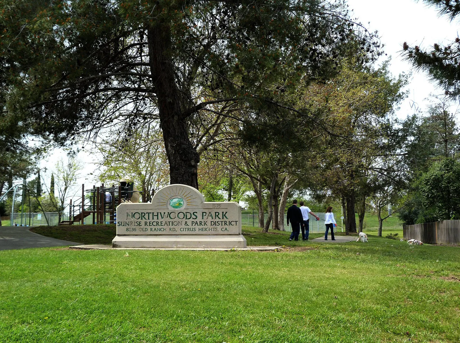
The city's central outdoor recreation zone managed by the Sunrise Recreation and Park District.
Practical local guidance
Use these grounded operational rules to streamline your plans and avoid unnecessary friction across Citrus Heights.
A simpler way to decide
Follow these steps to minimize transit friction when traveling across Citrus Heights during heavy commute periods.
Determine whether your route requires traveling along Greenback Lane or crossing Sunrise Boulevard during morning (7:30–9:00 AM) or evening (4:30–6:30 PM) commute hours.
Use Old Auburn Road or Antelope Road for diagonal cross-town movement to bypass the dense commercial signals around Sunrise MarketPlace.
If traveling on foot or bicycle between central residential areas and local parks, use the paved Class I Arcade-Cripple Creek Trail to bypass street traffic entirely.
If relying on SacRT Route 1 or Route 21, check the current bus schedule and download the Transit Connect mobile application for fare management before arriving at the bus stop.
Once arriving at commercial nodes like Marketplace at Birdcage or Citrus Town Center, park near your main target store; surface lot spaces are free and accessible.
Common local questions
These are common situations people face when trying to decide where to eat, what to do, where to get drinks, or how to spend their time in Citrus Heights.
Citrus Heights planning questions
Practical answers for people deciding where to eat, what to do, where to go, or how to make plans in Citrus Heights.
No light rail tracks or stations are located directly inside Citrus Heights city limits. The closest light rail access point is the Watt/I-80 Station (Blue Line), accessible from the Sunrise Mall Transit Center via SacRT Route 1 bus service.
The Arcade-Cripple Creek Trail network features a continuous 2.9-mile Class I paved corridor (over 4 miles total including park loops). It is 10 feet wide, ADA-compliant, and connects Arcade Creek Park Preserve through Tempo Park and C-Bar-C Park to Wachtel Way.
Stones Gambling Hall, located at 6508/6510 Antelope Road near Interstate 80, houses Sammy's Restaurant & Bar, which serves tavern fare, craft drinks, and daily menu items 24 hours a day.
Public parks, aquatics, and recreational sports leagues in Citrus Heights are managed by the Sunrise Recreation and Park District (SRPD), an independent special district, rather than the city municipality.
The off-leash dog park at C-Bar-C Park features separate fenced double-gated areas for large and small dogs, shade structures, bench seating, and drinking water, maintained in partnership with POOCH.
The historic core surrounds Sylvan Corners (Neighborhood Area 10), where Auburn Boulevard, Old Auburn Road, and Sylvan Road meet near the Sylvan Community Center.
Rusch Community Park features dedicated pickleball courts with outdoor lighting active until 10:00 PM, allowing for evening play during hot summer months.
Key indoor recreation venues include Steve Cook's Fireside Lanes for bowling, Sunrise Rollerland for roller skating, Smash Sacramento for rage rooms and VR escape games, and Pin High for virtual golf simulators.
Source transparency
Official and locally relevant sources used to verify the practical information presented in this Citrus Heights decision guide.
Citrus Heights decision engine
Tell Adventria what kind of experience you want, set your practical limits, and turn the options in Citrus Heights into one workable plan.
Choose a Citrus Heights Plan