Downtown Core / Central Davis
Best for
Dining, local shops, street parking, Farmers Market, and cultural walks
 AdventriaLocalOpen App
Yolo County Local Outing & Planning Framework
Trying to decide what to do in Davis? Adventria helps you cut through the options and choose a good-enough plan without endless scrolling. Whether navigating university term schedules, finding parking near Central Park, cycling through greenbelts, or planning around summer heat, this guide outlines practical decision frameworks for Davis residents and visitors.
The local decision problem
How to navigate Davis local rhythms, transit networks, seasonal heat, parking rules, and cultural highlights for seamless outings.
That is where Adventria comes in. Adventria helps narrow the options in Davis around practical factors like location, distance, budget, vibe, who you are with, and the kind of experience you actually want, so research can turn into a decision.
Let Adventria narrow the optionsPick the right part of town
Different parts of Davis work for different kinds of plans. Start with the experience you want, then narrow the map.
Best for
Dining, local shops, street parking, Farmers Market, and cultural walks
Best for
Historic streetscapes, craftsman architecture, and maker spaces
Best for
Sustainable housing design, passive solar architecture, and greenbelt paths
Best for
Suburban parks, family greenbelts, and urban agriculture
Best for
Commuter transit, newer housing developments, and regional highway access
Best for
Academic collections, performing arts, outdoor gardens, and net-zero living
This is a quick starting point. The full guide covers 7 local neighborhoods and districts in Davis.
Eat & drink
When the decision is less about what to do and more about where to eat or grab a drink, start here. These local cues narrow the food and drink decision without turning dinner or a night out into another hour of comparison.
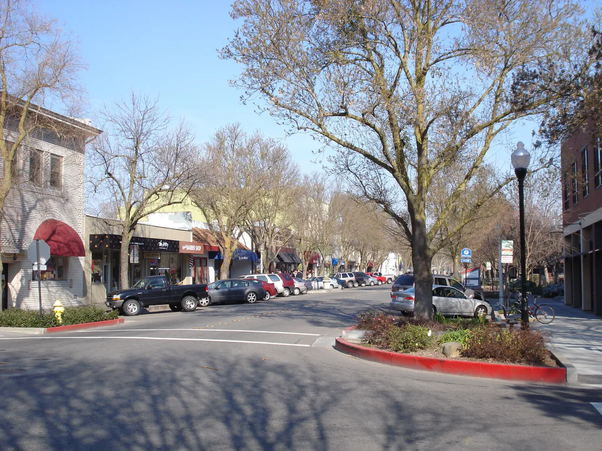
Downtown Davis along A through G Streets offers dense options ranging from authentic Thai at Sophia's Thai Kitchen to local craft brews at Three Mile Brewing Co. or pizza at Woodstock's. For local craft beer and industrial dining space east of the tracks, head to Sudwerk Brewing Co.
Catch a performance or student-discounted show at the Mondavi Center for the Performing Arts, or sample craft beer and patio dining along the G Street nightlife corridor at venues like G Street WunderBar.
Still comparing options? Adventria can narrow the choice around budget, distance, vibe, and who you are with.
Decide with AdventriaPlan by situation
Start with the kind of plan you are actually trying to make. These city-specific ideas narrow the choice around who you are with, what you want to spend, the weather, and the kind of outing you want.
For an outdoor plan from Davis, compare trails, state parks, national parks within trip range, and scenic drives. Options in the current city guide include Old Sacramento State Historic Park and Leland Stanford Mansion State Historic Park.
For a day trip from Davis, compare South Lake Tahoe and Half Moon Bay. More options are listed in the trip section below.
Stroll through the T. Elliot Weier Redwood Grove in the Arboretum as the Delta Breeze cools the late afternoon air, reserve patio seats in Downtown Davis, and browse contemporary regional works during 2nd Friday ArtAbout.
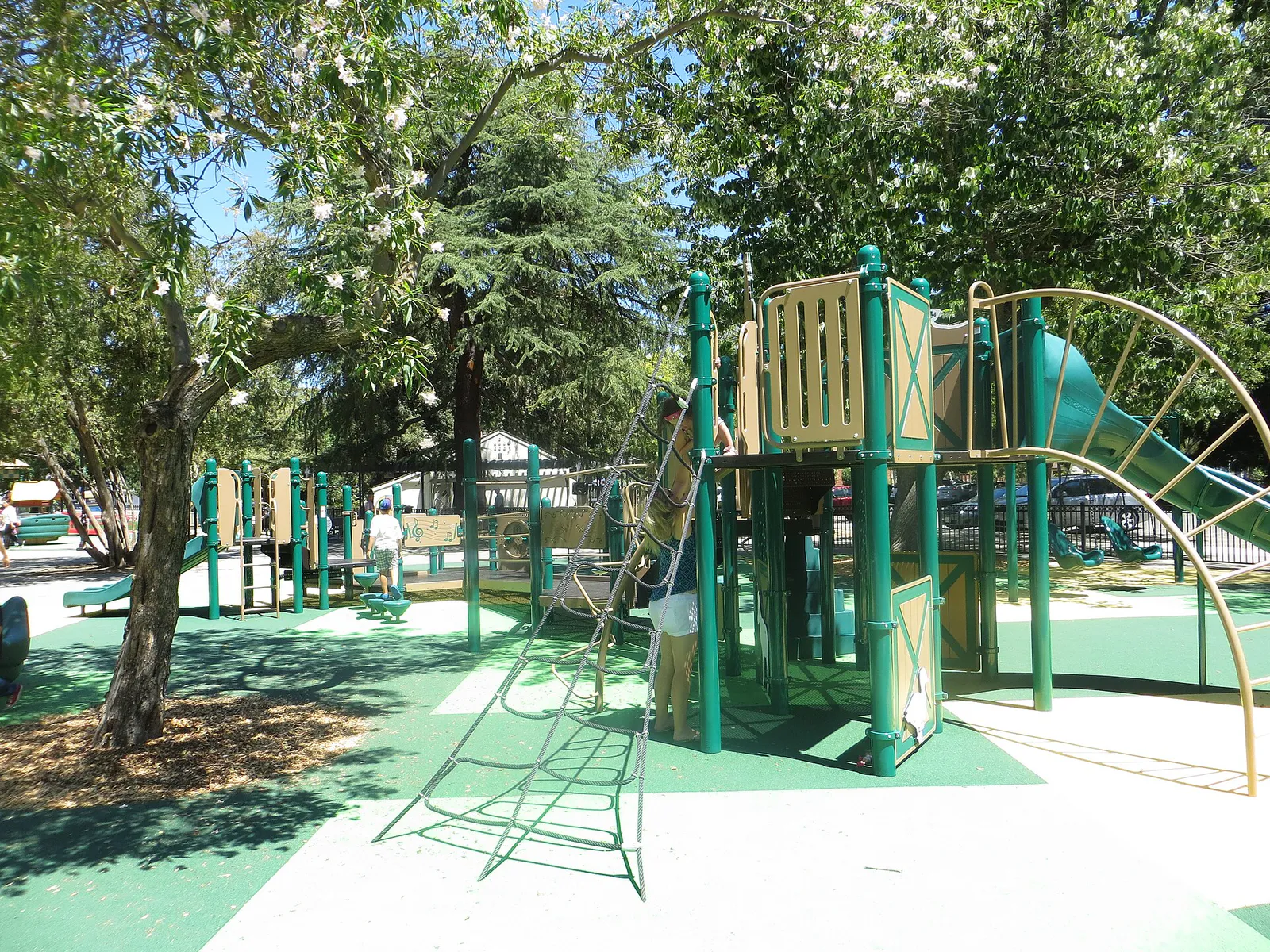
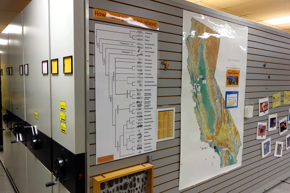
Play at Central Park's playground and splash pad, tour the Bohart Museum of Entomology on Tuesday or Wednesday afternoon for hands-on insect viewing, or walk through the nearby UC Davis Bee Haven.
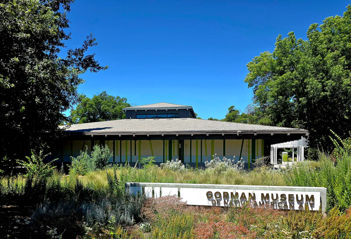
Avoid rain or winter tule fog by parking in the covered 4th & G Street structure and spending the afternoon exploring the free collections at the Gorman Museum of Native American Art and Manetti Shrem Museum, followed by a film at Varsity Theatre.
Rent or ride a bicycle through the greenbelt loop into Village Homes to inspect passive solar design and swales, browse books at Shields Library or Varsity Theatre Cafe, and explore contemporary art at Pence Gallery.
On Wednesday evenings from April through August (or October), head to Central Park for Picnic in the Park, where groups can set up picnic blankets, purchase local food truck meals, and enjoy live music.
Outdoors nearby
Use these nearby outdoor options when the plan calls for a trail, protected landscape, park, or drive instead of another indoor stop. Proximity here is geographic, not a promise about driving time.
Get out of town
When staying in town is not the answer, these nearby destinations give you a smaller starting set for a day trip, overnight escape, or weekend away.
Destination relationships are screened geographically. Straight-line proximity is not presented as road mileage or estimated travel time.
Local landmarks & attractions
These notable destinations offer a starting point when you want something specific to see, visit, or build into a day around Davis. Distances are approximate from the city area.
zoo in the United States
art museum in Sacramento, California
state capitol building of the U.S. state of California
association football stadium in Sacramento, California
an indoor arena, located in downtown Sacramento, California
arboretum and public garden at University of California, Davis
museum operated by the University of California, in Davis, California, United States
theater and former movie theater in Woodland, California, United States
Notable places are selected from structured public destination data and ranked for relevance, prominence, proximity, and variety.
Local decision signals
A useful local recommendation depends on how the city actually works. These conditions affect where to go, what to do, and whether a plan makes sense right now.
Restaurant wait times, transit frequencies, and parking availability fluctuate dramatically between academic quarters (fall, winter, spring) and out-of-session periods like summer or winter breaks.
Summer daytime heat frequently climbs above 90°F, but marine air pulled through the Sacramento-San Joaquin Delta typically lowers evening temperatures by 20°F to 30°F, making late afternoon and evening outdoor plans ideal.
Cyclists inside roundabouts near campus hubs like the Silo and Shields Library hold strict right-of-way. Motorists and pedestrians must yield to circulating bike traffic.
Union Pacific freight and passenger trains cross the main track line slicing Central and East Davis. Cyclists and pedestrians can bypass idling trains using the Pinecrest/H Street or 5th/L Street bike underpass tunnels.
The historic 1917 single-lane underpass connecting South Davis and Interstate 80 to Downtown creates major vehicle congestion during morning and evening commute windows.
On-street parking offers free 90-minute or 2-hour limits enforced Monday through Saturday, 8:00 a.m. to 6:00 p.m., using automated license plate readers. Downtown garages on 4th & G and 1st & F offer 3 hours free.
While weekday campus parking requires daily permits via mobile apps like AMP Park or ParkMobile, visitor parking is free on Saturdays, Sundays, and university holidays in non-special event lots.
Neighborhood context
Neighborhoods are not interchangeable. Each area offers a different balance of atmosphere, transportation, food, nightlife, activities, and planning friction.
Best for: Dining, local shops, street parking, Farmers Market, and cultural walks
Bounded by A Street, B/L Streets, 1st Street, and 5th Street, this commercial grid features independent dining, historic storefronts, Central Park, and direct proximity to campus.
Best for: Historic streetscapes, craftsman architecture, and maker spaces
Residential areas bordering downtown. Old North showcases craftsman bungalows and shaded canopies, while Old East mixes homes, small apartment buildings, and creative spaces along the rail corridor.
Best for: Sustainable housing design, passive solar architecture, and greenbelt paths
Spans residential subdivisions west of SR 113, featuring Village Homes—a 70-acre sustainable development built in the 1970s with natural swales, community orchards, and narrow shaded roads.
Best for: Suburban parks, family greenbelts, and urban agriculture
Located north of Covell Boulevard, offering established subdivisions like Covell Park, large recreational spaces at Arroyo Park, and The Cannery—a farm-to-table master-planned community built on a former industrial site.
Best for: Commuter transit, newer housing developments, and regional highway access
Situated south of I-80, South Davis provides suburban subdivisions, neighborhood retail plazas at Oakshade Town Center, and immediate freeway access to Sacramento.
Best for: Academic collections, performing arts, outdoor gardens, and net-zero living
A 5,300-acre university property southwest of Downtown containing the Arboretum, Gateway Cultural District, and West Village—an energy-positive campus neighborhood.
Best for: Custom golf course homes, spacious estates, and quiet residential streets
Unincorporated residential enclaves located southeast of city limits, centered around the private El Macero Country Club and offering larger residential lots.
Davis local guide
Davis is defined by its low gradient topographically, bicycle-first design, and the physical footprint of UC Davis. With over 60 miles of off-street greenbelts linking subdivisions to downtown, cycling functions as a primary transportation mode rather than mere recreation. Visitors and residents navigate distinct spatial boundaries, including the State Route 113 corridor to the west, Interstate 80 to the south, and the main Union Pacific railroad line bisecting Central and East Davis.
Travel friction in Davis centers on key physical bottlenecks. The historic 1917 Richards Boulevard underpass provides the main connection between Interstate 80 and Downtown, creating significant vehicle slowdowns during morning and afternoon commute hours. Meanwhile, long freight trains moving along the Union Pacific tracks can temporarily block street crossings at 3rd, 5th, and 8th Streets. Bicyclists and pedestrians routinely bypass these rail disruptions using grade-separated underpass tunnels at H Street/Pinecrest and 5th/L Street.
Temporal rhythms in Davis depend heavily on the university academic calendar and seasonal weather. During fall, winter, and spring quarters, student activity enlivens downtown dining and transit lines. During summer break and quarter hiatuses, crowd levels shrink dramatically. Summer afternoons often bring dry heat above 90°F, but the arrival of the Delta Breeze—a cooling marine wind from the river delta—reliably drops temperatures by evening, shifting social activity outdoors.
Explore your options
Davis offers several accessible cultural, historical, and scientific institutions across downtown and the UC Davis Gateway District.
Located in the campus Gateway Cultural District, this free contemporary art museum features rotating exhibitions under an architectural Grand Canopy.
Dedicated to contemporary Native American and Indigenous art, operating out of a newly renovated venue on Old Davis Road.
Situated on the edge of Central Park in Downtown Davis, showcasing over a century of American cycling history, trophies, and vintage bicycles.
Practical local guidance
Ensure a smooth visit by following these established transit, cycling, and parking regulations.
A simpler way to decide
Follow this structured sequence to explore UC Davis landmarks, outdoor public gardens, and art installations efficiently.
Arrive via Old Davis Road and park in Gateway Lot 1 or Lot 5. Remember that campus parking is managed via mobile apps like AMP Park or ParkMobile on weekdays and is free on weekends.
Join the 3.5-mile paved trail along Putah Creek. Explore distinct botanical gardens, including the Peter J. Shields Oak Grove and the T. Elliot Weier Redwood Grove.
Follow path signs north toward the campus core to view Robert Arneson's iconic bronze Egghead art installations, including Bookhead outside Shields Library and Eye on Mrak at Mrak Hall.
Head toward the south gateway to explore contemporary exhibits at the Manetti Shrem Art Museum and the Gorman Museum of Native American Art.
Cross A Street on foot or bicycle to reach the downtown grid for lunch, coffee, or browsing local shops around Central Park.
Common local questions
These are common situations people face when trying to decide where to eat, what to do, where to get drinks, or how to spend their time in Davis.
Davis planning questions
Practical answers for people deciding where to eat, what to do, where to go, or how to make plans in Davis.
Downtown street parking generally offers free 90-minute or 2-hour limits enforced Monday through Saturday from 8:00 a.m. to 6:00 p.m. Paid surface lots cost $1 per hour, while the multi-story structures at 4th & G Streets and 1st & F Streets provide three hours of free parking.
Yes, campus visitor parking is generally free on Saturdays, Sundays, and university holidays, except in lots specifically designated for major campus events.
Yes. General public riders can board Unitrans buses for $1.50 per trip. Fares are free for UC Davis undergraduate students with valid ID and youth age 18 and under. Note that Unitrans buses do not feature bike racks.
Cyclists and pedestrians can use grade-separated underpass tunnels, such as the Pinecrest/H Street bike tunnel or the 5th/L Street bike path tunnel, to cross under the Union Pacific tracks uninterrupted.
The Davis Farmers Market operates in Central Park year-round on Saturday mornings from 8:00 a.m. to 1:00 p.m., rain or shine. It also holds Wednesday afternoon markets, including the summer Picnic in the Park event.
Yes, major campus cultural venues like the Jan Shrem and Maria Manetti Shrem Museum of Art, the Gorman Museum of Native American Art, and the Bohart Museum of Entomology offer free admission.
Built in 1917, the Richards Boulevard underpass (known locally as The Subway) is a historic single-lane-each-way structure connecting Interstate 80 to Downtown Davis, creating a bottleneck during peak rush hours.
Village Homes is an internationally recognized 70-acre sustainable housing development built in the 1970s. It features passive-solar home orientation, natural drainage swales, community orchards, and narrow shaded pedestrian streets.
Cyclists already inside the roundabout circle hold the right-of-way. Entering cyclists, motorists, and pedestrians must yield before joining the roundabout traffic flow.
Source transparency
Official and locally relevant sources used to verify the practical information presented in this Davis decision guide.
Davis decision engine
Tell Adventria what kind of experience you want, set your practical limits, and turn the options in Davis into one workable plan.
Choose a Davis Plan