Historic Downtown Flagstaff
Best for
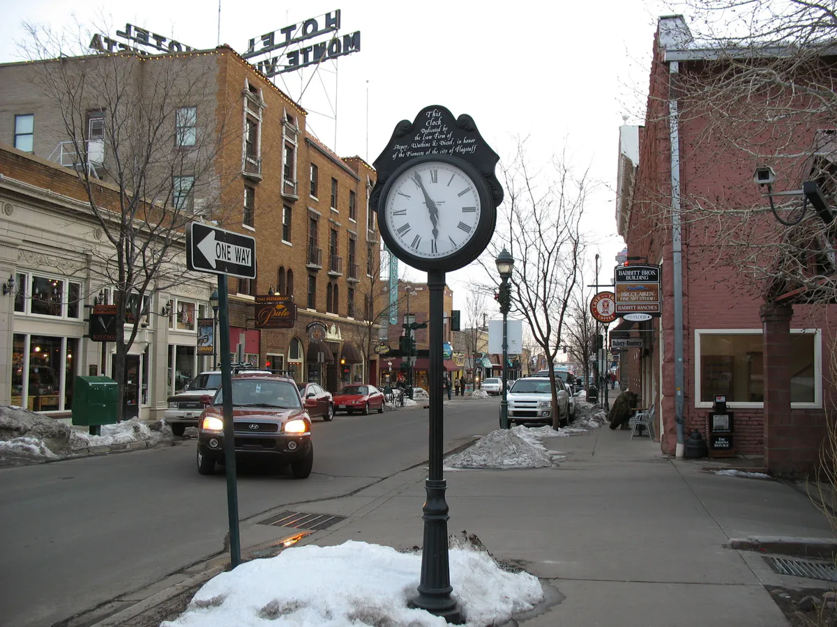
Walkable dining, boutique shopping, Heritage Square concerts, and historic brick architecture.
 AdventriaLocalOpen App
Flagstaff Operational Decision Guide
Trying to decide what to do in Flagstaff? Adventria helps you cut through the options and choose a good-enough plan without endless scrolling. Make practical choices on where to eat, hike, stargaze, and explore while managing high-altitude conditions, railroad delays, monsoon timing, and seasonal parking rules.
The local decision problem
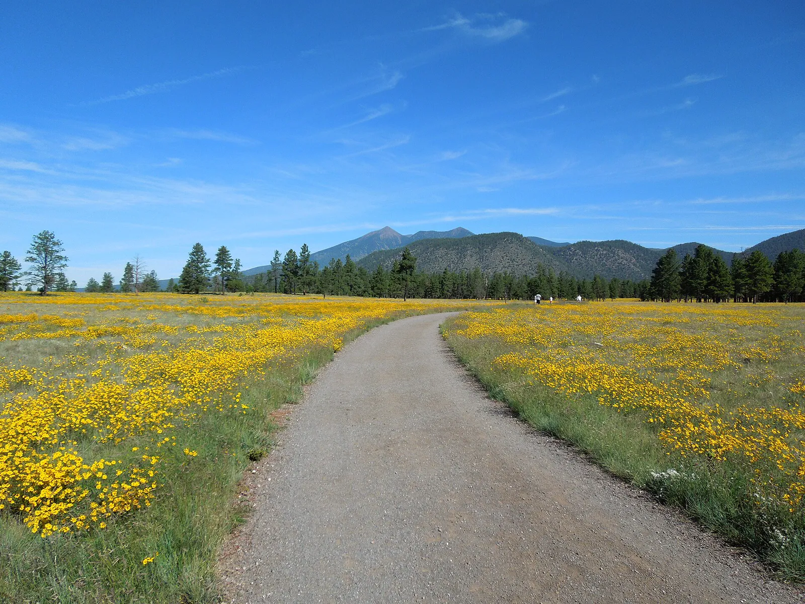
How to navigate dining, trail recreation, transit friction, weather shifts, and high-altitude logistics in Flagstaff, Arizona.
That is where Adventria comes in. Adventria helps narrow the options in Flagstaff around practical factors like location, distance, budget, vibe, who you are with, and the kind of experience you actually want, so research can turn into a decision.
Let Adventria narrow the optionsPick the right part of town
Different parts of Flagstaff work for different kinds of plans. Start with the experience you want, then narrow the map.
Best for
Walkable dining, boutique shopping, Heritage Square concerts, and historic brick architecture.
Best for
Craft microbreweries, creative eateries, student venues, and restored industrial spaces.
Best for
Authentic regional eateries, community markets, and quiet historic neighborhoods.
Best for
Exploring historic neighborhood roots along West Route 66 and Clay Avenue.
Best for
Residential forest access, proximity to Cheshire Park, and gateway travel to Snowbowl.
Best for
Low-density forested enclaves, cultural institutions, and northwest highway access.
This is a quick starting point. The full guide covers 7 local neighborhoods and districts in Flagstaff.
Eat & drink
When the decision is less about what to do and more about where to eat or grab a drink, start here. These local cues narrow the food and drink decision without turning dinner or a night out into another hour of comparison.
Head to Historic Downtown or the Southside Historic District for walk-in craft dining. Microbreweries like Mother Road Brewing on Route 66, Dark Sky Brewing on Beaver Street, and Lumberyard Brewing offer local food menus and tap selections without requiring formal advance bookings.
Pick up a Flagstaff Brewery Trail Passport at the Visitor Center located in the historic Route 66 train station. Collect stamps while guiding visitors through historic brick streets in Downtown and industrial Southside taprooms.
Still comparing options? Adventria can narrow the choice around budget, distance, vibe, and who you are with.
Decide with AdventriaPlan by situation
Start with the kind of plan you are actually trying to make. These city-specific ideas narrow the choice around who you are with, what you want to spend, the weather, and the kind of outing you want.
For an outdoor plan from Flagstaff, compare trails, state parks, national parks within trip range, and scenic drives. Options in the current city guide include Riordan Mansion State Historic Park and Slide Rock State Park.
Explore interactive natural history and dinosaur displays at the Museum of Northern Arizona. For active kids, visit Fort Tuthill County Park south of I-40 to experience the tree-canopy courses at Flagstaff Extreme Adventure Course or play at Wheeler Park downtown.
When summer monsoon storms arrive between 12:00 PM and 4:00 PM or winter snow hits, retreat indoors. Explore the indoor ethnology halls at the Museum of Northern Arizona, take a covered house tour at Riordan Mansion, or view gallery exhibitions at Coconino Center for the Arts.
Enjoy free recreation along the 59-mile FUTS network or the flat loop at Buffalo Park. Take advantage of $10 Sunday admission for Northern Arizona residents at the Museum of Northern Arizona, and park for free in the City Hall parking lot after 5:00 PM on weekdays and all day on weekends.
Begin with dinner in Southside at Foret Coffee or Pizzicletta, then stroll across the pedestrian footbridge into Downtown. Conclude the evening on Mars Hill at Lowell Observatory for night-sky stargazing overlooking the city lights.
Bring or rent a bicycle to ride the Flagstaff Urban Trail System (FUTS), a 59-mile non-motorized network connecting neighborhoods and forest edges. Stop by MacAulay's or Foret for coffee before exploring the visual art gallery at Coconino Center for the Arts.
Gather at large outdoor venues such as the Dark Sky Beer Garden on Birch and Beaver or the patio at Mother Road. For evening entertainment, purchase advance tickets for outdoor forest concerts at Pepsi Amphitheater in Fort Tuthill County Park.
Outdoors nearby
Use these nearby outdoor options when the plan calls for a trail, protected landscape, park, or drive instead of another indoor stop. Proximity here is geographic, not a promise about driving time.
Get out of town
When staying in town is not the answer, these nearby destinations give you a smaller starting set for a day trip, overnight escape, or weekend away.
Destination relationships are screened geographically. Straight-line proximity is not presented as road mileage or estimated travel time.
Local landmarks & attractions
These notable destinations offer a starting point when you want something specific to see, visit, or build into a day around Flagstaff. Distances are approximate from the city area.
museum in Flagstaff, Arizona
arboretum in Coconino County, Arizona
United States National Monument in Arizona
theater and movie theater in Flagstaff, Arizona, United States
historic area
Notable places are selected from structured public destination data and ranked for relevance, prominence, proximity, and variety.
Local decision signals
A useful local recommendation depends on how the city actually works. These conditions affect where to go, what to do, and whether a plan makes sense right now.
An active rail corridor carries over 80 trains daily, bisecting Downtown and Southside with limited vehicle street crossings at Milton Road, Beaver Street, San Francisco Street, and Enterprise Road.
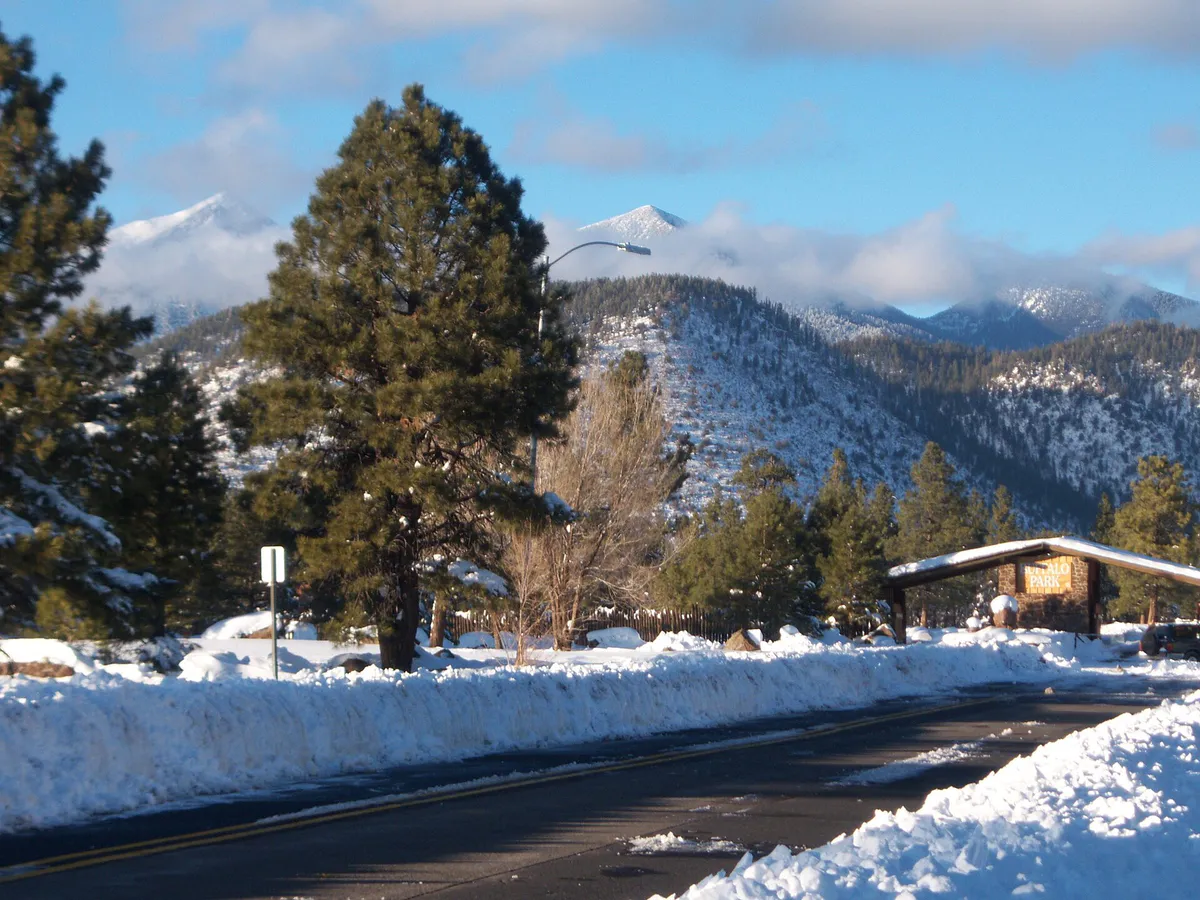
Designated as the world's first International Dark Sky City, low-pressure amber outdoor lighting maintains stargazing visibility directly from town, requiring flashlights for evening pedestrian walks on residential side streets.
Situated above 6,900 feet elevation on the Coconino Plateau, daily temperatures swing 30 to 40 degrees Fahrenheit between daytime and nighttime hours year-round.
July and August bring rapid lightning and severe afternoon rainstorms almost daily between 12:00 PM and 4:00 PM, making morning outdoor scheduling vital.
To accommodate city snowplow clearance, on-street parking is prohibited city-wide overnight from November 1 through April 1.
Milton Road funnels major university and interstate traffic into town, while Fort Valley Road experiences heavy morning queues toward Arizona Snowbowl in winter and autumn foliage spots in October.
Major outdoor event facilities south of Interstate 40, including the Pepsi Amphitheater within county park grounds, operate exclusively on digital and card transactions.
Neighborhood context
Neighborhoods are not interchangeable. Each area offers a different balance of atmosphere, transportation, food, nightlife, activities, and planning friction.
Best for: Walkable dining, boutique shopping, Heritage Square concerts, and historic brick architecture.
Bordered by Humphreys Street, Verde Street, Birch/Cherry Avenue, and Route 66, this core features historic 1890s buildings, craft taprooms, galleries, and pedestrian plazas.
Best for: Craft microbreweries, creative eateries, student venues, and restored industrial spaces.
Located directly south of the BNSF railway line down to Butler Avenue, Southside features Craftsman bungalows, colorful murals, independent coffee shops, and popular craft breweries.
Best for: Authentic regional eateries, community markets, and quiet historic neighborhoods.
Positioned east of downtown along 3rd and 4th Streets, Sunnyside is a long-standing Hispanic neighborhood home to local markets and authentic Mexican dining.
Best for: Exploring historic neighborhood roots along West Route 66 and Clay Avenue.
One of Flagstaff's oldest residential enclaves, situated west of downtown, featuring historic homes and active community heritage preservation.
Best for: Residential forest access, proximity to Cheshire Park, and gateway travel to Snowbowl.
A quiet northwest residential corridor along Fort Valley Road (US-180) offering access to forest trails and cultural centers.
Best for: Low-density forested enclaves, cultural institutions, and northwest highway access.
Stretching northwest on US-180 toward the San Francisco Peaks, this area houses major cultural hubs like the Museum of Northern Arizona and Coconino Center for the Arts.
Best for: Family-oriented neighborhoods with direct greenbelt trail network connections.
Residential areas located south of Interstate 40, built around trail systems like the High Country Trail greenbelt and Southwest Crossing Trail.
Explore your options
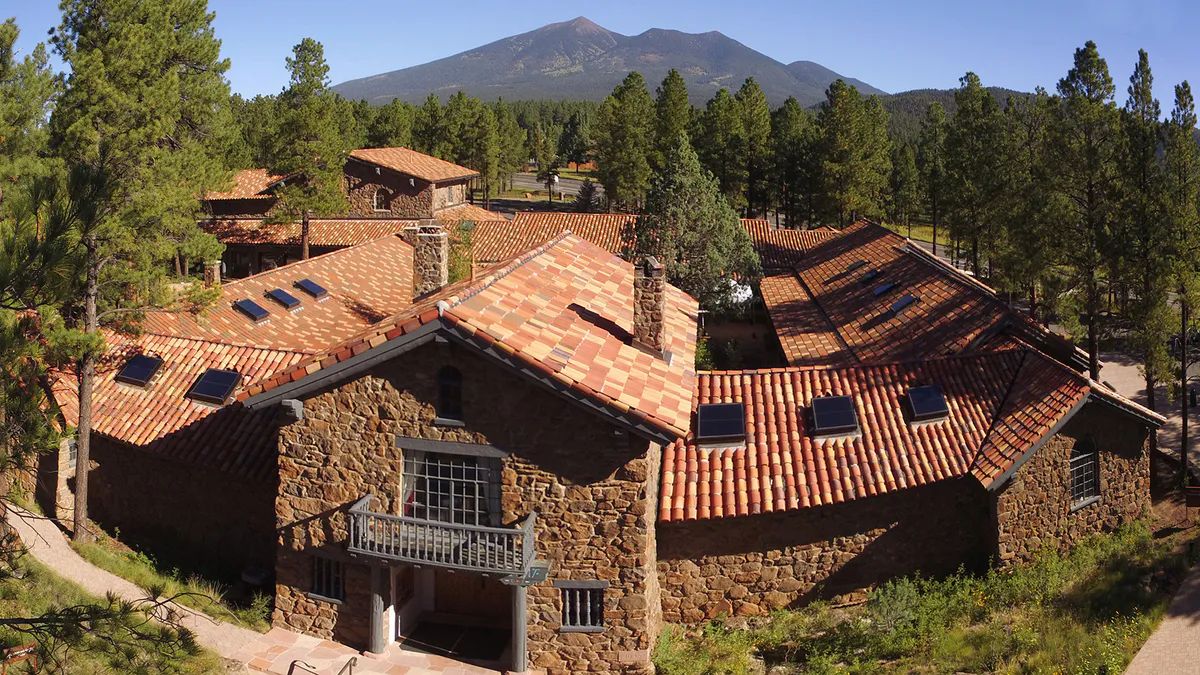
Match your schedule, budget, and travel preferences with targeted local activities tailored to Flagstaff constraints.
Explore downtown streetscapes and local dark sky stargazing without needing advance reservations.
Plan outdoor recreation around high elevation, unpaved forest roads, and early afternoon storm risks.
Seek shelter during summer monsoon rain showers or winter cold snaps at local arts and history centers.
Practical local guidance
Keep these practical rules and operational factors in mind when planning outings around Flagstaff.
A simpler way to decide
Follow these steps to navigate local transit bottlenecks, elevation factors, and weather shifts smoothly.
Pack outerwear layers to handle a 30 to 40 degree drop between day and night temperatures, and double your water intake upon arriving at 7,000 feet.
Complete high-altitude hikes or mountain bike rides before noon, particularly during July and August when monsoon rain develops daily.
Avoid Milton Road during university traffic peaks and Fort Valley Road on ski mornings by timing trips midday or utilizing multi-use FUTS trail pathways.
Pay for on-street parking via ParkFlag kiosks or park for free at the City Hall lot at 211 W Aspen Ave after 5:00 PM on weekdays or on weekends.
Cross the BNSF railway tracks using pedestrian sidewalks on Beaver Street or San Francisco Street to access taprooms and dining without re-parking your vehicle.
Common local questions
These are common situations people face when trying to decide where to eat, what to do, where to get drinks, or how to spend their time in Flagstaff.
Flagstaff planning questions
Practical answers for people deciding where to eat, what to do, where to go, or how to make plans in Flagstaff.
At roughly 7,000 feet elevation, lower atmospheric pressure and low humidity cause faster dehydration, increased UV exposure, and quicker physical exertion. Visitors should drink double their normal amount of water, apply high-SPF sunscreen, and limit heavy uphill exertion during their first day.
While central street parking and surface lots cost $1.00 per hour through ParkFlag, municipal lots such as the City Hall lot (211 W Aspen Ave) and Coconino County administrative lots offer free parking after 5:00 PM on weekdays and all day on weekends.
The city enforces a strict overnight winter parking ban from November 1 to April 1 between midnight (or 3:00 AM in business districts) and 7:00 AM to allow municipal plows to clear snow from street shoulders.
The active BNSF railway carries over 80 freight and passenger trains daily, dividing Downtown from Southside. Vehicles must cross at Milton Road, Beaver Street, San Francisco Street, or Enterprise Road, where passing trains regularly create short traffic delays.
In July and August, sudden thunderstorms and lightning occur almost daily between 12:00 PM and 4:00 PM. Schedule outdoor hikes for early morning, and shift to indoor cultural activities—such as the Museum of Northern Arizona or Riordan Mansion—during the afternoon.
As the world's first International Dark Sky City, Flagstaff enforces strict outdoor lighting codes requiring shielded, narrow-spectrum amber lighting. This minimizes skyglow to protect astronomical research at Lowell Observatory while allowing clear stargazing directly from municipal neighborhoods.
Pick up a official Flagstaff Brewery Trail Passport at the Visitor Center inside the historic Route 66 train station. Collect stamps from participating microbreweries across Downtown, Southside, and Eastside, then return the completed passport for a commemorative souvenir pint glass.
Historic Downtown, Southside, and the NAU campus are compact and walkable, connected by Mountain Line buses and the 59-mile Flagstaff Urban Trail System (FUTS). However, outer attractions like Walnut Canyon, Snowbowl, or outlying trailheads require a vehicle.
To see the interior of the 13,000-square-foot 1904 Arts & Crafts duplex, visitors must join a guided tour led by state park staff. Reserving tour tickets online in advance is strongly recommended as tour capacities are capped.
During winter storms, Arizona Department of Transportation regulations mandate four-wheel drive, all-wheel drive, or tire chains on US-180 and Snowbowl Road. Heavy morning ski traffic routinely builds northbound queues along Fort Valley Road.
Source transparency
Official and locally relevant sources used to verify the practical information presented in this Flagstaff decision guide.
Flagstaff decision engine
Tell Adventria what kind of experience you want, set your practical limits, and turn the options in Flagstaff into one workable plan.
Choose a Flagstaff Plan