Downtown / Historic Core
Best for
Dining, craft beer, historic architecture, and fault creep walking tours
 AdventriaLocalOpen App
San Benito County Decision Guide
Trying to decide what to do in Hollister? Adventria helps you cut through the options and choose a good-enough plan without endless scrolling. Whether you are managing a weekday Silicon Valley commute, heading south toward Pinnacles National Park, or looking for dinner downtown, practical choices in Hollister depend heavily on timing, route friction, and local geography.
The local decision problem
Navigating regional commuter bottlenecks, park access timing, active fault geography, and seasonal activity windows across Hollister and San Benito County.
That is where Adventria comes in. Adventria helps narrow the options in Hollister around practical factors like location, distance, budget, vibe, who you are with, and the kind of experience you actually want, so research can turn into a decision.
Let Adventria narrow the optionsPick the right part of town
Different parts of Hollister work for different kinds of plans. Start with the experience you want, then narrow the map.
Best for
Dining, craft beer, historic architecture, and fault creep walking tours
Best for
Suburban neighborhood living, school access, and local parks
Best for
Modern master-planned housing and commuter family amenities
Best for
Gated golf course residential living and quiet semi-private surroundings
Best for
Utility shopping, regional travel logistics, and light industrial services
Best for
Estate winery tastings, scenic foothill drives, and off-road motor sports
This is a quick starting point. The full guide covers 7 local neighborhoods and districts in Hollister.
Eat & drink
When the decision is less about what to do and more about where to eat or grab a drink, start here. These local cues narrow the food and drink decision without turning dinner or a night out into another hour of comparison.
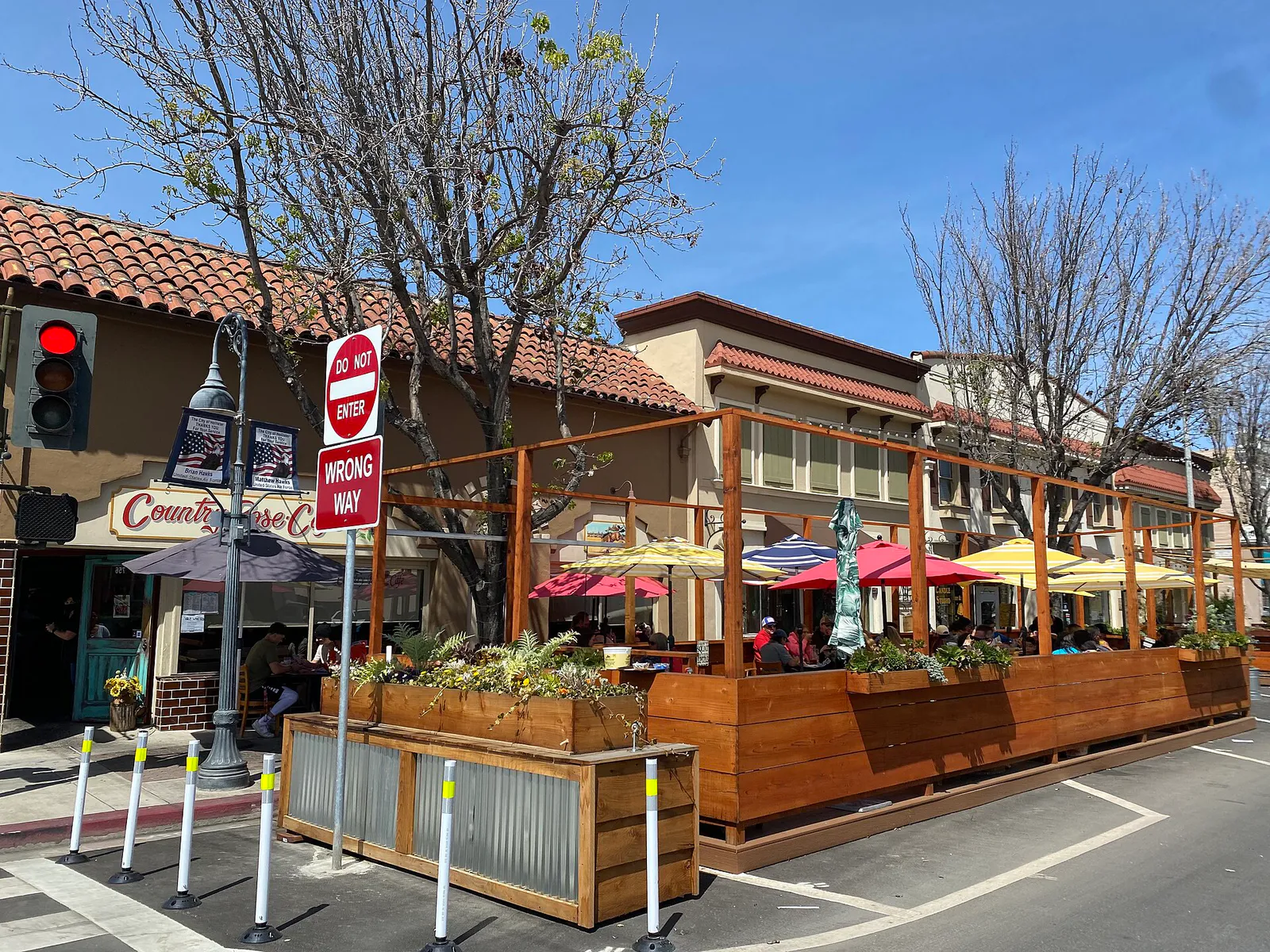
Head to San Benito Street in downtown Hollister for walk-in casual dining. Running Rooster offers wood-fired pizzas and burgers with ample seating, while Mad Pursuit Brewing Company serves craft beers alongside relaxed taproom food options. For wine flights and small plates without formal booking, Crave Wine Company accommodates walk-in guests during evening hours.
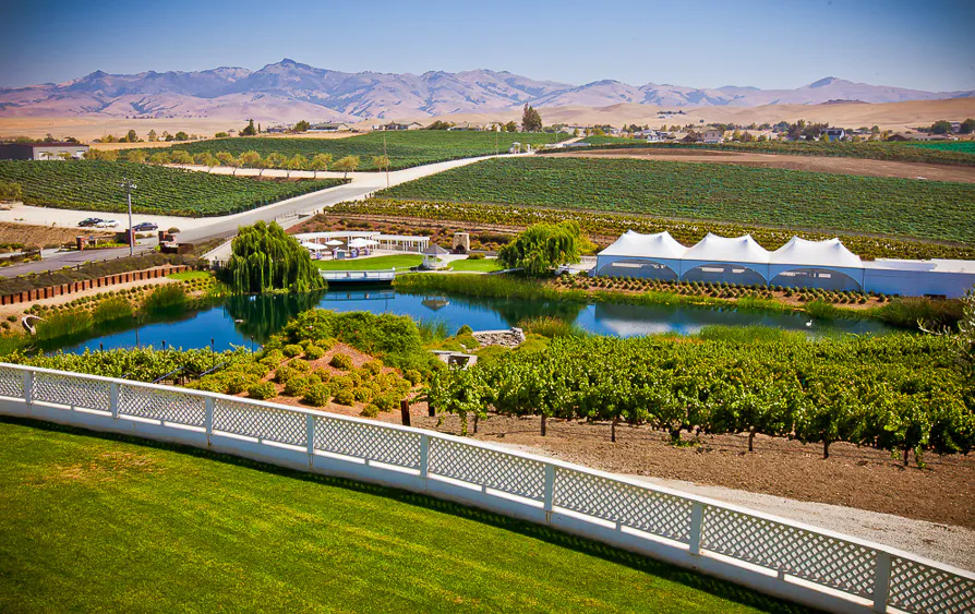
Begin with an afternoon wine tasting flight on the lawn at Eden Rift Vineyards along Cienega Road, surrounded by historic vines. Follow it with an early evening walk downtown, stopping for artisanal craft brews at Mad Pursuit Brewing Company or wine flights at Crave Wine Company.
Still comparing options? Adventria can narrow the choice around budget, distance, vibe, and who you are with.
Decide with AdventriaPlan by situation
Start with the kind of plan you are actually trying to make. These city-specific ideas narrow the choice around who you are with, what you want to spend, the weather, and the kind of outing you want.
Visit the San Benito County Historical Park in Tres Pinos to explore the outdoor grounds of the Historical Village, where kids can examine vintage train stock and historic schoolhouses for a nominal vehicle parking fee. Alternatively, bring bicycles or strollers to the paved San Benito River Trail running between Nash Road and San Benito Street.
Spend a rainy morning examining regional historical archives and artifacts at the Wapple House Museum on 5th Street during its open weekend hours. Follow with indoor tasting flights at Crave Wine Company or catch a film at Premiere Cinemas downtown.
Combine a quiet solo street walk mapping fault offsets through historic residential blocks east of downtown with a afternoon reading session or craft beer tasting flight at Mad Pursuit Brewing Company on San Benito Street.
Gather your group at Hollister Hills SVRA along Cienega Road, offering over 6,800 acres and 200 miles of off-road trails designed for 4x4 vehicles and dirt bikes. Be sure to check park trail conditions beforehand during winter rainy periods, as wet adobe clay soil can prompt temporary trail closures.
For an outdoor plan from Hollister, compare trails, state parks, national parks within trip range, and scenic drives. Options in the current city guide include San Juan Bautista State Historic Park and Fremont Peak State Park.
For a short escape from Hollister, compare Carmel-by-the-Sea and Santa Cruz. More options are listed in the trip section below.
Outdoors nearby
Use these nearby outdoor options when the plan calls for a trail, protected landscape, park, or drive instead of another indoor stop. Proximity here is geographic, not a promise about driving time.
Get out of town
When staying in town is not the answer, these nearby destinations give you a smaller starting set for a day trip, overnight escape, or weekend away.
Destination relationships are screened geographically. Straight-line proximity is not presented as road mileage or estimated travel time.
Local landmarks & attractions
These notable destinations offer a starting point when you want something specific to see, visit, or build into a day around Hollister. Distances are approximate from the city area.
Spanish mission in California, United States
family amusement and nature park
motorsport track in the United States
state historic park in San Juan Bautista, California, United States
non-profit organization in the USA
cemetery in California
historic district in Hollister, California, United States
sporting complex in California, US
Notable places are selected from structured public destination data and ranked for relevance, prominence, proximity, and variety.
Local decision signals
A useful local recommendation depends on how the city actually works. These conditions affect where to go, what to do, and whether a plan makes sense right now.
The Calaveras Fault passes directly through residential neighborhoods east of downtown, creating visible annual street, curb, and sidewalk displacement.
Hollister connects directly to the East Entrance of Pinnacles National Park; there is no interior drive connecting to the West Entrance in Soledad.
Northbound Highway 25 experiences peak weekday morning congestion toward Highway 101, with matching southbound friction during evening commute hours.
Wet winter weather turns the clay soils at Hollister Hills SVRA slick, triggering temporary off-road trail closures.
Pinnacles National Park provides no gas stations or food service inside its boundaries, making Hollister the final supply stop.
San Benito County Express runs regional commuter express shuttles to the Gilroy Caltrain station for Silicon Valley transfers.
Downtown street parking is free with strict two-hour time limits, backed by free unlimited public off-street parking lots behind main commercial blocks.
Neighborhood context
Neighborhoods are not interchangeable. Each area offers a different balance of atmosphere, transportation, food, nightlife, activities, and planning friction.
Best for: Dining, craft beer, historic architecture, and fault creep walking tours
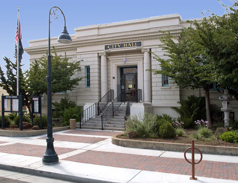
Centered on San Benito Street between 3rd and South Streets, featuring 83 designated historic structures, City Hall at the historic Carnegie Library, local bakeries, craft taprooms, and Dunne Park.
Best for: Suburban neighborhood living, school access, and local parks
Established residential tracts along Sunnyslope Road, Hillcrest Road, and Memorial Drive housing local public schools such as Marguerite Maze Middle School and neighborhood green spaces.
Best for: Modern master-planned housing and commuter family amenities
A growing master-planned development along Fairview Road and Sunnyslope Road featuring single-family housing, newly constructed neighborhood parks, and updated local infrastructure.
Best for: Gated golf course residential living and quiet semi-private surroundings
An unincorporated gated community situated southeast of city limits along Highway 25, built around the fairways of the semi-private Ridgemark Golf & Country Club.
Best for: Utility shopping, regional travel logistics, and light industrial services
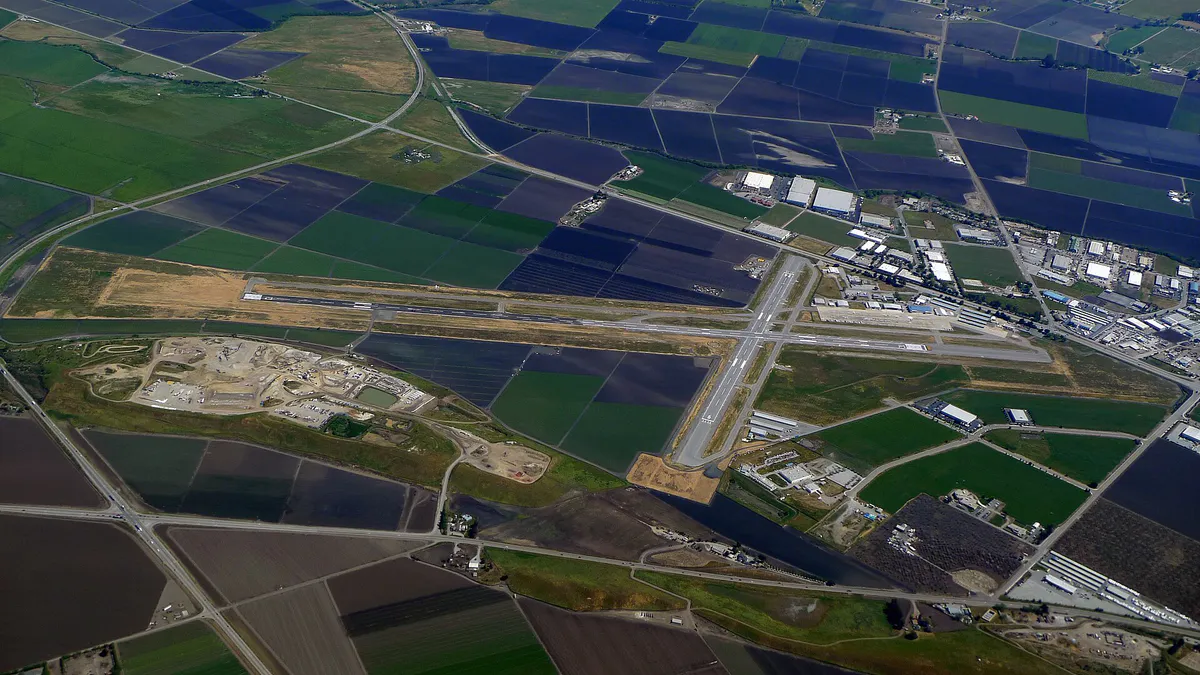
Stretching along Highway 156, San Felipe Road, and the Highway 25 Bypass, this district hosts Hollister Municipal Airport, major retail plazas, and municipal service infrastructure.
Best for: Estate winery tastings, scenic foothill drives, and off-road motor sports
Extending southwest along Cienega Road toward the Gabilan Range, home to historic vineyards like Eden Rift and Calera, along with the expansive Hollister Hills SVRA.
Best for: Historic village outings, rustic steakhouse dining, and park event space
An unincorporated historic township five miles south on Highway 25 serving as a southern gateway to the San Benito County Historical Park and Bolado Park Event Center.
Explore your options
Select options tailored to your specific itinerary, weather preferences, and recreation goals.
Explore downtown's walkable grid, featuring historic civic architecture, local bakeries, craft taprooms, and cultural venues.
Sample cool-climate Pinot Noir and dry-farmed heritage varietals along the foothill vineyards southwest of town.
Access high-altitude rock formations, off-road vehicle courses, and paved riverfront greenways.
Connect with regional express buses, municipal aviation services, and local shopping plazas.
Practical local guidance
Keep these practical regional dynamics in mind when organizing your schedule in and around Hollister.
A simpler way to decide
Follow these practical steps to secure parking and navigate your morning outing smoothly.
Check official National Park Service advisories for current conditions regarding Bear Gulch Cave openings and parking lot availability before departing.
Ensure your vehicle is fully fueled and that you have gathered all necessary water, snacks, and trail supplies before leaving city limits, as Pinnacles offers no food or gas facilities.
Leave Hollister by 7:15 AM to drive the 30 miles south along Highway 25 and Highway 146 to Paicines, arriving before the main gate queues form.
Have your credit card, digital payment, or America the Beautiful interagency pass ready at the East Entrance station for vehicle access.
Proceed directly to the upper parking areas near Bear Gulch Day Use Area to secure a spot before lots fill completely for the day.
Review the trail head bulletin board for updated weather advisories, flash flood warnings in talus caves, or mid-day heat restriction notices.
Common local questions
These are common situations people face when trying to decide where to eat, what to do, where to get drinks, or how to spend their time in Hollister.
Hollister planning questions
Practical answers for people deciding where to eat, what to do, where to go, or how to make plans in Hollister.
Take a self-guided walking tour through residential neighborhoods just east of downtown near Dunne Park. Look along 6th Street, 7th Street, Locust Street, and Central Avenue to observe distinct offsets in concrete curbs, sidewalks, and retaining walls caused by continuous annual fault movement.
No. Pinnacles National Park is divided by high rock formations with no road connecting the two sides inside the park. Reaching the West Entrance in Soledad from the East Entrance requires a detour of 1.5 to 2 hours around the mountain range via Highway 101.
San Benito County Express operates the Caltrain Express shuttle on weekdays during peak commuter hours. This route carries passengers directly from Hollister to the Gilroy Caltrain station for train connections into San Jose and Silicon Valley.
Free street parking is available throughout downtown Hollister, though main commercial stretches carry two-hour time limits. Unlimited free public parking is available in municipal off-street parking lots situated behind businesses along 4th, 5th, and San Benito Streets.
The North American plate portion of Hollister Hills SVRA consists of dense adobe clay soil. Heavy winter rain turns this soil into extremely slick mud, prompting temporary trail closures to prevent soil erosion and protect rider safety.
No. There are no gas stations, restaurants, or grocery stores inside Pinnacles National Park. Visitors must fuel vehicles and purchase food, water, and hiking supplies in Hollister or Paicines before entering the park.
The Hollister Downtown Farmers Market runs seasonally on Wednesdays from 3:00 PM to 7:30 PM, typically operating from April through October along San Benito Street.
San Benito County Express operates local fixed 'Tripper' bus routes connecting schools, medical facilities, and retail centers, alongside 'GO County Express,' an app-based on-demand microtransit service providing curb-to-curb shared rides within city limits.
Crave Wine Company on San Benito Street offers curated tasting flights, glass pours, and retail bottles highlighting estate wines produced across San Benito County sub-AVAs alongside international selections.
Source transparency
Official and locally relevant sources used to verify the practical information presented in this Hollister decision guide.
Hollister decision engine
Tell Adventria what kind of experience you want, set your practical limits, and turn the options in Hollister into one workable plan.
Choose a Hollister Plan