Downtown / Third Street Promenade
Best for
High-density retail, dining, hotel clusters, and direct light rail transit access.
 AdventriaLocalOpen App
Local Decision Matrix & District Guide
Trying to decide what to do in Santa Monica? Adventria helps you cut through the options and choose a good-enough plan without endless scrolling. Santa Monica spans 8.3 square miles along the Los Angeles County coastline, blending dense commercial centers, distinct residential corridors, and high-volume oceanfront parks. Making the most of your time here requires understanding how coastal microclimates affect beach plans, how local parking rules operate, and how district transitions alter travel speed.
The local decision problem
Navigating neighborhood tradeoffs, coastal weather patterns, parking regulations, and transit bottlenecks in Santa Monica.
That is where Adventria comes in. Adventria helps narrow the options in Santa Monica around practical factors like location, distance, budget, vibe, who you are with, and the kind of experience you actually want, so research can turn into a decision.
Let Adventria narrow the optionsPick the right part of town
Different parts of Santa Monica work for different kinds of plans. Start with the experience you want, then narrow the map.
Best for
High-density retail, dining, hotel clusters, and direct light rail transit access.
Best for
Blufftop ocean views, coastal dining, landmark sightseeing, and historic park walks.
Best for
Walkable boutique shopping, weekend dining, neighborhood pubs, and indie galleries.
Best for
Residential neighborhood living, community parks, craftsman homes, and aviation history.
Best for
Boutique browsing, artisan bakeries, quiet sidewalk cafes, and repertory cinema.
Best for
Quiet estate walking, residential architecture, and coastal bluff vistas along Adelaide Drive.
This is a quick starting point. The full guide covers 8 local neighborhoods and districts in Santa Monica.
Eat & drink
When the decision is less about what to do and more about where to eat or grab a drink, start here. These local cues narrow the food and drink decision without turning dinner or a night out into another hour of comparison.
For immediate dining without prior bookings, head to the Pico Boulevard Corridor for casual Mexican taquerias and traditional delis, or visit Bay Cities Italian Deli on 15th Street for famous counter-service sandwiches. On Montana Avenue, venues like R+D Kitchen accommodate walk-in diners, while Main Street offers relaxed gastropubs and neighborhood bistros where bar seats open up throughout the evening.
Catch a classic 35mm film print or filmmaker Q&A screening at the historic Aero Theatre on Montana Avenue, or book seats for a concert or dance performance at BroadStage. For casual evening drinks, stroll Main Street's stretch of neighborhood pubs, or head to Ocean Avenue for rooftop hotel lounges overlooking Palisades Park and the illuminated Pier wheel.
Still comparing options? Adventria can narrow the choice around budget, distance, vibe, and who you are with.
Decide with AdventriaPlan by situation
Start with the kind of plan you are actually trying to make. These city-specific ideas narrow the choice around who you are with, what you want to spend, the weather, and the kind of outing you want.
For a short escape from Santa Monica, compare Costa Mesa and Avalon. More options are listed in the trip section below.
Start at the Cayton Children's Museum inside Santa Monica Place for hands-on indoor play structures, then cross Ocean Avenue to Tongva Park to let children explore the splash pad and wireframe observation structures. Alternatively, visit the Annenberg Community Beach House for its splash pad and beach grounds, or head to Airport Park to watch plane takeoffs from the picnic area.
Head indoors to the 21,000-square-foot Cayton Children's Museum at Santa Monica Place, explore the covered gallery spaces at Bergamot Station Arts Center, or browse local history exhibits at the Santa Monica History Museum next to the Main Library. Cap off a rainy afternoon with a film screening at the Aero Theatre.
Avoid coastal freeway bottlenecks by arriving via the Metro E Line at the Downtown Santa Monica Station. Walk through Santa Monica Place toward Ocean Avenue, stroll through Palisades Park, and visit the historic Santa Monica Pier. Rent beach cruisers along the Strand trail to take visitors on a scenic ride down to neighboring Venice Beach.
Reserve beach canopies or volleyball courts in advance at the Annenberg Community Beach House via the city's Reserve Santa Monica portal. For interior gatherings, book picnic shelters with outdoor BBQ grills at Clover Park or Airport Park in the Sunset Park neighborhood.
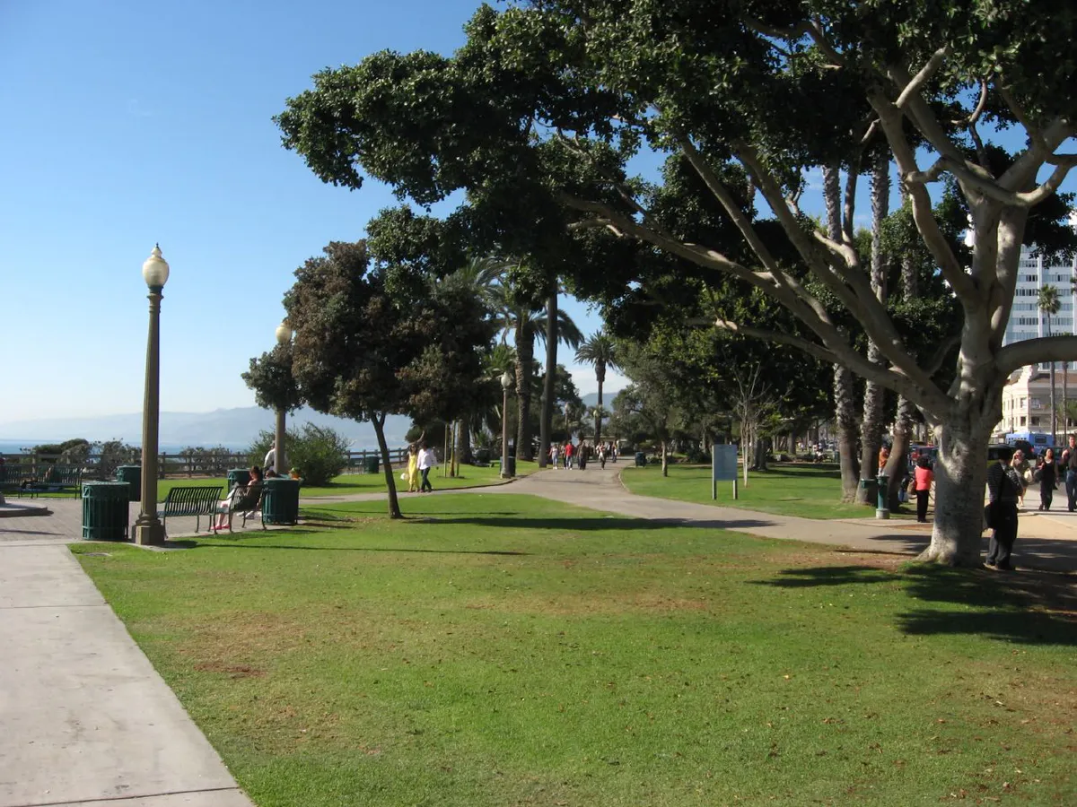
Begin with a late-afternoon stroll through Palisades Park along the Ocean Avenue bluffs, taking in panoramic views of Santa Monica Bay and the Malibu coastline. Follow up with dinner at an Ocean Avenue fine-dining venue or an intimate neighborhood bistro along Montana Avenue, capped off with an indie movie at the Aero Theatre.
Enjoy free admission to the Santa Monica Pier, Tongva Park, and Palisades Park for coastal views. Entry to the 20+ fine art galleries at Bergamot Station Arts Center is entirely free, as is access to the historic Marion Davies Guest House grounds at the Annenberg Community Beach House.
Outdoors nearby
Use these nearby outdoor options when the plan calls for a trail, protected landscape, park, or drive instead of another indoor stop. Proximity here is geographic, not a promise about driving time.
Get out of town
When staying in town is not the answer, these nearby destinations give you a smaller starting set for a day trip, overnight escape, or weekend away.
Destination relationships are screened geographically. Straight-line proximity is not presented as road mileage or estimated travel time.
Local landmarks & attractions
These notable destinations offer a starting point when you want something specific to see, visit, or build into a day around Santa Monica. Distances are approximate from the city area.
sign reading "HOLLYWOOD" located in Los Angeles, California, United States
campus of the Getty Museum and other programs of the Getty Trust in Los Angeles
library and art museum in San Marino, California
Pier in Santa Monica, California, USA
live entertainment theatre in Los Angeles, California, United States
art museum in Los Angeles, California, U.S.
multi-purpose arena in Los Angeles, California, United States
more than 2,700 five-pointed terrazzo and brass stars embedded in the sidewalks along 15 blocks of Hollywood Boulevard and three blocks of Vine Street in Hollywood, California
Notable places are selected from structured public destination data and ranked for relevance, prominence, proximity, and variety.
Local decision signals
A useful local recommendation depends on how the city actually works. These conditions affect where to go, what to do, and whether a plan makes sense right now.
May Gray and June Gloom bring cool morning fog that often burns off by midday, making early afternoon to late afternoon ideal for beach visits.
City Structures 1–9 and the Ken Edwards Center offer the first 90 minutes for $1, providing the most cost-effective option for short visits.
Demolition and replacement of the historic 1939 Pier Bridge at Ocean and Colorado Avenues requires vehicle detours, though pedestrian access is continuously maintained.
The McClure Tunnel connection between I-10 and Pacific Coast Highway creates severe traffic bottlenecks during weekday commute hours and sunny summer weekends.
Neighborhood streets north of Wilshire, south of Pico, and near Main Street strictly require residential permits to avoid 2-hour limits and overnight bans.
The LA Metro E Line connects Downtown Santa Monica directly to Downtown Los Angeles in approximately 46 minutes, bypassing east-west freeway traffic.
Neighborhood context
Neighborhoods are not interchangeable. Each area offers a different balance of atmosphere, transportation, food, nightlife, activities, and planning friction.
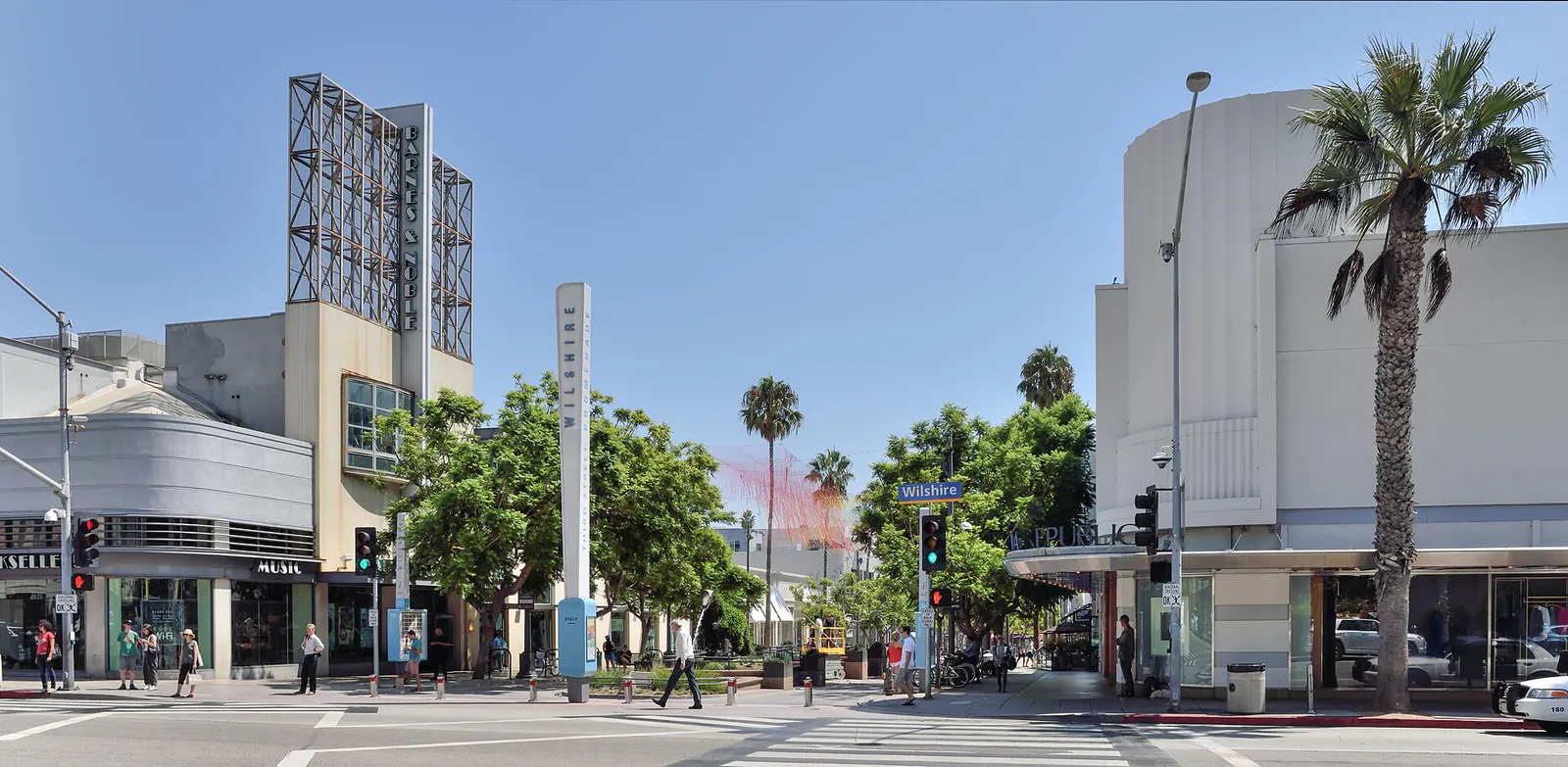
Best for: High-density retail, dining, hotel clusters, and direct light rail transit access.
The commercial center stretching from Wilshire Boulevard south to Colorado Avenue. It features pedestrian-only shopping zones, multi-level public parking structures, and direct pedestrian access to Santa Monica Place and the light rail terminus.
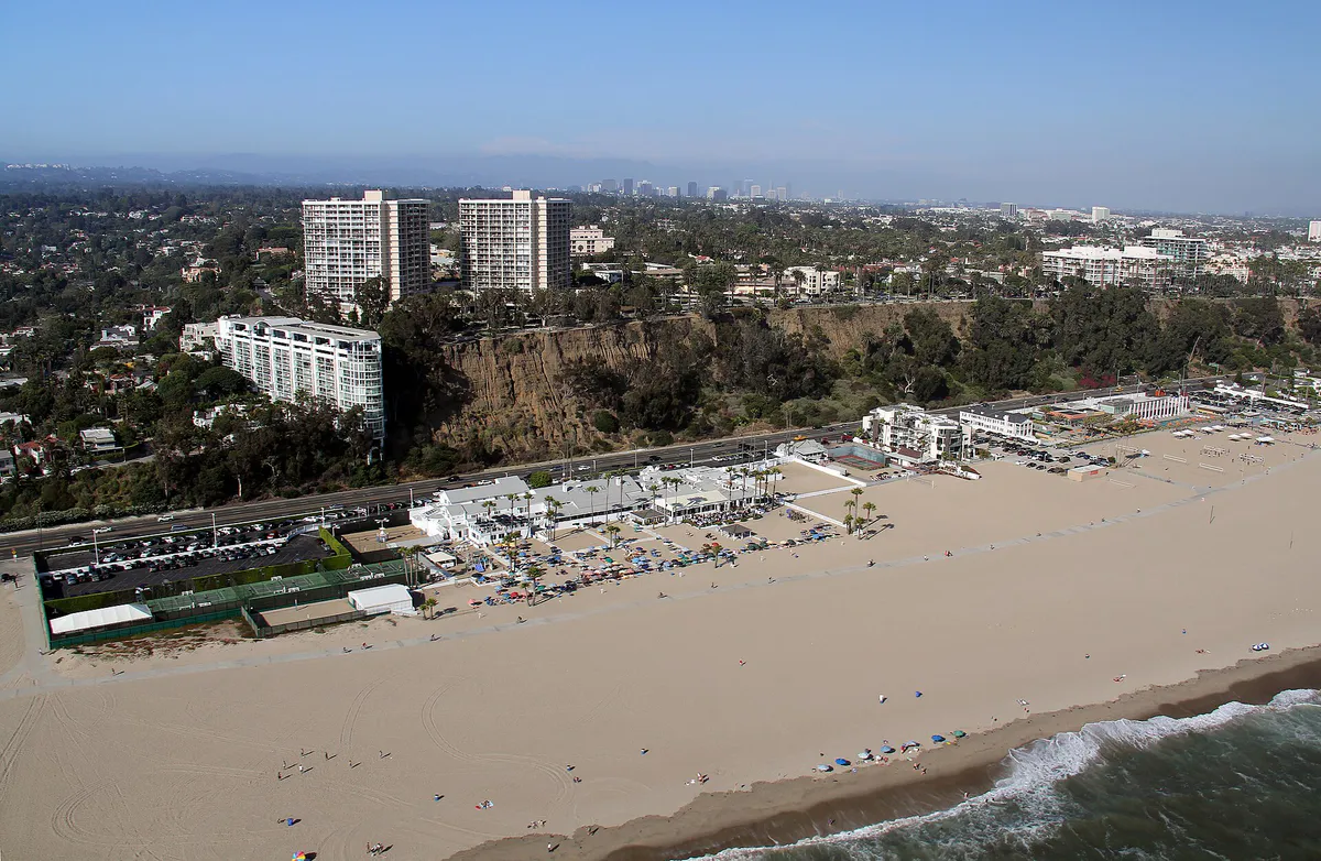
Best for: Blufftop ocean views, coastal dining, landmark sightseeing, and historic park walks.
Runs along the sandstone bluffs atop Palisades Park and extends down to the historic Pier at Colorado Avenue. Home to mid-rise luxury hotels, fine dining with ocean vistas, and active access routes down to Santa Monica State Beach.
Best for: Walkable boutique shopping, weekend dining, neighborhood pubs, and indie galleries.
Extending south from Pico Boulevard to the Venice border at Marine Street, Main Street offers a lower-density, beach-casual corridor with local coffee shops, Sunday farmers markets, and neighborhood nightlife.
Best for: Residential neighborhood living, community parks, craftsman homes, and aviation history.
Occupies the southern interior grid of the city. Features quiet residential streets, Clover Park's athletic fields, and the Santa Monica Airport, home to the Museum of Flying and Airport Park.
Best for: Boutique browsing, artisan bakeries, quiet sidewalk cafes, and repertory cinema.
A 15-block upscale commercial stretch running from 7th Street to 26th Street. Designed for neighborhood walkability, it caters to residential neighbors with independent home decor shops, juice bars, and the historic Aero Theatre.
Best for: Quiet estate walking, residential architecture, and coastal bluff vistas along Adelaide Drive.
The city's most exclusive single-family residential neighborhood, running from Montana Avenue north to San Vicente Boulevard. Features tree-lined avenues and minimal commercial activity.
Best for: Arts destinations, live performance venues, major medical centers, and transit access.
A central, transit-oriented business zone extending along Wilshire, Santa Monica, and Olympic Boulevards. Houses Bergamot Station Arts Center, the Eli & Edythe Broad Stage, and major medical complexes.
Best for: Authentic multi-ethnic delis, casual taquerias, record shops, and community parks.
Running east-west past Santa Monica College, Pico Boulevard features diverse, lower-cost dining options, neighborhood services, the Saturday Pico Farmers Market, and Virginia Avenue Park.
Santa Monica local guide
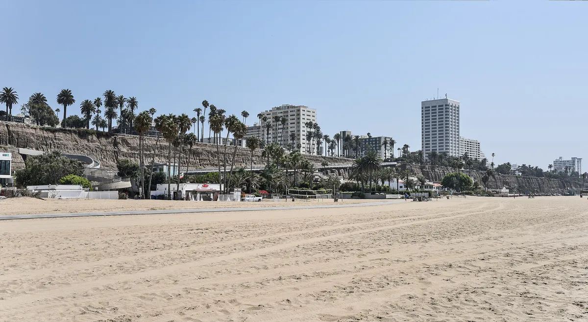
Santa Monica's layout is visually straight forward but topologically constrained. The city sits on an elevated coastal plain that drops precipitously down to sea level via steep sandstone palisades. Transitioning between the elevated downtown grid and the Pacific Coast Highway beach level requires using specific chokepoints: the California Incline, the McClure Tunnel I-10 connector, or pedestrian stairs located along Arizona and Montana Avenues.
Regional traffic heavily affects local travel. The Santa Monica Freeway (I-10) terminates directly at 4th Street and Lincoln Boulevard before feeding into the McClure Tunnel toward State Route 1 (PCH). Morning eastbound and evening westbound commute rushes create major bottlenecks along Lincoln Boulevard and Ocean Avenue. Northbound PCH chokes during sunny summer weekends as beachgoers head toward Malibu.
Local drivers should also prepare for long-term bridge replacement construction at Ocean and Colorado Avenues. The city is executing a full replacement of the 1939 Santa Monica Pier Bridge. Temporary pedestrian bridges and modified detour routes maintain continuous access to all Pier attractions and Pacific Park businesses, but drivers should expect traffic shifts along Ocean Avenue.
Explore your options
Choosing the correct transportation mode depends heavily on your target neighborhood and time of day.
Provides direct rail connections between Downtown Los Angeles and Santa Monica, completely bypassing freeway traffic.
Santa Monica's clean-energy municipal bus transit network offering high-frequency service across the Westside.
Flexible short-haul transportation options operating under city permits across commercial districts.
Dedicated bike infrastructure separated from vehicular traffic along primary corridors.
Practical local guidance
Understanding Santa Monica's Mediterranean microclimate prevents common timing missteps during beach trips.
Common local questions
These are common situations people face when trying to decide where to eat, what to do, where to get drinks, or how to spend their time in Santa Monica.
Santa Monica planning questions
Practical answers for people deciding where to eat, what to do, where to go, or how to make plans in Santa Monica.
In City Public Parking Structures 1 through 9 and the Ken Edwards Center in Downtown Santa Monica, the first 90 minutes of parking cost $1. Standard incremental rates apply after the initial 90 minutes up to daily maximum limits.
Shift outdoor beach activities, rides at Pacific Park, and ocean photography to late afternoon when coastal fog usually burns off. Use foggy mornings for indoor gallery browsing at Bergamot Station, visits to the Cayton Children's Museum, or exploring local farmers markets.
Yes. While the city is actively replacing the 1939 Santa Monica Pier Bridge at Ocean and Colorado Avenues, temporary pedestrian bridge structures and vehicular detours maintain continuous access to the Pier, Pacific Park, and surrounding businesses.
The Metro E Line light rail connects Downtown Los Angeles (7th St/Metro Center) directly to Downtown Santa Monica in approximately 46 minutes, eliminating the need to drive or park along the I-10 freeway.
Residential streets in these districts enforce strict Preferential Parking Permit rules. Non-permit holders face 2-hour stay limits during daytime hours and total parking bans during evenings and weekends. Parking enforcement actively tickets non-permitted vehicles.
Combine the LA Metro E Line for east-west cross-town travel with Santa Monica's Big Blue Bus system for local neighborhood connections. For short coastal hops between Ocean Avenue and Main Street, use the on-demand Circuit electric shuttles or rent bicycles along the Marvin Braude Beach Trail.
Top free attractions include walking through Palisades Park along the ocean bluffs, exploring the award-winning landscape design at Tongva Park, browsing contemporary art galleries at Bergamot Station Arts Center, and taking docent-led tours of the Marion Davies Guest House at the Annenberg Community Beach House.
Group canopy reservations and court bookings at the Annenberg Community Beach House typically open 28 days in advance through the city's Reserve Santa Monica online reservation system.
Head to the Pico Boulevard Corridor for casual Mexican taquerias and ethnic delis, or visit Bay Cities Italian Deli on 15th Street for counter-service sandwiches. The weekly Santa Monica Farmers Markets also feature hot food vendors and affordable prepared snacks.
Source transparency
Official and locally relevant sources used to verify the practical information presented in this Santa Monica decision guide.
Santa Monica decision engine
Tell Adventria what kind of experience you want, set your practical limits, and turn the options in Santa Monica into one workable plan.
Choose a Santa Monica Plan