Downtown Ventura
Best for
Historic sights, car-free walking, craft dining, and museum visits
 AdventriaLocalOpen App
Local Ventura Planning Framework
Trying to decide what to do in Ventura? Adventria helps you cut through the options and choose a good-enough plan without endless scrolling. Plan your outings in Ventura, California with neighborhood breakdowns, microclimate considerations, parking strategies, and activity paths tailored to weather, budget, and group dynamics.
The local decision problem
Navigating Ventura's microclimates, transport bottlenecks, car-free pedestrian zones, and ferry logistics to plan activities and dining across distinct beachfront, downtown, and hillside districts.
That is where Adventria comes in. Adventria helps narrow the options in Ventura around practical factors like location, distance, budget, vibe, who you are with, and the kind of experience you actually want, so research can turn into a decision.
Let Adventria narrow the optionsPick the right part of town
Different parts of Ventura work for different kinds of plans. Start with the experience you want, then narrow the map.
Best for
Historic sights, car-free walking, craft dining, and museum visits
Best for
Beachfront rentals, casual seafood shacks, surf shops, and coastal access
Best for
Authentic taquerias, fine-art studios, craft breweries, and bike trail access
Best for
Local shopping, medical centers, mid-century residential streets, and taprooms
Best for
Waterfront dining, national park access, water sports, and residential boat slips
Best for
Quiet foothill suburbs, high school technology centers, and neighborhood parks
This is a quick starting point. The full guide covers 7 local neighborhoods and districts in Ventura.
Eat & drink
When the decision is less about what to do and more about where to eat or grab a drink, start here. These local cues narrow the food and drink decision without turning dinner or a night out into another hour of comparison.
Head to Main Street Moves in Downtown for outdoor parklet dining, craft cocktails, and sustainable seafood at Lure Fish House. For casual tempura fish tacos, visit Spencer Makenzie's on Thompson Boulevard in Midtown, or grab fresh fish and chips at Andria's Seafood Restaurant in Ventura Harbor Village. If you want authentic Mexican taquerias and craft microbreweries, explore Ventura Avenue on the Westside.
Evening activity centers on casual craft breweries and live performance spaces. Catch sunset drinks at MadeWest Brewery's pier location or Topa Topa Brewing Co. on Thompson Boulevard. Afterward, look for live indie, rock, or reggae performances at Ventura Music Hall or the historic Majestic Ventura Theater. For a relaxed drink, visit Fluid State Beer Garden on Main Street for craft beers and wood-fired pizza before venues close around midnight.
Still comparing options? Adventria can narrow the choice around budget, distance, vibe, and who you are with.
Decide with AdventriaPlan by situation
Start with the kind of plan you are actually trying to make. These city-specific ideas narrow the choice around who you are with, what you want to spend, the weather, and the kind of outing you want.
Head to Harbor Cove Beach ("Mother's Beach") near Spinnaker Drive, where breakwaters create calm water ideal for young swimmers. Visit nearby Marina Park to let kids explore the play ship structure, then check out the interactive marine touch tank and watch the park movie at the Channel Islands National Park Visitor Center. For green space, head inland to Arroyo Verde Park for its inclusive playground and large lawns.
Rent a bicycle to ride the continuous paved Ventura River Trail from the Westside north onto the Ojai Valley Trail. Spend your afternoon catching waves or watching the surf break at Surfers' Point (C Street), then conduct a self-guided gallery and brewery walk along Ventura Avenue or Thompson Boulevard.
Rent multi-person character pedal boats at Ventura Harbor Village or organize a picnic with reserved sites at San Buenaventura State Beach or Arroyo Verde Park. For adult groups, set up a craft brewery crawl through the Westside and Midtown microbreweries, stopping at places like Topa Topa, Transmission Brewing, and Leashless Brewing.
For an outdoor plan from Ventura, compare trails, state parks, national parks within trip range, and scenic drives. Options in the current city guide include San Buenaventura State Beach and McGrath State Beach.
Begin your afternoon wandering through Ventura Botanical Gardens in Grant Park during golden hour, followed by panoramic coastal views at Serra Cross. Walk down to Downtown for an outdoor dinner along Main Street Moves, then attend a professional equity theater production at Rubicon Theatre Company or catch a sunset walk to the tip of the historic Ventura Pier.
When coastal fog or rain strikes, take shelter inside the Channel Islands National Park Visitor Center to watch the 25-minute documentary narrated by Kevin Costner and explore marine exhibits. Tour the indoor museum rooms and historic chapel at Mission San Buenaventura, or examine 3,500 years of local history across five cultures at the Albinger Archaeological Museum and Museum of Ventura County.
Experience Ventura without heavy spending by fishing for free off Ventura Pier (no state license needed) or visiting Ventura Botanical Gardens on free Fridays. Explore the Albinger Archaeological Museum on weekends for free, visit the Museum of Ventura County on Free First Sundays, or take advantage of free parking across 14 surface lots in Downtown.
Outdoors nearby
Use these nearby outdoor options when the plan calls for a trail, protected landscape, park, or drive instead of another indoor stop. Proximity here is geographic, not a promise about driving time.
Get out of town
When staying in town is not the answer, these nearby destinations give you a smaller starting set for a day trip, overnight escape, or weekend away.
Destination relationships are screened geographically. Straight-line proximity is not presented as road mileage or estimated travel time.
Local landmarks & attractions
These notable destinations offer a starting point when you want something specific to see, visit, or build into a day around Ventura. Distances are approximate from the city area.
presidential library and museum for U.S. President Ronald Reagan in Simi Valley, California
non-profit organization in the USA
music venue and movie theater in Ventura, California, United States
automobile museum
zoo in California, United States
historic site in Ventura, California
ballpark in Ventura, California
movie theater in Santa Barbara, California, United States
Notable places are selected from structured public destination data and ranked for relevance, prominence, proximity, and variety.
Local decision signals
A useful local recommendation depends on how the city actually works. These conditions affect where to go, what to do, and whether a plan makes sense right now.
US-101 physically separates Downtown from the ocean, requiring pedestrian overpasses like Ash Street or underpasses at California Street to reach the pier and beach.
Morning coastal fog and marine layers drop oceanfront temperatures 5 to 10 degrees lower than inland neighborhoods like the East End during late spring and early summer.
Daily coastal winds rise after mid-day, creating prime windsurfing conditions at Surfers Point while shifting beachgoers to inland parks or wind-sheltered harbor spots.
Main Street is permanently closed to vehicle traffic between Figueroa and Fir Streets, requiring drivers to navigate to Santa Clara Street or Thompson Boulevard for parking access.
Campsite reservations on the Channel Islands do not secure boat passage; ferry tickets through Island Packers must be booked independently before setting island plans.
Development along the northern foothills above Foothill Road requires mandatory geotechnical reviews due to terrain sloped at or above 20 percent.
Public ocean fishing on the historic Ventura Pier does not require a California state fishing license.
Neighborhood context
Neighborhoods are not interchangeable. Each area offers a different balance of atmosphere, transportation, food, nightlife, activities, and planning friction.
Best for: Historic sights, car-free walking, craft dining, and museum visits
The walkable core centered along Main Street Moves, stretching uphill toward Poli Street with historic Victorians, San Buenaventura Mission, and City Hall.
Best for: Beachfront rentals, casual seafood shacks, surf shops, and coastal access
High-density oceanfront enclave along Pierpont Boulevard and S. Seaward Avenue, giving immediate access to San Buenaventura State Beach.
Best for: Authentic taquerias, fine-art studios, craft breweries, and bike trail access
An industrial and artistic corridor along Ventura Avenue between the Ventura River and western foothills, hosting the trailhead for the Ojai Valley Trail.
Best for: Local shopping, medical centers, mid-century residential streets, and taprooms
Positioned centrally between Downtown and the College Area along Thompson Boulevard, featuring local commercial strips, Pacific View Mall, and major hospitals.
Best for: Waterfront dining, national park access, water sports, and residential boat slips
Coastal commercial harbor hosting boutique shops, Island Packers, and the Channel Islands National Park Visitor Center alongside deep-water residential canals.
Best for: Quiet foothill suburbs, high school technology centers, and neighborhood parks
An east-central suburban neighborhood surrounding Ventura College and Foothill Technology High School along Telegraph Road.
Best for: Suburban housing, Metrolink commuter rail, regional sports parks, and valley connections
Sprawling residential tracts extending east toward Santa Clara River Valley with Kimball Community Park, Montalvo rail links, and agricultural borders near Saticoy.
Ventura local guide
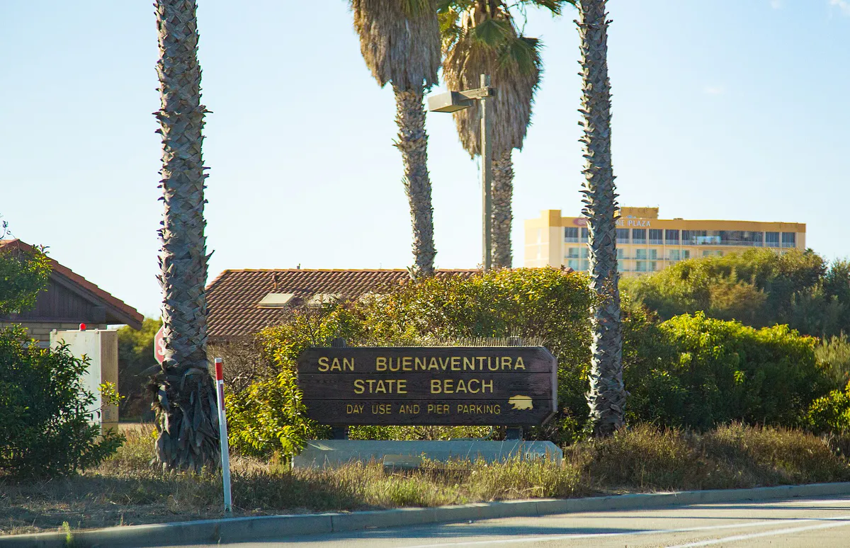
Ventura's distinct geography creates localized weather patterns and travel hurdles that shape daily plans. Bordered by the Pacific Ocean, the Ventura River, the Santa Clara River, and steep coastal foothills, the city transitions quickly from oceanfront beaches to inland residential valleys. While coastal temperatures hover in the mid-60s or 70s during summer, neighborhoods located just three to five miles inland—such as the College Area and East End—frequently experience significantly warmer temperatures due to the breakdown of the coastal marine layer.
Highway infrastructure introduces key spatial considerations. US-101 acts as a physical barrier between Downtown/Midtown and the shoreline. Moving between Main Street and the Ventura Pier requires using designated pedestrian overpasses like Ash Street or underpasses such as California Street. Traffic bottlenecks occur along US-101 southbound during morning commute hours toward Oxnard and northbound during evening peak periods toward Santa Barbara. For inland travel, State Route 33 provides direct northern access to Ojai, while State Route 126 runs east toward Santa Paula through the Santa Clara River Valley.
Parking strategies vary directly by district. Downtown offers over 2,900 free parking spaces spread across 14 city surface lots and upper levels of the Santa Clara Parking Structure. Conversely, oceanfront locations like Surfers' Point, the Harbor Boulevard Parking Structure, and San Buenaventura State Beach require hourly or daily parking fees. Downtown's Main Street Moves pedestrian mall closes Main Street from Figueroa to Fir to vehicle traffic, so drivers should target Santa Clara Street or Thompson Boulevard when searching for parking.
Explore your options
Use these district summaries to align your schedule with local character, parking arrangements, and transit access across Ventura.
The historic, car-free heart of Ventura offering walkable access to cultural landmarks, fine dining, and craft cocktail lounges.
Coastal waterfront hubs providing direct water access, national park connections, casual seafood dining, and surf breaks.
An industrial and creative corridor rich in Mexican dining, independent fine-art studios, craft microbreweries, and outdoor trailheads.
Practical local guidance
Keep these environment, transit, and timing factors in mind when building an itinerary in Ventura.
A simpler way to decide
Follow this step sequence to coordinate Channel Islands National Park excursions and coastal transport without booking conflicts.
Determine whether you are planning a day trip or an overnight camping stay on islands such as Santa Cruz or Anacapa based on ferry departure schedules.
Book your boat tickets through Island Packers at Ventura Harbor prior to finalizing any campsite bookings, as boat capacity fills early.
If staying overnight, complete your campground reservation through the National Park Service only after confirming your ferry seats.
Review marine weather forecasts and swell reports the evening before departure to prepare appropriate ocean gear and anti-motion sickness measures.
Park in the free surface lots at Ventura Harbor Village and check in at the Island Packers terminal at least 45 minutes before departure.
Common local questions
These are common situations people face when trying to decide where to eat, what to do, where to get drinks, or how to spend their time in Ventura.
Ventura planning questions
Practical answers for people deciding where to eat, what to do, where to go, or how to make plans in Ventura.
No, public fishing from the historic Ventura Pier does not require a California state fishing license.
Downtown features over 2,900 free parking spaces across 14 city surface lots, select street blocks, and the upper floors (3rd through 5th) of the Santa Clara Parking Structure at 55 S. California Street.
Because US-101 separates Downtown from the coastline, use pedestrian pathways such as the Ash Street overcrossing or the California Street underpass to reach the Ventura Pier and promenade.
Amtrak Pacific Surfliner stops at the Ventura Station platform near the Pier and Fairgrounds. Metrolink operates the Ventura County Line from the East Ventura Station in Montalvo, with codeshare options available on select Surfliner trains.
During late spring and early summer ("May Gray" and "June Gloom"), the coastal marine layer creates morning fog that typically clears by mid-afternoon, keeping beachfront areas cooler than inland neighborhoods.
Camping requires securing ferry transportation through Island Packers before reserving a campsite through the National Park Service. Ferry passage is not automatically included with a campground reservation.
Harbor Cove Beach ("Mother's Beach"), located at the end of Spinnaker Drive near Ventura Harbor, features breakwater protection that creates calm ocean water ideal for families and paddleboarding.
Main Street is closed to vehicle traffic between Figueroa and Fir Streets as part of the car-free Main Street Moves pedestrian mall.
Admission to the Ventura Botanical Gardens in Grant Park is $7 for adults, free for ages under 18, free for everyone on Fridays, and dog-friendly on Wednesdays and Fridays.
The continuous paved trail starts on the Westside (Avenue) as the Ventura River Trail and extends over 15 miles north into downtown Ojai.
Source transparency
Official and locally relevant sources used to verify the practical information presented in this Ventura decision guide.
Ventura decision engine
Tell Adventria what kind of experience you want, set your practical limits, and turn the options in Ventura into one workable plan.
Choose a Ventura Plan