Old Quad / Downtown
Best for
Walkable collegiate charm, historic architecture, and regional rail transfers
 AdventriaLocalOpen App
Santa Clara City Decision Guide
Trying to decide what to do in Santa Clara? Adventria helps you cut through the options and choose a good-enough plan without endless scrolling. From late-night Korean BBQ along El Camino Real to navigating event days around Levi's Stadium and enjoying municipal perks like low-cost electricity, this guide provides clear advice for moving, dining, and spending time in Santa Clara.
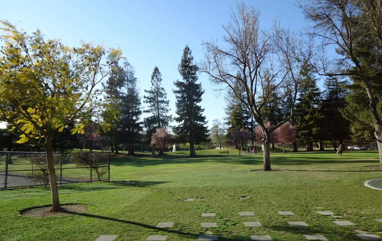
The local decision problem
Navigating travel friction, event surges, dining enclaves, and low-overhead civic amenities in Santa Clara.
That is where Adventria comes in. Adventria helps narrow the options in Santa Clara around practical factors like location, distance, budget, vibe, who you are with, and the kind of experience you actually want, so research can turn into a decision.
Let Adventria narrow the optionsPick the right part of town
Different parts of Santa Clara work for different kinds of plans. Start with the experience you want, then narrow the map.
Best for
Walkable collegiate charm, historic architecture, and regional rail transfers
Best for
Family-oriented master-planned suburban living with centralized retail
Best for
Corporate headquarters visits, casual lunch stops, and movie outings
Best for
Live events, theme park visits, and high-density residential access
Best for
Tabletop Korean BBQ, late-night stews, Asian bakeries, and boba
Best for
Civic amenities, green space, local library access, and swim facilities
This is a quick starting point. The full guide covers 7 local neighborhoods and districts in Santa Clara.
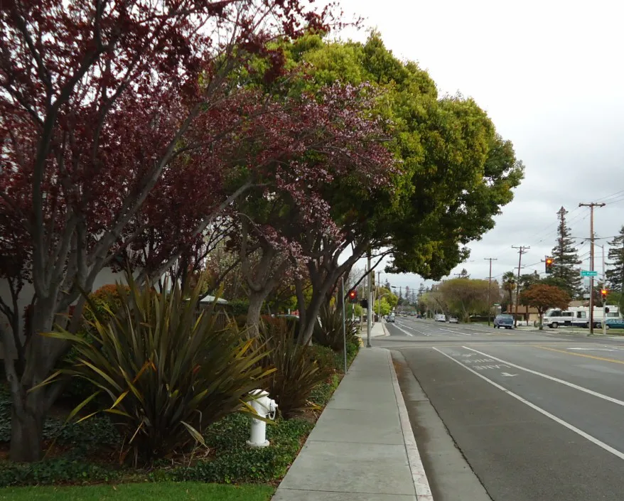
Eat & drink
When the decision is less about what to do and more about where to eat or grab a drink, start here. These local cues narrow the food and drink decision without turning dinner or a night out into another hour of comparison.
Begin with a late afternoon walk through the historic Mission Santa Clara de Asís grounds and Mission Gardens on the SCU campus, then drive west to El Camino Real for interactive tabletop Korean BBQ and dessert at an Asian bakery.
Head to the El Camino Real corridor between San Tomas and Lawrence Expressways. This strip features several Korean BBQ and pub-style dining spots open past midnight, serving tabletop grills, fried chicken, stews, and boba.
Still comparing options? Adventria can narrow the choice around budget, distance, vibe, and who you are with.
Decide with AdventriaPlan by situation
Start with the kind of plan you are actually trying to make. These city-specific ideas narrow the choice around who you are with, what you want to spend, the weather, and the kind of outing you want.
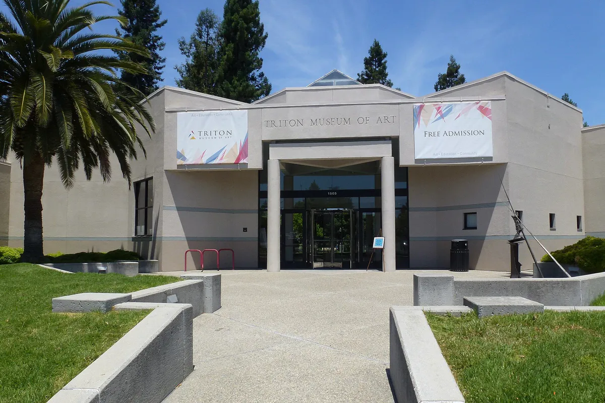
Tour the free indoor exhibits at the Intel Museum, explore current gallery collections at the Triton Museum of Art, or head to the adjacent Westfield Valley Fair shopping complex along Stevens Creek Boulevard to browse indoor shops and dine at Eataly.
For an outdoor plan from Santa Clara, compare trails, state parks, national parks within trip range, and scenic drives. Options in the current city guide include Castle Rock State Park and Portola Redwoods State Park.
Run or bike along the paved 5.45-mile San Tomas Aquino Creek Trail from Homestead Road northward toward the Bay Trail, or walk the dirt paths through native oak woodland and chaparral ecosystems at the 40-acre Ulistac Natural Area.
Koreatown establishments along El Camino Real are structured for communal dining with built-in tabletop grills and shared banchan. For student or casual group gatherings, Franklin Square in the Old Quad offers outdoor seating options and pizza/ramen spots.
For a short escape from Santa Clara, compare Richmond and Antioch. More options are listed in the trip section below.
Central Park on Kiely Boulevard provides 52 acres featuring green lawns, a scenic lake, picnic pavilions, the Central Library, and the Magical Bridge Playground, which is specifically designed for physical and cognitive accessibility for kids of all abilities.
You can walk directly into the Intel Museum on Mission College Boulevard for self-guided exhibits on semiconductor technology, or visit the Triton Museum of Art on Warburton Avenue to view contemporary California art. Both offer free admission and free parking without advance reservations.
Outdoors nearby
Use these nearby outdoor options when the plan calls for a trail, protected landscape, park, or drive instead of another indoor stop. Proximity here is geographic, not a promise about driving time.
Get out of town
When staying in town is not the answer, these nearby destinations give you a smaller starting set for a day trip, overnight escape, or weekend away.
Destination relationships are screened geographically. Straight-line proximity is not presented as road mileage or estimated travel time.
Local landmarks & attractions
These notable destinations offer a starting point when you want something specific to see, visit, or build into a day around Santa Clara. Distances are approximate from the city area.
museum in Mountain View, California
arena in San Jose, California, United States
park in San Jose, California, United States
theme park in Santa Clara, California
building in San Jose, California, United States
concert venue in Mountain View, California, United States of America
architectural structure in Oakland, California, USA
zoo and non-profit organization in Oakland, California
Notable places are selected from structured public destination data and ranked for relevance, prominence, proximity, and variety.
Local decision signals
A useful local recommendation depends on how the city actually works. These conditions affect where to go, what to do, and whether a plan makes sense right now.
City-owned municipal electric utility operating since 1896, delivering electricity at rates 25% to 57% lower than surrounding Bay Area cities on PG&E service.
Strict perimeter enforcement and tow-away enforcement along Lick Mill Boulevard and surrounding Northside residential streets during stadium events.
A dense concentration of Korean BBQ, late-night stews, bakeries, and boba shops operating along Highway 82 between San Tomas and Lawrence Expressways.
Direct connection point across Caltrain, ACE, Amtrak Capitol Corridor, and VTA bus routes immediately opposite Santa Clara University.
Paved multi-use trail networks along San Tomas Aquino Creek and the Guadalupe River providing north-south pedestrian and bicycle connectivity across the city.
Co-located historic Mission Santa Clara de Asís, Mission Gardens, and the de Saisset Museum offering quiet walking grounds in the Old Quad district.
Neighborhood context
Neighborhoods are not interchangeable. Each area offers a different balance of atmosphere, transportation, food, nightlife, activities, and planning friction.
Best for: Walkable collegiate charm, historic architecture, and regional rail transfers
Historic residential core anchored by Santa Clara University and Franklin Square. Characterized by Craftsman bungalows, Victorians, casual campus dining, and the Santa Clara Transit Center.
Best for: Family-oriented master-planned suburban living with centralized retail
High-density suburban community in North Santa Clara built around Rivermark Village, Don Callejon School, and neighborhood parks. Highly structured and easy to navigate on foot.
Best for: Corporate headquarters visits, casual lunch stops, and movie outings
North-central commercial district near Highway 101 containing Mission College, corporate tech campuses including Intel, and the Mercado Center shopping complex.
Best for: Live events, theme park visits, and high-density residential access
Energy-heavy northern corridor along Tasman Drive housing Levi's Stadium, California's Great America, the Santa Clara Convention Center, and Ulistac Natural Area.
Best for: Tabletop Korean BBQ, late-night stews, Asian bakeries, and boba
Busy commercial strip extending along El Camino Real between San Tomas and Lawrence Expressways, packed with Korean restaurants, markets, and late-night options.
Best for: Civic amenities, green space, local library access, and swim facilities
Suburban civic core centered on Kiely Boulevard and Warburton Avenue, home to Central Park, the Central Library, Triton Museum of Art, and International Swim Center.
Best for: Light industrial parks, suburban subdivisions, and expressway commutes
Western edge bordering Sunnyvale along Lawrence Expressway and Bowers Avenue, combining commercial plazas, light industrial campuses, and residential subdivisions.
Santa Clara local guide
Santa Clara occupies a strategic position in the center of the South Bay, bounded by San Jose to the south and east, Sunnyvale to the west, and Cupertino to the southwest. Its urban form spans two distinct eras: the 19th-century historic core centered around Santa Clara University and the Old Quad, and the northern technology corridor built alongside expressways, corporate campuses, and major entertainment venues.
Navigating the city requires understanding the distinction between daily high-tech commuter traffic and event-driven gridlock. Major east-west and north-south arterials like US Highway 101, State Route 237, San Tomas Expressway, and Lawrence Expressway experience heavy weekday commute windows between 7:00 AM–9:30 AM and 4:00 PM–6:30 PM. Meanwhile, North Santa Clara operates on an entirely separate rhythm dictated by the event schedule at Levi's Stadium.
For residents and corporate operators, Santa Clara offers a unique municipal advantage through Silicon Valley Power (SVP). Established in 1896, this city-owned electric utility provides power rates 25% to 57% lower than neighboring communities served by regional private utilities, significantly lowering electricity overhead for households and high-density tech operations alike.
Explore your options
Explore key public institutions, historic landmarks, and natural reserves across the city.
A 10,000-square-foot self-guided museum situated at Intel Headquarters on Mission College Boulevard.
A civic art museum located on Warburton Avenue across from the City Hall complex.
Santa Clara's only natural habitat preserve, spanning 40 acres along the Guadalupe River.
Historic mission founded in 1777, located at the heart of the Santa Clara University campus.
Practical local guidance
Key multimodal transit routes and hubs for navigating the city and broader South Bay region.
A simpler way to decide
Follow these steps to minimize travel friction and avoid traffic enforcement zones on game and event days.
Check the Levi's Stadium event calendar before scheduling non-stadium outings, dinner reservations, or trail trips in North Santa Clara.
Take VTA Light Rail to Great America Station or arrive via Caltrain/ACE rail connections rather than driving directly to stadium lots.
Reserve stadium parking passes in advance, as all venue lots operate on cashless pre-paid bookings and directed traffic routes.
Do not attempt street parking along nearby neighborhood roads like Lick Mill Boulevard, which enforce strict tow-away rules on event days.
Ensure all bags adhere strictly to the stadium clear-bag policy to streamline entry screening at security gates.
Bring sun protection for daytime stadium seating, and bring a warm layer for the sudden temperature drop caused by late afternoon marine air.
Common local questions
These are common situations people face when trying to decide where to eat, what to do, where to get drinks, or how to spend their time in Santa Clara.
Santa Clara planning questions
Practical answers for people deciding where to eat, what to do, where to go, or how to make plans in Santa Clara.
Santa Clara operates its own municipal electric utility, Silicon Valley Power (SVP), founded in 1896. Because it is a public municipal utility rather than an investor-owned company, SVP offers electricity rates that are typically 25% to 57% lower than neighboring cities served by PG&E.
Yes. The Intel Museum at 2200 Mission College Blvd, the Triton Museum of Art at 1505 Warburton Ave, and the de Saisset Museum on the Santa Clara University campus all offer free general admission and free parking.
VTA Bus Route 60 provides direct connection from the Santa Clara Transit Center in the Old Quad straight to airport terminals. SJC Airport is immediately adjacent to Santa Clara's eastern border, making rideshare journeys under ten minutes from most central locations.
The El Camino Real corridor between San Tomas Expressway and Lawrence Expressway forms Santa Clara's Koreatown. It features a wide variety of tabletop Korean BBQ restaurants, Korean fried chicken, tofu specialty houses, Asian bakeries, and late-night stews.
Yes. The paved 5.45-mile San Tomas Aquino Creek Trail runs north directly past major tech campuses and terminates near Levi's Stadium and the Santa Clara Convention Center. However, trail segments immediately adjacent to the stadium may be restricted during major stadium events.
Official stadium parking requires advance cashless booking. Neighborhood streets surrounding the stadium, such as Lick Mill Boulevard, enforce strict event-day access restrictions and designated tow-away zones for non-resident vehicles.
California's Great America operates on a seasonal schedule, generally running from March through November. Always check the official website to verify specific operating days and water park operating hours prior to visiting.
Located inside 52-acre Santa Clara Central Park, the Magical Bridge Playground is an outdoor play area designed for complete physical and cognitive accessibility, catering to children and adults of all mobility levels and abilities.
During SCU academic terms, parking near the Old Quad and Franklin Square is more in demand, transit around Santa Clara Transit Center is busier, and SCU's de Saisset Museum runs regular gallery hours. During academic breaks, campus perimeter streets are generally less congested.
Source transparency
Official and locally relevant sources used to verify the practical information presented in this Santa Clara decision guide.
Santa Clara decision engine
Tell Adventria what kind of experience you want, set your practical limits, and turn the options in Santa Clara into one workable plan.
Choose a Santa Clara Plan